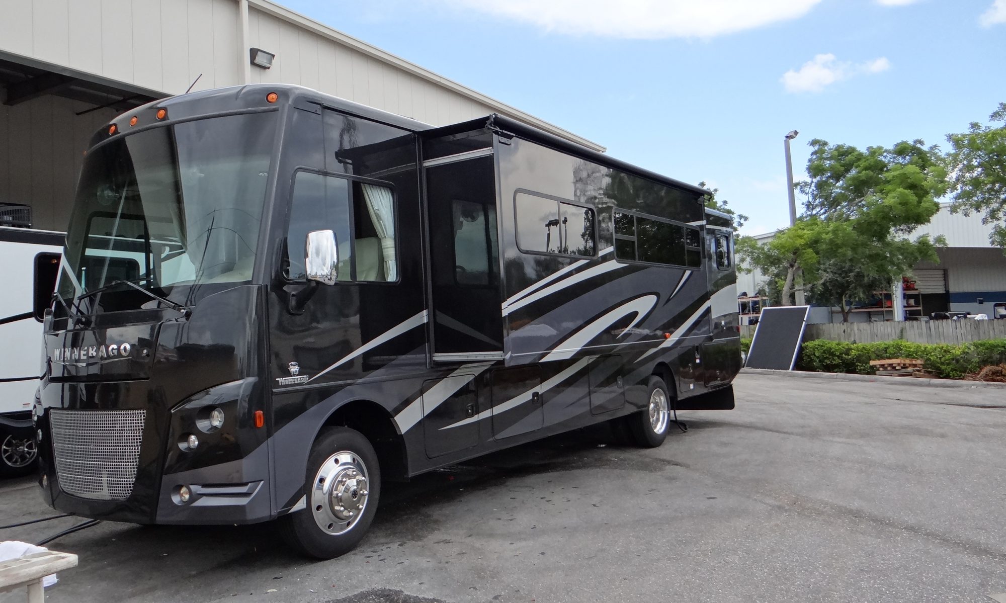
From San Francisco we travelled across country to visit Yosemite National Park. I had booked us in to Yosemite Pines RV Park which is close to the town of Groveland.
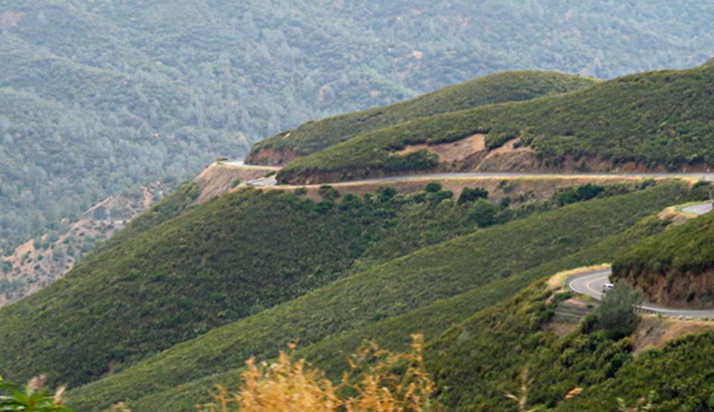
Looked lovely on the website (as indeed it was as you will see in a minute) but what I hadn’t realised was it was 3,000ft up in the mountains and to get to Groveland you had to use US120 which climbs up the side of a mountain along a twisty road with quite large drop offs on the side of the road. I wasn’t someone’s favourite person!!
We came up that!! And we have to go up and down it to visit some of the interesting places in the valley and do the grocery shopping.
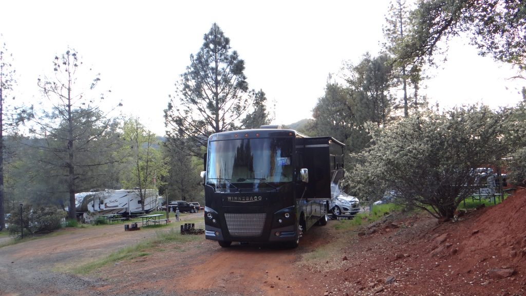
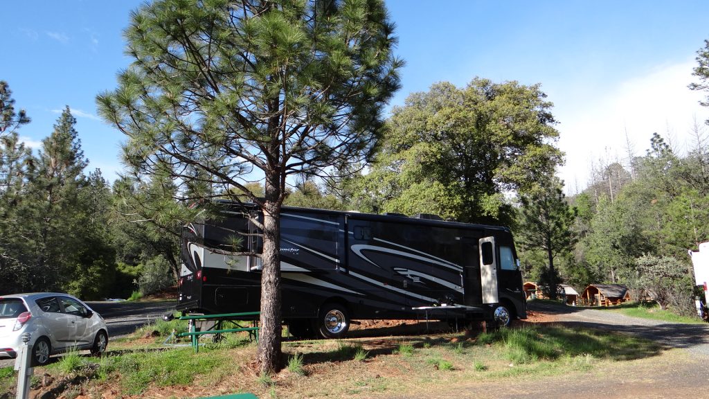
As I said though the campsite was well worth it with a lovely position halfway up a hill in amongst the pine trees.
Level site with full service hook-ups halfway up a hill.In the middle of a pine forest.Another view, lovely place.
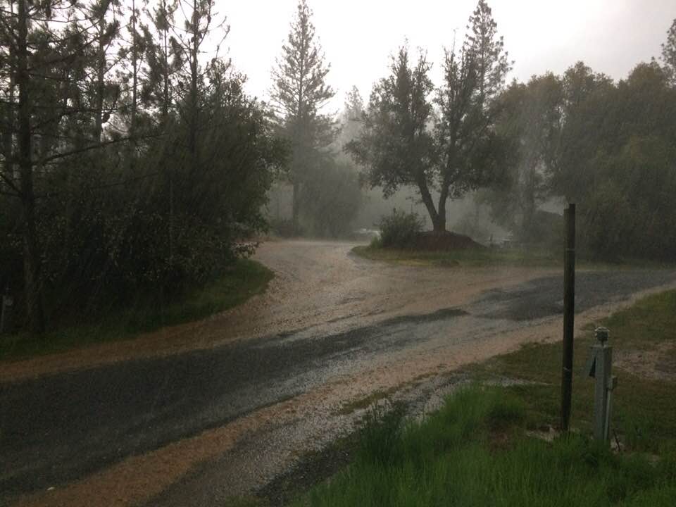
The next day we decided to explore and go up to the entrance of Yosemite National Park. Unfortunately the weather got gradually worse, with low cloud and fog and then it started to hail, so we decided to turn back and visit some of the towns in the valley.
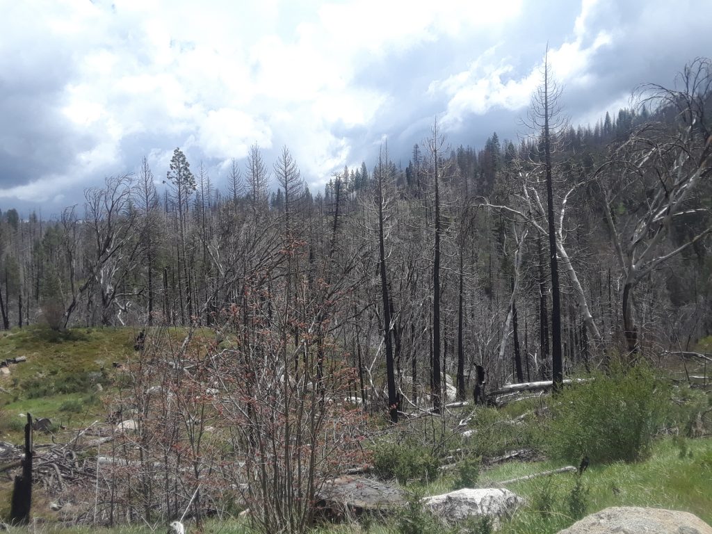
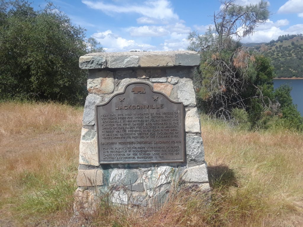
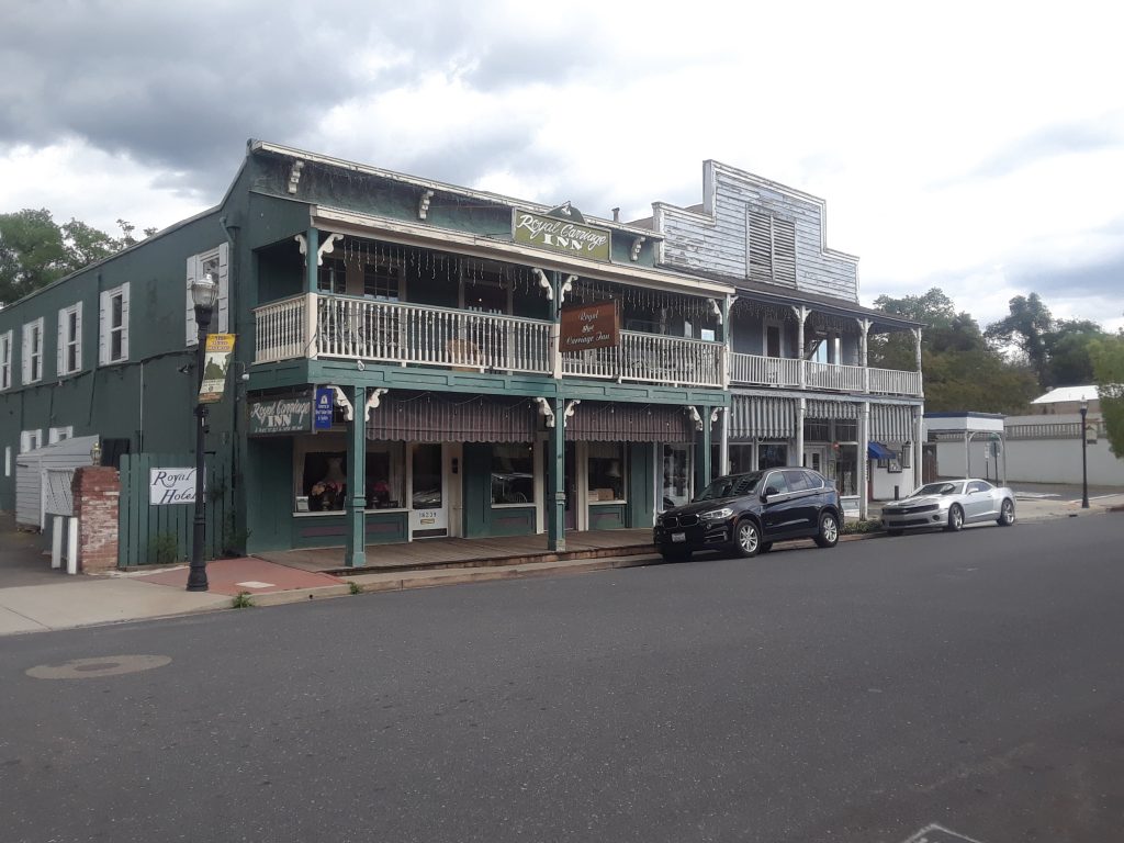
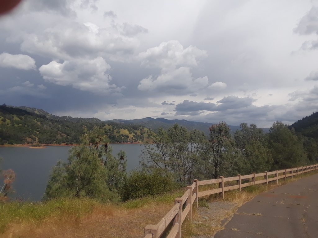
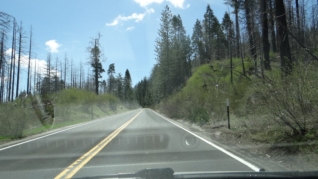
On the way into Yosemite and why we turned back!!On the way back down we saw the results of a massive fire in 2013.Lake Don PedroAttempt at a selfie, sun in eyes!!The lake, caused by a dam, swallowed the town of Jacksonville.We visited Jamestown, a historic town with wooden sidewalks.On the way back to the campground it got a bit foreboding!!And this happened, a massive thunderstorm!!
But by the next morning it was all dry.
Next day we decided that we had left the laundry too long and the forecast didn’t look good. Although to be honest it was a nice day and it gave us a rest!!
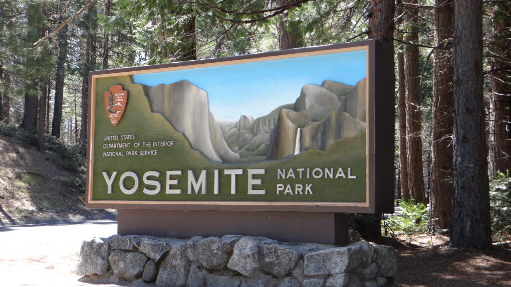
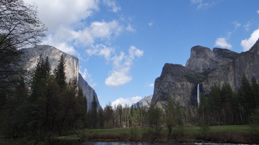
So the day after we tried Yosemite again as the forecast looked good, and sure enough it turned out to be a lovely day and Yosemite didn’t disappoint. Now, I am at this point going to have to apologise as this post is going to get really picture heavy, as no amount of words are going to explain this magnificent place. Wherever you looked stunning views, vistas and ……… so here goes.
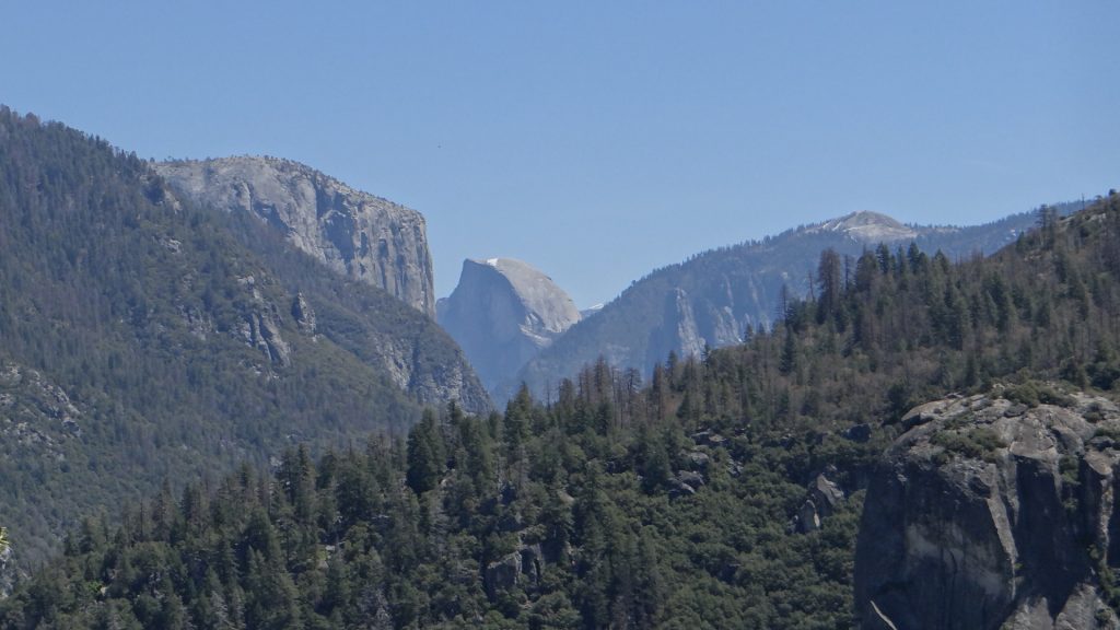
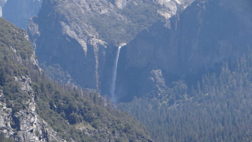
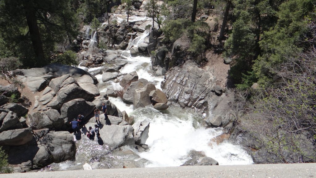
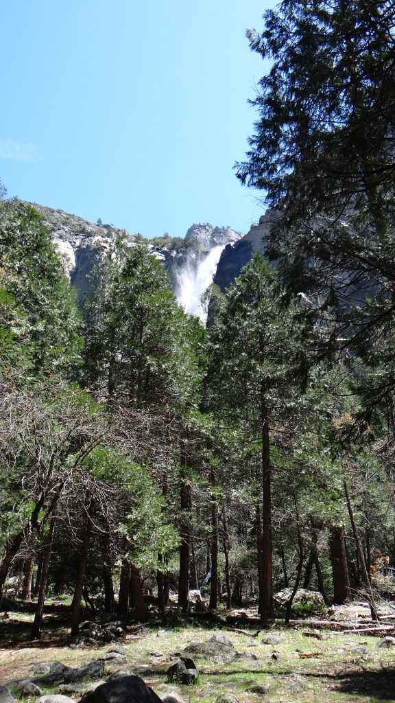
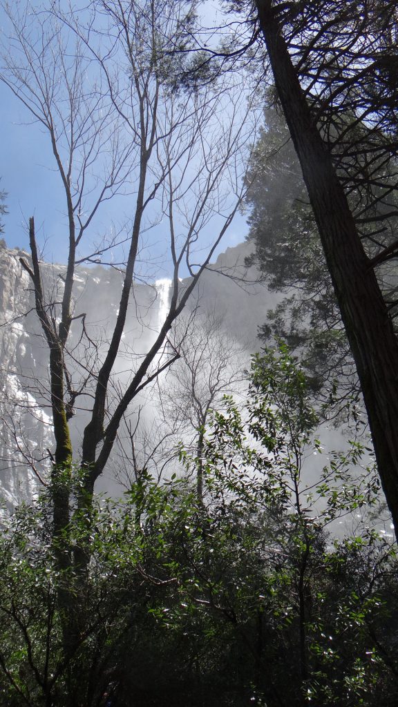
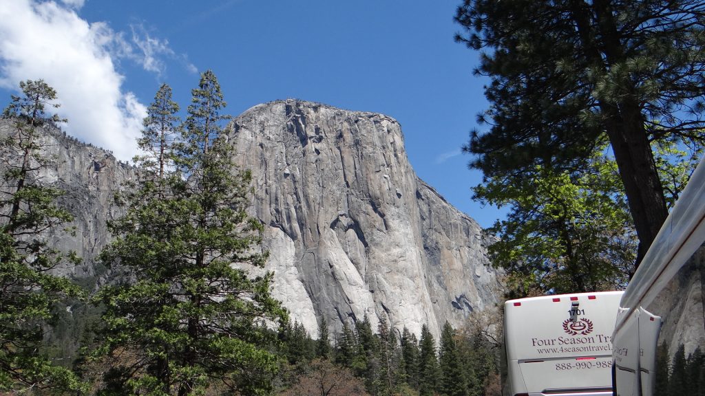
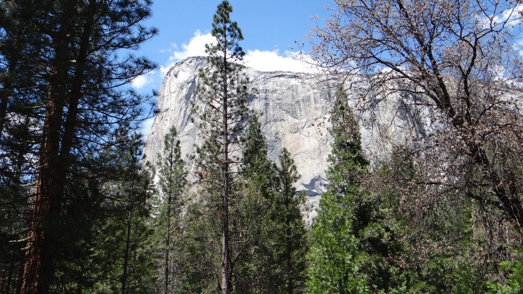
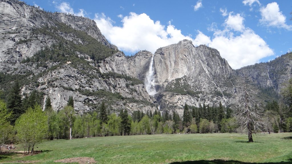
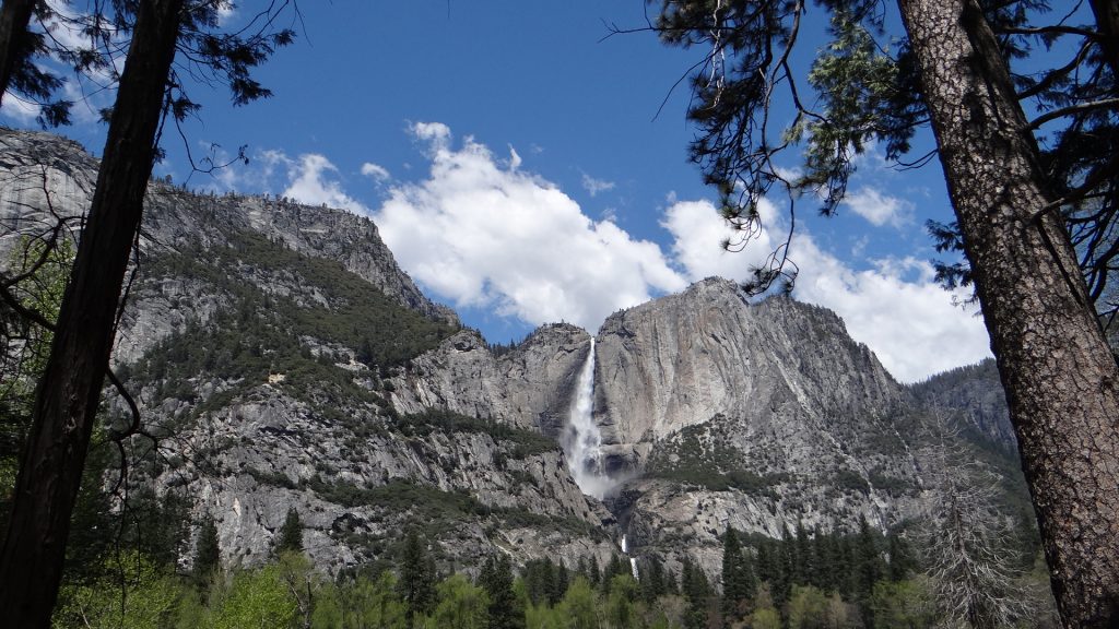
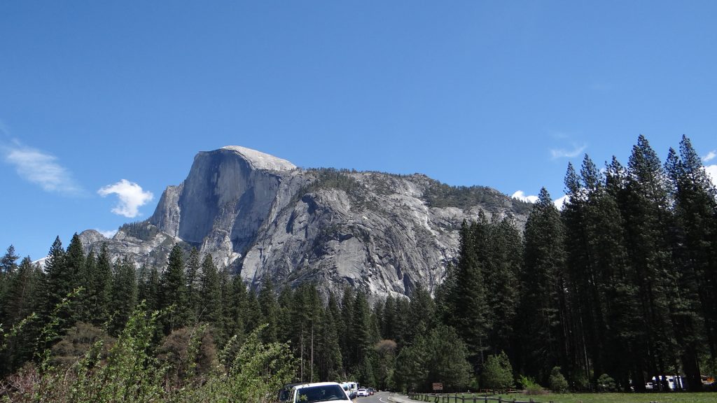
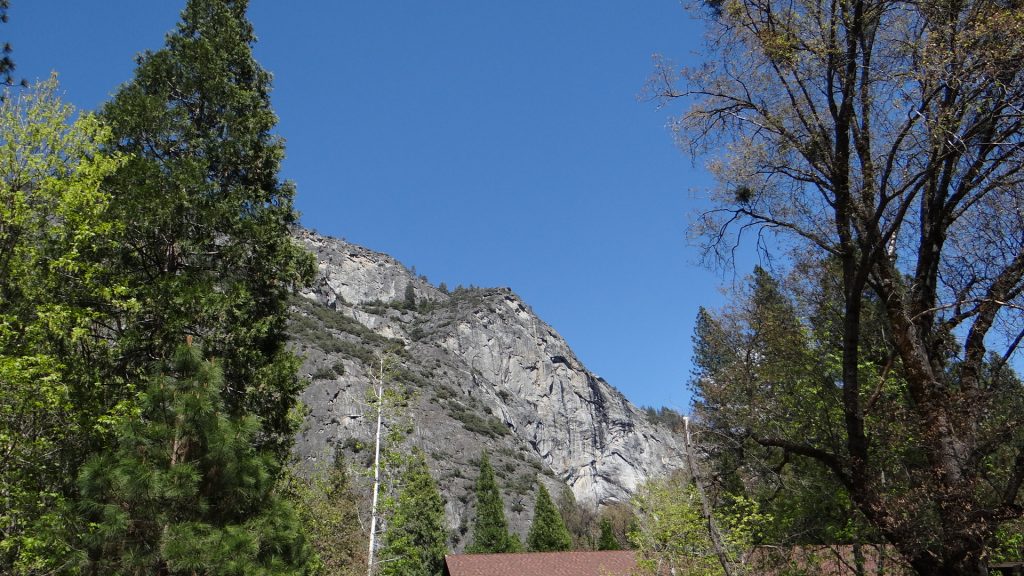
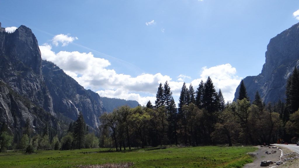
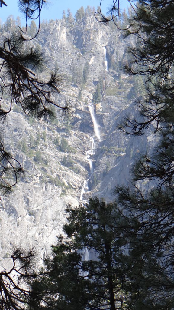
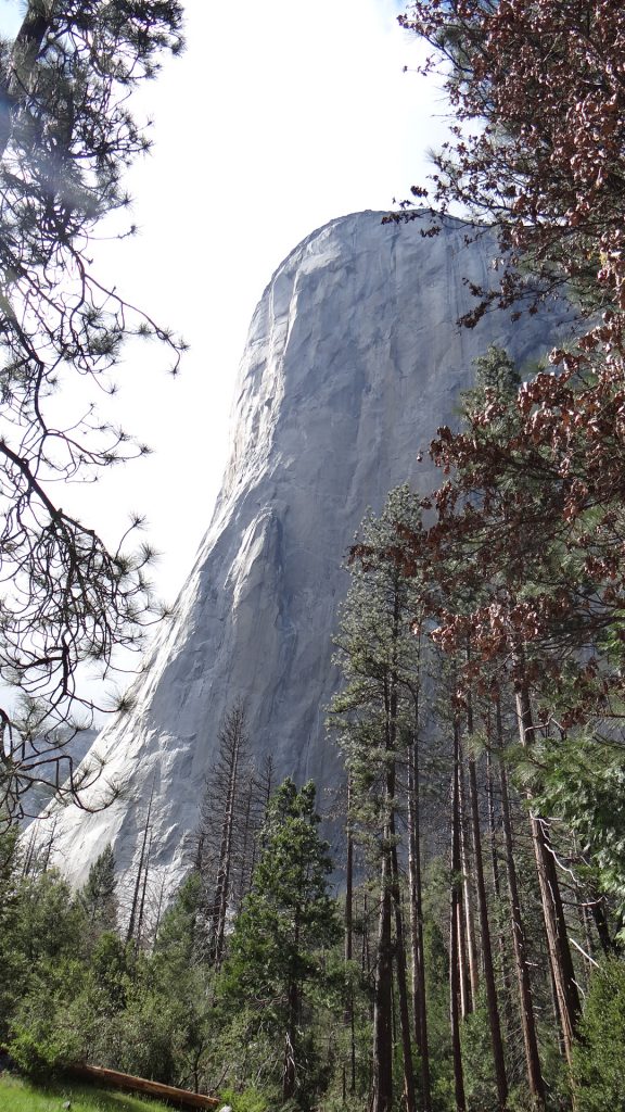
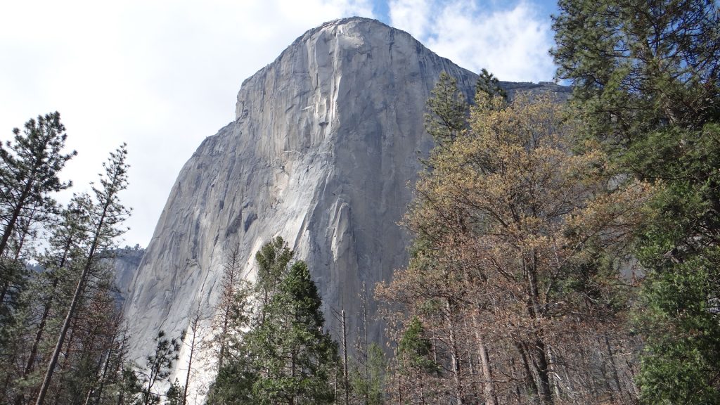
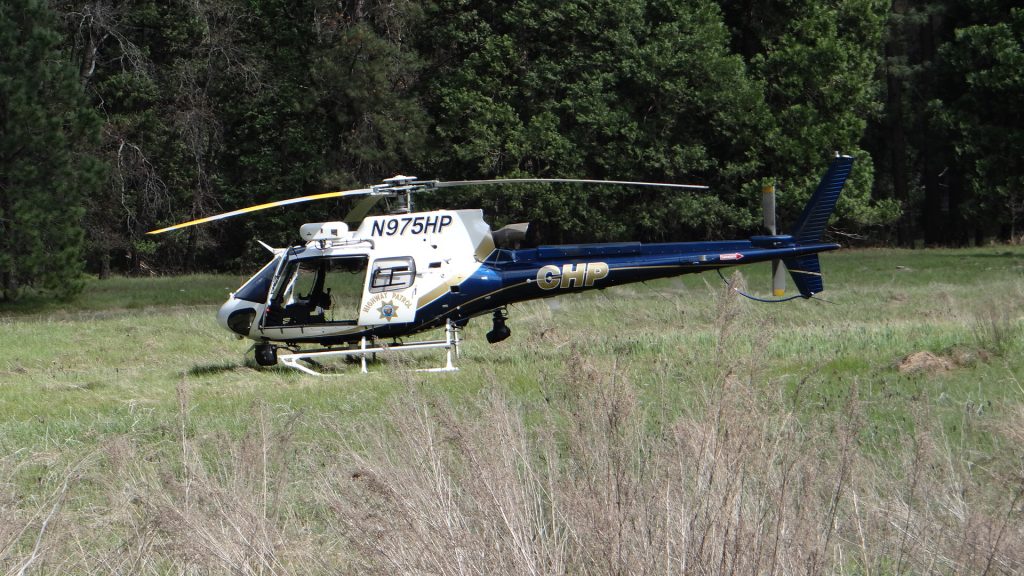
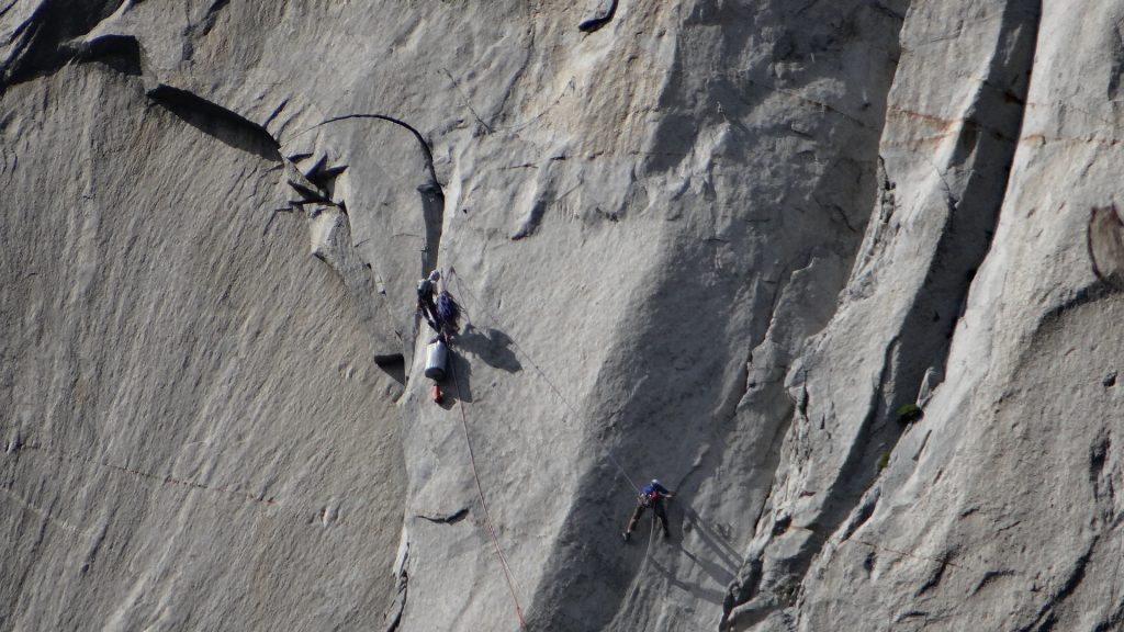
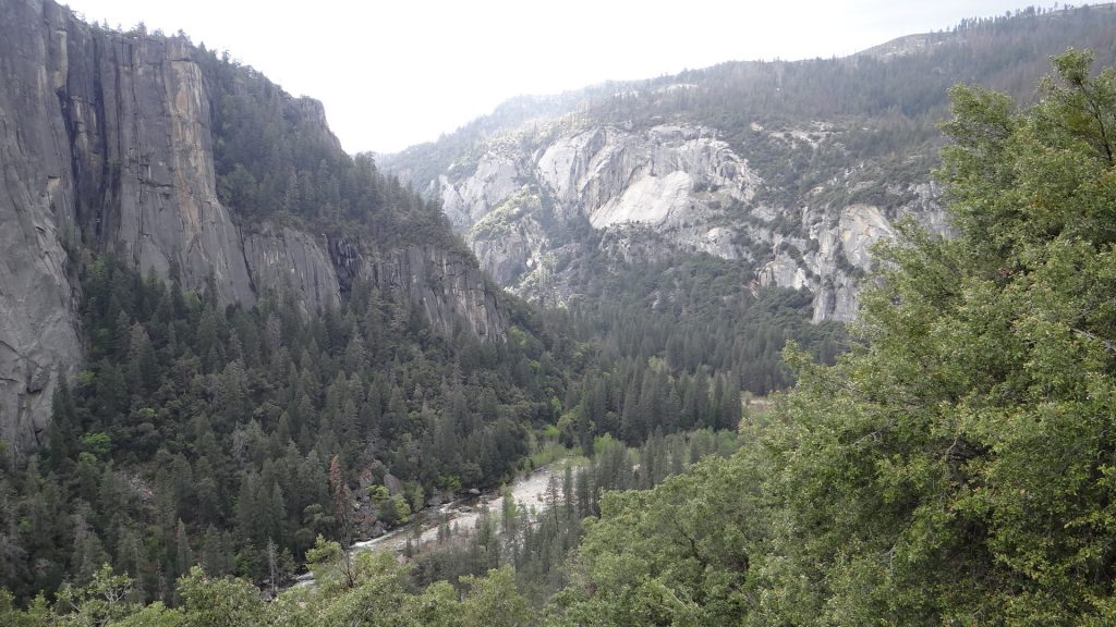
The entrance sign.Almost the same place as two days ago, but a world of difference in the weather.Half Dome in the distance, nearly there.Bridalveil falls from a distanceCascade Creek Falls on the way to the valley, above the road.And below the road.Bridalveil Falls, getting closer.And closer.And finally almost underneath getting soaked!!El Capitan. The road into, and out of Yosemite, goes in a one way loop, so this was taken from the road farthest away.Looking back at Bridalveil falls.El Capitan again.Yosemite falls photographed across a lovely meadow.Same falls close up.And a wide angle view.Falls from a wooden bridge across a river that had trout in it. A very peaceful place.Getting closer to Half Dome at the end of the valley. Even though it is called Half Dome geologists do not believe it was ever a full dome.Closer still.Snow on top of the Dome.Yosemite falls on the way back, close to the Visitor Centre.Granite rock peaks behind the Visitor Centre (that’s its roof).A view back down the absolutely stunning valley.One of the many smaller falls.El Capitan closer up. A sheer cliff that rises to 3,000ft above the valley floor. Remember that finger of rock half way up.A bit further round showing both facesA rescue helicopter. This was called out because there were 8 (yes 8!!) climbers on the face of El Capitan that day and one of them had fallen about halfway up the climb just above that finger of rock. When he fell he broke his ankle, so his partner was now trying to get him and all their kit back to the ground. Bear in mind they started at 8am and this picture was taken about 2.45pm, so it was touch and go.And this was another group of 3 climbers at about 2.45pm. You see that big bag under the top climber, it contains a larger balcony structure that just before it gets dark they fix to the sheer face and they sleep on it overnight so they can start again next morning. All I can say is rather them than me!!Bridalveil falls from the other side of the valley.Looking back down the valley, El Capitan on the left and Bridalveil Falls on the right.Leaving this most magnificent place was rather sad but the wonders continued with a picture of the river leaving the valley.
As I said when I started, words cannot really describe it but I hope my pictures have given you an idea of what it is like. And if you ever get the chance to visit it yourself you will NOT be disappointed.
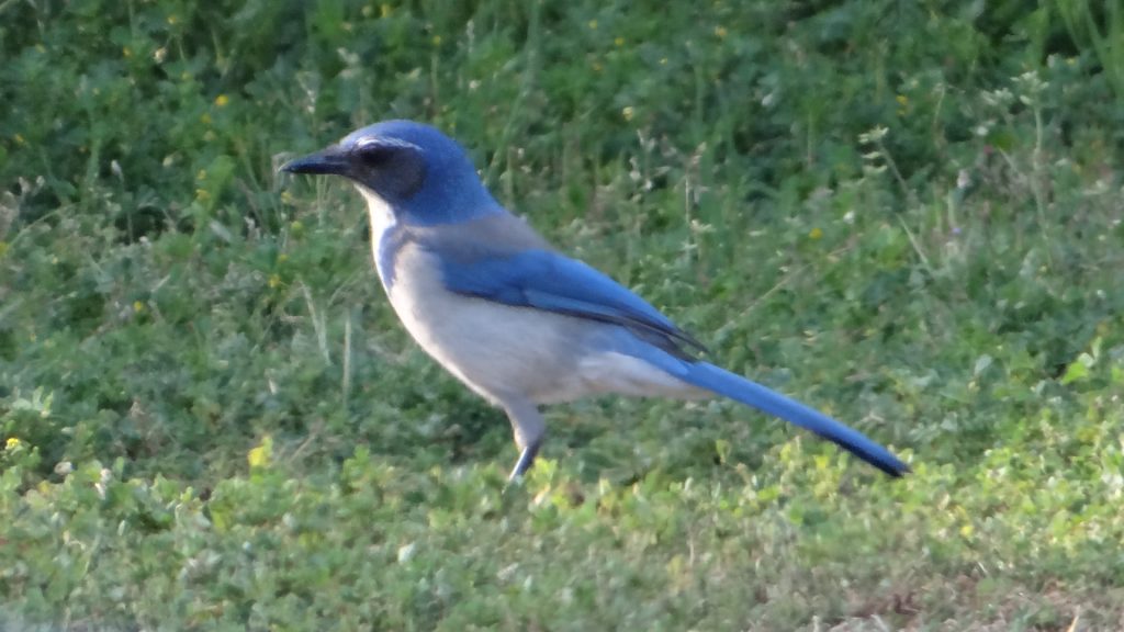
Back at the campground I finally got a picture of a blue scrub jay. There was quite a lot at the campground and they are a beautiful blue.
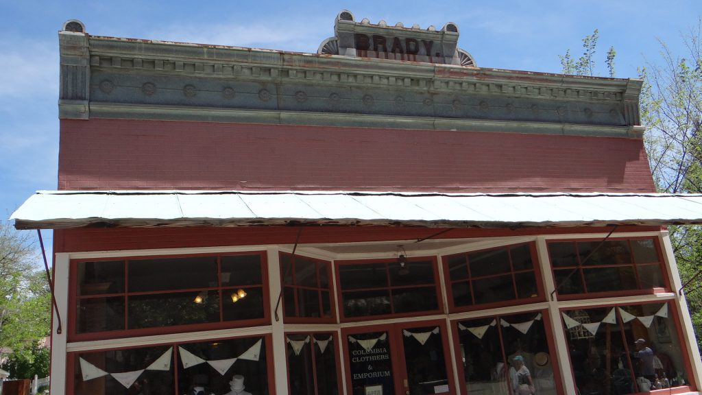
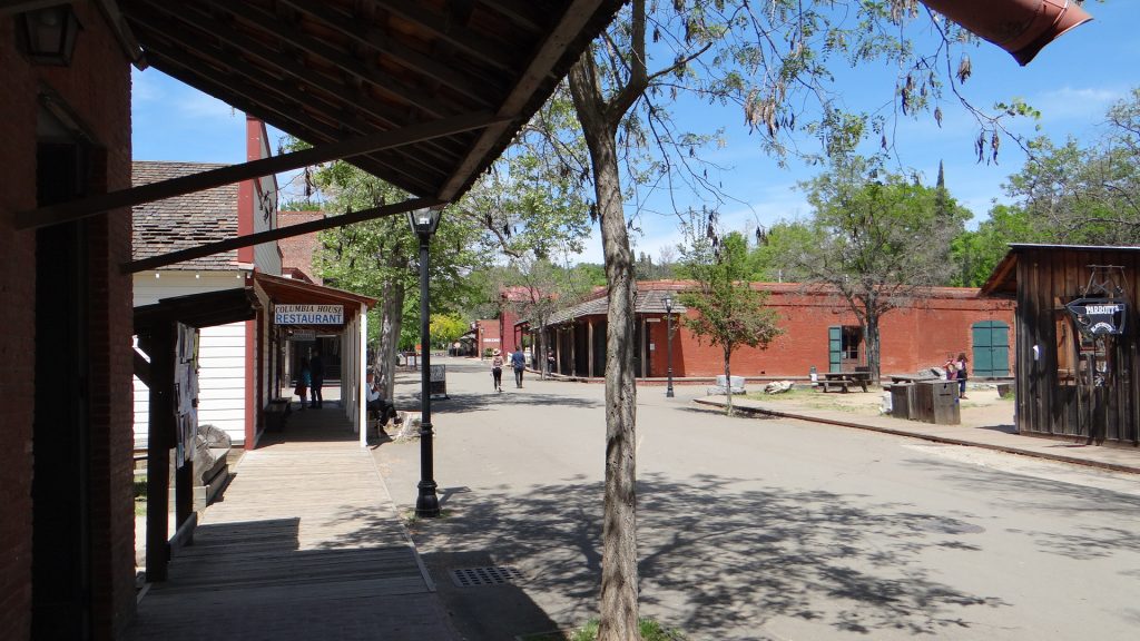
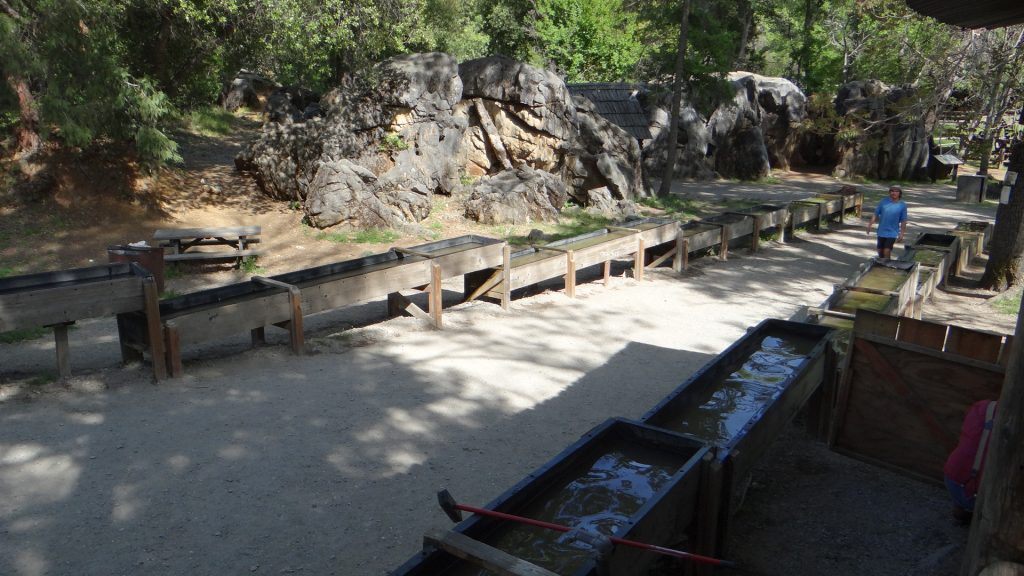
Our last day was spent touring Columbia Old Town State park. This town has been preserved much as it was in the heyday of the Californian Gold Rush. Here though they used hydraulic mining, using high pressure hoses to wash all the mud and sediment into the gold sluices. Between 1850 to 1870 they reckon over a billion dollars of gold was found and at one time Columbia was the second largest town in California.
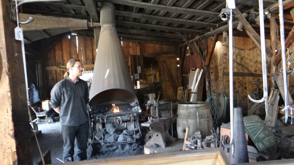
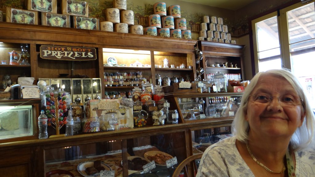
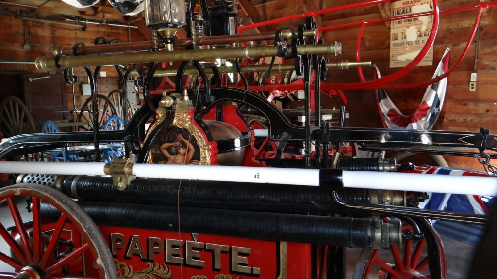
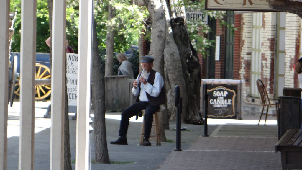
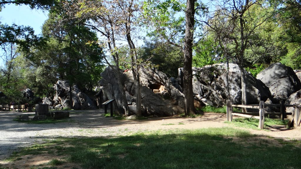
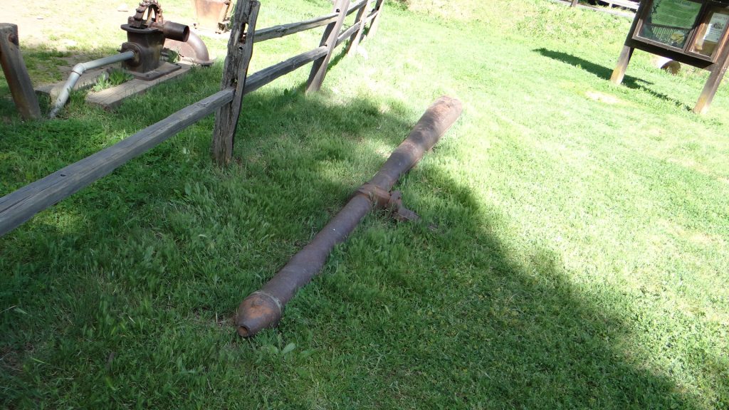
You can take a stagecoach ride around the town.Brady the haberdashery.Main StreetThe blacksmiths.Coffee and chocolate brownies in the old coffee shop.The hand pumping fire engines.Another view of Main St.Penny whistle player. Lots of people in costume all over the place.The gold sluices.We were puzzled when we were driving in why the entire countryside for miles around Columbia had loads of exposed rocks like this. This is, of course, what you get when you wash all the soil and sediment into the sluices with powerful hydraulic monitors. Imagine very high powered hoses!!A hydraulic monitor that shot the powerful jets of water at the gold diggings. Eventually this type of mining was stopped as it was too destructive and anyone downstream of the diggings suffered flooding and sediment problems.
That was our last day at Yosemite, so we moved on (back down that incline!!) and further north into the northern valleys of California where almonds, olives and grapes are grown.
I have updated our RV Map but it is a bit ahead of the blog as it show our route to Bend, Oregon.