On our way down to Las Vegas we stopped off at a WillowWind RV Park that allowed us to visit both Bryce Canyon and Zion National Parks.
Very nice campsite with a shady back-in for us.
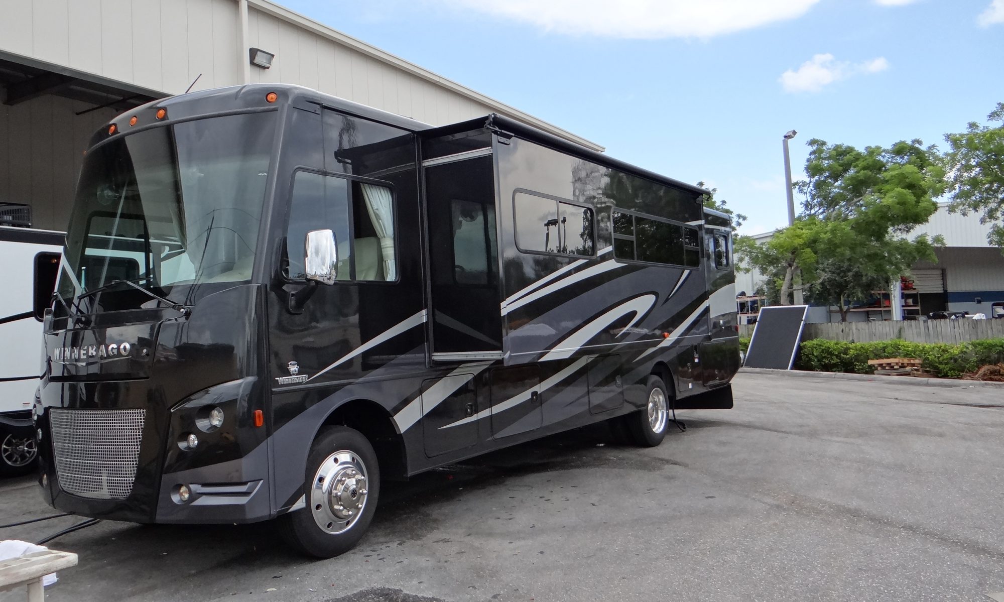
Anne took this as we were setting up, no slides out yet!!
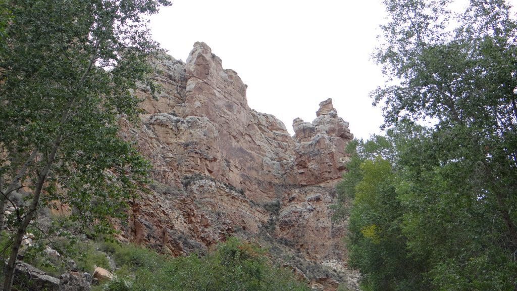
The following day we set off for Bryce Canyon which meant a drive through Zion national Park to reach it, so I will not steal Zion’s thunder!! But I will say it involved quite a steep climb and a tunnel.
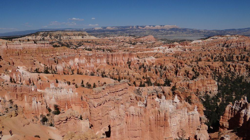
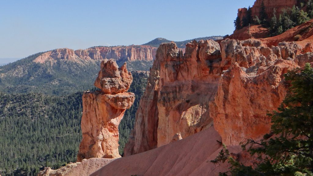
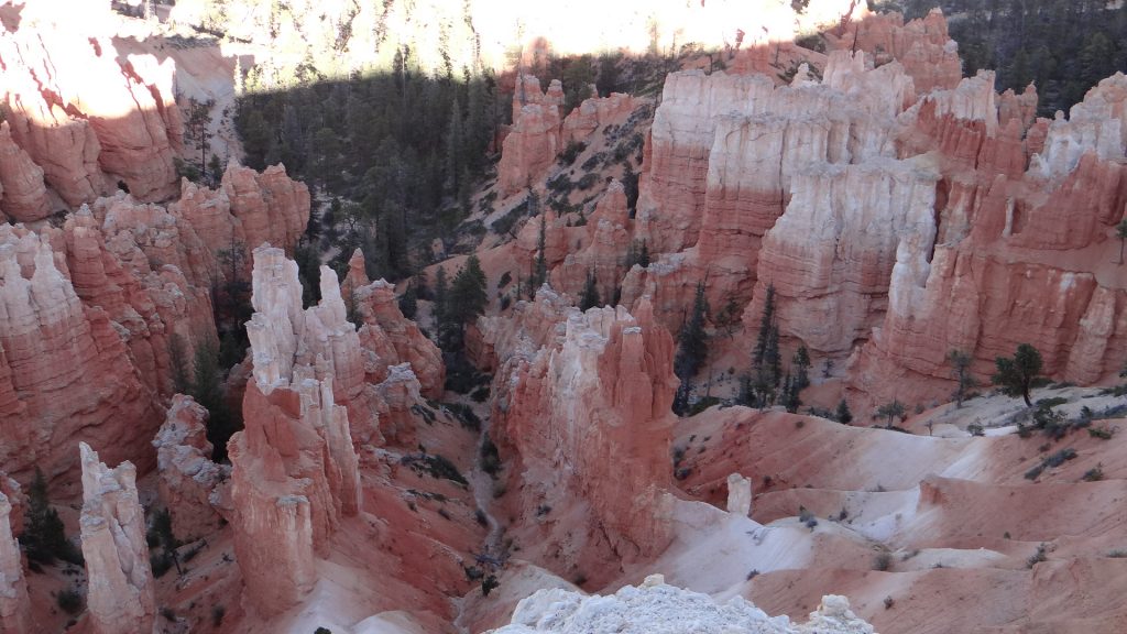
We reached Bryce Canyon about midday and boy oh boy is this place spectacular. It involves an 18 mile drive up the canyon and every stop seems to get better and better. For those of you who have never been there, Bryce is famous for its “hoodoos”. These are tall skinny spires of rock that protrude from the bottom of arid basins and “broken” lands with multiple levels of strata in them, all of different colours. The ones in Bryce Canyon are hundreds of feet high!! So with that explanation here they are.
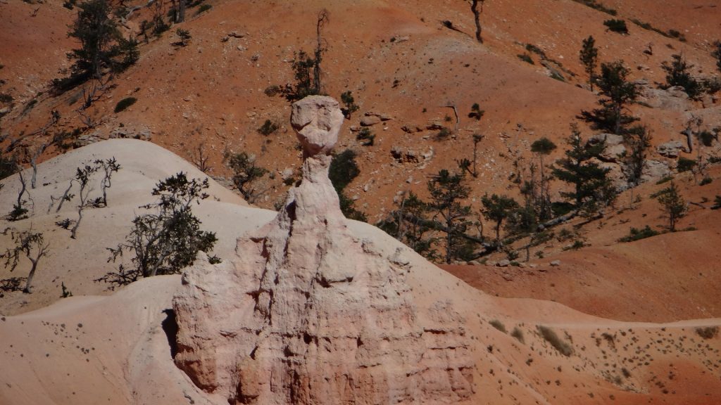
Our first site of hoodoos, spectacular but it gets better.It was quite hot!!A complete vista of hoodoos.The thing about them is, it seems as though a sculptor has carved them, when it is really just wind and rain.Thor’s hammer for obvious reasons.This angle shows it better.More carvings, look at the colours.Another set of figures!!And a close up. The one on the right is almost a human statue!! And all done by nature.
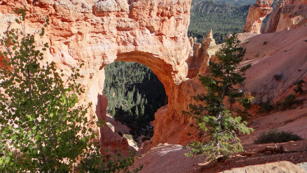
We moved up the route and discovered this.
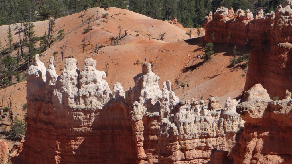
A natural arch carved by wind and rain.Amazing sight!And more hoodoos.They get better.Just to prove that we were both there although we got photo bombed.
We got to the end of the canyon route where there was a controlled burn going on, so there were lots of fire fighters.
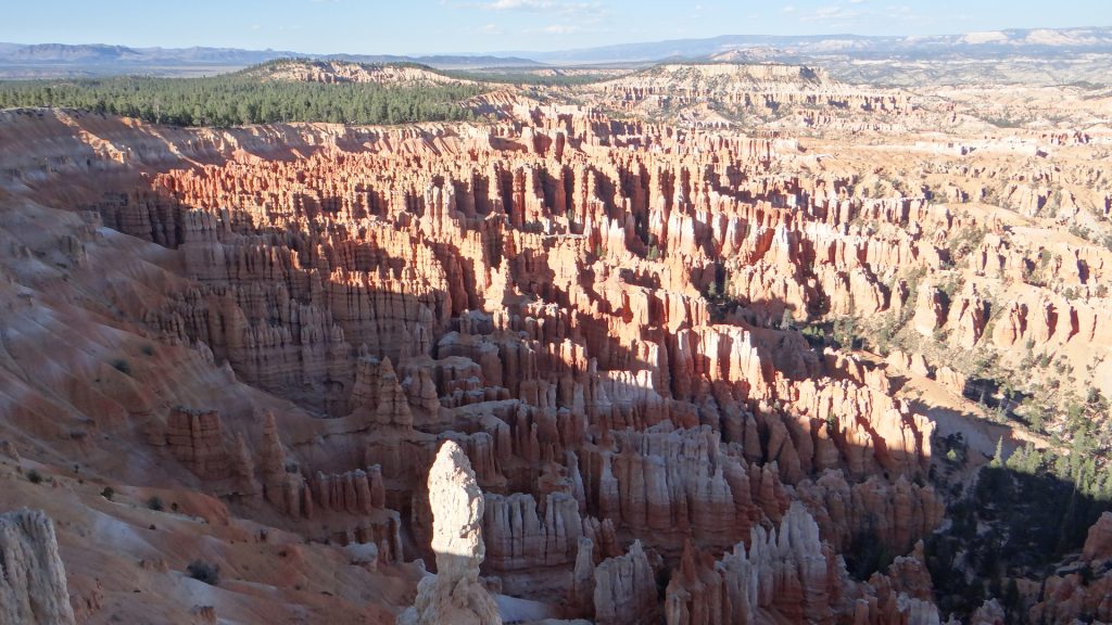
Looking back along the entire canyon. At this point we were over 9,000ft above sea level!!
We then tracked our way back filling in the bits we missed and I climbed Inspiration Point, which made me puff a bit, climbing 500ft at 9,000ft does that, but the view was worth it.
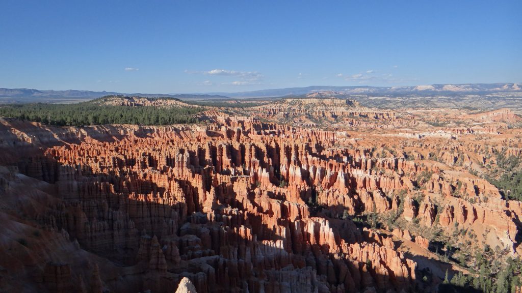
Just when you think you are hoodoo’d out this appears. A massive field stretching into the distance.It’s getting late look at the shadows.And more!!Impressive colours.
There is one other place I ought to mention, Red Canyon. This is on the road up to Bryce Canyon and it has some pretty impressive red rocks in its own right. But in the evening sunset they are something else!!
Red Canyon on the way up to Bryce.Impressive rocks.Shows how high they are when someone stands in front of them.And the road goes through part of the rock.On the way back from Bryce the Red Canyon in the sunset. Wow!!As red as you can get!!
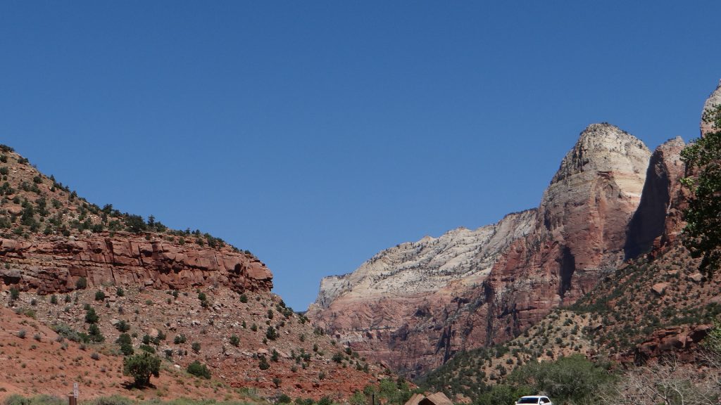
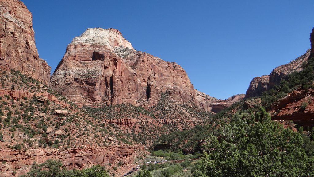
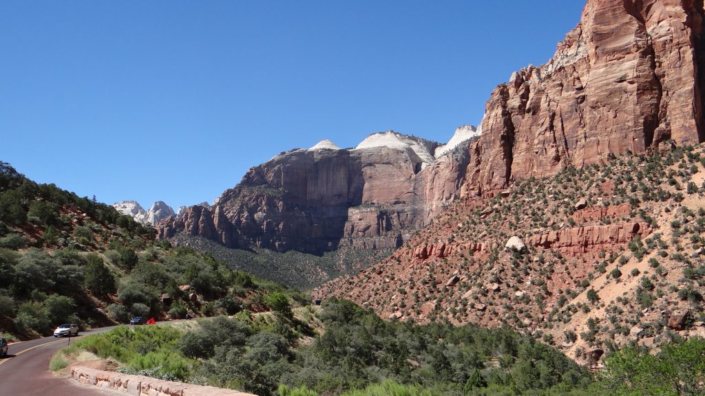
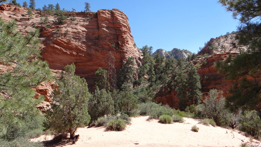
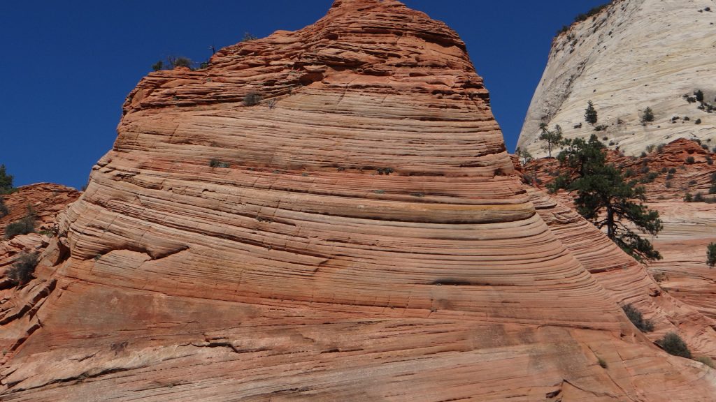
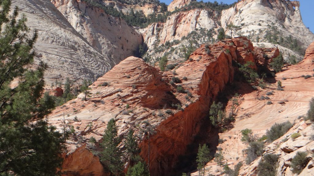
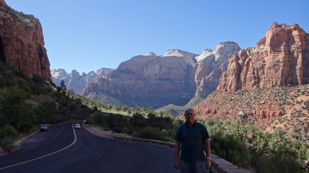
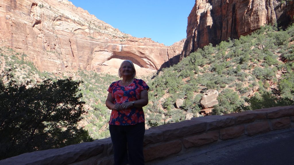
The next day saw us visit Zion National Park which we had previously just driven through. A different type of park, but equally as spectacular with its massive rock faces, the 1.1 mile tunnel to the top, and at the top so many types of rock formations.
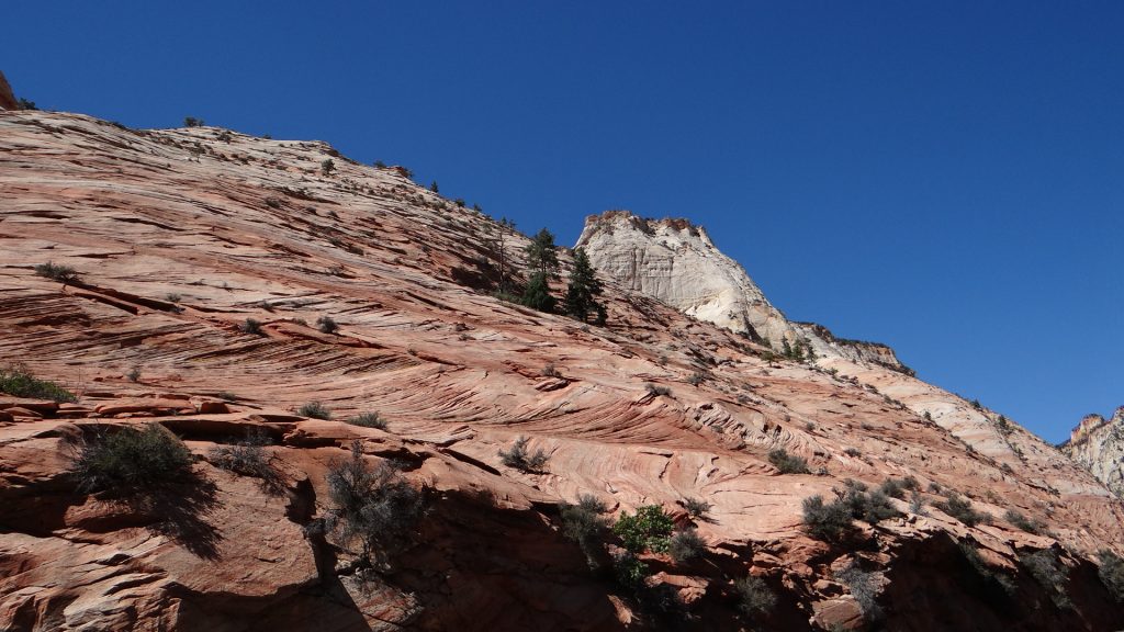
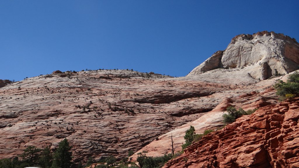
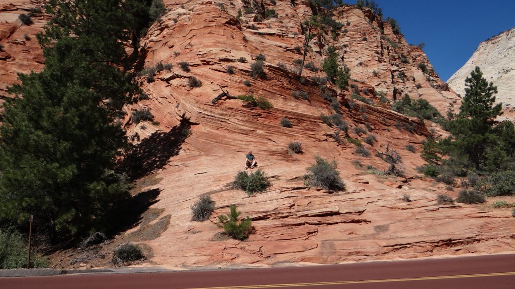
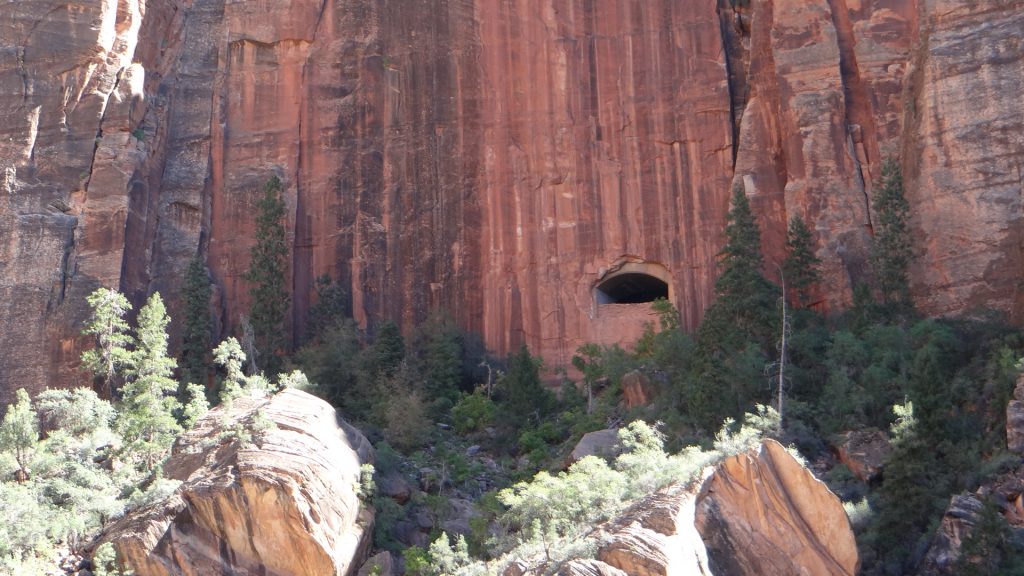
As you enter the park you see these massive rock faces.And they get bigger and multi coloured.That is not snow. It is as tall as El Capitan in Yosemite.Huge curves in the rock. To the right of this is the tunnel.Looking back down the valley.And they get higher as we climb towards the tunnel.Queuing to go through the tunnel.After the tunnel it flattens out and there are lots of sandy valleys and rock canyons carved by water.And layers of rock and colour.From red to white.Impressed they made the road red to match the rock.Look carefully, that is me sat just below a huge curve of rock.How’s that for strata!!.And this is called Chequerboard rock. Vertical stripes down the strata caused by water freezing and cracking the rockA huge red fault line.On the way back down this is a window into the tunnel. It goes to the left up through the rock and is 1.1 miles long.A view down the valley with me in the way!!Anne framed by the curve in the rock.
After this we moved on to Las Vegas, one of the subjects of my next post, but I will always remember the hoodoos!!
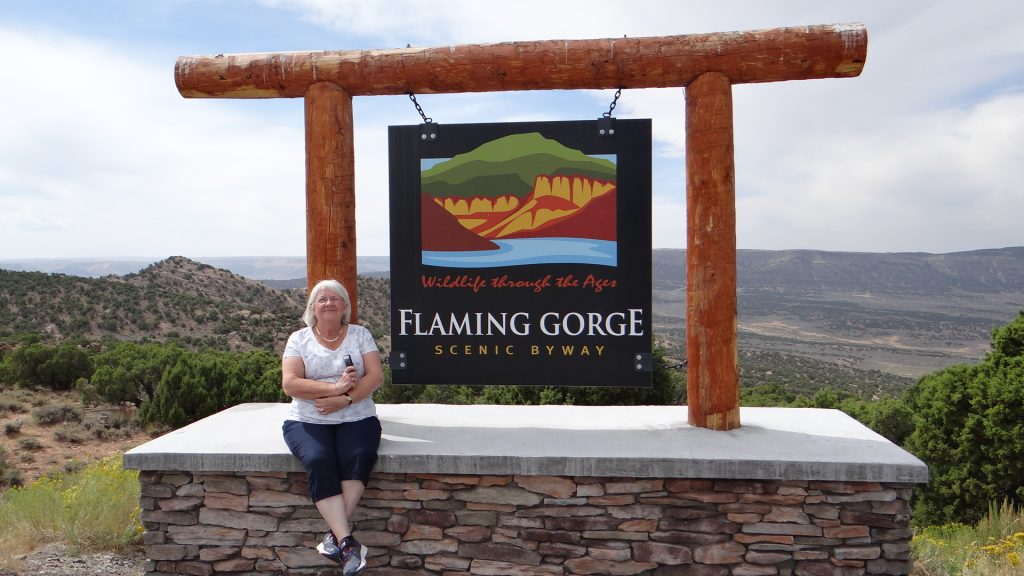
As I said in my last post we moved on to a site near Green River Wyoming as a base to see the Flaming Gorge.
Our route took us along the Chief Joseph Scenic Byway all the way up to a spectacular view of the valley we had driven through.
Some of Wyoming’s wildlife!!The view.
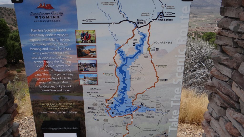
After arriving at Green River we set off the following day on a circular route that took in the Flaming Gorge Dam, Flaming Gorge and the Sheep Creek Geological area.
Map of route. We went down the right side and up the left side back to Green River.I guess we are on the right route!!
After about an hour we reached the dam but on the way we saw quite a few herds of Pronghorn Antelope.
And they saw us!!
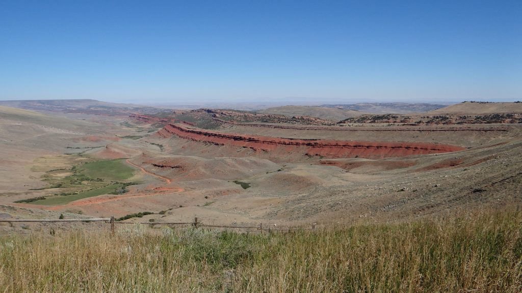
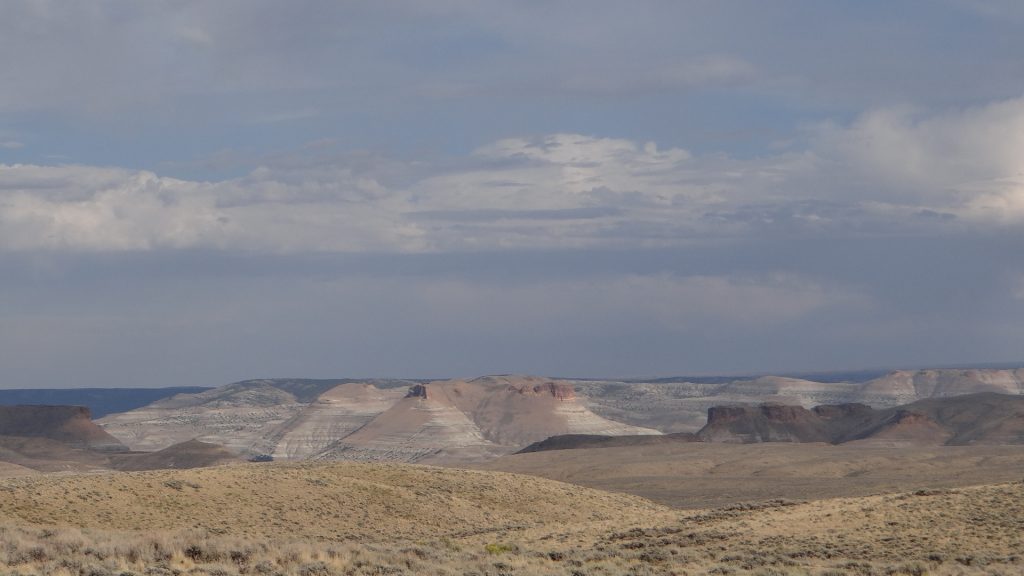
And many bluffs displaying great strata lines of rock.
You can see how the rock was laid down, but this was nothing compared to what was to come.
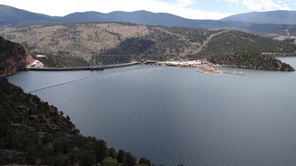
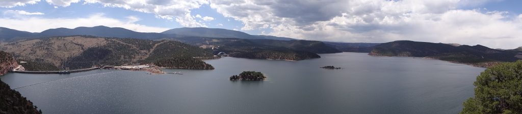
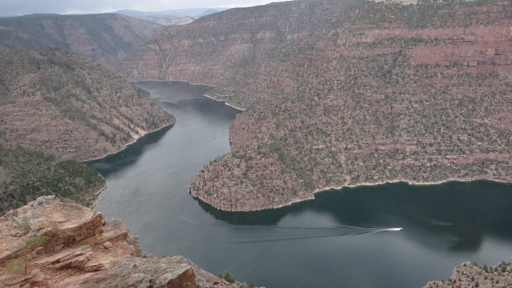
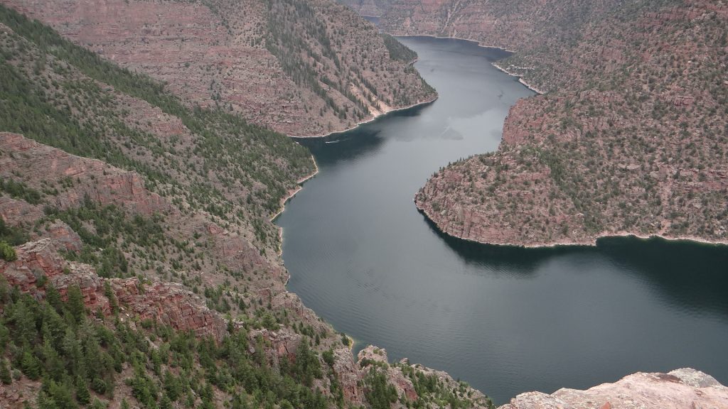
Just before the dam there was a “scenic overlook” that gave a great view across the dam and the lake.
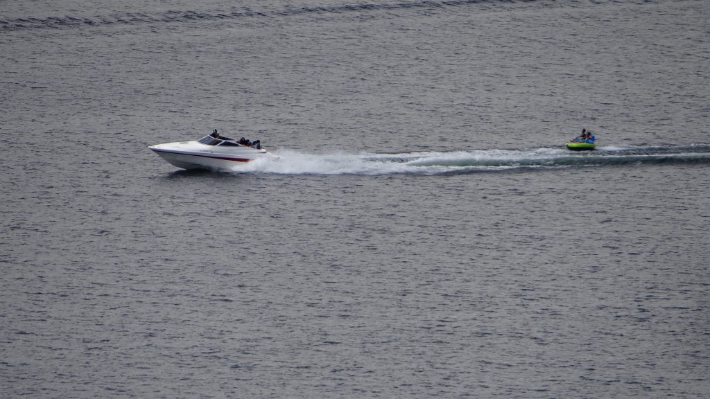
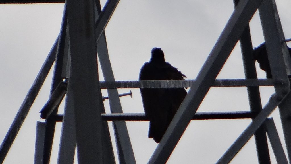
Flaming Gorge DamPanoramic view.A bridge we crossed after the dam.The lake had a lot of recreational boats on it.The dam would have been interesting but you could only visit it on a tour and they were over for the day.Eagle (one of many) on the pylons of the dam.
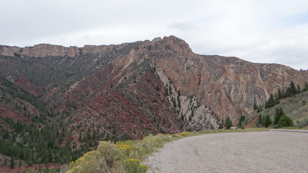
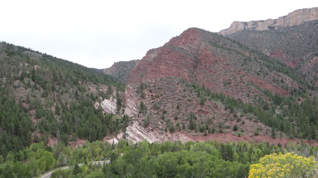
So we moved on to the Red Canyon visitor centre to see the Flaming Gorge.
On the way there we saw this mule deer.And then we were there. To be honest it looked redder than my photos but the sun had gone in.It’s a long way down.And you could walk right up to the edge if you have a head for heights.Closest I got to the edge!!Lots of fissures in the rock you had to jump across.Another edge photo, I got on my knees and crawled forward to look over as I didn’t fancy getting blown over!!More Mule deer.
We then went round the Sheep Creek geological area where there were many examples of how the rocks were formed.
Different types of rock provide the colours and the strata.Towering cliffs.If you look carefully above the pale line of rock in the centre you can see how the rock has been folded into a loop. Just shows the forces that managed to bend an entire rock layer.More red rock.The rusty colour is caused by water leaching iron out of the rock.This part was like the Cheddar Gorge but much higher and towering above us as we drove down the narrow canyon.This was Tower RockOn the drive back to Green River you could see lots of eroded bluffs with multiple coloured rocks in them.
We then moved on to Salt Lake City Utah.
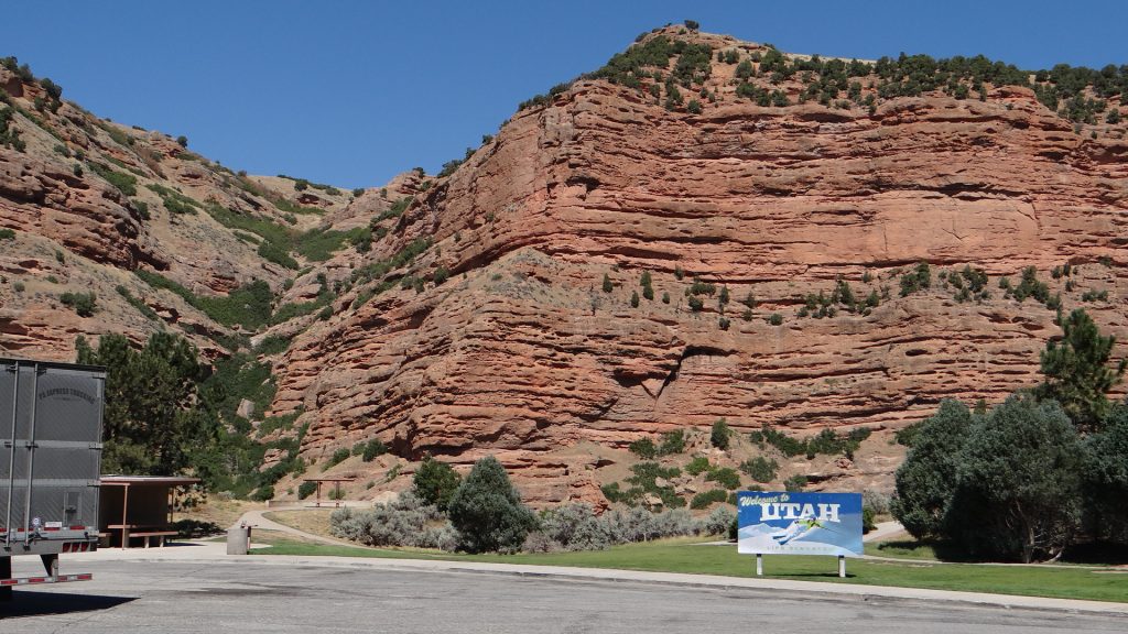
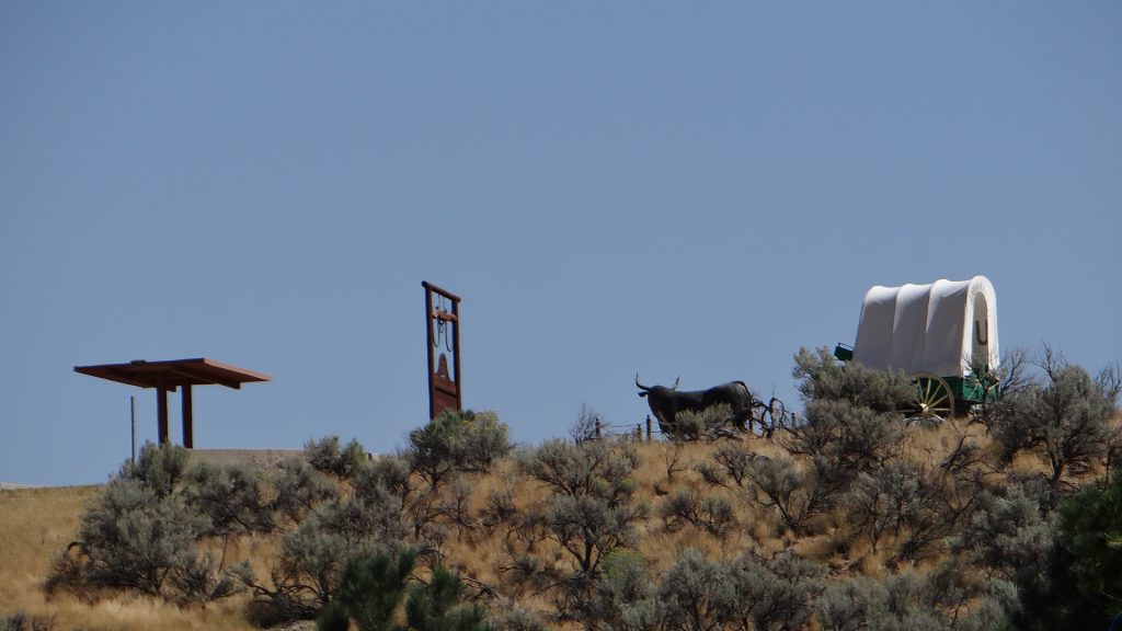
Rest area with more red rocks!!The Interstate followed one of the old wagon routes through the mountains.
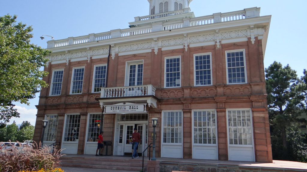
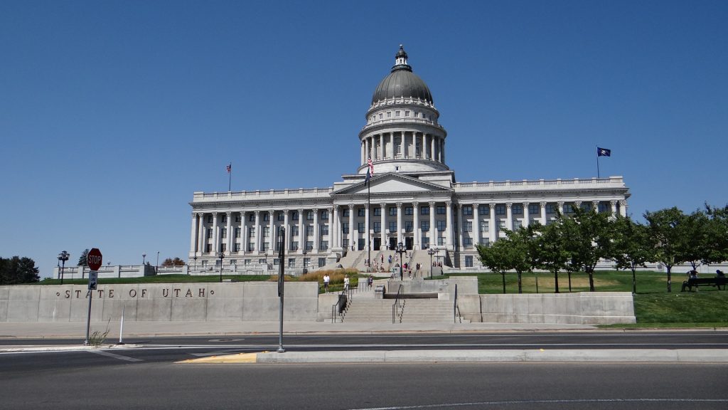
We arrived in Salt Lake City on Saturday and set off to explore on Sunday not expecting much to be open, and found that the Visitor centre and State Capitol building were open.
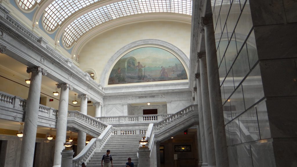
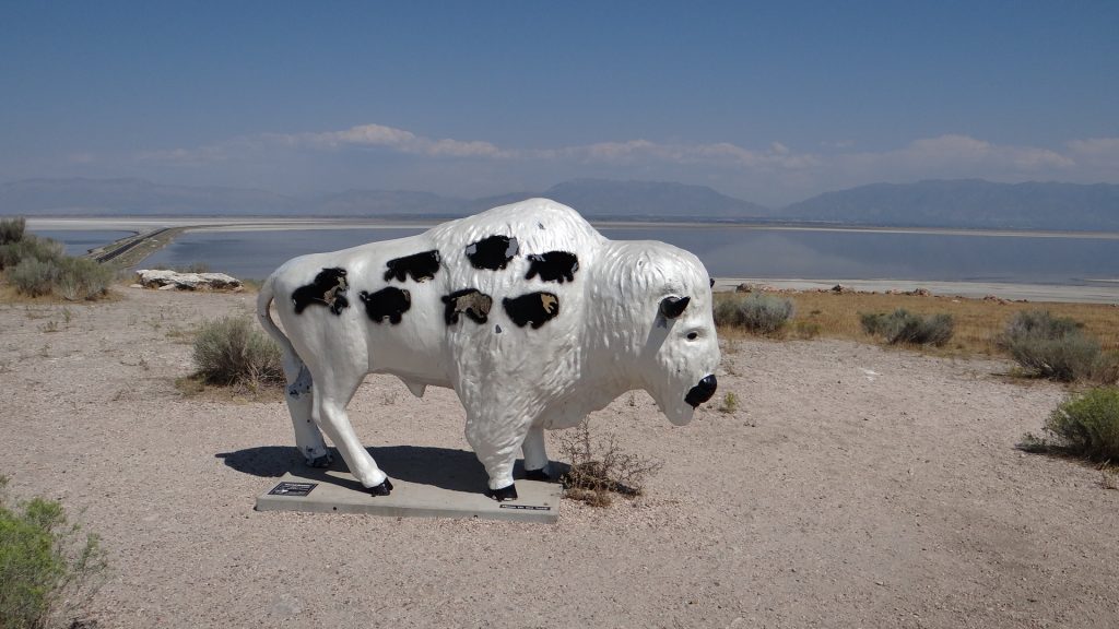
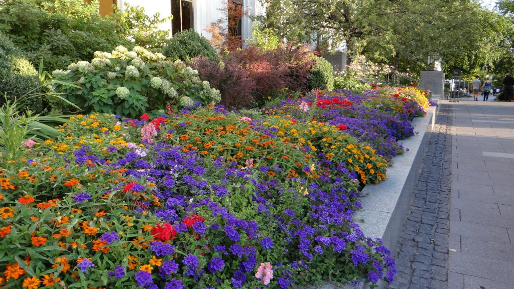
The visitor centre was the old Capitol building.And then they came into some money via an inheritance tax they introduced so they built this!!They were running a Gromit type competition but using Buffalos.The amazing interior. So much marble!!Statue of Brigham Young the Mormon founder of Salt Lake City. Notice the index finger which has been worn down by people touching it.
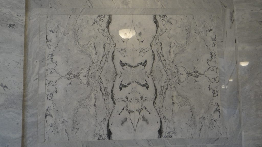
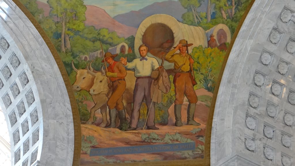
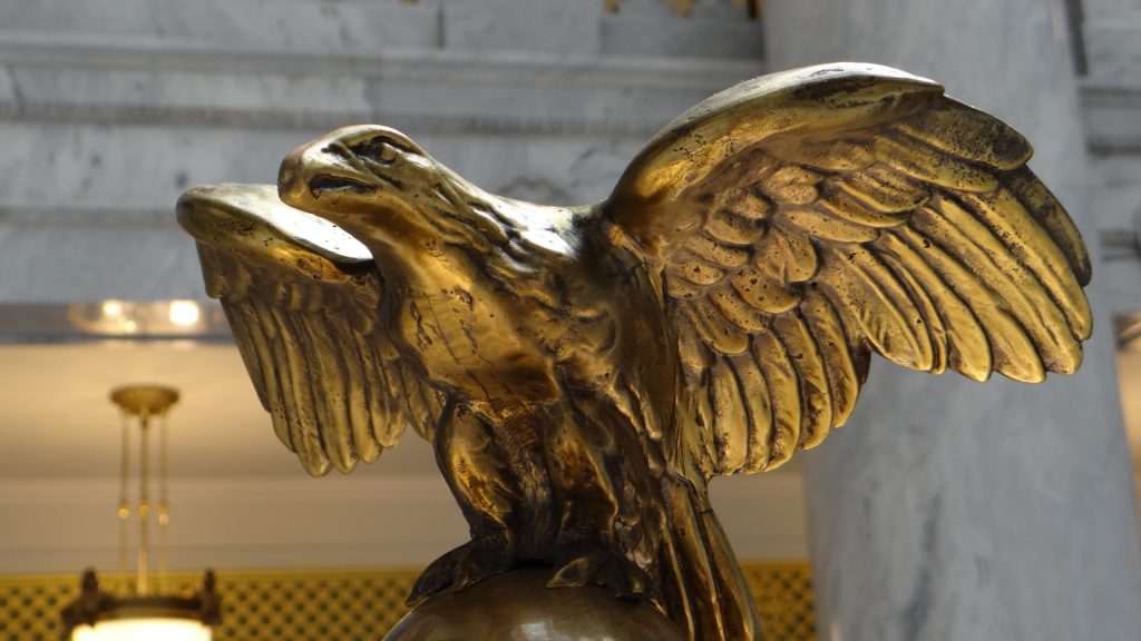
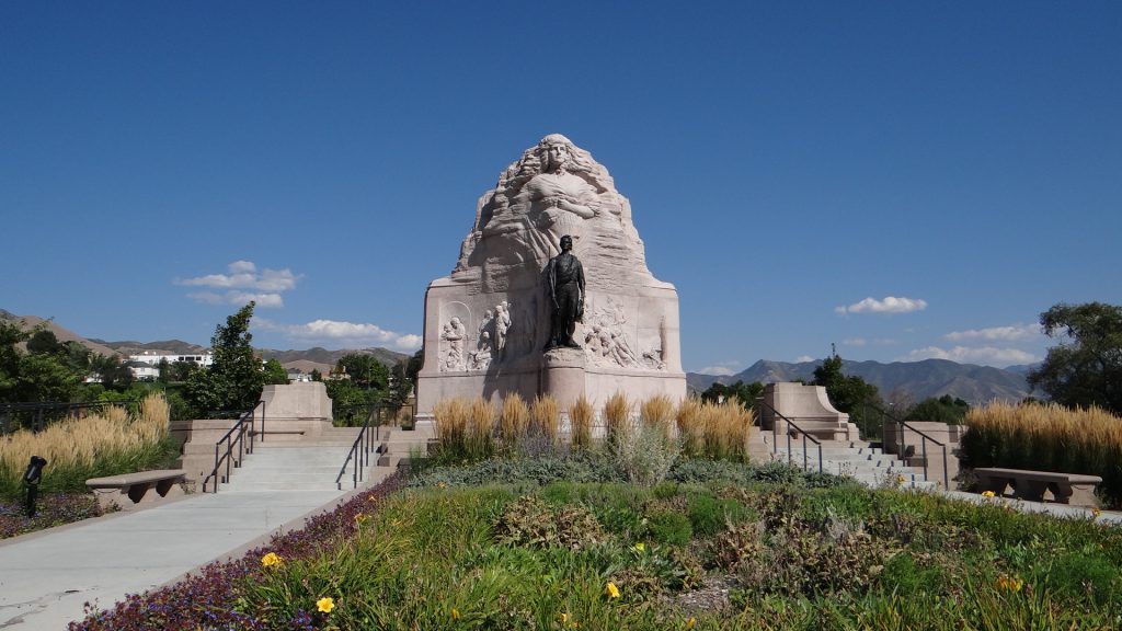
One of the many marble panels with amazing patterns in them.A view from one wing to the other with the cupola in the middle.View up into the cupola.One of the painted murals around the cupola. This shows Brigham Young looking out over the valley and declaring this is where the Mormon city would be founded.The State seal.The state bird was everywhere.View from the Capitol buildings front steps across the rest of the city. The Mormon buildings are to the right hidden amongst the trees.A memorial to the Mormon Battalion which made a gruelling march of nearly 2,000 miles from Council Bluffs, Iowa, to San Diego, California to fight in the Mexican War.
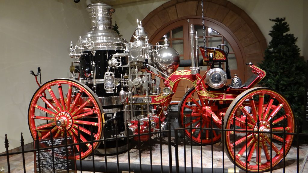
The next day we took the Trolley Bus tour and visited the Pioneer Memorial Museum, which did not allow pictures to be taken, but I managed to persuade them to allow me to take a photo of an amazingly restored Steam Pump Fire Engine.
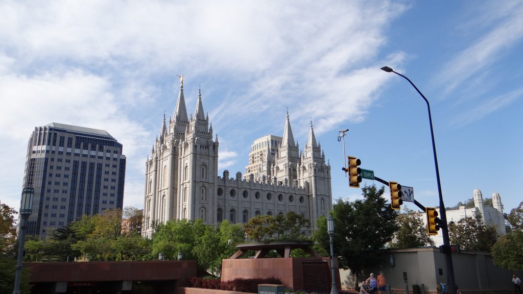
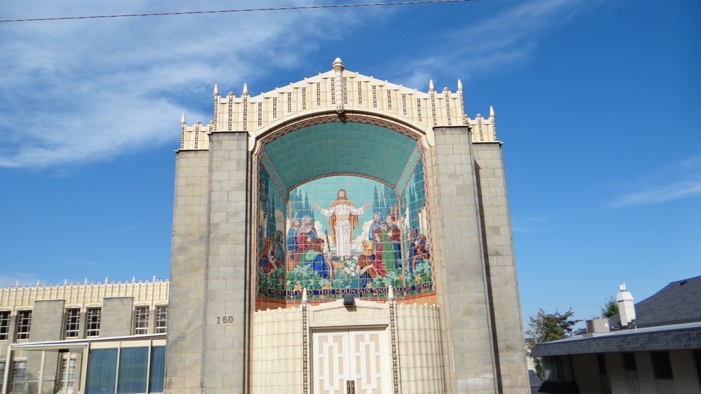
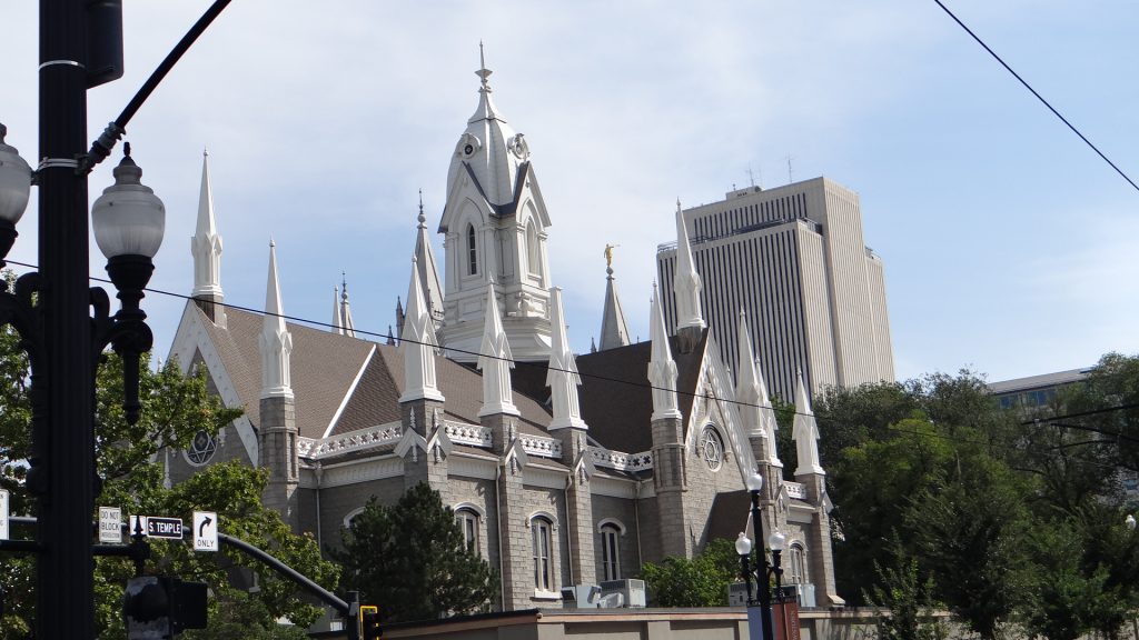
The Mormon Temple.The Catholic Cathedral (with a bus in the way!!).Amazing tiled mural.University of Utah gardens.According to the driver we should have been able to see the Salt Lake from here but that California fire smoke got in the way again.Tram painting.Memorial statues of Brigham Young and the Mormon Battalion.A junction of opposites!!Think this was another Mormon Church.Eagle Gate which once marked the entrance to Brigham Young’s farmland.Pioneer Memorial Museum.The beautifully restored Steam Fire Pump.
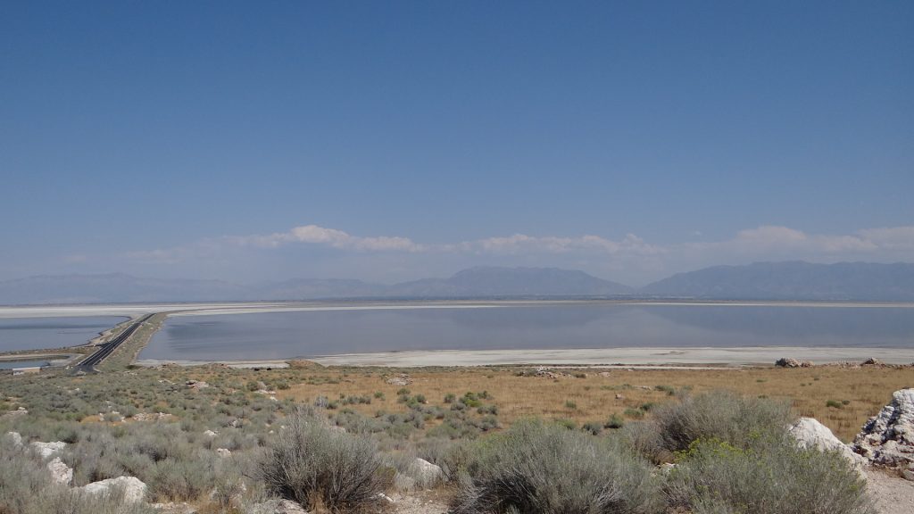
The next day we decided to go and visit Antelope Island State Park, which is an island in the Salt Lake accessed by a causeway.
A view of the 7 mile causeway that links the park to the mainland.
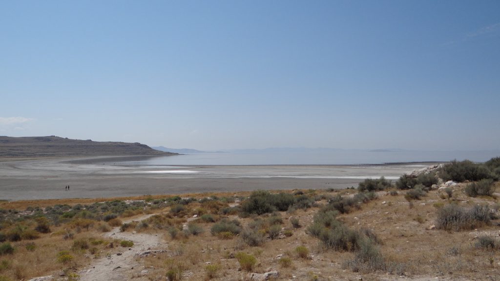
The island is surrounded by the Salt Lake which gets a bit stinky in places but was a fascinating place to visit.
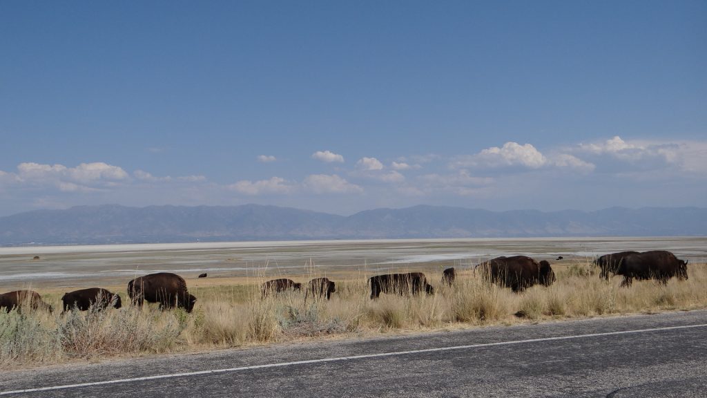
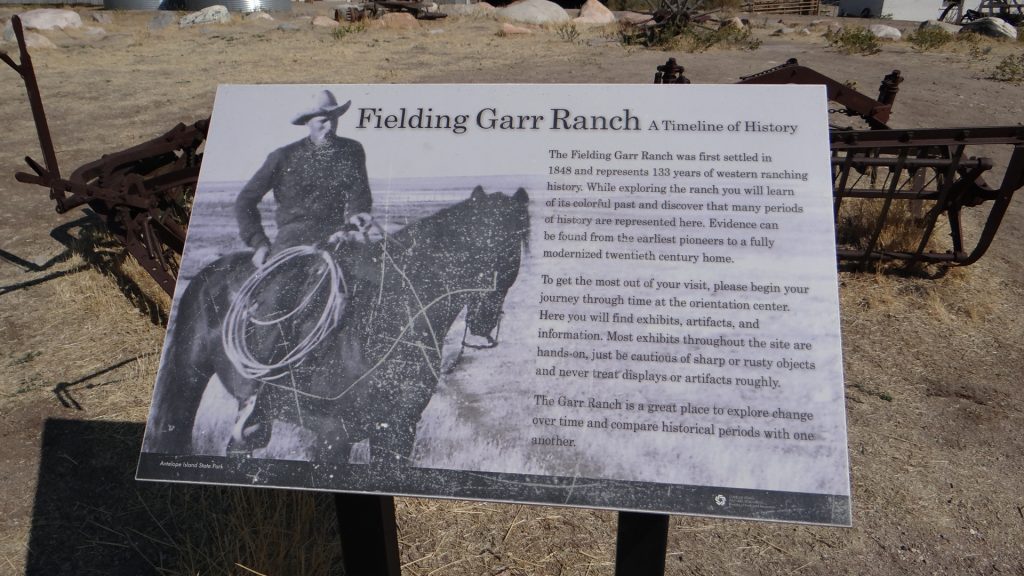
It is also home to one of the largest Buffalo herds in the USA.
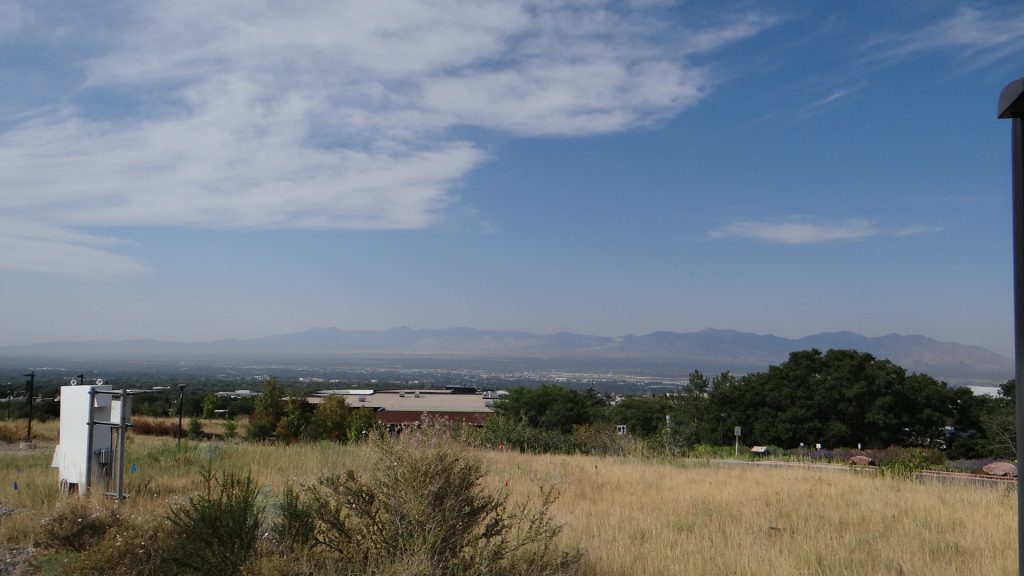
A view across the Lake from Lady finger Point. Looks like a beach and the sea, but apparently swimming in the lake is not a pleasant experience. We didn’t try it!!Another Bison in the competition at the Visitor Centre.The real thing.And a larger herd crossing the road.A herd of Pronghorn Antelope after whom the island is named.This part of the herd was heading across a dried out bit of the lake to a grassy island.The Fielding Garr Ranch was the last working ranch on the island before it was taken over by the State and turned in to a Park.A Humming bird on a feeder at the ranch.A golden eagle.A panoramic view from a high point on the island.Salt Lake city in the distance.
On the Thursday Anne and I spent the whole day in the Mormon Family History Museum looking up our family trees and filling in the holes. It is an amazing place that allows you to set up a free account to investigate your family trees and while you are there you get access to records that would normally cost you money to access. You also get access to some Mormon helpers who lead you through how to access certain sites and how to use the search facilities. A fascinating day, which finished all too soon, but we had planned to go and see the Mormon Tabernacle choir which held its practice on a Thursday and you could watch for free. It was a fascinating 2 hours and the choir and orchestra were very good.
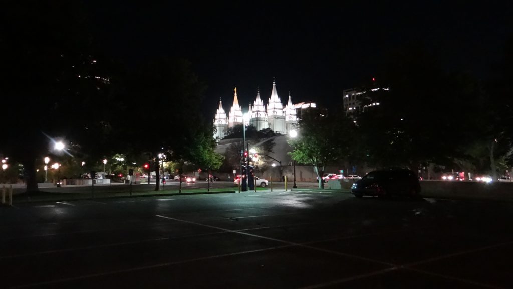
A memorial to Brigham Young and the Pioneers.The Temple of the Church of Latter Day Saints.The inscription on the main front of the Temple.Gardens surrounding the Temple.The Tabernacle Choir and Orchestra. The choir is named after the building they sing in.The massive Tabernacle organ.The Temple lit up at night.
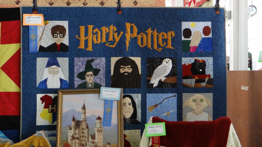
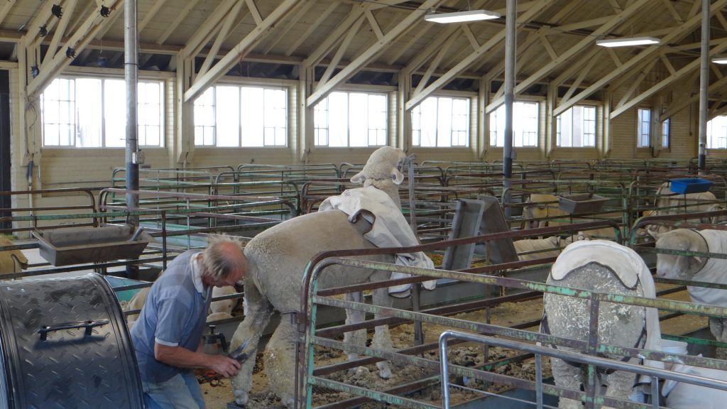
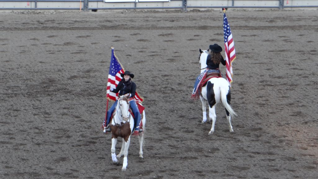
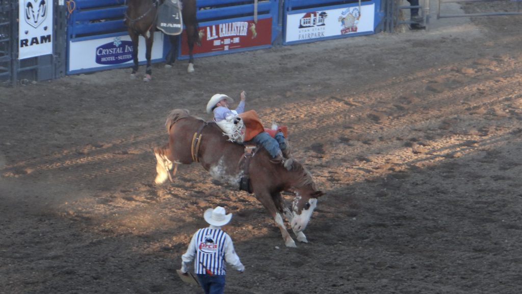
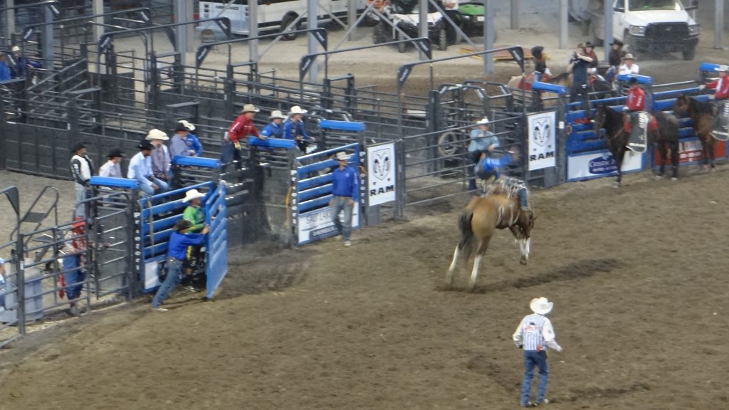
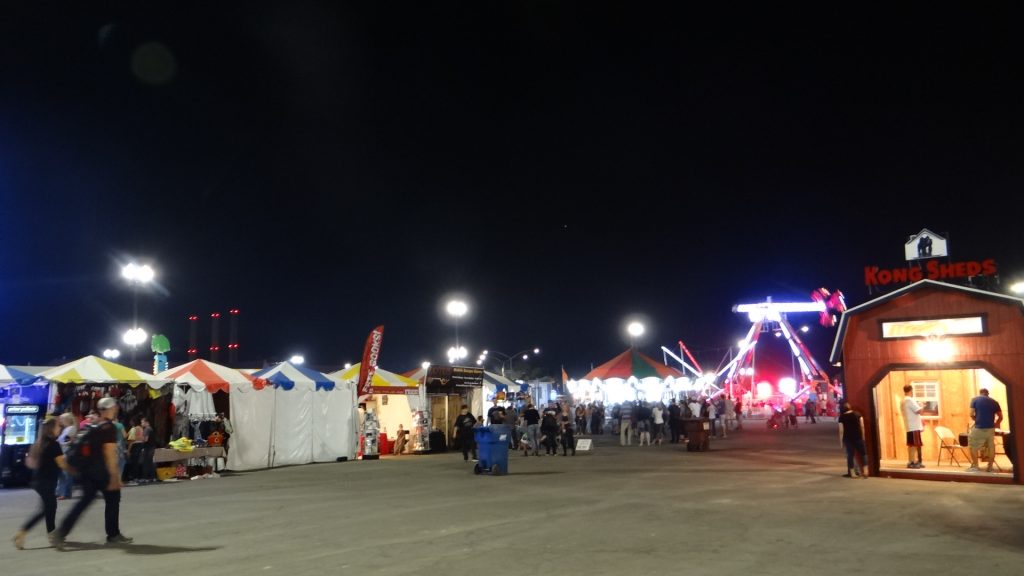
On the Friday we went to the Utah State Fair and in the evening the Rodeo. We finally got to see a complete Rodeo from start to finish including the bull riding. How they stayed on the bulls I do not know, but getting off looked even more dangerous.
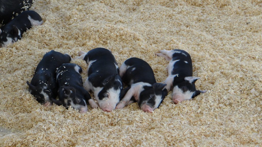
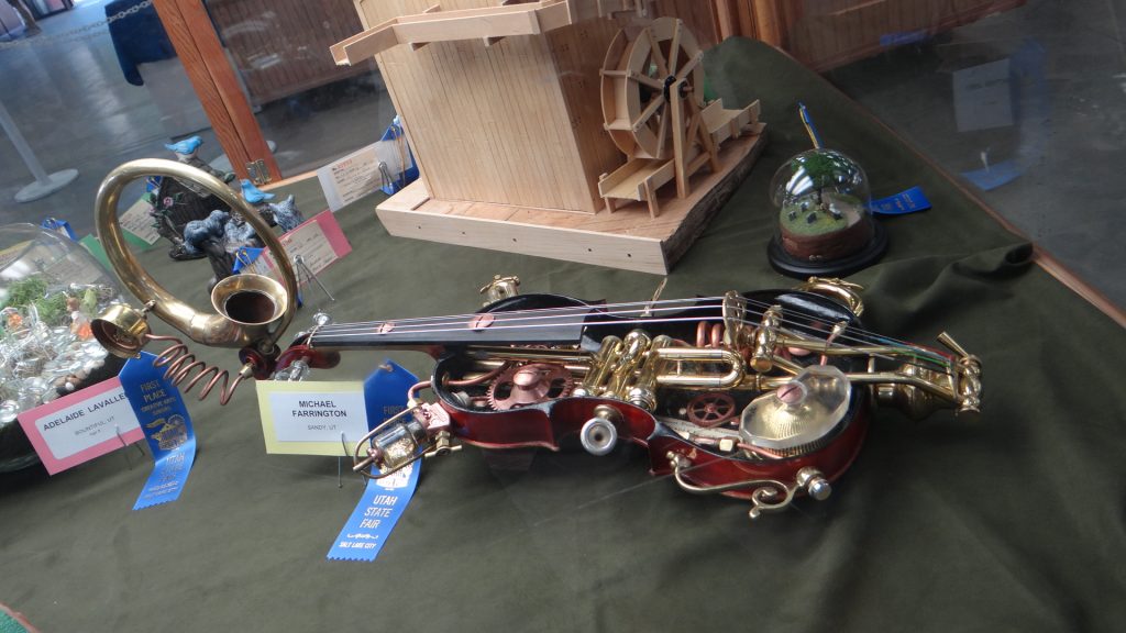
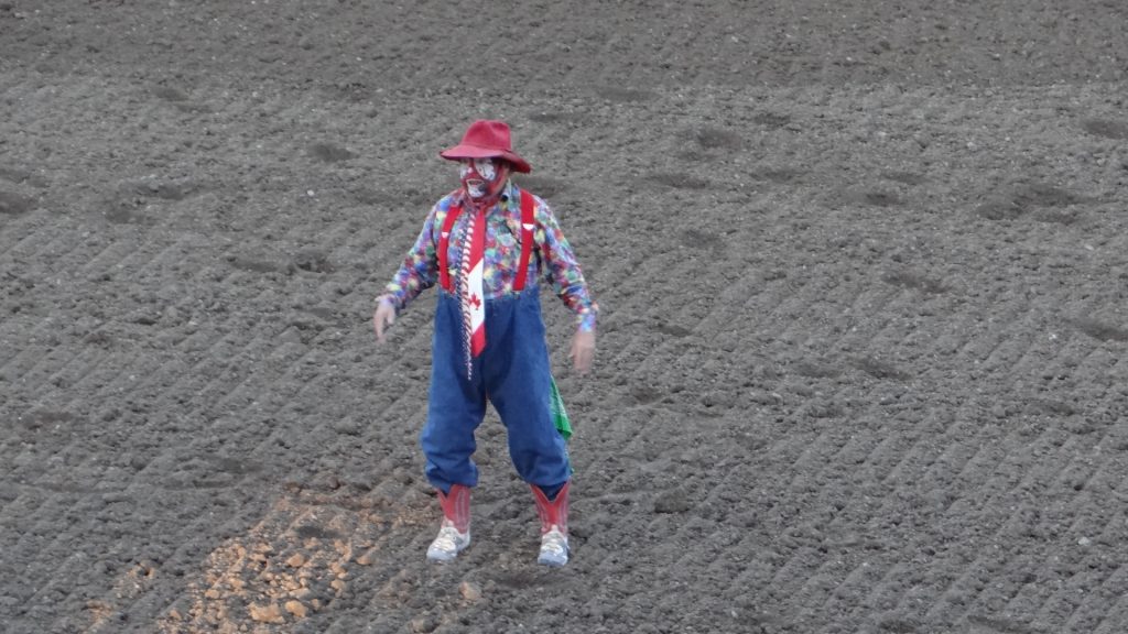
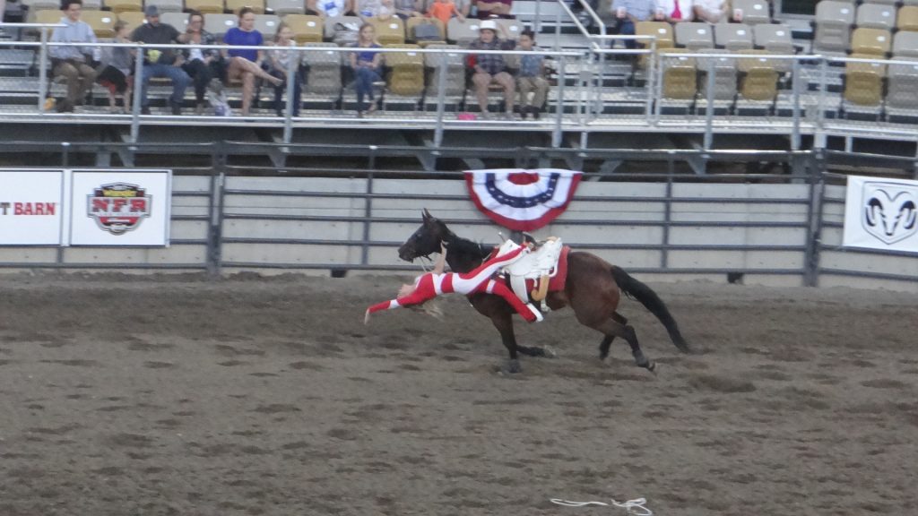
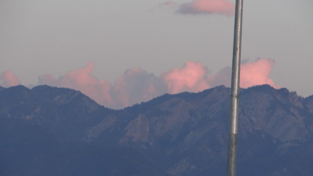
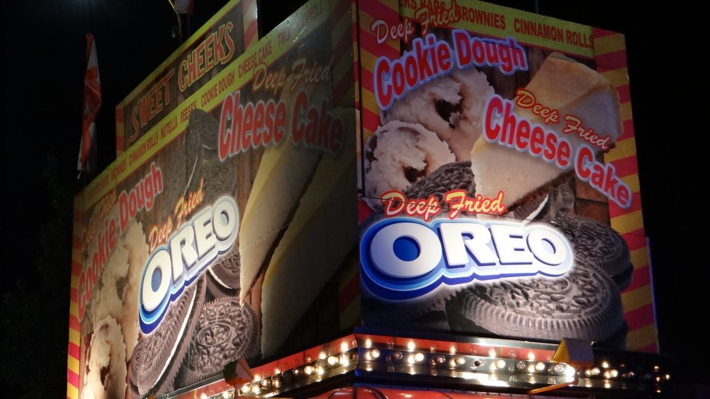
A quilt in the Handicrafts arena.A show sheep getting a trim.Huge cattle arena.Pigs all over the place including sleeping piglets!!Goats were also there.A beautiful metalwork eagle with a gold beak and talons.An amazing violin.One of the many art exhibits.The opening of the Rodeo included cattle herding cowboy style.Part of the main parade.Bucking bronco time.And getting them off after they had achieved the 8 second ride.The rodeo clown is also part of the entertainment.Trick riding and roping.More trick riding.Sun setting on the mountains behind Salt Lake CityMore bronco riding.Best bull riding photo I could get. The bulls are really quick and difficult to photograph. The riders must be nuts!!The Fairground all lit up as we left.You can have FRIED anything!! And I thought fried Mars Bars were bad enough!!
On our last day we spent the afternoon back in the Mormon Family History Museum completing some of the searches we were unable to finish the first time we were there.
The next day we set off for Las Vegas, but first stopping half way down to see Bryce Canyon and Zion National Parks, my next post.