We moved on from Butte to Livingston which was close to the Northern Gate into Yellowstone Park.
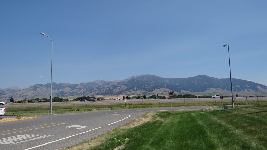
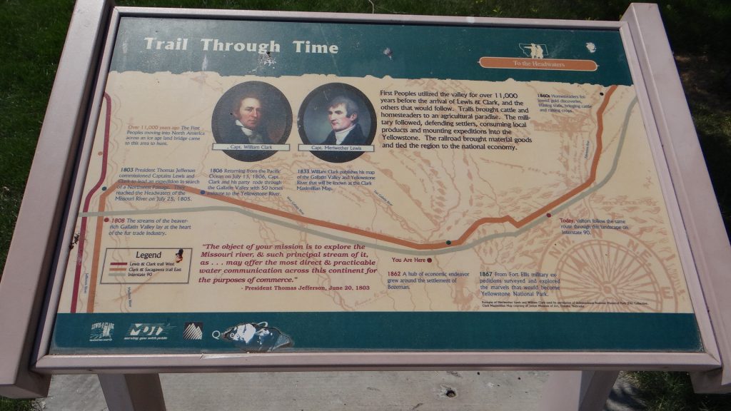
Rest Area on the way to Livingston.Still “Big Sky” countryWe keep meeting these people!! Lewis & Clarke expedition.
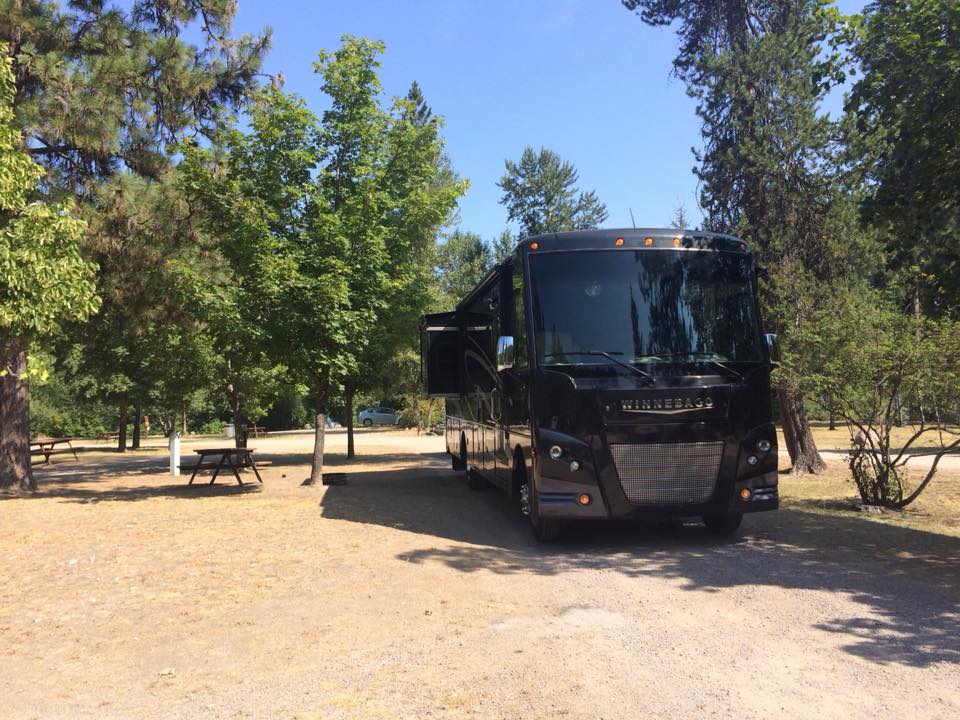
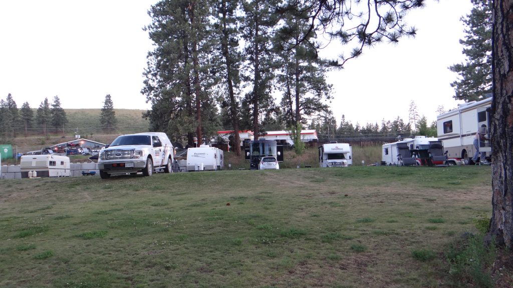
Arrived at Osen’s RV Park and got set up.
Our site.
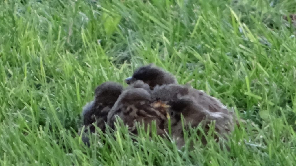
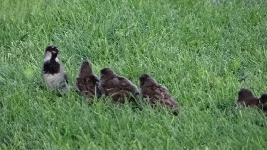
While we were eating we noticed that there were 5 chicks on the ground and the mother trying to feed them all!!
The five chicks huddled together.Every time the mother turned up there was a rush to get fed first.
Livingston was chosen as it was close (in American terms) to the North entrance to Yellowstone National Park.
After looking at the maps it looked like we would have to make at least 3 visits in order to cover it all.
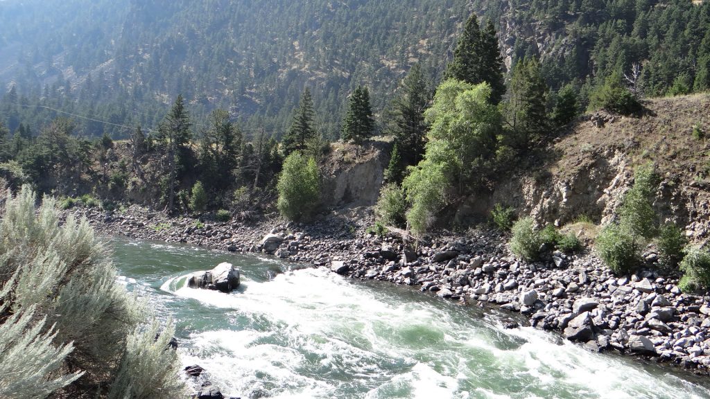
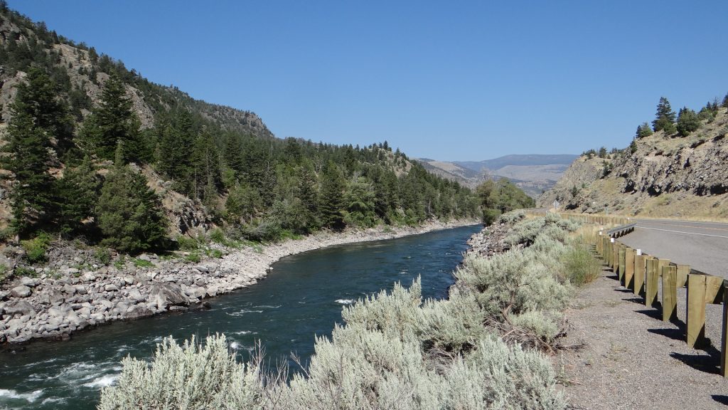
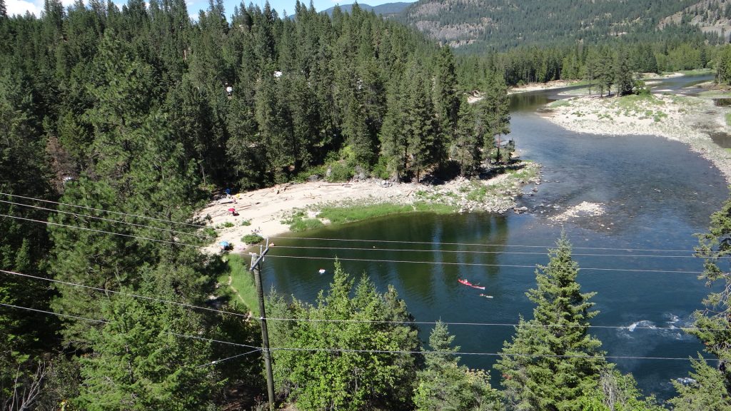
So we set off on visit one. Even getting there was interesting with the Yellowstone River running alongside the road all the way and numerous trout fishing areas.
Lots of places advertising white water rafting and you can see why.Yellowstone river valley.And “Big Sky” was still with us.
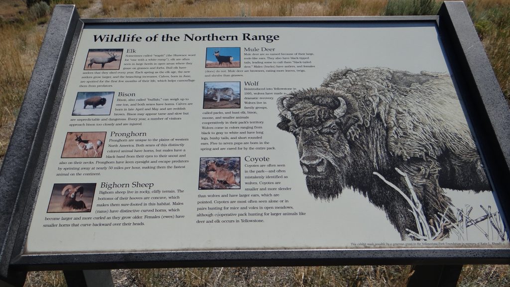
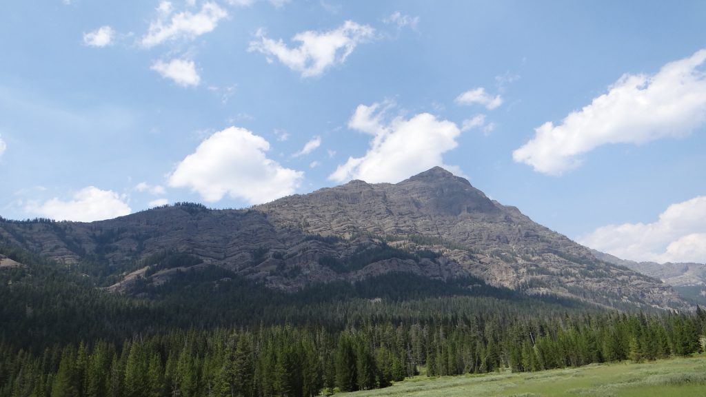
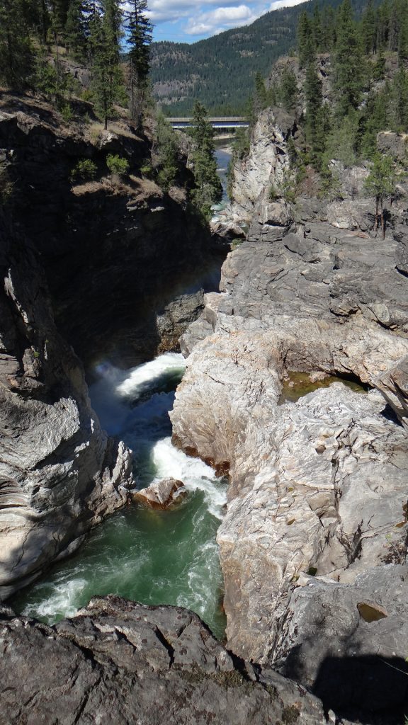
And then we were in the Park. I think this is the most magnificent place we have been, but you, the viewer, will have to decide for yourself.
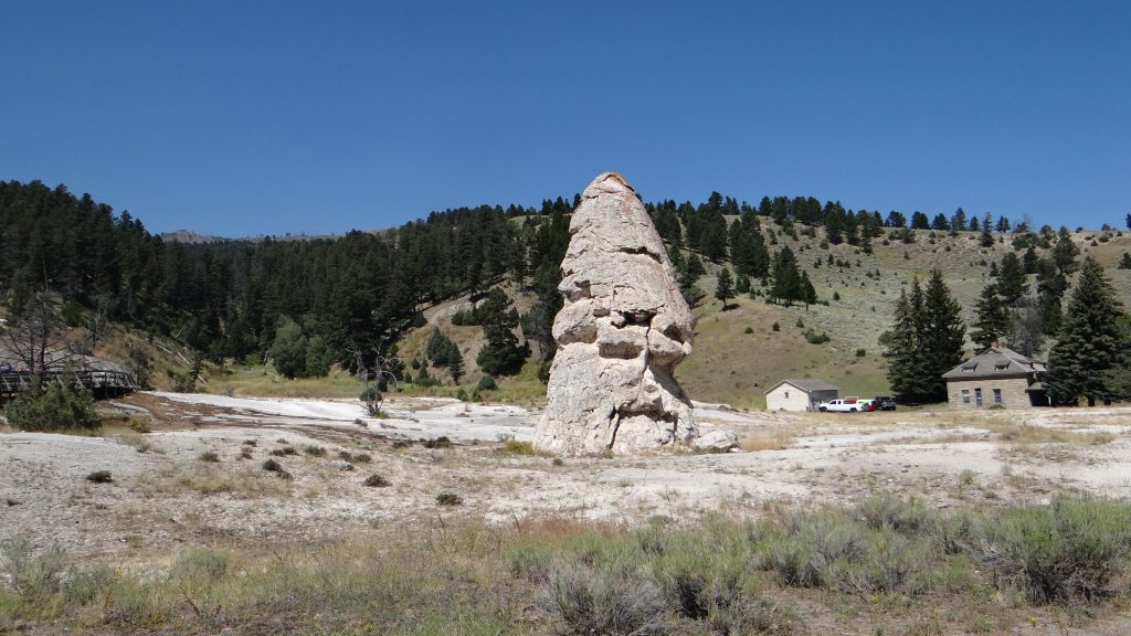
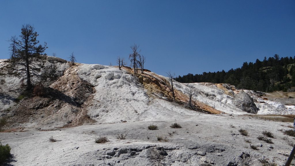
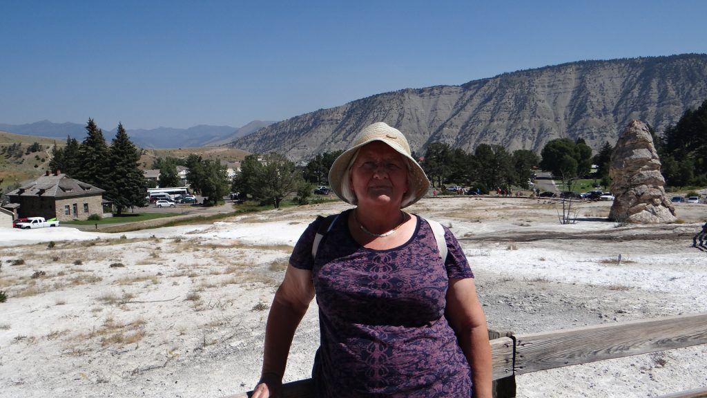
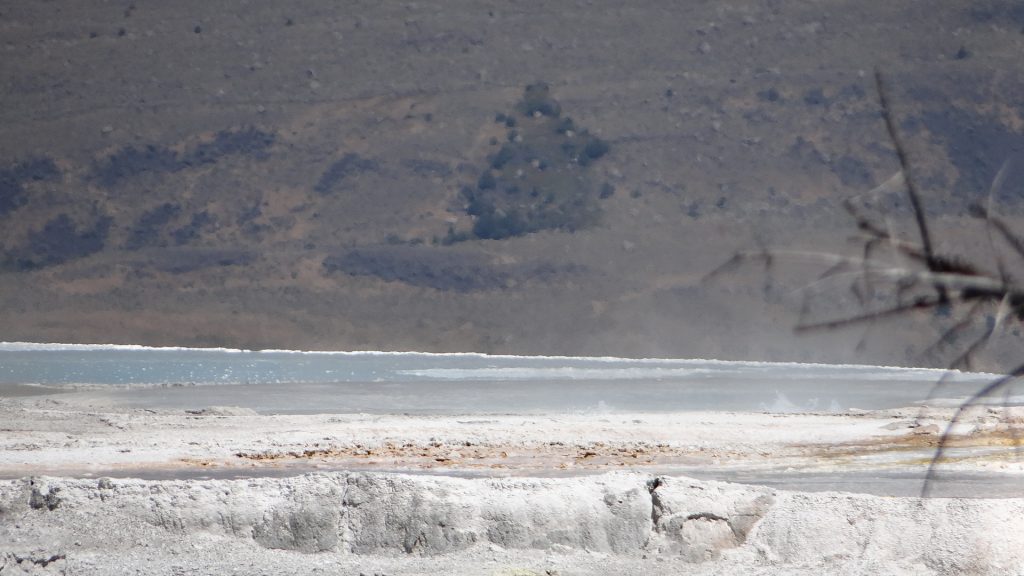
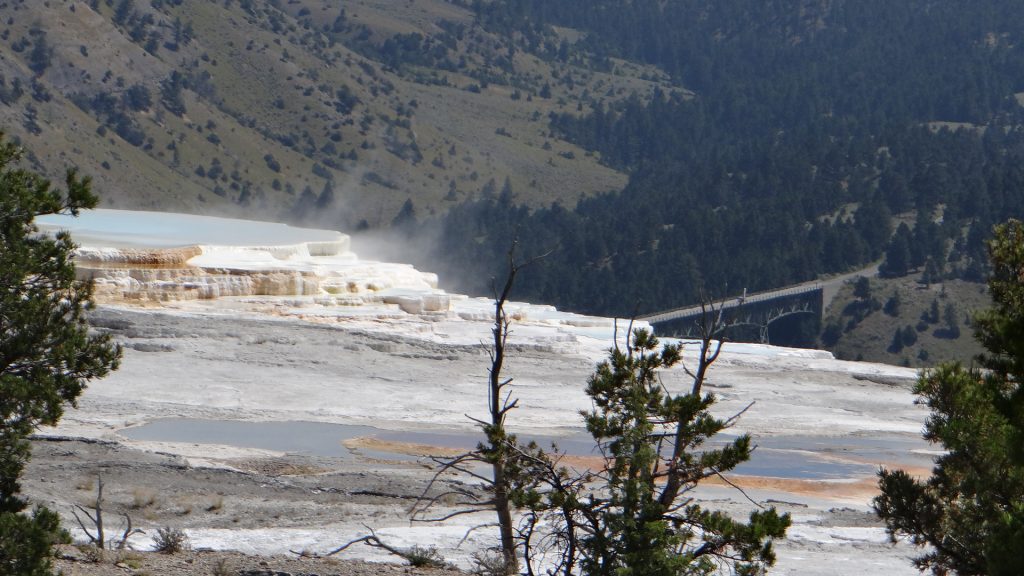
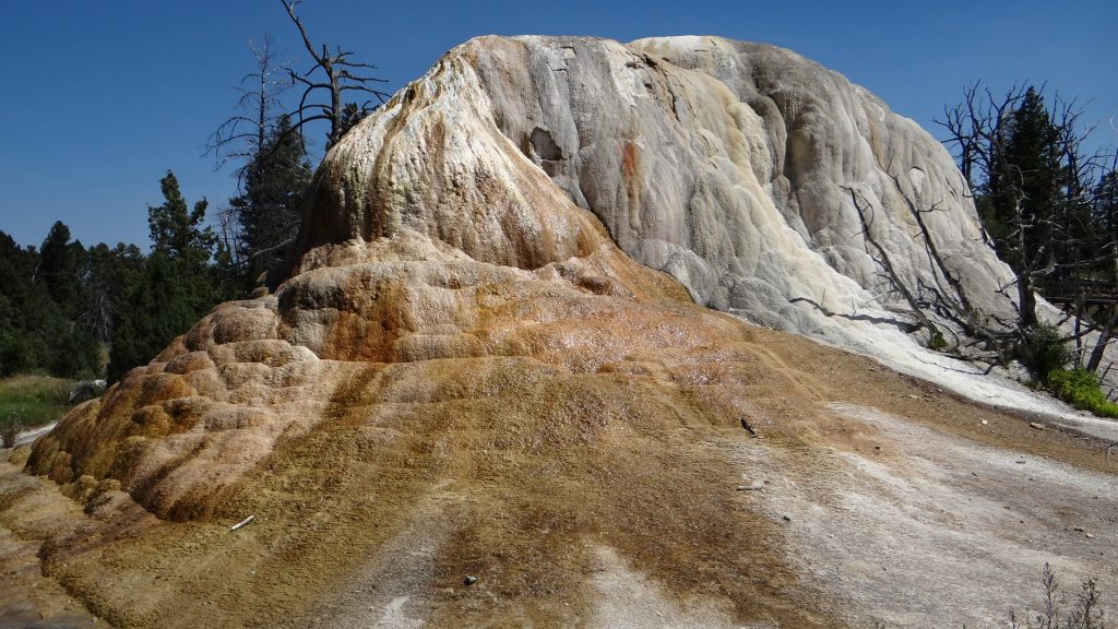
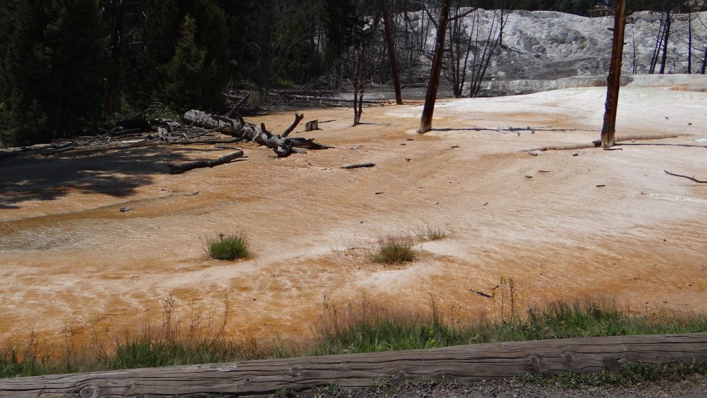
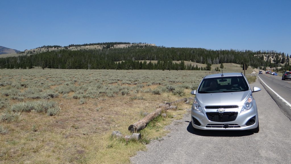
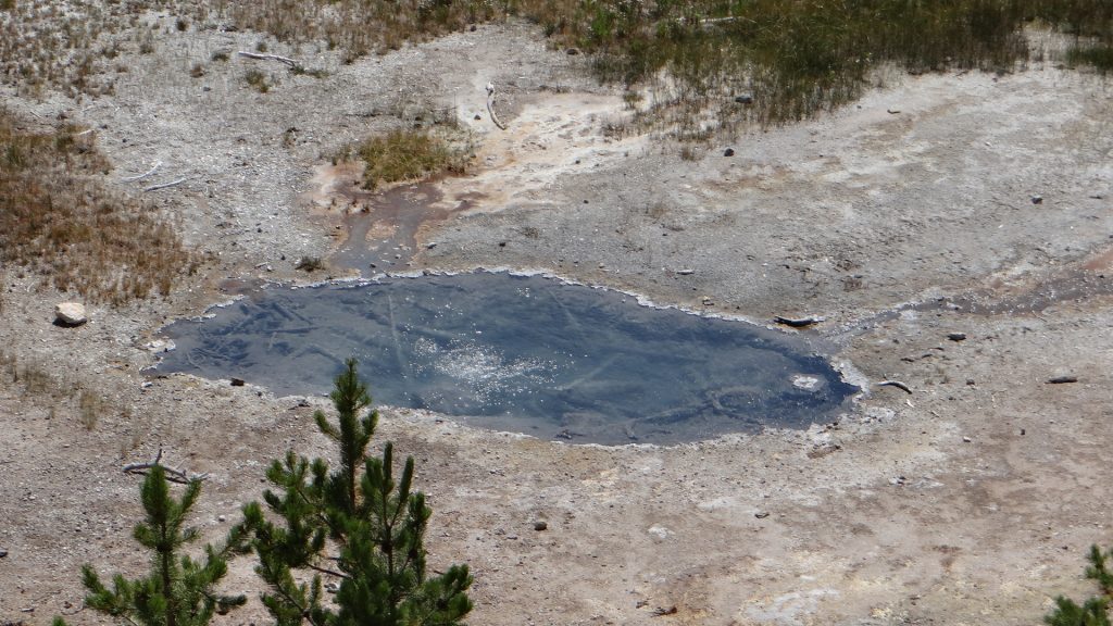
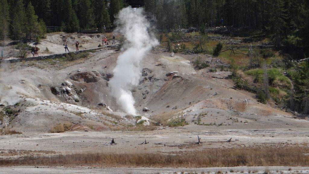
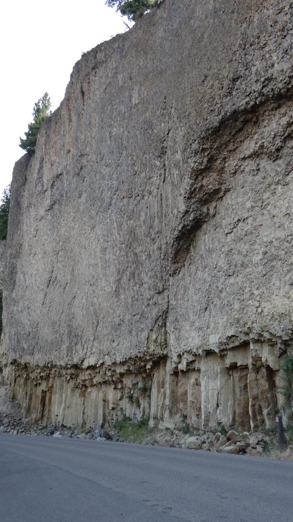
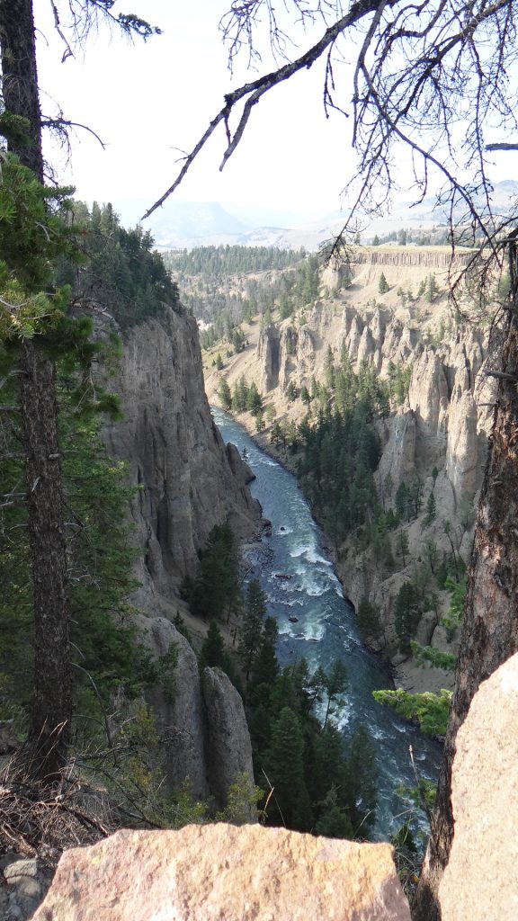
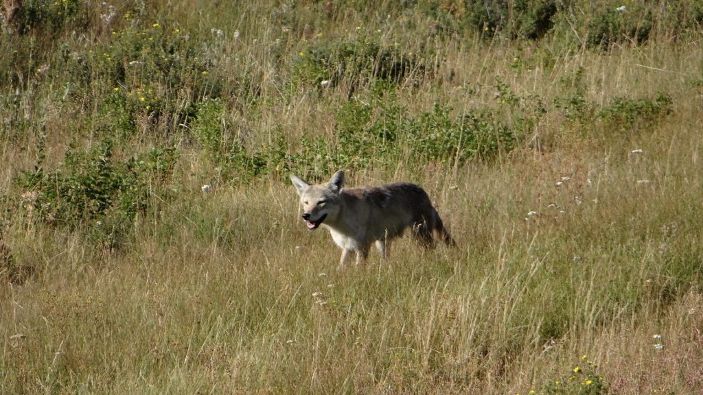
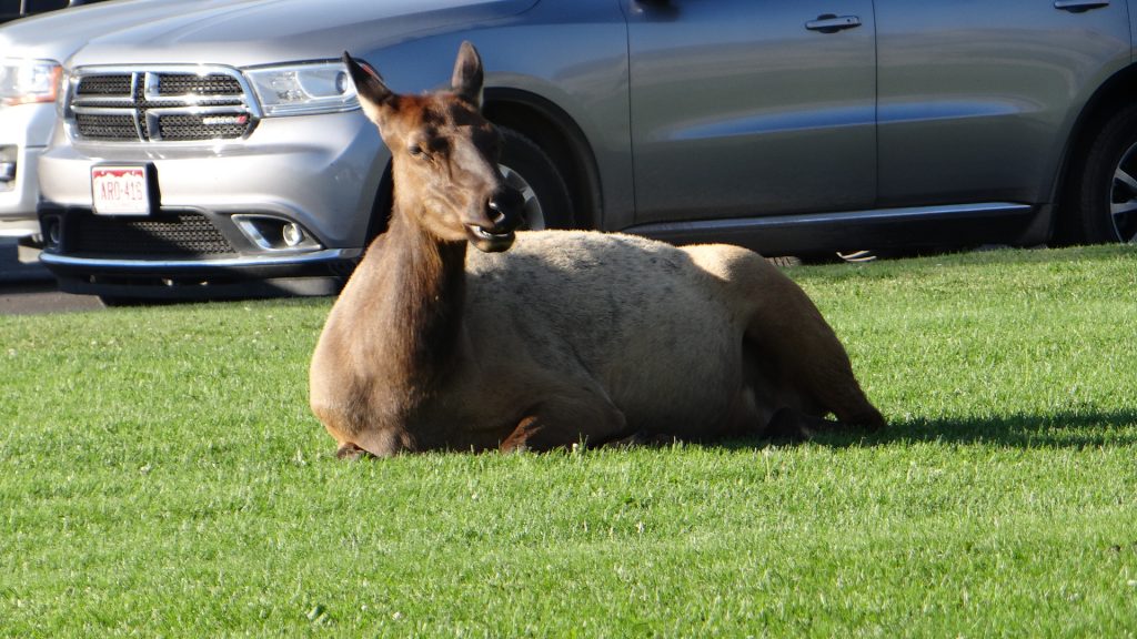
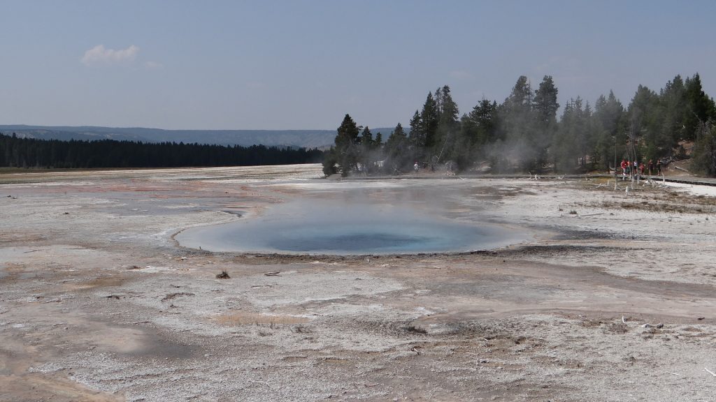
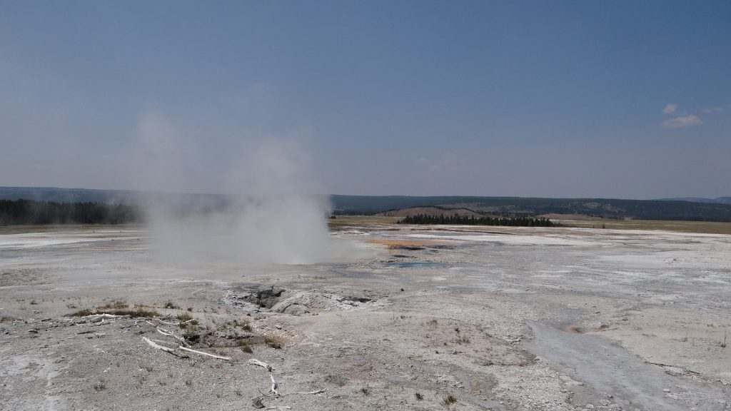
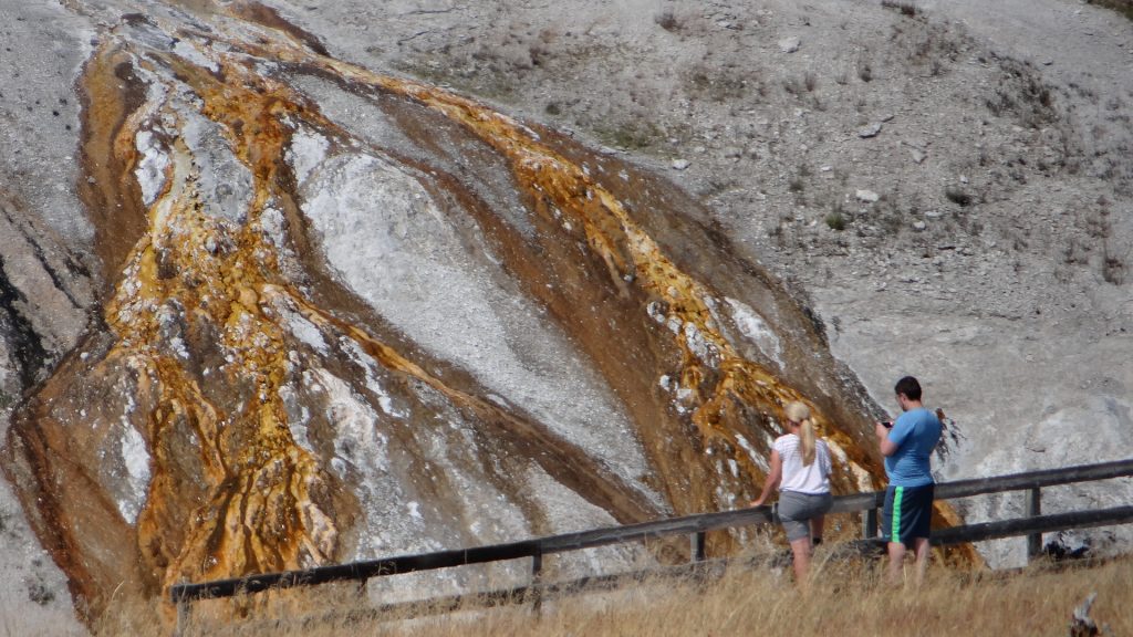
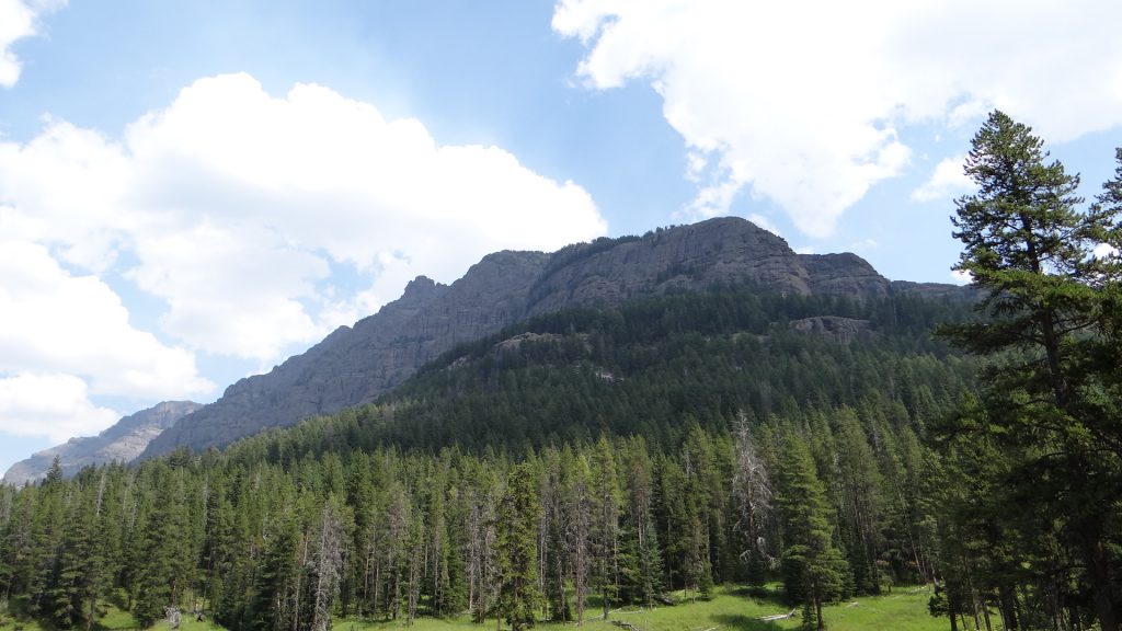
What we can expect to see in Yellowstone Park.Mountain Ranges from Mammoth Springs.The remains of a calcified spring in Mammoth Springs.The runoff from the hot spring above causes the calcification.This spring has also attracted bacteria that causes the change in colour.Steps caused by gradual build up of calcium.Mammoth springs in the background which has huge ranger station.This is the hot spring above the previous pictures that fed the cascade.And further up the levels there was this spring.And then at the top this beautiful pale blue spring, so hot it had steam blowing off it.Calcium column caused by the spring growing up the middle of the column. More bacteria causing the colouring.A whole bed of coloured calcium deposits.The Spark parked on one of the plains on top of the park around 8,000ft up.Snow still on the mountains in August.Panorama showing the lake (Swan Lake) and the mountains.This was called Staircase Rocks. Same basalt configuration of the Needles in IrelandAnother lake formed by hot springs.And this is the spring that did it!!Norris geyser basin.Wherever you looked something was either bubbling, gushing or spouting!!Small geyser going off.Very hot steam fumarole.Yellowstone river cut this valley.Strata in the rock face that ran alongside the road.Yellowstone river canyon.A petrified tree.And just when we had gone all day without seeing any wildlife I spotted these Sand Cranes.And while we were stopped for the Cranes this guy/gal turned up. Coyote!!And he proceeded to catch something right in front of us and here he is chewing on it!!And when we got back to Mammoth on the way back to Livingston there were Elk feeding on the lovely mown lawns. They obviously know where the best grass is!!
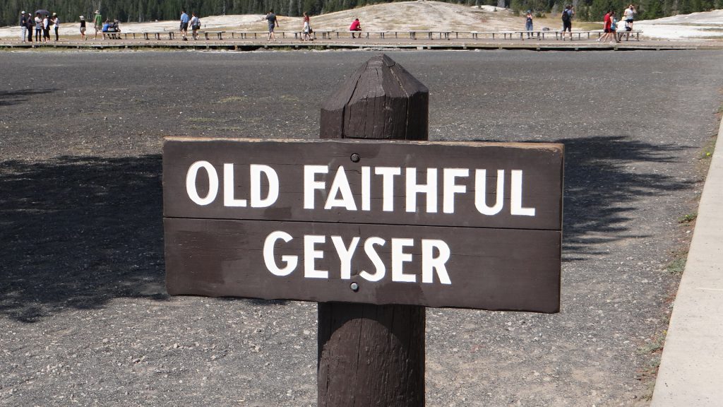
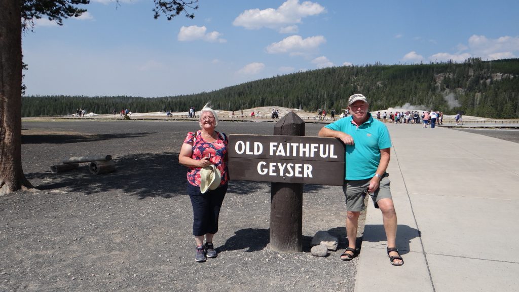
We had a day’s rest and then did the bigger loop to see Old Faithful.
An amazingly coloured Spring that flowed into the river.And the colours of Anne’s top nearly matched it!! I don’t think!!
A hot spring called Beryl. Temperature is between 188.5F (87C) and 192F (89C) so don’t take a bath!!
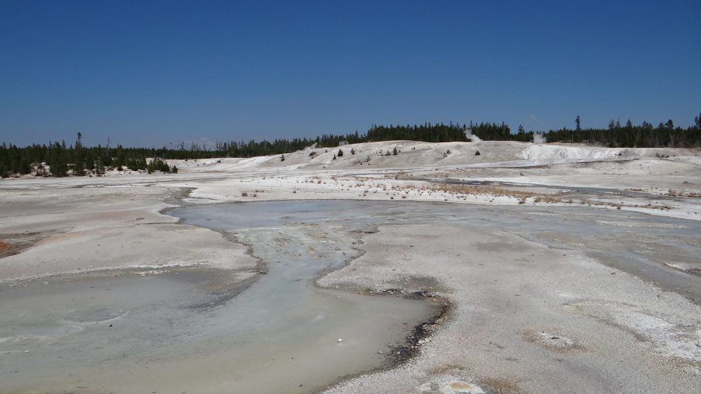
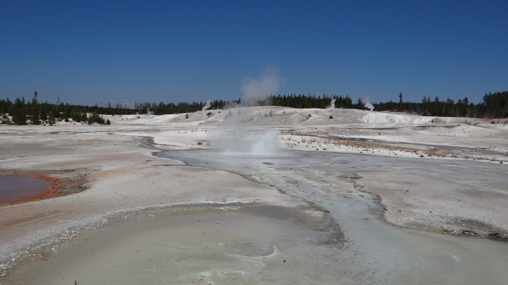
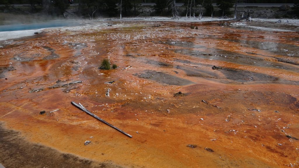
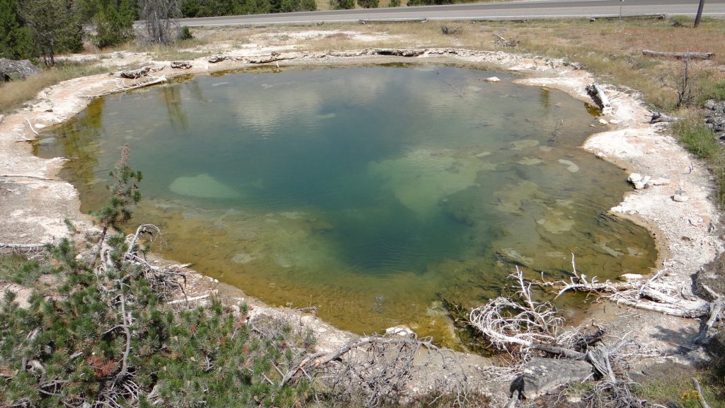
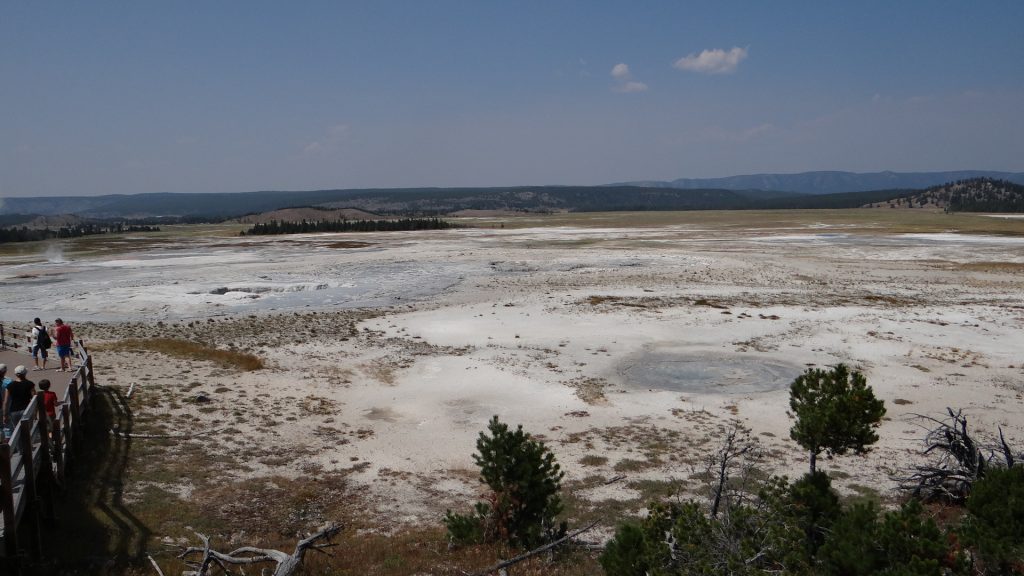
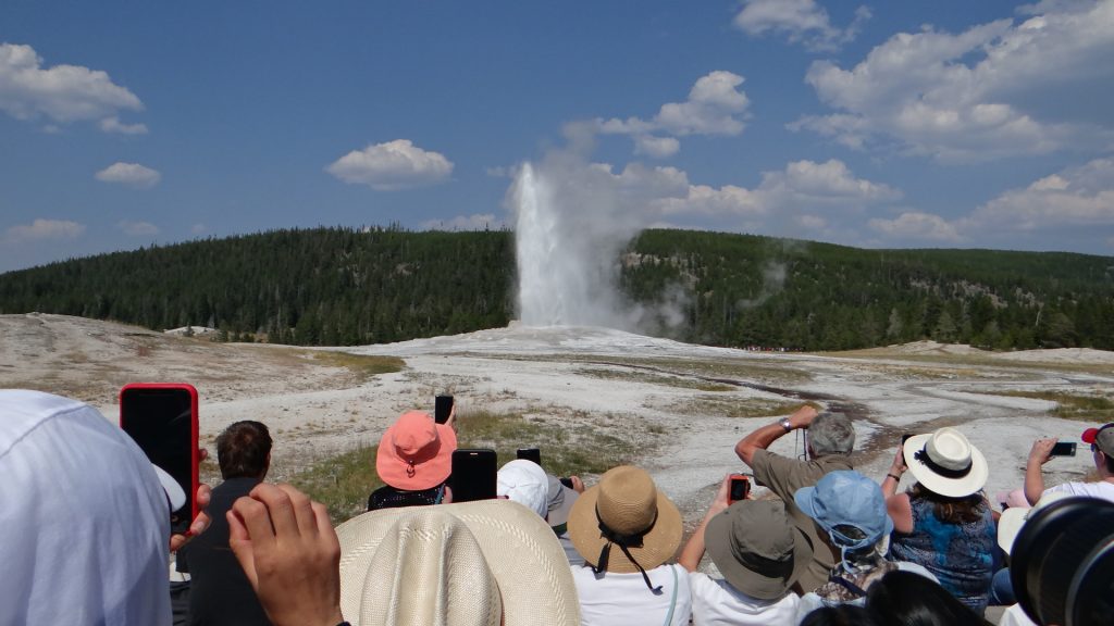
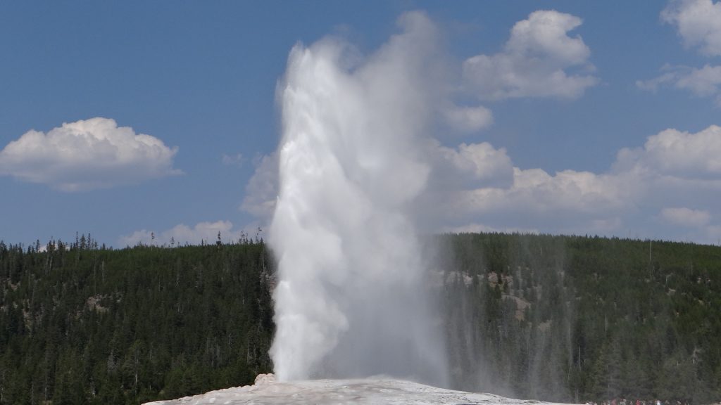
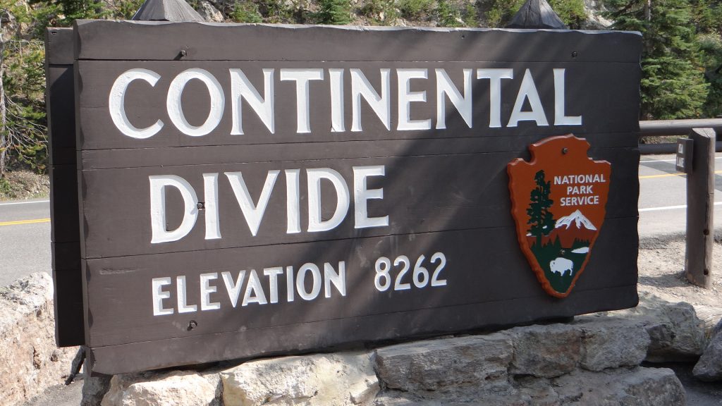
Lower Yellowstone FallsLower Geyser Basin, a hot spring.Bacteria causes the beautiful colours.A deep blue hot spring.A mud spring, just as hot!!This is called Leather Spring.The whole Lower Geyser Basin, it was huge!!A steam geyser, as you walked past it water droplets hit your skin. Very cooling.The main hot spring.This hot spring drained into the Yellowstone River.And then we arrived at ……And with brilliant timing it erupted just as we got to the viewing area.Reached about 50-60ft in the air.Two old geezers at the geyser!!Another beautiful multi-coloured spring.And then we crossed the Continental Divide again at quite a height!!And there was this beautiful lake full of water lilies right next to the Continental Divide that fed two rivers one going east and the other west.Yellowstone Lake as with everything in Yellowstone was huge!!
At this point we turned towards Livingston and thought the Jordan curse of seeing no wildlife had hit again and then out of the corner of my eye as we passed a picnic area………
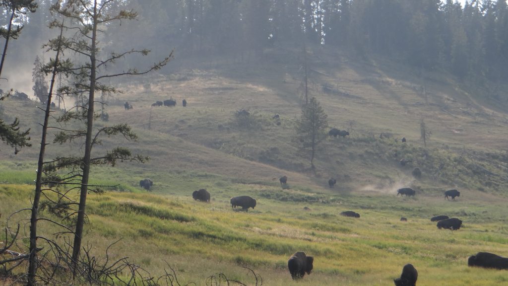
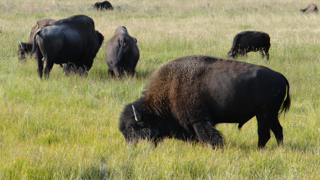
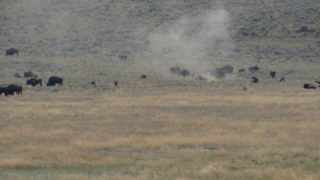
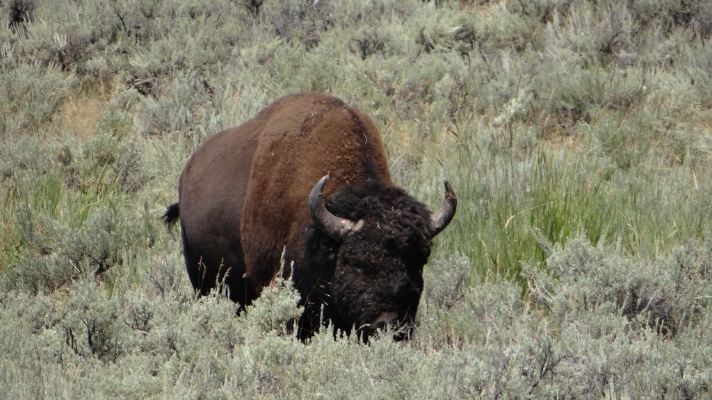
Bison feeding just about 50yds from a family sat at picnic table!!He had a massive head and horns.And then it got silly, a massive herd!!Feeding right next to the road and causing a traffic jam as they crossed it.You can see how close we were to them here.
So we returned to the campsite after a meal in a cowboy grill in Gardiner just outside the Park.
For our third visit we decided to go along the Lamar valley where we were told we had the best chance of seeing bear.
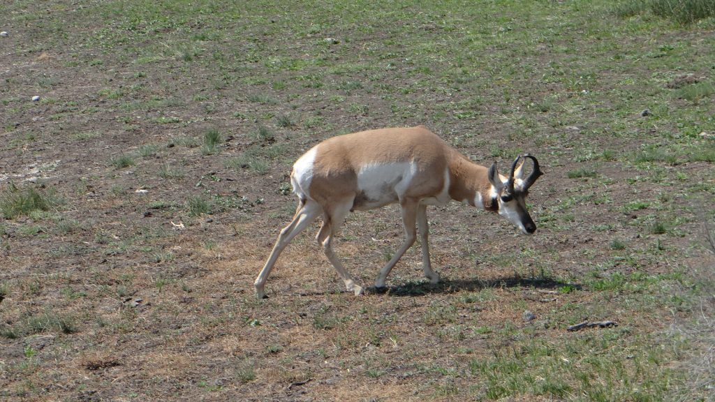
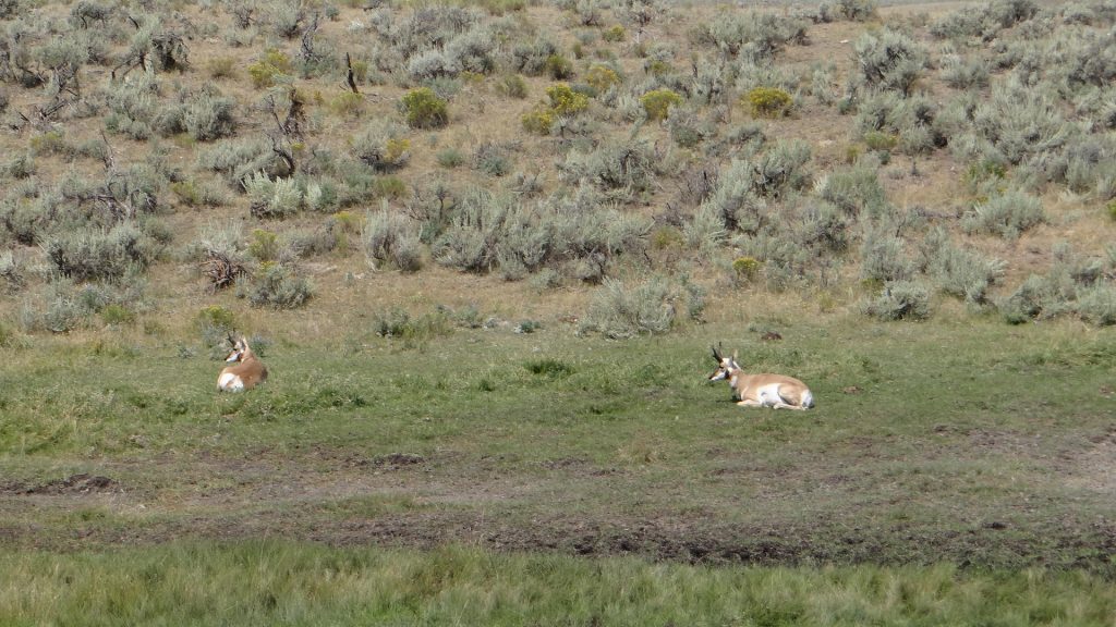
Yellowstone River again.Beautifully marked Pronghorn deer.Better view of the markings.And massive herds of Bison. One having a dust bath to cool down.Another two Pronghorns further down the road.Mother and calf.While we concentrating on the main herd, this huge bull bison came wandering down behind us, and wandered across the road and then back again holding up traffic. You wouldn’t argue with him he was much bigger than the Spark.Magnificent scenery at the end of the Lamar Valley road.Huge mountains either side of the road.
And that was the end of our visits to Yellowstone, still no bear, but lots of other animals and seeing Bison was a treat.
Then we moved on to Billings so I could see the Battle of Liitle Bighorn National Monument.
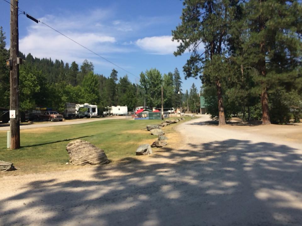
Well our first stop in Montana was Campground St. Regis a small but very nice campground just outside, you guessed it, St. Regis.
Our site, nicely shaded if a little dusty!!View down the site to the Office, and the swimming pool.
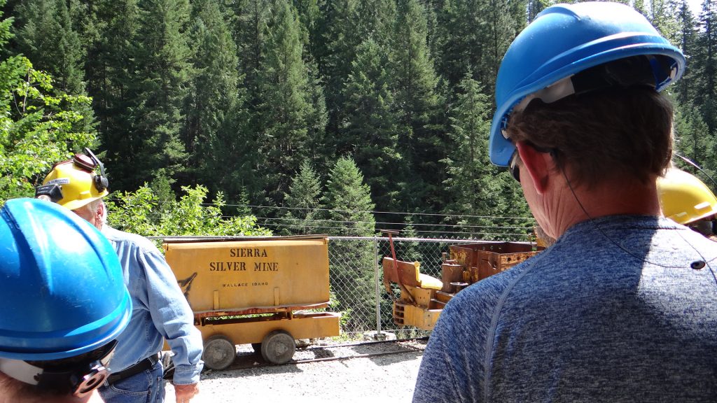
We were told by our Canadian friends from Spokane we just had to go back into Idaho and visit a town called Wallace where, among other things, there was a very good Silver Mine tour.
And so it turned out, we really enjoyed the tour of the mine and the rest of the trolley bus tour gave us an orientation of Wallace.
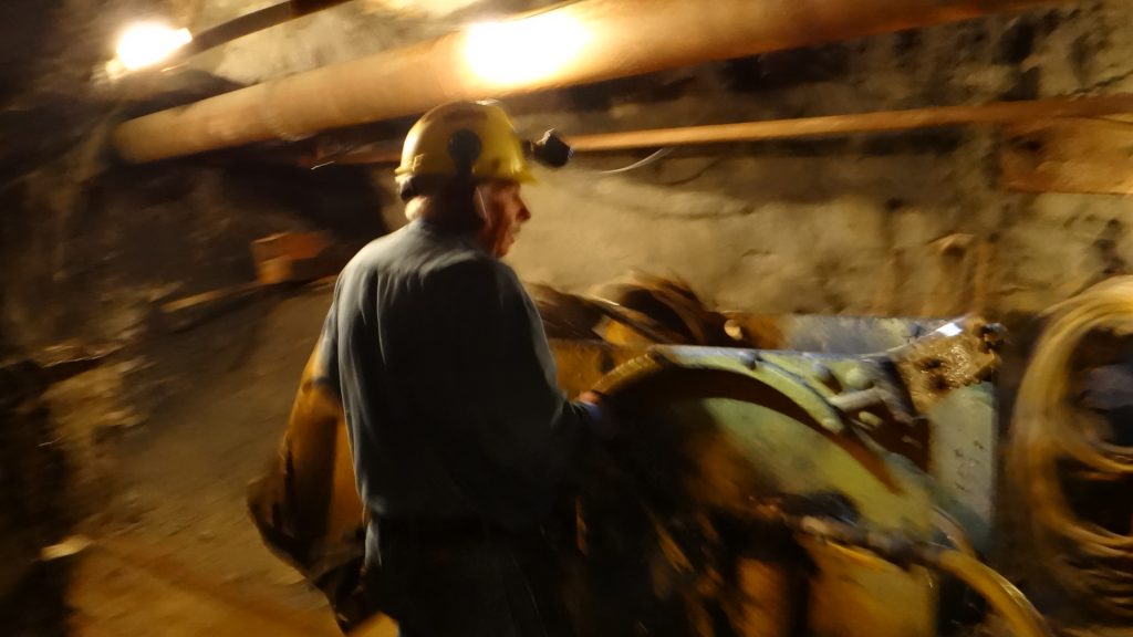
We met our guide (an ex-miner of Swedish origin who had a very good sense of humour) and got kitted out with our hard hats.
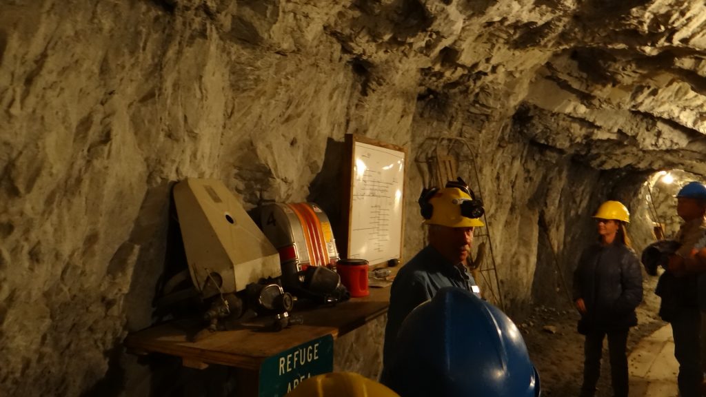
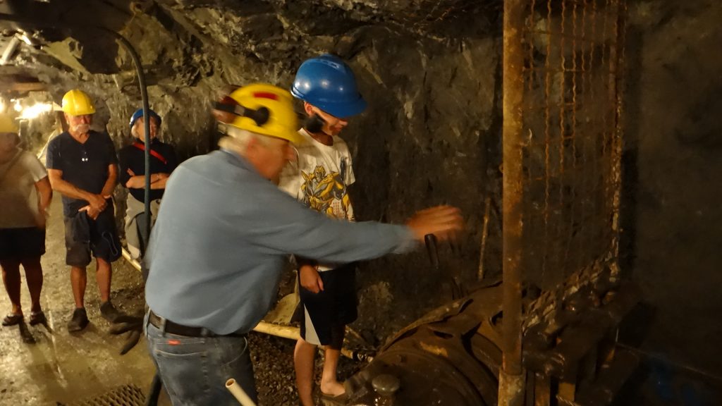
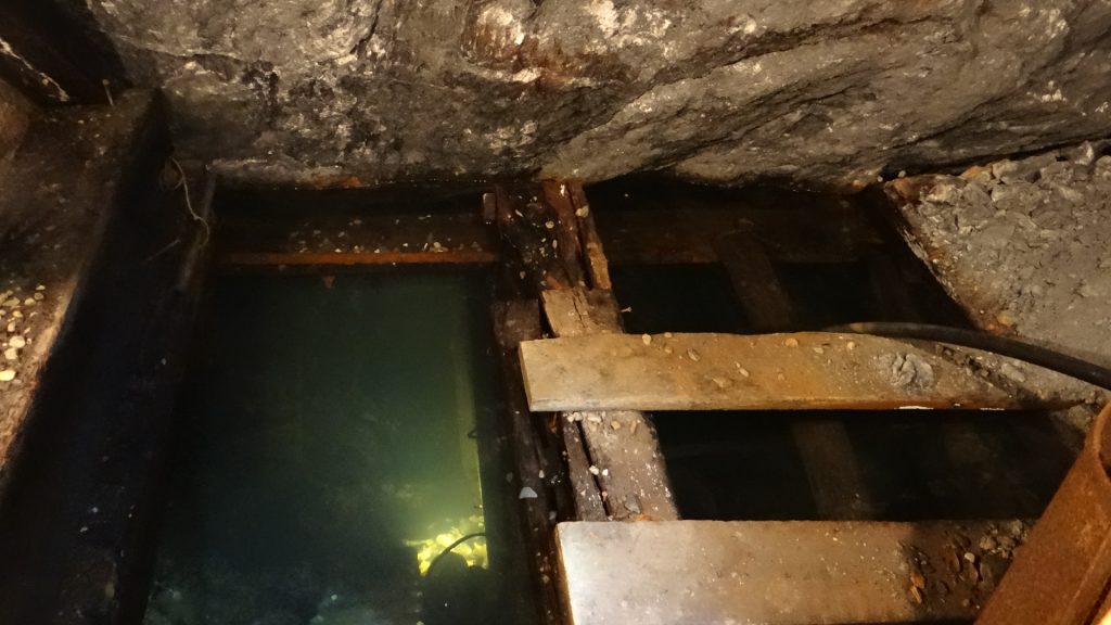
He moved!! This was our guide.Anne and I in appropriate attire.And off we go into the mine.Our guide showing core samples from the mine.Explaining the levels of the mine and mine rescue breathing sets.Diagram of mine levels. Mine when in production had 14 levels.Guide demonstrating a pneumatic drill. Water is also sprayed at the face to keep the dust down.Demonstration of a blast sequence. Luckily only lights flashed.Child on the tour running the drag shovel.Steel hawsers running back to drag shovel. Pneumatic powered.Tunnel got quite tight at times.Our guide explaining how the mine lifts worked and showing these girls how to work the lift signals.Flooded section.A pneumatic dump shovel . Run the digger forward, fill up the shovel, and the shovel goes up and over and deposits the ore into a cart behind. Keep you fingers out of the way!!Core sample showing silver which is actually the black rock, white is quartz.
We then had a look around Wallace itself. It is quite an old town that has the distinction of every downtown building being on the National Register of Historic Places. This came about because when they were building I90 they planned to knock down most of Wallace for the Interstate to go through, which obviously the inhabitants thought was a bad plan. A local businessman, Harry Magnuson, sued the Road building authorities saying they hadn’t done a proper environmental impact. And he won, and as part of that process got all the downtown buildings placed on the National Register which forced them to build I90 over Wallace on a flyover!!
It also considers itself to be the “Centre of the Universe” which came about because it claimed to be the centre of the silver mining area that had mined over 1.2 billion ounces of silver in the mines surrounding it. With a population of just 784 that is a pretty big boast, but you can see the plaque if you take your life in your hands as it is in the middle of a cross roads!!
Centre (Center) of the Universe Plaque.
There is also quite an interesting museum of the Northern Pacific Railroad.
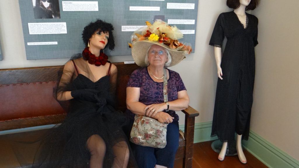
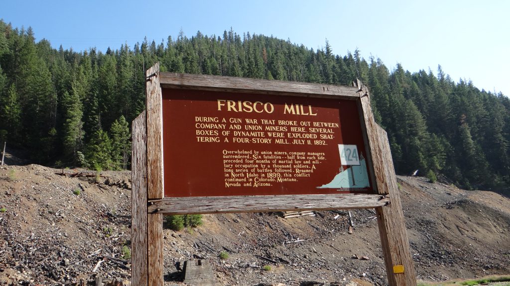
Illustration of the route of the Northern Pacific Railroad.Anne modelling a dressing up hat in the Museum. For some reason this was also in the part of the museum that had a display of bordellos in Wallace, hence the other “ladies”.Pictures showing how they moved the station building (where the museum is housed) during the building of I90Apparently Lana Turner, the Hollywood star, was born in Wallace.Lots of old silver mine sites around the town.Including one that was blown up with dynamite by the miners in a gun war between the miners and the mining company! The rubble behind is all that is left.
Wallace was a very interesting place and well worth the trip if you are ever close by.
You can see why they call it “Big Sky Country”, blue skies and magnificent views.
The following day we went to a local county fair. Local people displaying their handiwork, and their livestock, plus some events in the rodeo arena. Unfortunately the rodeo itself was not on until after we left the area.
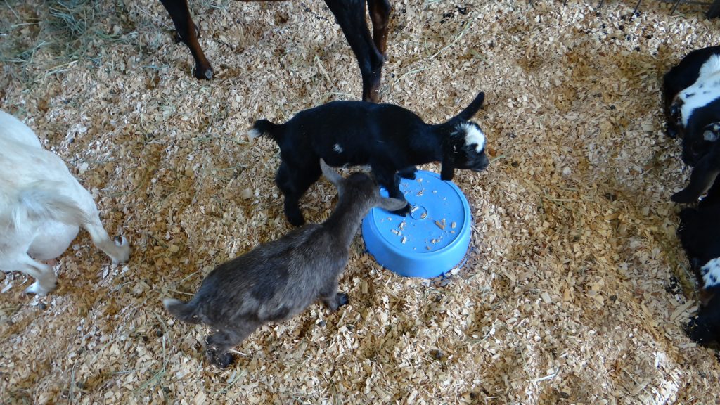
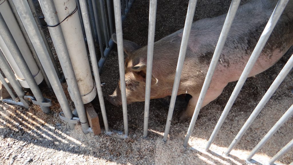
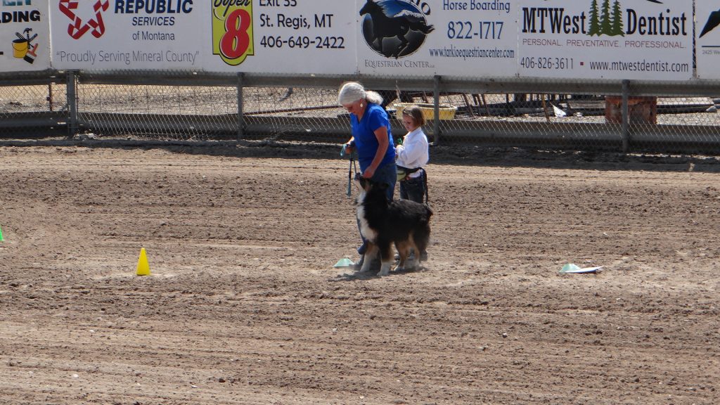
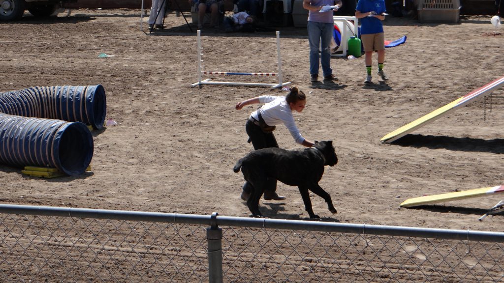
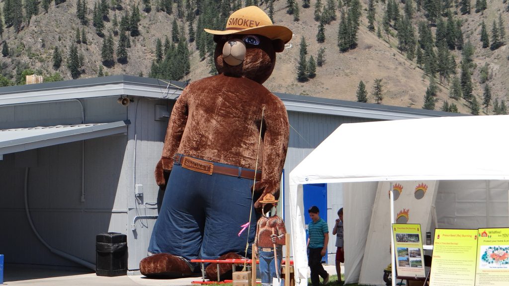
Award winning quilt.Goat kids having fun.Lots of pigs.Rodeo arena set up for dog agility.This one was very good.This one hadn’t got a clue and was a bit large for the tunnels!!Smokey the Bear put in an appearance but had to be taken down when the wind got up (he is already leaning!!).
And then we moved on to Indian Creek Campground, Deer Park which is just above Butte, Montana.
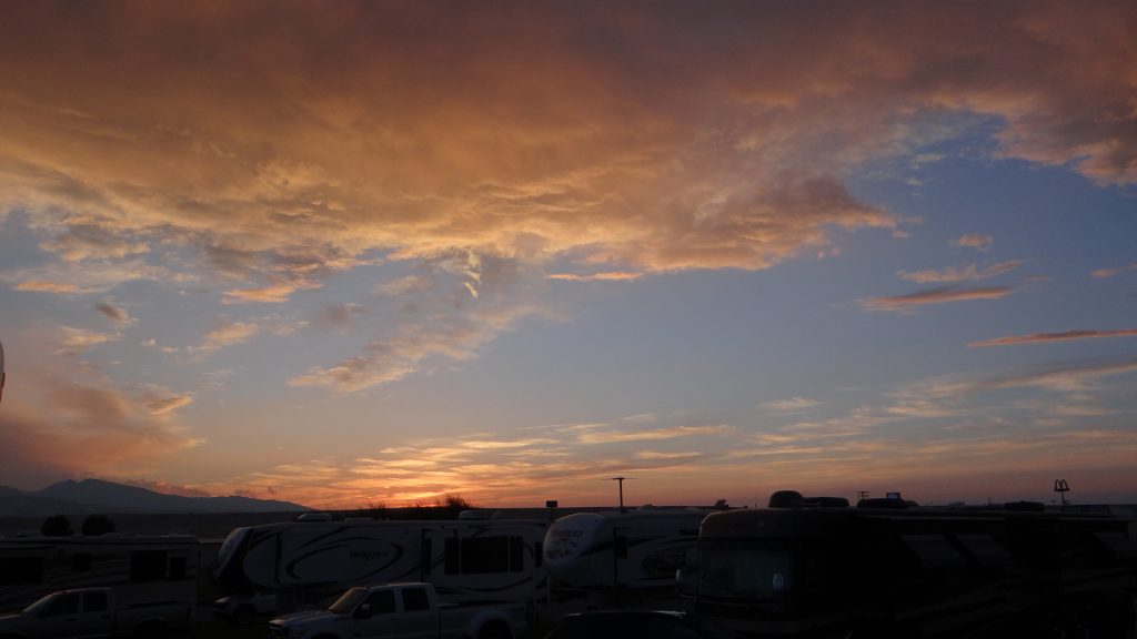
Rest stop and more “Big Sky”.Blue skies everywhere.Even the sunsets are huge!!
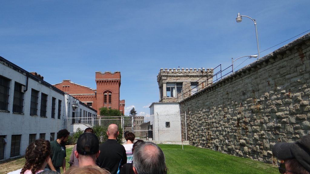
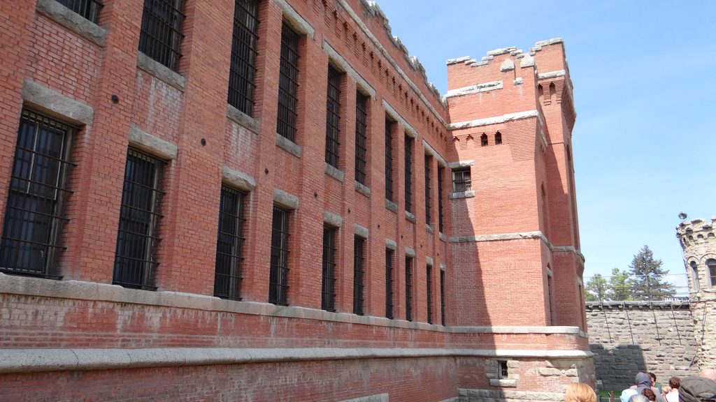
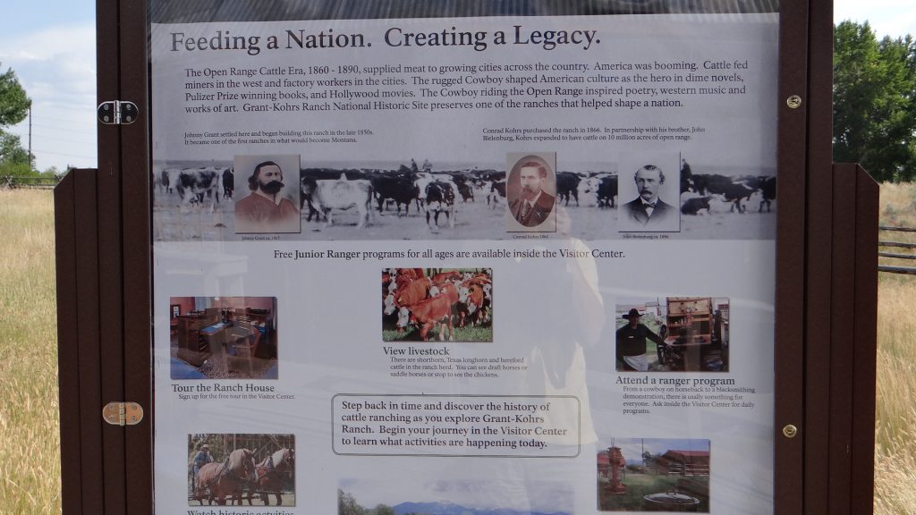
It never ceases to amaze me what we find on this trip of ours. Deer Lodge was chosen because it is just above Butte, Montana the site of the largest opencast copper mine in the country. But Deer Lodge itself was home to the Montana State prison Museum, a huge classic car museum and at least another 3 museums, plus the Grant-Kohrs Ranch National Historic Site a completely preserved Ranch.
External granite walls and internal prison brick buildings built by prison labour in the late 1800s.Execution of two prisoners who killed a guard trying to escape.Main prison building.Typical cell, block was very like Alcatraz.Cell block at rear, shower block and canteen in foreground.
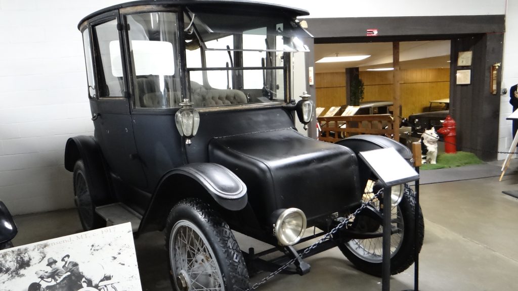
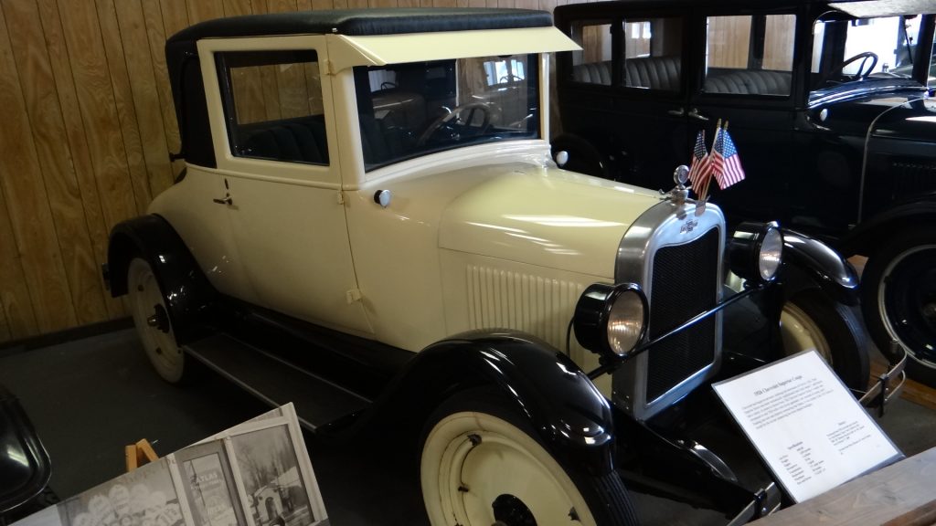
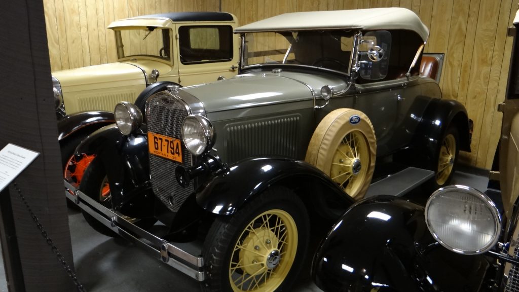
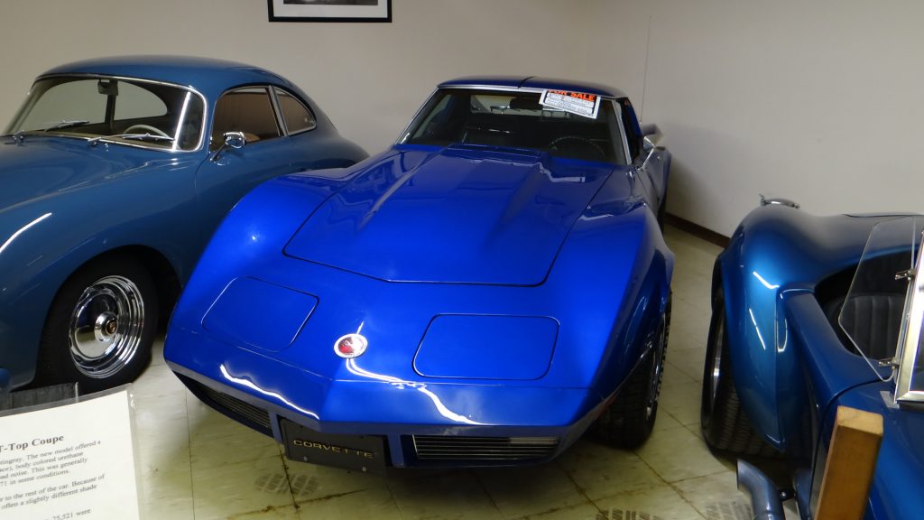
And right next door is a classic car museum with cars from very early Mercedes Benz (1886) to the classic cars of the 70’s & 80’s.
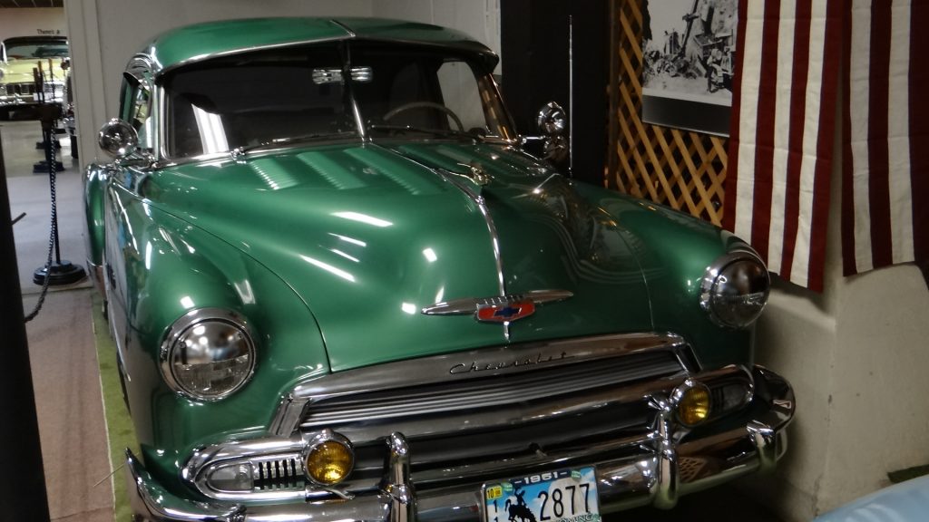
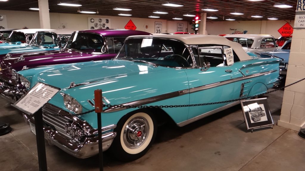
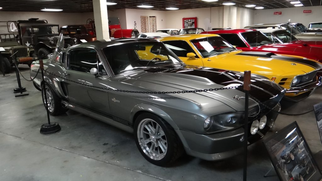
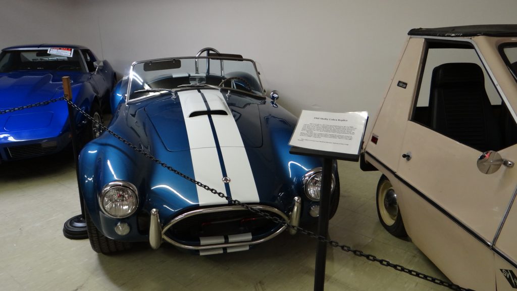
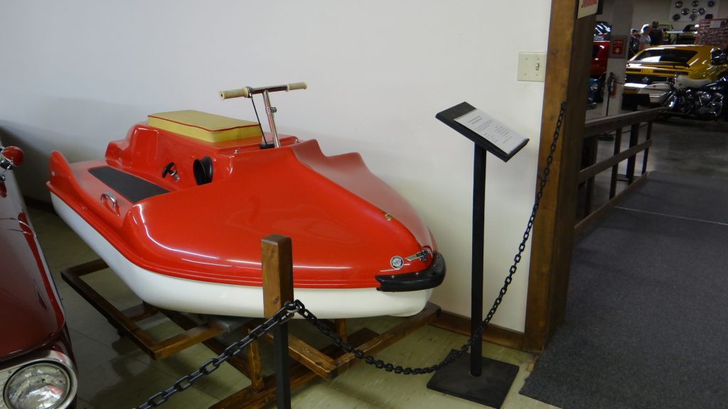
1914 Detroit Electric Car with an advertised range of 80 miles although in tests it did over 200 miles on a single charge.1926 Chevrolet Superior CoupeFord Model T cabriolet, very rare.Early air conditioning a Thermador Car Cooler. You filled it with cold water and the air was cooled as it passed through the unit into the car.Beautifully restored green Chevrolet circa 1951. The paintwork was immaculate.Chevrolet Impala ConvertibleAnother classic Chevrolet.“Gone in 60 seconds” Mustang GT500 “Eleanor”1965 Shelby Cobra.Corvette Stingray.Guess what this is?The first jet ski!! 1958
I could put up more pictures but there are over 160 cars in immaculate condition.
And outside were two immense trains.
This massive diesel loco is nicknamed “Little Joe” as they were originally built for Russian railways after WWII, but the contract was stopped because of the Cold War, so they were converted to work on US railways but that meant a change of track width, and they did it!!And then the “Milwaukee Road” was electrified and these were used to pull passenger trains. Funny how now the entire network out here seems to have reverted to diesel and freight only.And when we got back to the RV there was a “Big Sky” sunset.
The following day we came back to see the other museums and the Grant-Kohrs Ranch National Historic Site.
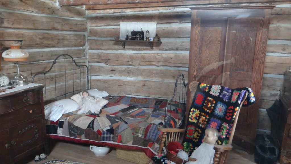
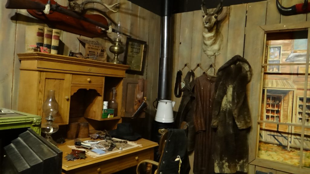
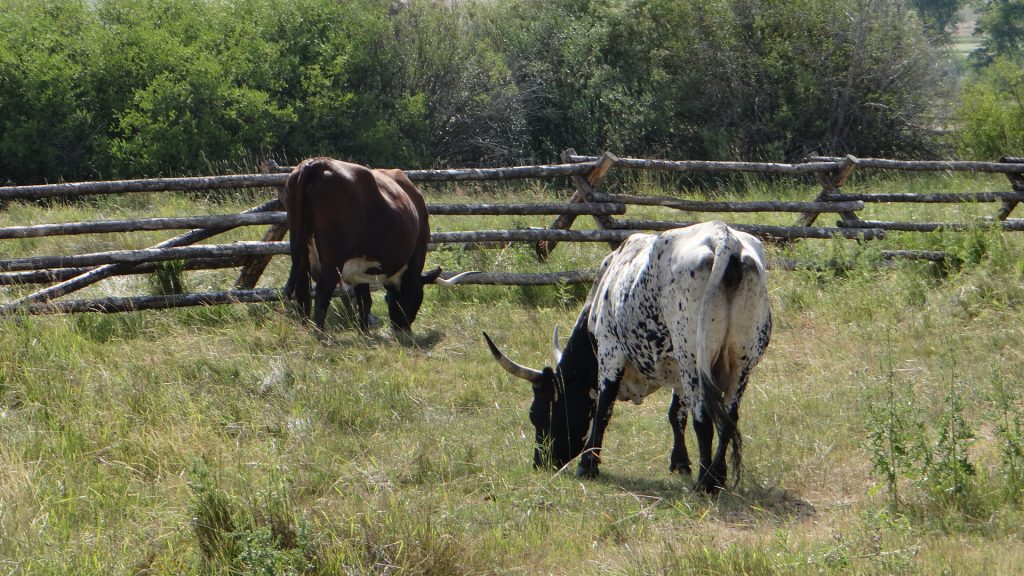
A small town exhibit.Another house in the town.Dentist price list (notice “Without Pain”!!)Gun exhibit in the Western Museum.Dolls in another museum. There were at least 20 exhibits like this.Grant-Kours Ranch.Ranch HouseLonghorn cattle on the ranch.Ranch cat in the Blacksmith’s shop.
All I can say is we were amazed that so much was available in a town with a total population of 3,111!!
So on to Butte, the reason we stayed in Deer lodge in the first place. We took the Trolley Bus tour.
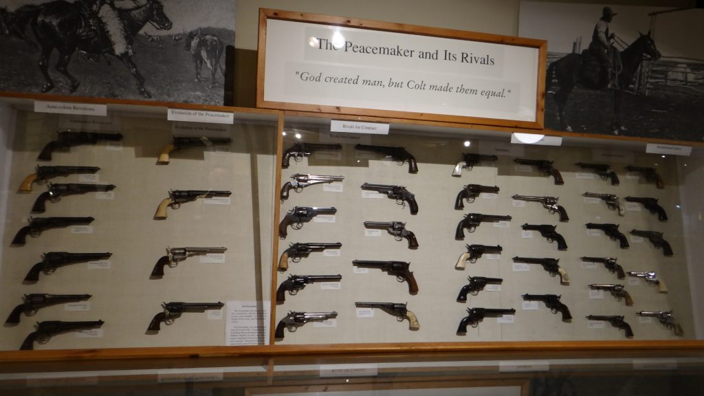
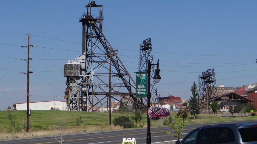
Butte is a copper mining town established in 1864 and grew to become the largest copper mining town in the USA and at one time in the world. Incredible amounts of copper were mined using conventional techniques i.e. digging a shaft and then cutting galleries into the seam. Some of the mines were over 6,000 ft deep. In its heyday there were 19 mines (14 mine headframes are still standing) and in 1910 alone copper ore mined from the Butte mining district totalled 284,000,000 pounds (130,000 tons). It attracted miners from all over the world including Cornish miners from the tin mines hence why there are these.
We actually ate pasties in this shop and they weren’t at all bad.Mine HeadframeAnd another one at the Museum of Mining.
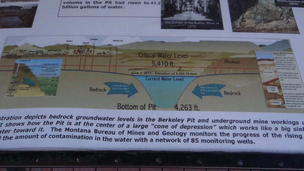
In the 1950’s underground mining gave way to open cast mining leading to the creation of one of the largest open cast pits in the world, the Berkley Pit.
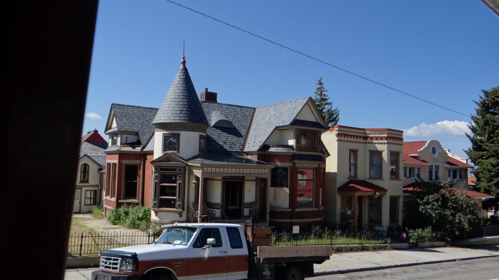
The Berkeley open cast pit, which flooded when mining ceased in 1983 and was replaced by an equally large and productive open cast pit called the Continental Pit. The water came in from the old mine shafts when pumping also ceased in 1983.A 4,263 ft deep lake was formed, which is highly toxic and they have to scare water birds away as they will die if they ingest the water. They are gradually reducing the level by purifying the water and pumping it elsewhere as it mustn’t be allowed to seep into local aquifers and poison the drinking water. Lots of “old” buildings around Butte including Dumas House, a house of Prostitution opened in 1890 and wasn’t closed until 1982 even though prostitution was illegal in Butte!!Example of a pre 1900’s house.And another, mainly built for the mine owners. They liked their round towers!
After the trolley bus tour we visited the World Museum of Mining which included another mine tour.
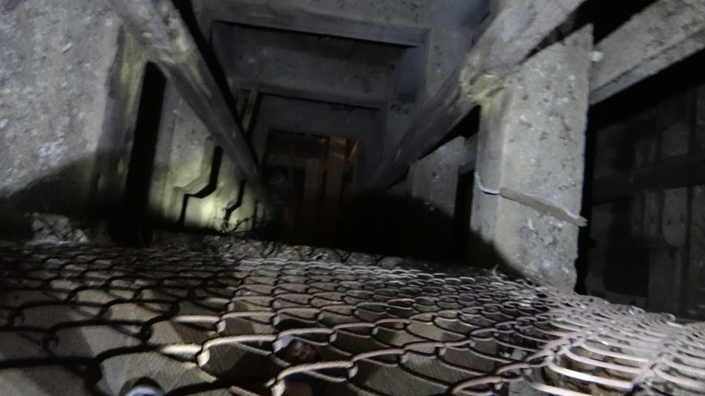
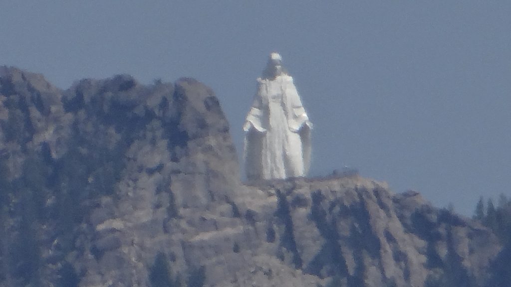
Down we go into the mine.Imagine going to work in this every day. This is a mine cage for lowering the miners into the mine. Apparently it was usual for 6 to go down but 9 to come up!! This was about 3ft square so it was a tight fit!!Looking down the shaft to the levels below. This mine when it was in production was 2,600ft deep. Now the bottom levels are flooded.The mine signals universally used by hoisting engineers. This one goes from 100ft to 5,000ft but we have seen them down to 6,000ft. At that depth the temperature reached 50C (122F) and ventilation was very important.View from the top of the headframe about 100ft up. Big Sky!!This is Our Lady of the Rockies. The statue was built by volunteers using donated materials to honour women everywhere, especially mothers. The base is 8,510 feet above sea level and 3,500 feet above the town. The statue is lit and visible at night. It was put there by helicopter and they plan to build a cable car to visit it. It looks down on Butte and I got this photo from the top of the headframe.
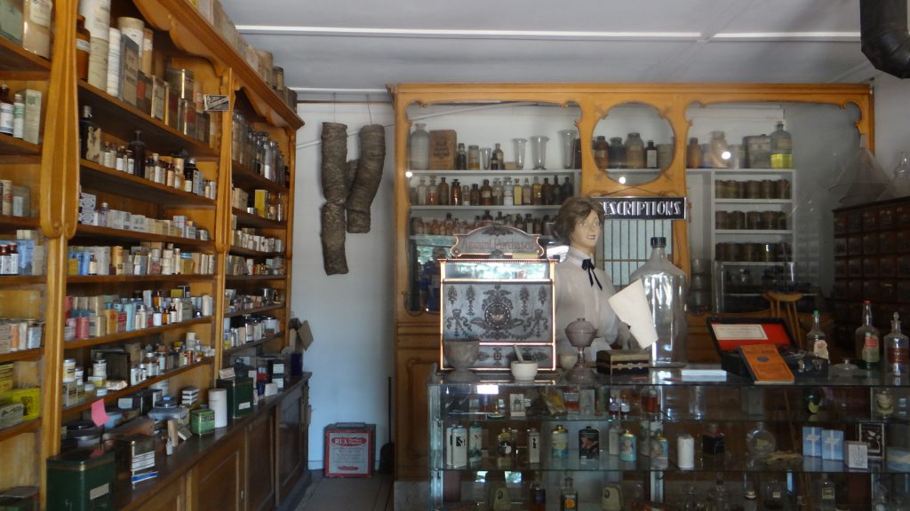
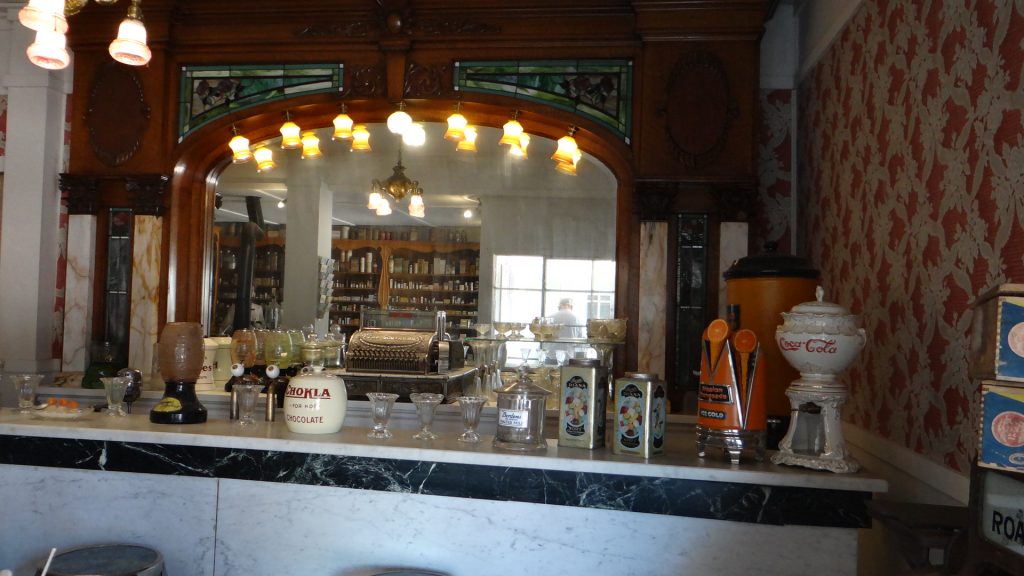
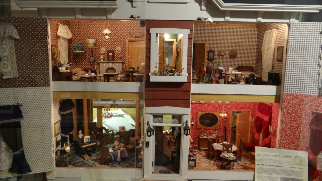
The Museum also had an old town section and a collection of dolls houses.
The drug store.The Soda store.One of the dolls houses.And another.
As always there is so much to see and we ran out of time.
From here we moved on to Livingston Montana and Yellowstone Park.
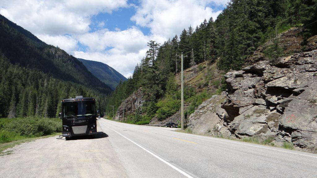
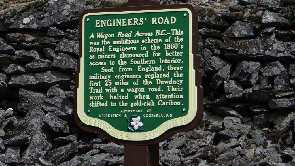
I was aiming to cross the border further East but hoping to not cross too many mountain ranges in doing so. So the first part of our route brought back memories of our RV trip in 2013, when we did the huge loop around British Columbia in a Canadream hire RV, as we were following the same route but in reverse. Up BC 1 to just above Hope and then BC 3 (known as the Crowsnest Highway) to Princeton.
Taking a rest on the Crowsnest Highway.Built by the Royal Engineers in the 1860’s.
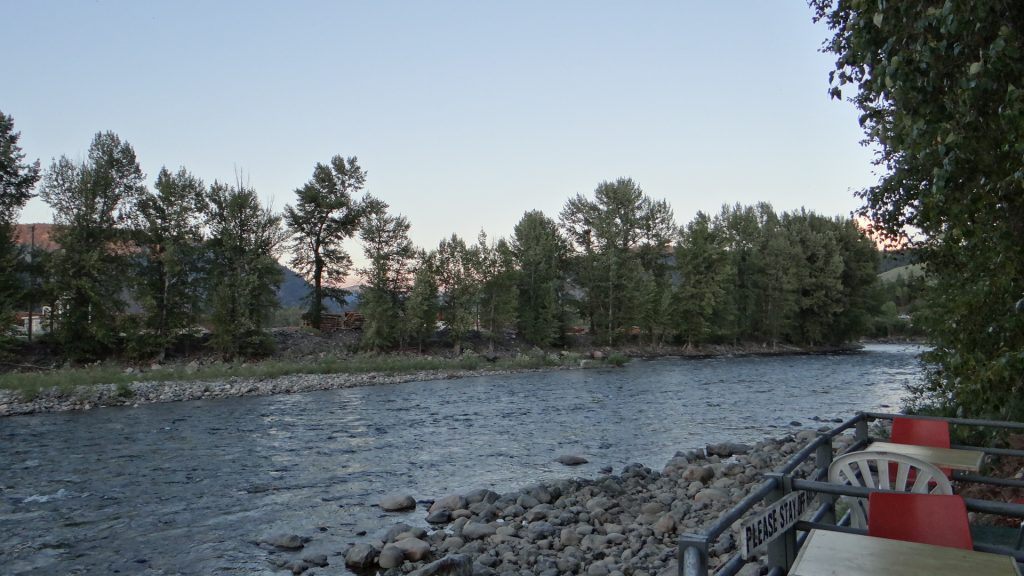
We arrived in Princeton and stayed overnight at a small site called River’s Edge RV & Camping.
View down the river we were on the edge of!!View back from the river bank to the RV in the middle of the picture.
The next morning we were off again after dumping the tanks (getting rid of excess water etc. this site just had 30amp electricity and water connections), and on to BC 3 to the bottom of Christina Lake. Here we stayed in our last campsite in Canada called Cascade Cove RV Park. Purpose of the stop here was twofold. One to get ourselves ready to cross back into the USA by reading what we were allowed to take back in , and two to have a last look around Canada.
Parked up at Cascade Cove (well not quite the slide is on its way out).
Our site was just above the border crossing at Laurier.
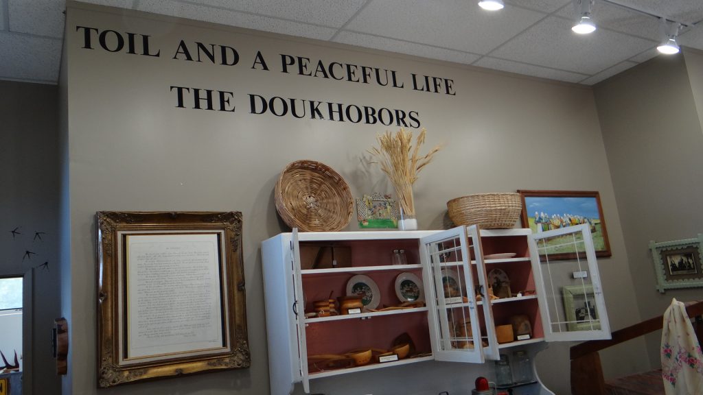
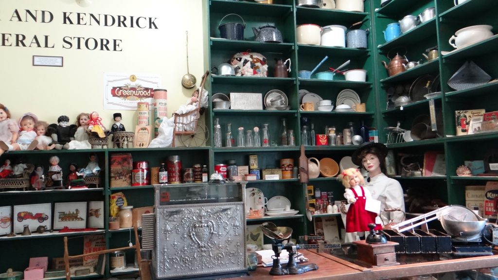
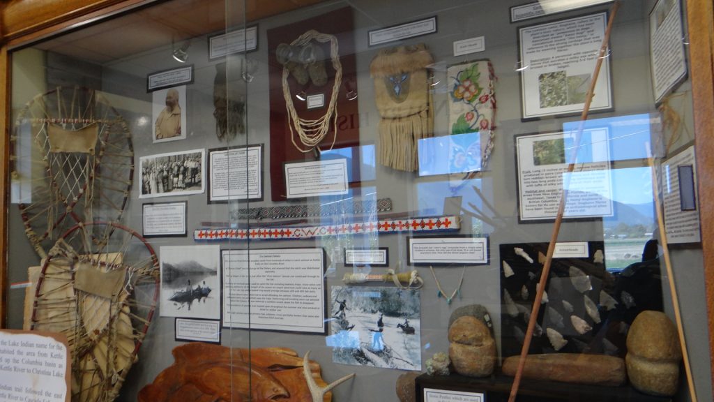
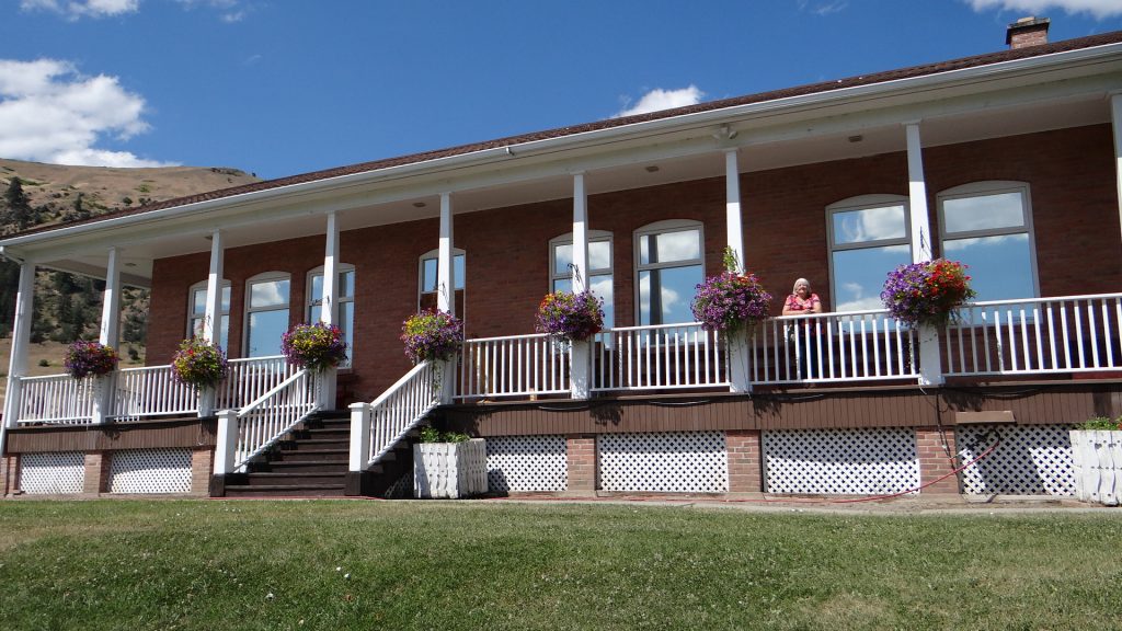
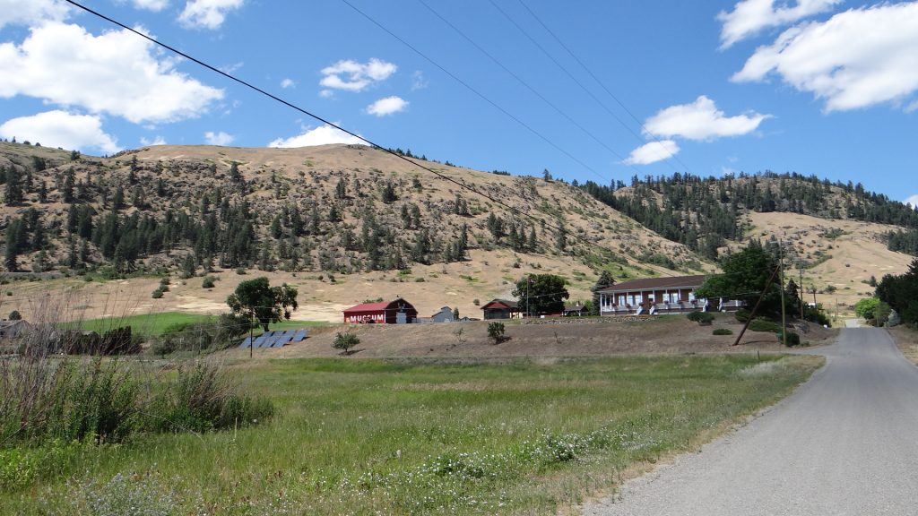
Just back along BC 3 from where we parked was the town of Grand Forks which had a fascinating little museum called the Boundary Museum. It contained a lot of very interesting exhibits from a whole room devoted to the Doukhobors, to a whole store and an exhibit of a copper mine that grew to be huge in 10 years and 10 years later nothing of it existed. Boom to bust in 20 years!!
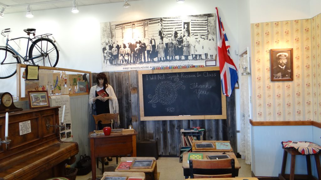
The Doukhobors were a Russian religious sect that believed in hard work and rejected the use of any technology. A bit like the Amish they built a community in the area that farmed thousands of acres and built schools and towns devoted to their way of life. Unfortunately they were distrusted by the local population and by federal government, which gradually split the communities, firstly by making all schools abandon Russian as a language, and then by forcibly taking children and putting them in residential schools stopping them learning about their culture and breaking the link between generations. Because of this the community farms no longer exist and the Doukhobors were assimilated into the general population of Canada.
The Doukhobor exhibition. Over 7,500 emigrated from Russia to Canada.A Doukhobor classroom. In case you cannot read it across the top it reads “I will not speak Russian in class”.A Canadian General Store.First Nation exibits.The museum.The complete site of the Museum
Grand Forks was an interesting little town but unfortunately a lot of it was closed up due to the Fraser river flooding it in the early spring.
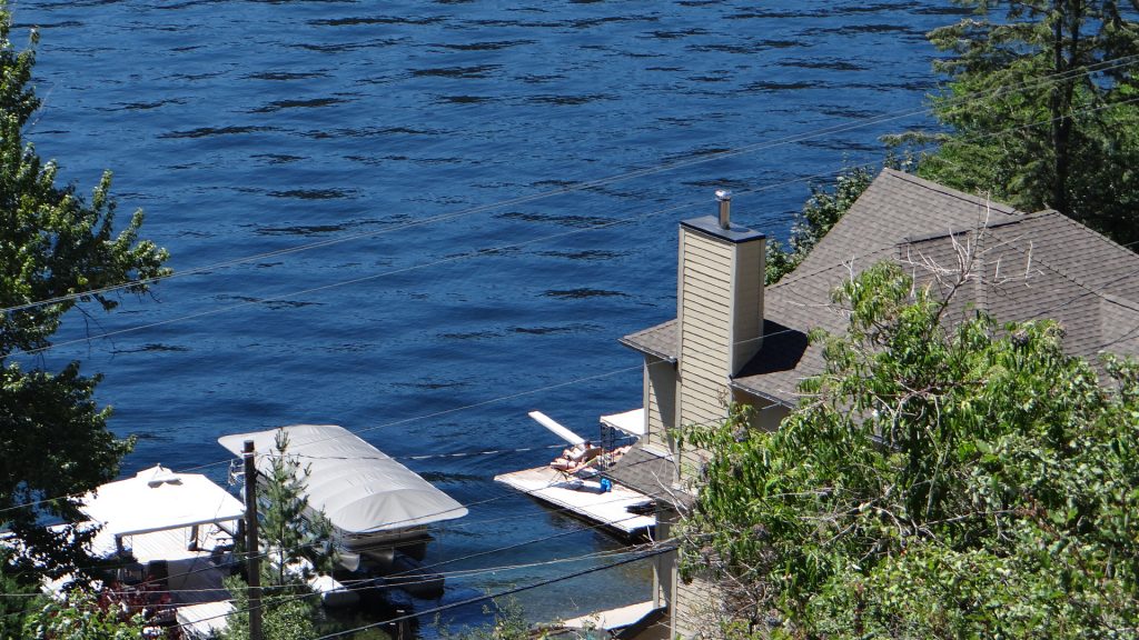
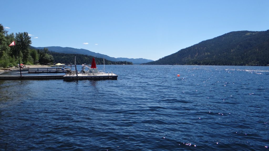
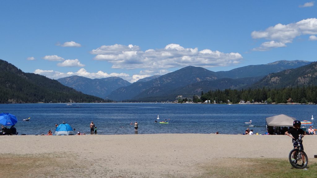
We also had a look around Christina Lake which is a huge lake with homes right on the edge with boat docks, beaches (can never get used the idea of a beach on a lake) and lots of little inlets and parks all around it.
Christina LakeOne of the many houses with boat dock lake access.Boat docks.The beach and if you didn’t know it was a lake you would think you were at the seaside.Lots of boats all over the lake. Also lots of water skiing.
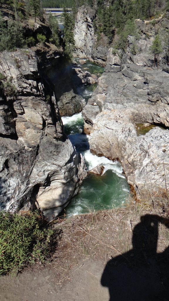
I also took a hike up to Cascade falls just up the Kettle river from Cascade Cove RV Park.
Cascade Falls, not the most impressive but the water falls!!Looking from the Falls to the BC 395 bridge. Becomes RT 395 on the other side of the border.The Falls from the bridge.And the private cove on the Kettle River attached to Cascade Cove RV Park.
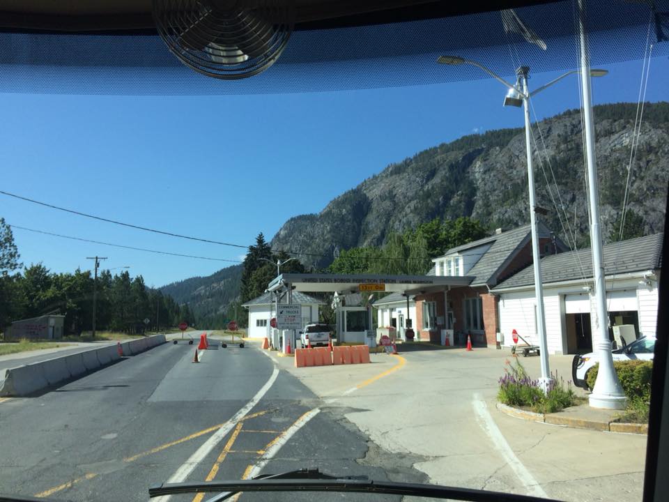
Having got rid of all the foodstuffs we thought would get confiscated at the US/Canada border on the Monday 23rd we crossed back into the USA at the Laurier border crossing.
US Immigration and Customs post at Laurier.
And despite our best efforts our tomatoes and peppers were confiscated by the guard who searched the RV. Didn’t read they were banned anywhere until he showed us another list. But he let us back in and stamped our passports until January 2019.
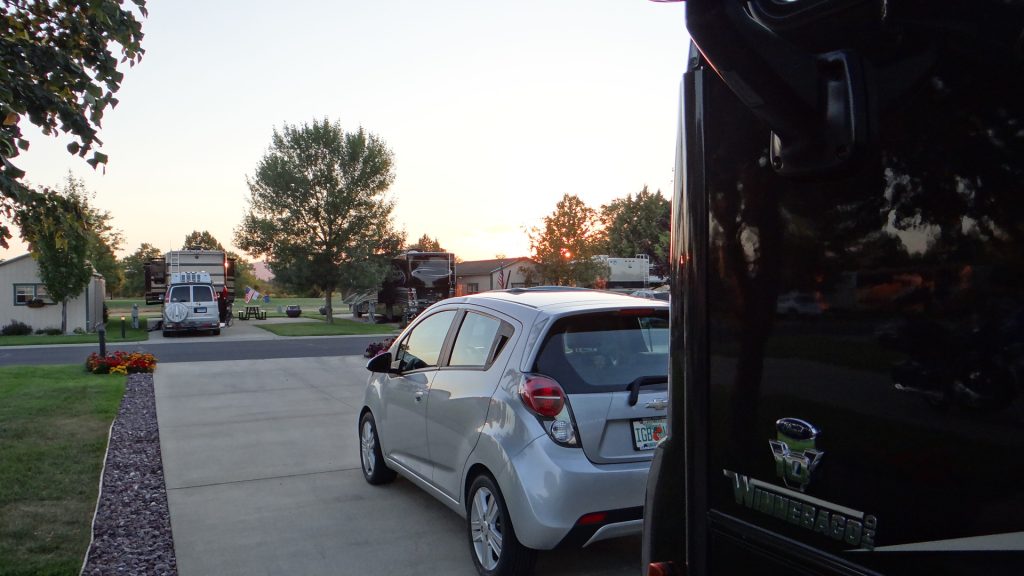
So we set off to Spokane RV Resort in Deer Park just about 15 miles north of Spokane, Washington. This was a lovely site right next to a golf course.
Sunset at Spokane RV ResortHuge concrete pads and flowers and manicured lawns. Must be paradise!!
To be honest we were treating this site as a rest stop as we thought there wasn’t much to see around the area and we needed a rest. The facilities were great, lovely sites, great swimming pool and we found that our next door neighbours were from Edmonton in Canada and we got on very well with them and enjoyed their company.
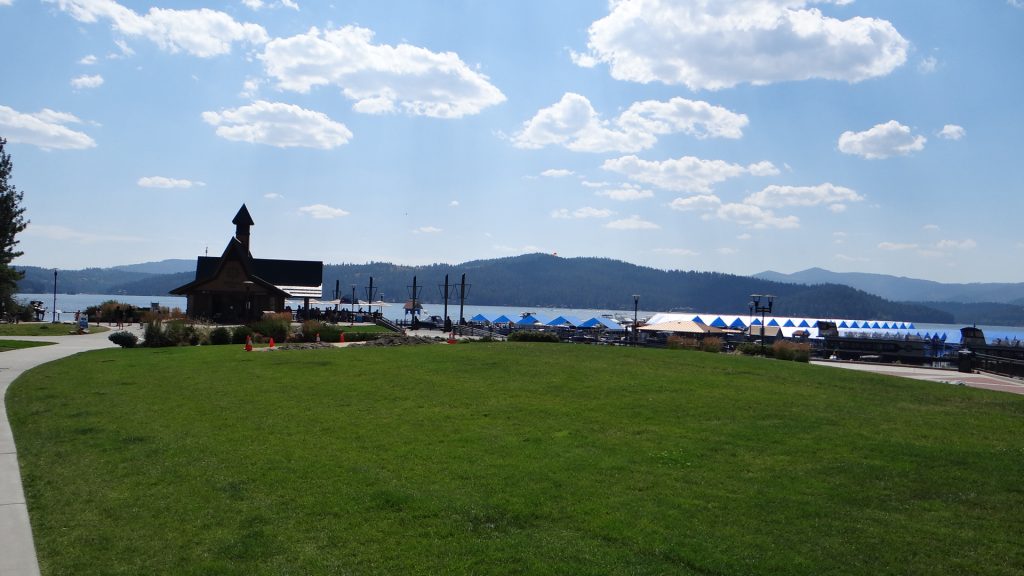
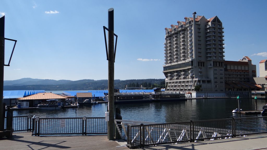
We were told we ought to go and see Coeur d’Alene which was a very pretty lake and there was quite a lot to see in the town. Well it turned out to be a nice lake but the town was one of those American tourist traps.
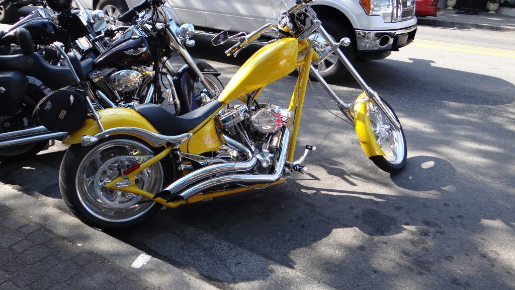
View across the Lake from the Park.Purpose built apartments all around the lake each of which comes with a boat dock (they are the blue canvas structures to the left and beyond the tour boats).View across the lake, with boat area in the foreground, photographed from a restaurant we ate in.Strolled around the town and lots of tourist shops etc. but a nice Harley!!
You can probably guess we were not too impressed, but I guess it must appeal to someone as it was doing a roaring trade.
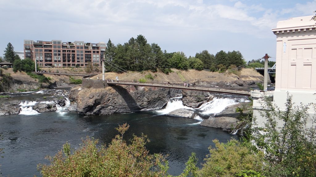
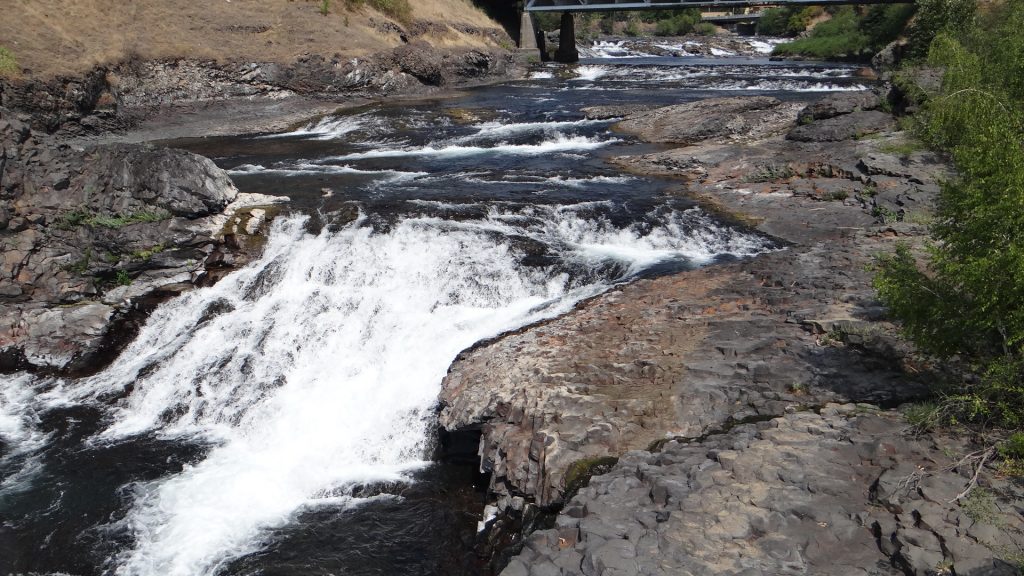
Next stop was Spokane itself. There was supposed to be some impressive falls here. But two problems arose. Firstly the park (Riverfront Park) where the falls were, had been part of the 1974 World Fair and lots of the structures were being updated as they had obviously got a bit old and tatty. So about 60% of the park was closed and it made it a lot harder to walk around. I will give it its due when it is finished it will look quite spectacular if the plans are to be believed, but in 2018 it is a building site!!
And secondly the Falls we were told are spectacular when the river is in full flow. Only when we arrived there was not much water going over them.
The clock tower was the only part of the park open.The falls with a lack of water.We were told this was about a tenth of the normal flow, so this would be quite spectacular with more water going over it. Indeed if you look closely at the rocks you can see where the normal water level is.
On the Saturday we had to move sites right next to the golf course.
The front windows were facing right over the golf course. Got to see some interesting golf swings. Site rules said if a golf ball hit us nobody was liable except us. Luckily no balls came anywhere close!!
Then Deer Park held Settlers Day which apparently is the oldest continuous community celebration in the State of Washington, running over 100 years. And I have to say that Anne and I really enjoyed it. We walked around here for hours, meeting various people, and listening to the music that was being played by various groups.
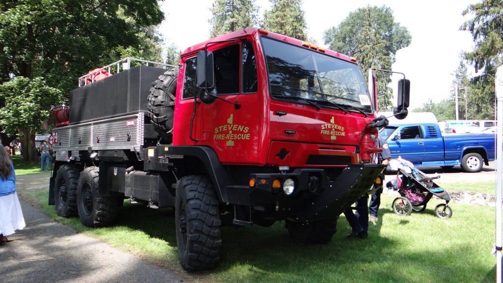
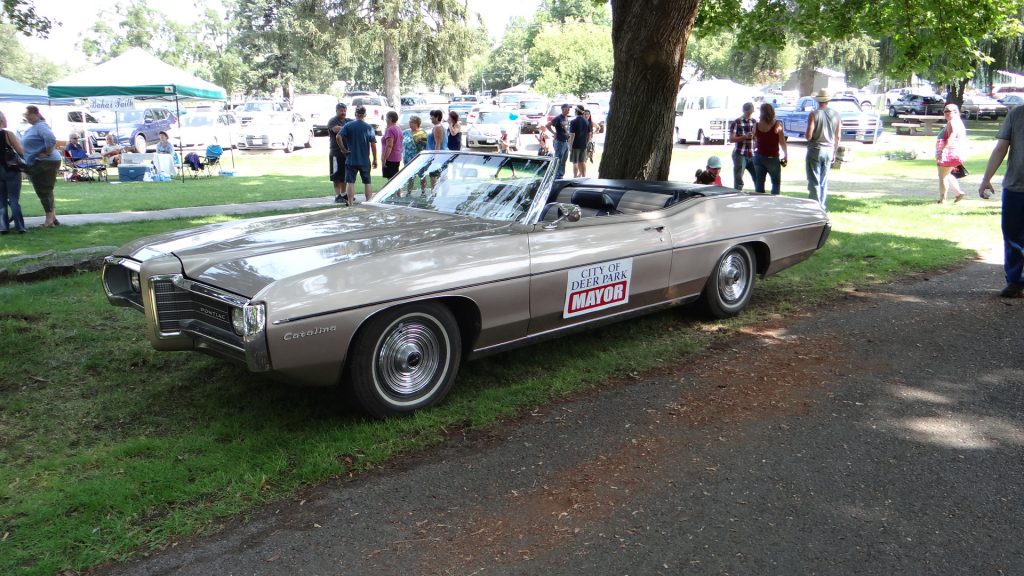
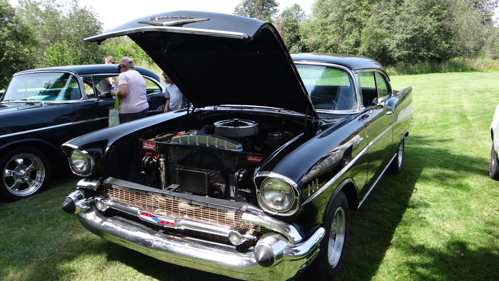
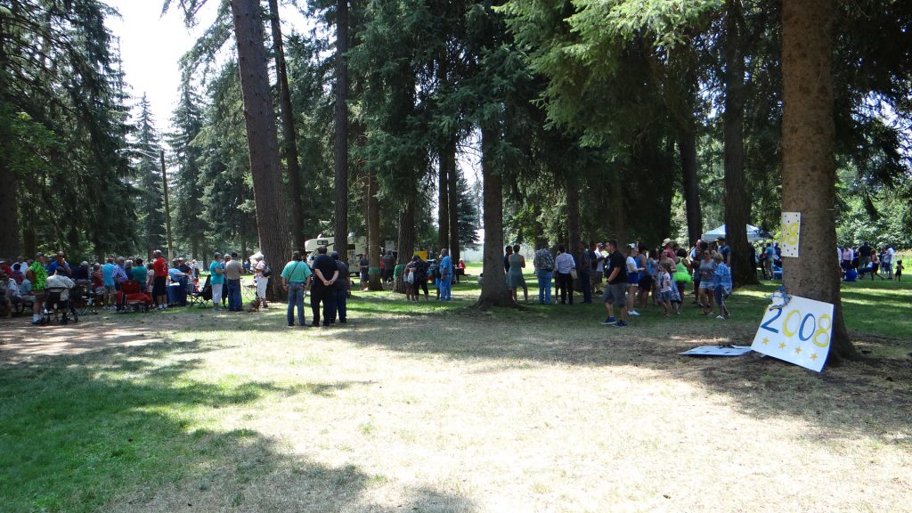
Deer Parks Fire truck.And their off road truck for fighting forest fires.The mayor’s car.Beautiful blue Pontiac Le MansA few big block ChevroletsAn entire park taken over with all sots of stands.This was interesting, they had an entire area set aside for reunions of years of the local High School. Here is 2008.Some very good local groups played all sorts of music.
And then we moved on into Montana after crossing a little bit of Idaho.
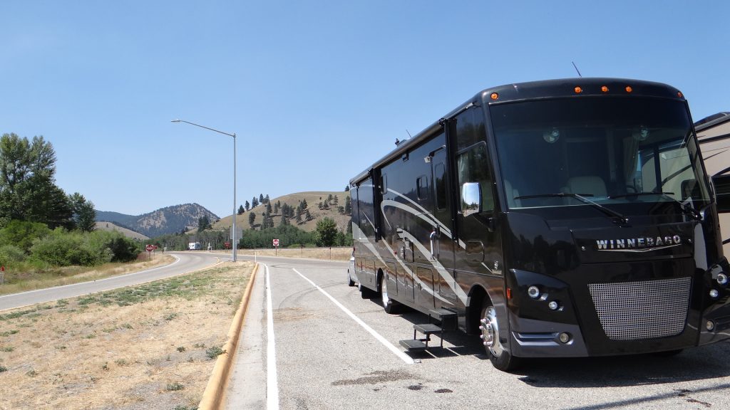
Back on the Lewis and Clarke trail. They got everywhere!!First Rest Area in Montana, the land of Big Sky!!
I have also updated the RV Map but as is usual it is ahead of where we really are.
But more of that in my next post as Montana is another story.
Caroline & Rashied and family returned late on the Monday from the USA as extensive shopping had to take place in various US outlet malls.
On the Tuesday they came out to us and we all visited the Fort that Fort Langley is named after. Another place with lots to do although initially a fine drizzle put a bit of a damper on it.
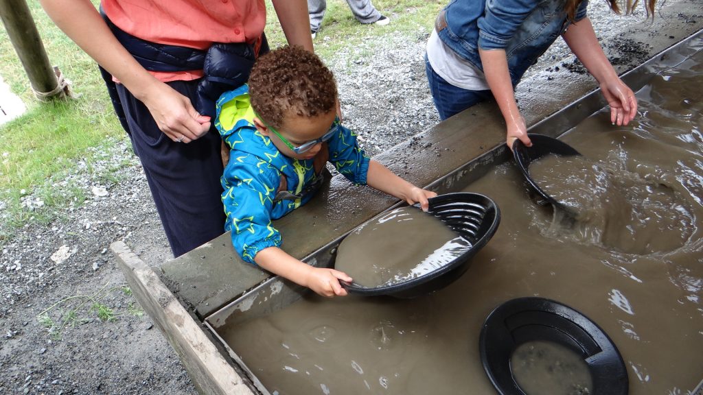
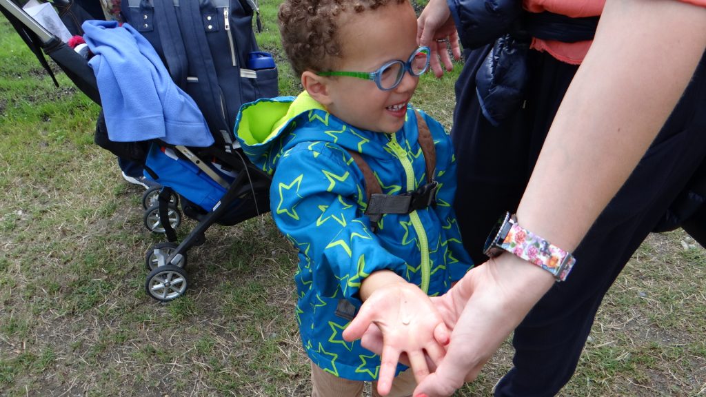
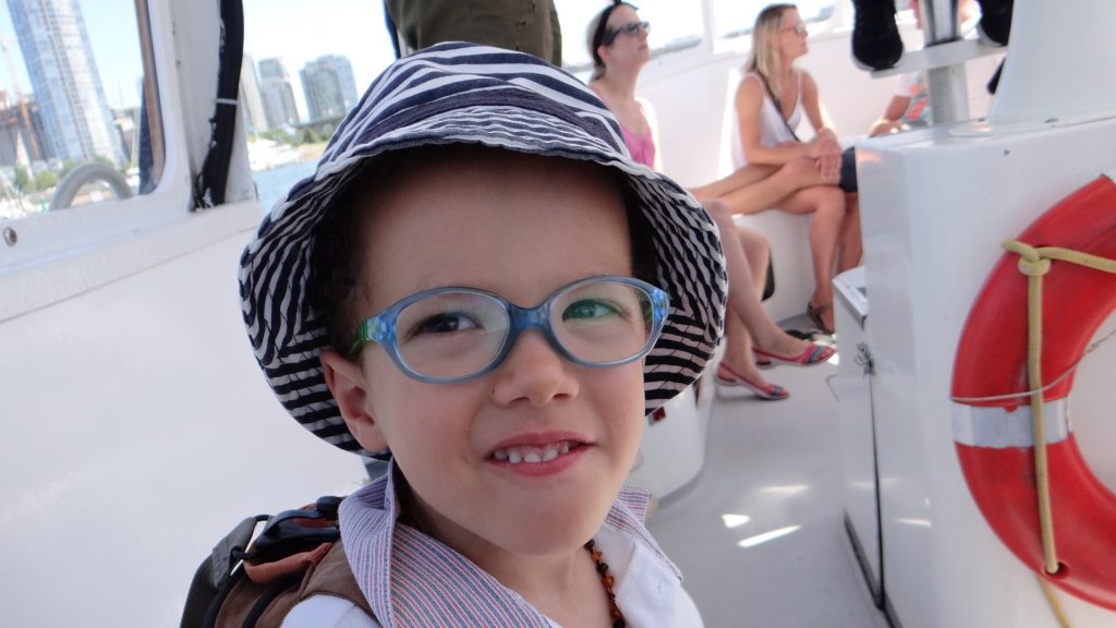
Zaid signing inZaid found a canoe.“I will paddle the canoe Mum, you and Zara catch the fish”Zara had fun as well.A bigger family boat!!Zaid panning for gold.Look I panned a bit of gold, although I am not sure what it is.Walking back to the ice cream parlour.Look granddad’s taking a photo!!This is my new outfit grandma made me, twirl!!
We ate in the RV and then they all returned to Tim’s.
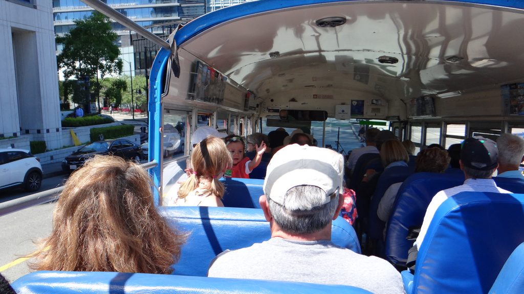
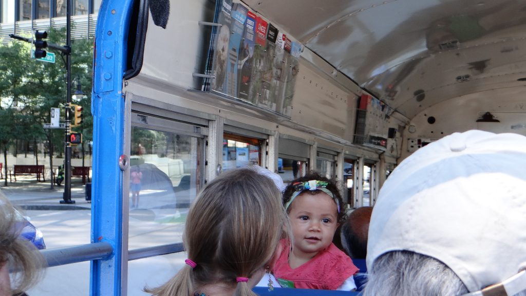
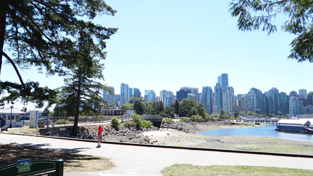
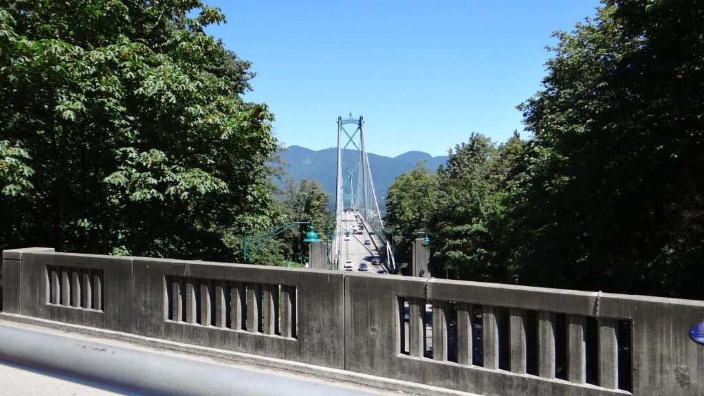
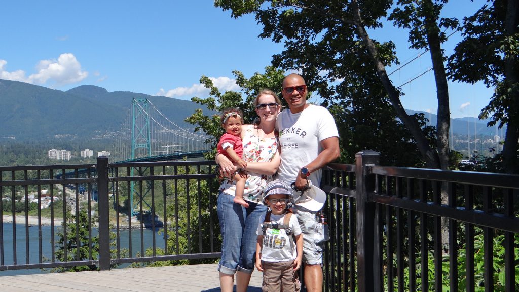
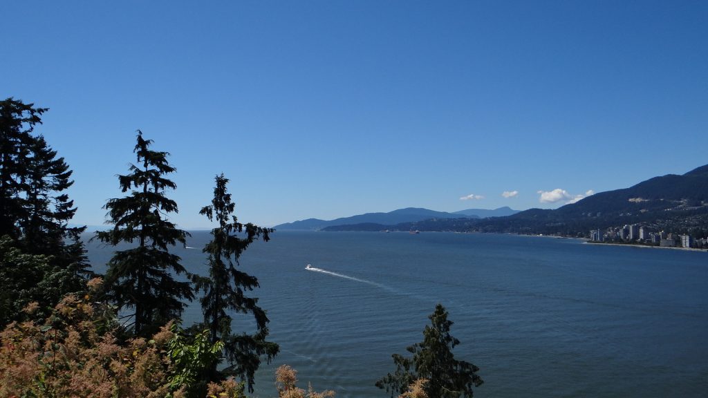
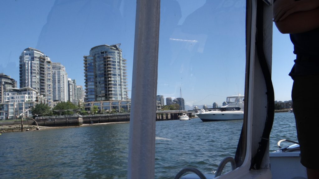
Next up was the trolley bus tour of Vancouver. We decided that we would get off at two points, Prospect Point which has views over the harbour and the Lions Gate Bridge, and the Chinese garden.
Zara decided to entertain the people on the bus by giving them a royal wave much to everyone’s amusement.
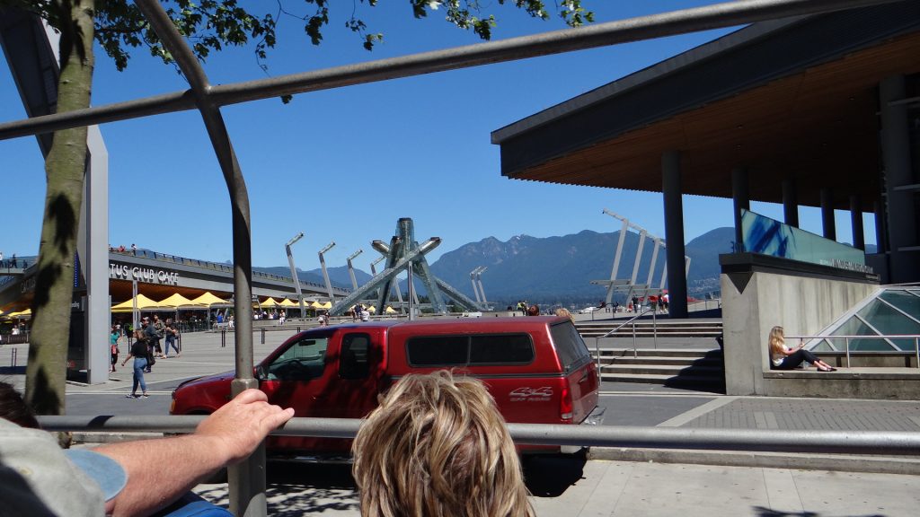
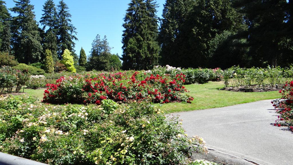
Hello I am Zara and I am waving!!Come on lighten up!!The Olympic torch for the Winter Games in 2010.Stanley Gardens rose bushes.Vancouver skyline from Stanley Park.And again.Lions Gate Bridge from the trolley bus.
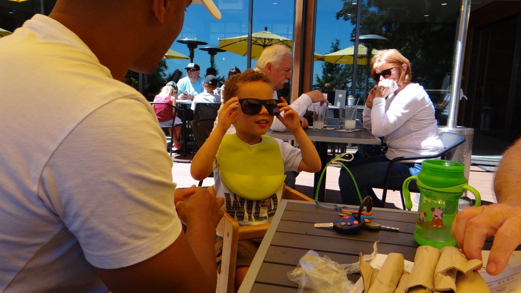
Then we got off at Prospect Point where we had lunch and the terrible twosome were given sun glasses.
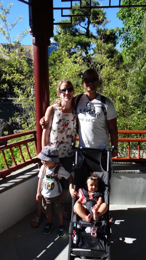
What do you do with these?Like this Zara.We got to meet a Mountie bear!!Prospect Point with Lions Gate Bridge in the background.And this nice man took a picture of all of us. Zaid wants his sunglasses.Zaid would be pointing at this and saying “Flying Boat”!!The view from the Point towards the Pacific.
Then we got back on the bus and got off again at the Chinese garden.
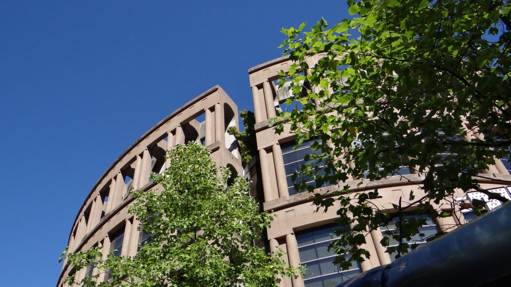
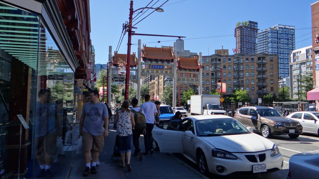
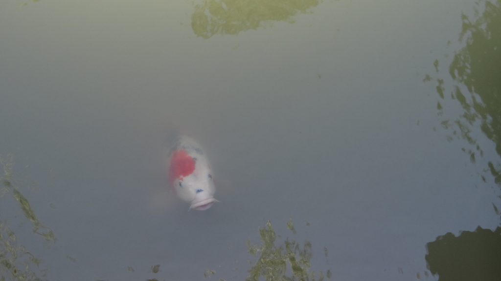
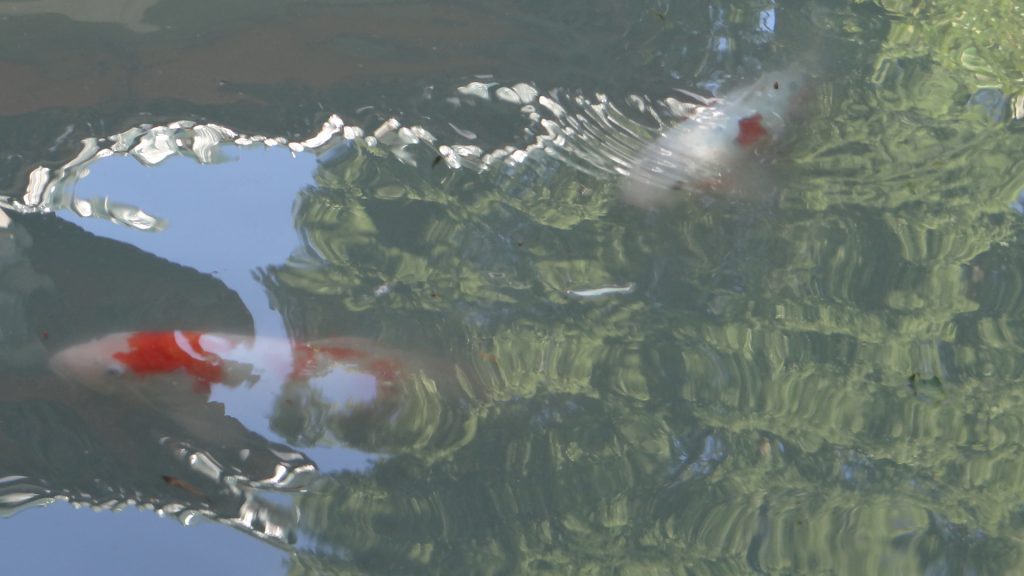
“Amazing Laughter” a group of laughing statues in Morton Park.Steel crab outside the MacMillan Space CentreVancouver public library looks like the Coliseum!!China Town.Koi Carp in the Chinese Gardens.And a turtle.In a pagoda!! Zaid look this way!! “I have seen a fish”.More Koi Carp.
Caroline and Rashied went off souvenier shopping again as they hadn’t bought all they wanted to.
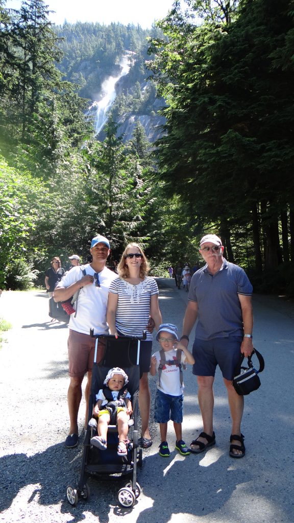
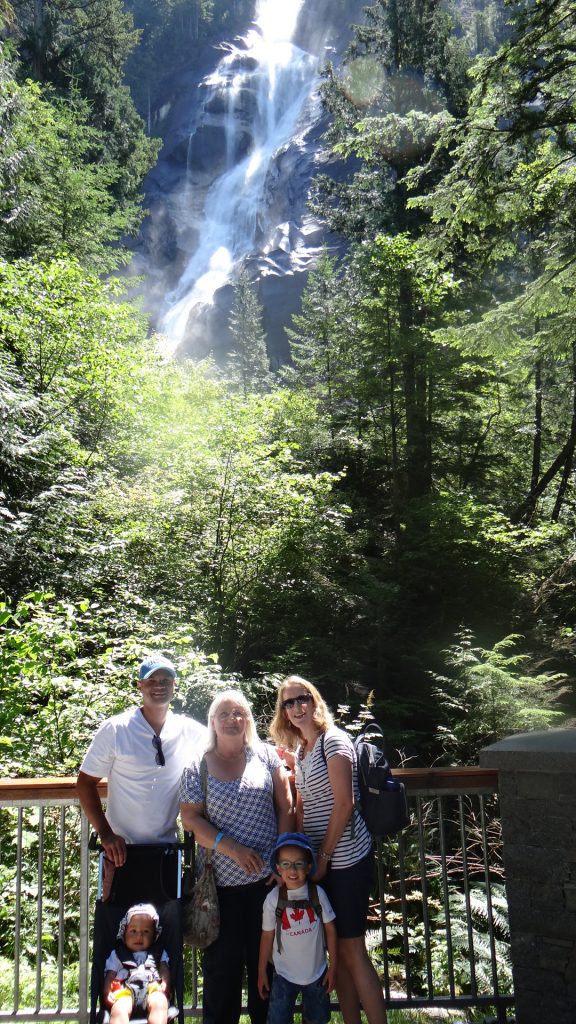
On the Thursday we were invited to Brenda’s house (Emily’s mother) for a barbeque in the evening. So we decided to spend the day visiting Squamish and Shannon Falls as her as her house was at Horseshoe bay on the way back.
Shannon Falls from a distance.On the way up.Here they are close up.We made it.
We went into Squamish to get something to eat and of course the obligatory shopping!!
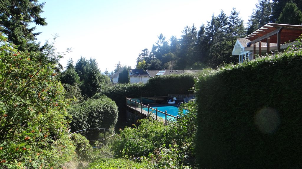
Then we drove back to Brenda’s house for the barbeque. It overlooks Horseshoe Bay and the marina.
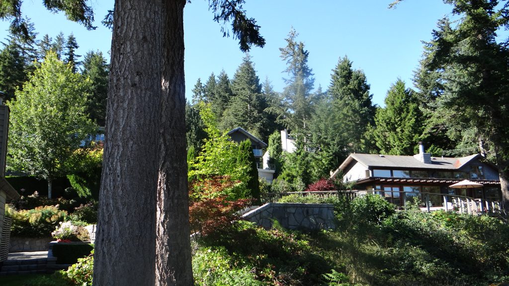
Brenda’s (Emily’s mother) house perched on the hillside overlooking Horseshoe Bay.Swimming pool next door.Other houses up the hill.The marina in the bay (difficult to see through the trees).
Brenda treated us to a great barbeque (with Tim on gas barbeque duty) and we thoroughly enjoyed the evening.
And then we reached the last full day before before Caroline, Rashied, Zaid and Zara were due to go back to the UK.
They still had some shopping to do so after returning their hire car we took the train into central Vancouver to “The Bay” (the shop named after the Hudson Bay company).
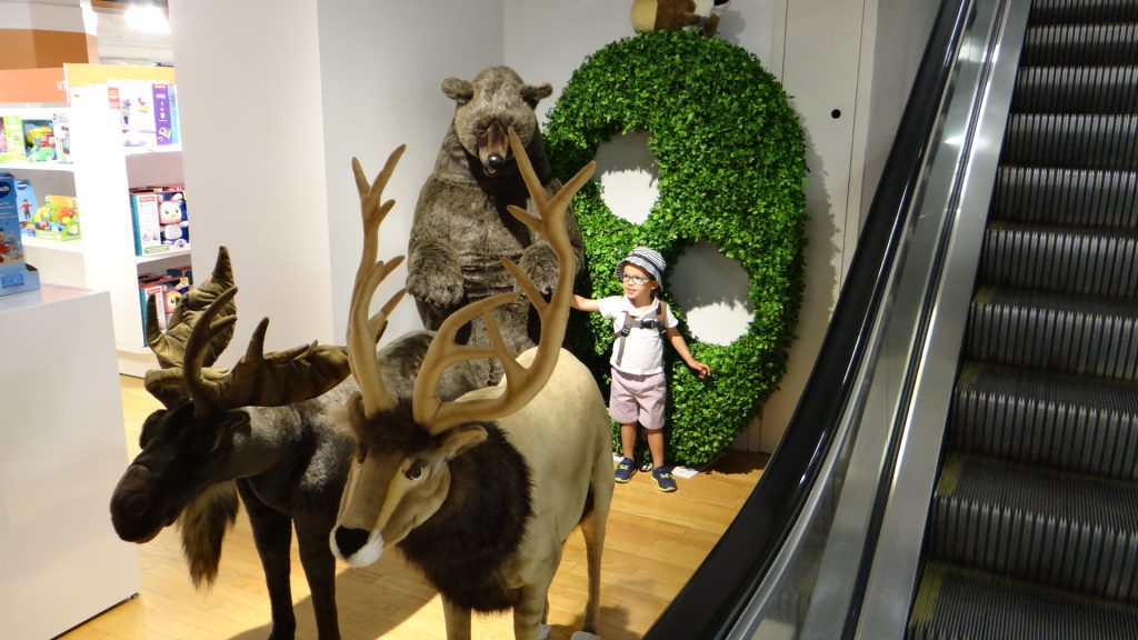
Zaid found some Canadian friends at the store.
Then we went to Granville Island on the Water Bus.
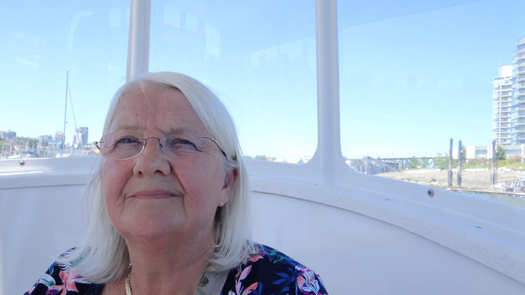
Zara liked the ride.Zaid sat next to GrandadView from the Water Bus.Grandma enjoyed it (I think).
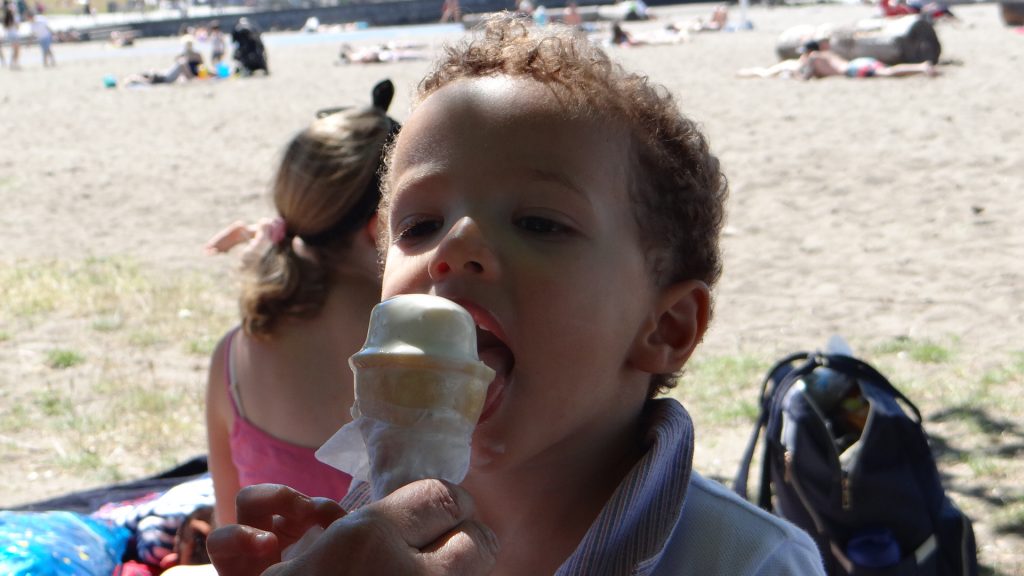
You guessed it, more shopping took place, and we also had lunch there, before walking to Kitsilano (Kits) Beach for Zaid and Zara to get their last swim in Canada.
Mmmmm I like this ice cream.I am tired out with all this shopping!!
Tim and Emily joined us after work and we all walked back to the Afghan Horsemen for the family’s last meal out in Vancouver.
Great food at the Afghan Horsemen.
And suddenly it was Saturday the 14th and we arrived at Tim’s early to find they still hadn’t completely packed. They finally managed to get their clothes and all that shopping in their cases, plus a few extra carry on items!! Their luggage was a little bit overweight, but Zara did a good job of charming the airline staff, so they managed to check in without an extra costs. And then we had to say goodbye. Speaking for Anne and I we had a great time in Vancouver with them, and I think they thought the same!!
The Dirk family departing.Grandad and Grandma saying goodbye.And thanks to Tim and Emily for putting them up.
Afterwards we returned the car seats and the cot to the hire firm and then returned to the RV to relax!!
On Sunday we met up with Anna, Ian (Anna’s Dad) and Jim, Anna’s new partner, for breakfast at the White Spot, where we caught up with what they had been up to since we last saw them.
Monday was a day of rest and Tuesday was time to get the RV ready to move on. We met up with Tim and Emily in the evening for our last meal out in Vancouver.
Goodbye son. You may notice someone got her hair cut!!Cheerio Tim & Emily.
And then on Wednesday we set off across Canada to reach the point we had decided to cross the border back into the USA, which is the next post.