This post is going to cover the visit of our friends Kathy and Anne. The original plan had been that Kathy and Anne would arrive in New Orleans, where we would spend a few days, and then we would move to Houston where we would meet up with Kathy’s daughter, Nikki and tour the sites, we never did this because of Hurricane Harvey last year. Then we would move up to Dallas which neither Kathy nor Anne had visited. Anne would then fly back to the UK and Kathy would catch a coach back to Houston to stay with Nikki for a couple of weeks before flying back from there to the UK.
However, since that plan had been made, Nikki’s husband Matt had got a new job in Calgary and they would no longer be in Houston when Kathy was returning to stay with them. As it happened Anne (Jordan) wanted to visit a quilt show in Houston so the last part of the plan saw Kathy and us wend our way back to Houston where we would stay until Kathy flew out to the UK.
At this point I should point out there are now two RV maps of our journey around the USA as I ran out of space on the original one. The original one RV Map 1 takes you as far as Oklahoma and the new one RV Map 2 shows the route beyond Oklahoma and hopefully it will have enough room for our route in 2019.
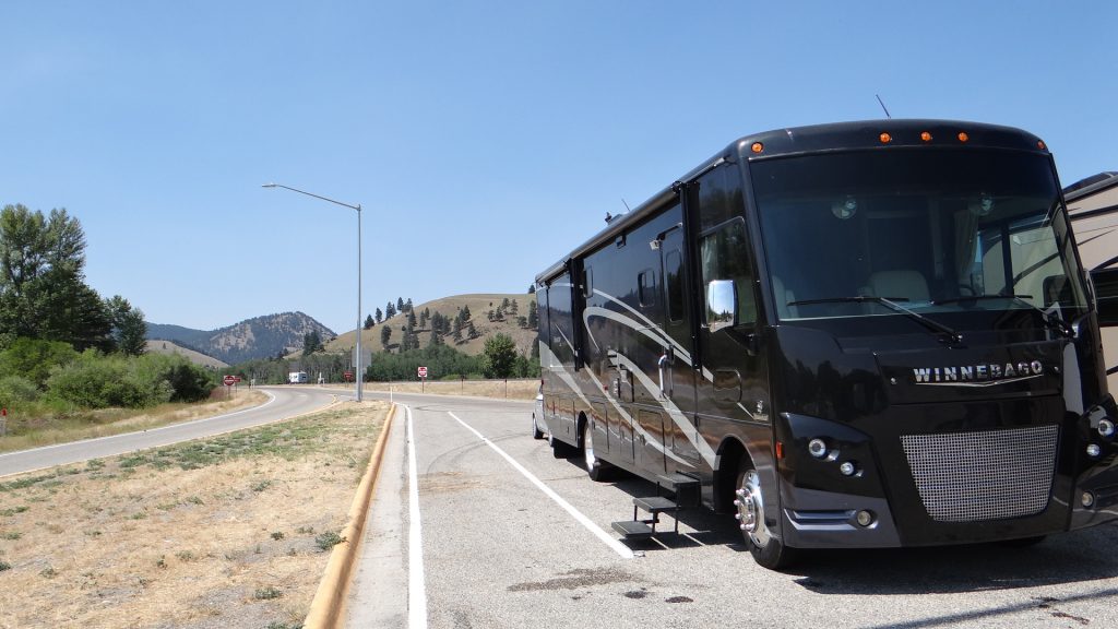
So on the 15th October we picked up Kathy and Anne at New Orleans airport.
They have arrived safe and sound. Hope they will like living in a RV!!
After taking them back to the RV and introducing them to “Big Beast”, we sorted out their sleeping arrangements and they eventually collapsed after a long day.
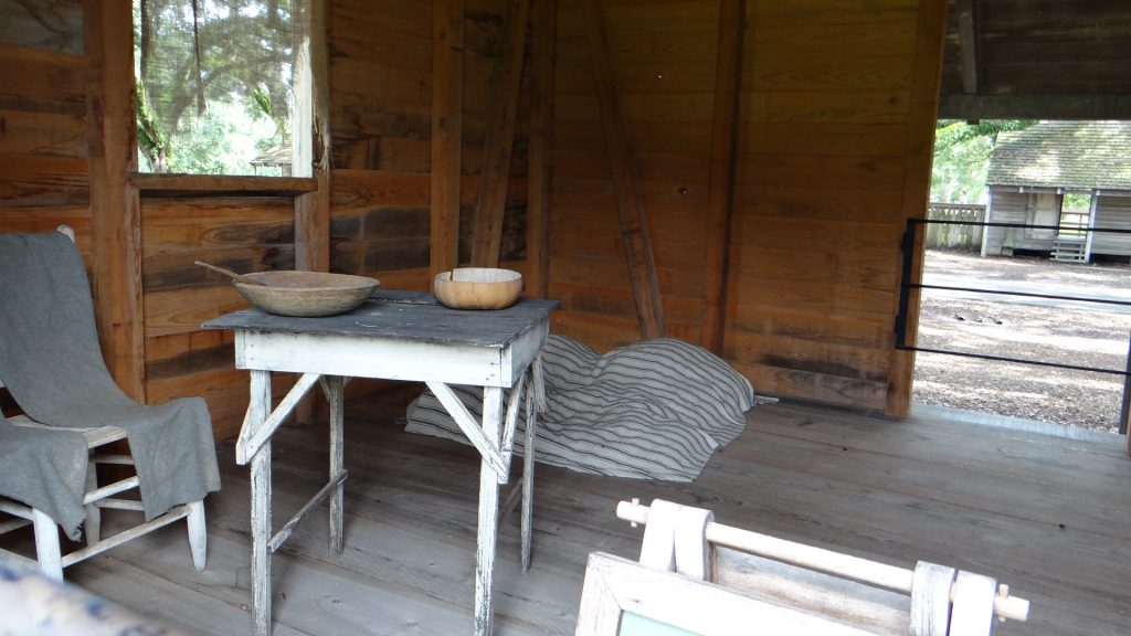
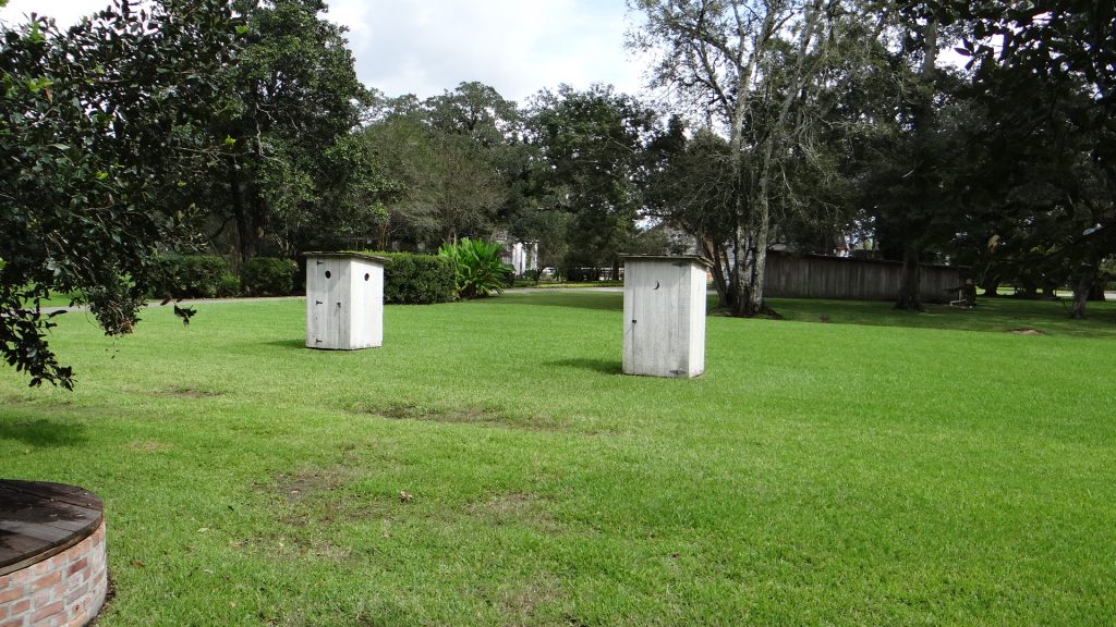
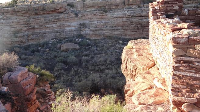
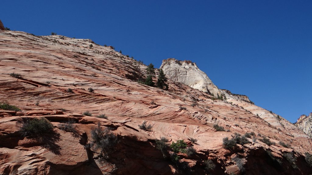
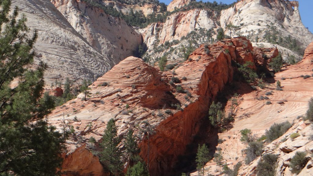
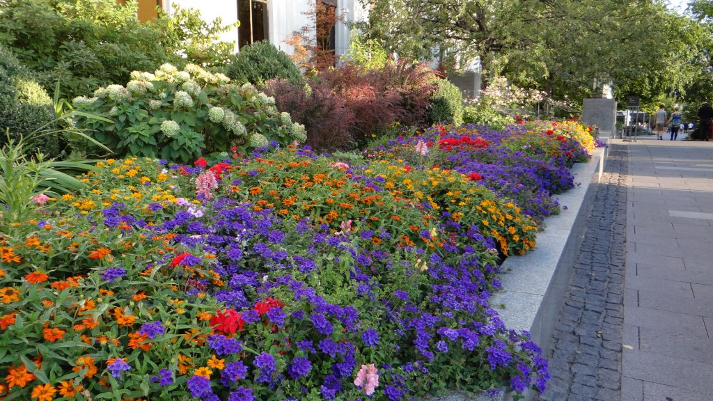
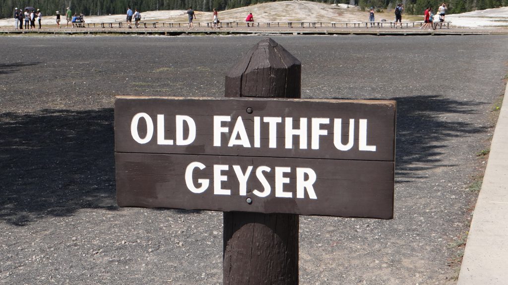
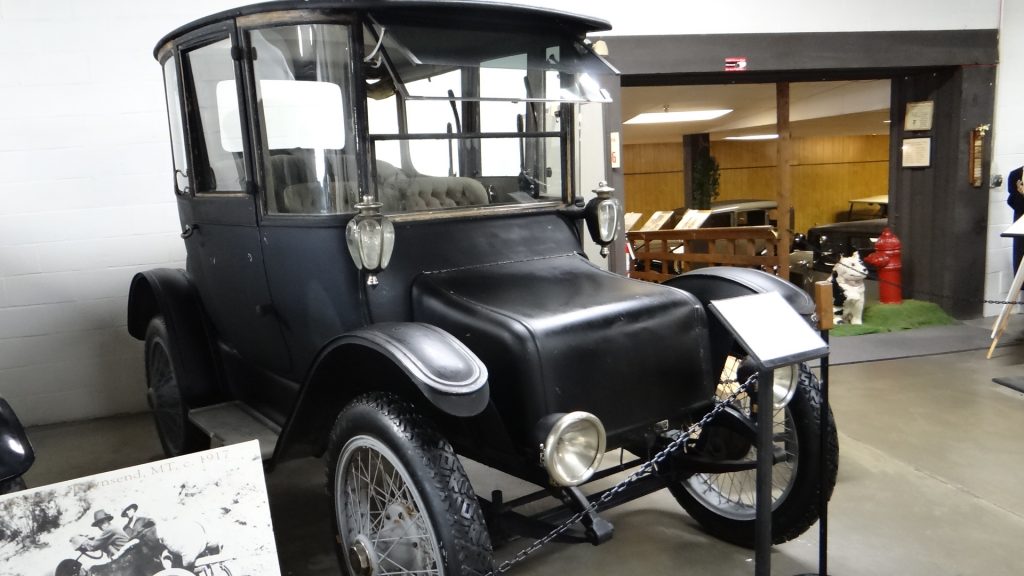
We decided to take it easy on their first day and visited Oak Alley Plantation. This is a complete Plantation with the original house and slave quarters on the edge of the Mississippi, inland from New Orleans.
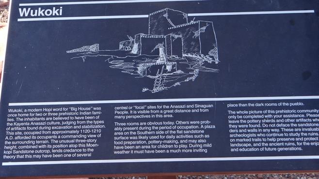
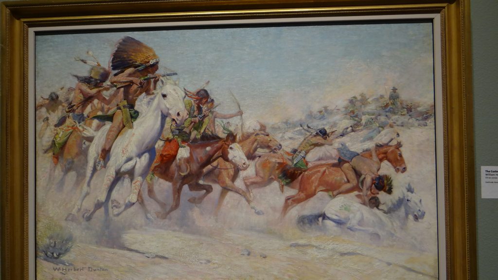
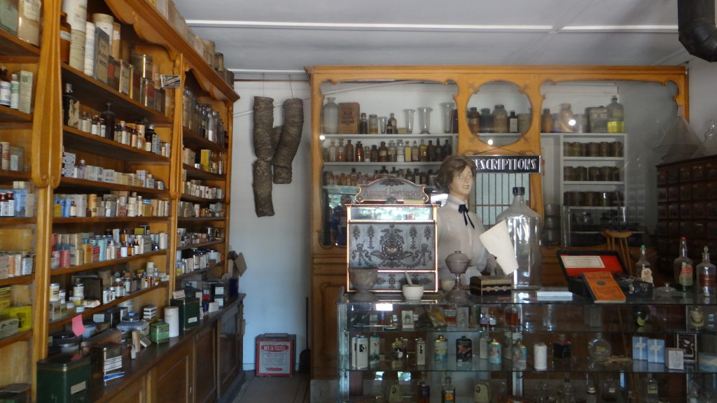
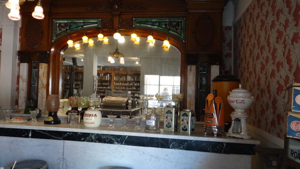
The front of the Plantation HouseAnd the back view.A group of tourists on the balcony at the front.Slave quarters (not original as they fell down).The inside of a slave quarter. The whole family lived in one room.Guess what these are? Outside toilets!!A banana plant.
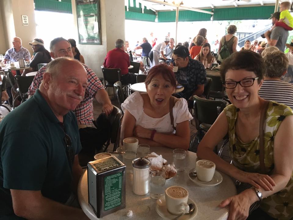
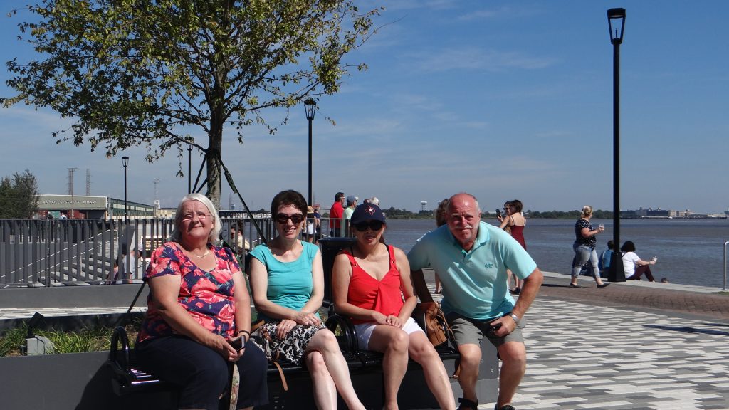
The next day it was the turn of New Orleans to submit to the Brit invasion.
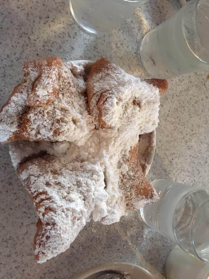
After the mandatory beignets we hopped on a hop on hop off bus.
Café du Monde. I don’t think Kathy believes how sugary they are!!A beignet in all its glory.
Then a group photo before we hopped on the “hop on, hop off” bus tour.
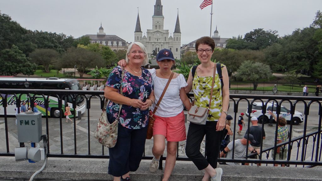
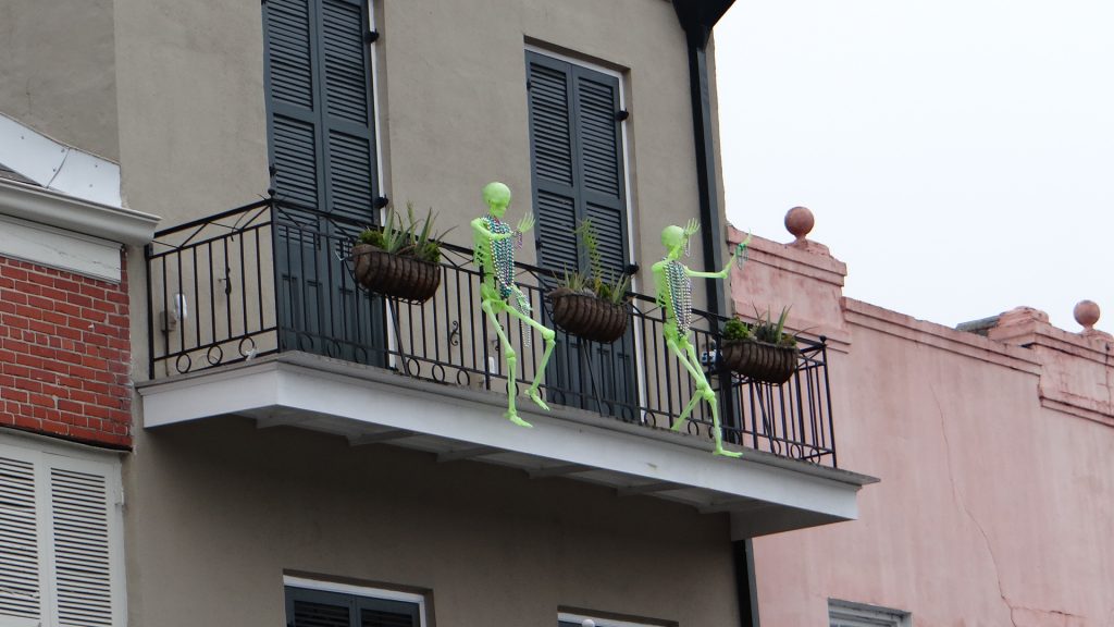
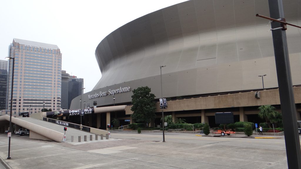
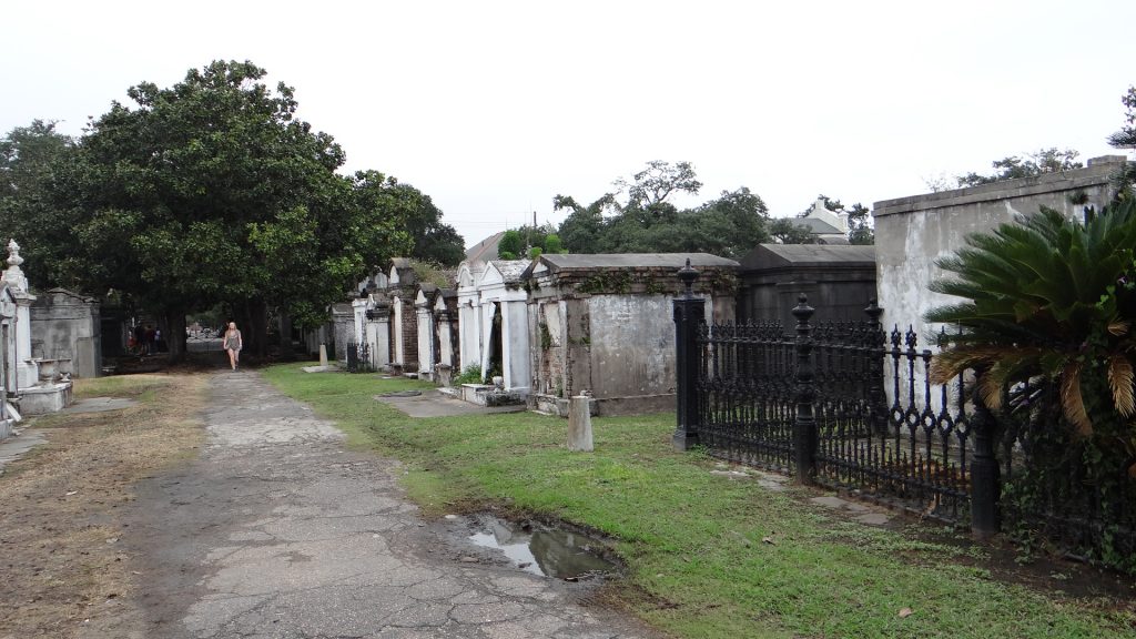
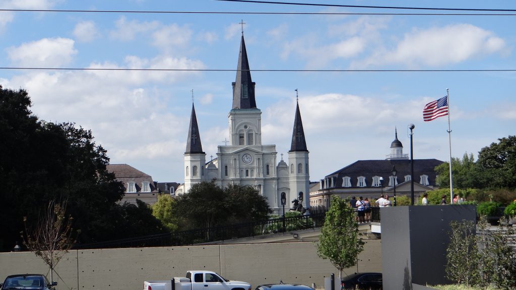
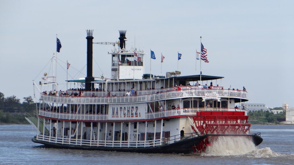
The “three amigos” in front of Jackson ParkFancy wrought ironwork on the balconies.It must be Halloween!!An amazing frieze, but where it was I cannot remember.Mercedes Superdome – the home of the New Orleans Saints (an American football team for those of you who have no clue).It is Halloween!! Wall to wall pumpkins.We visited Lafayette Cemetery, one of the famous above ground Cemeteries. You cannot bury anyone in New Orleans as most of the place is below the water table, so you would be under water.A family tombArtwork near the French MarketThe paddle steamer we went on last year.
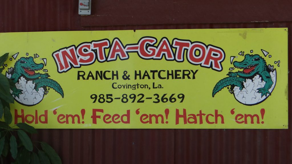
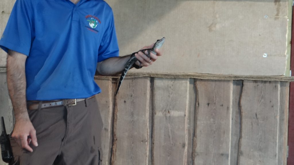
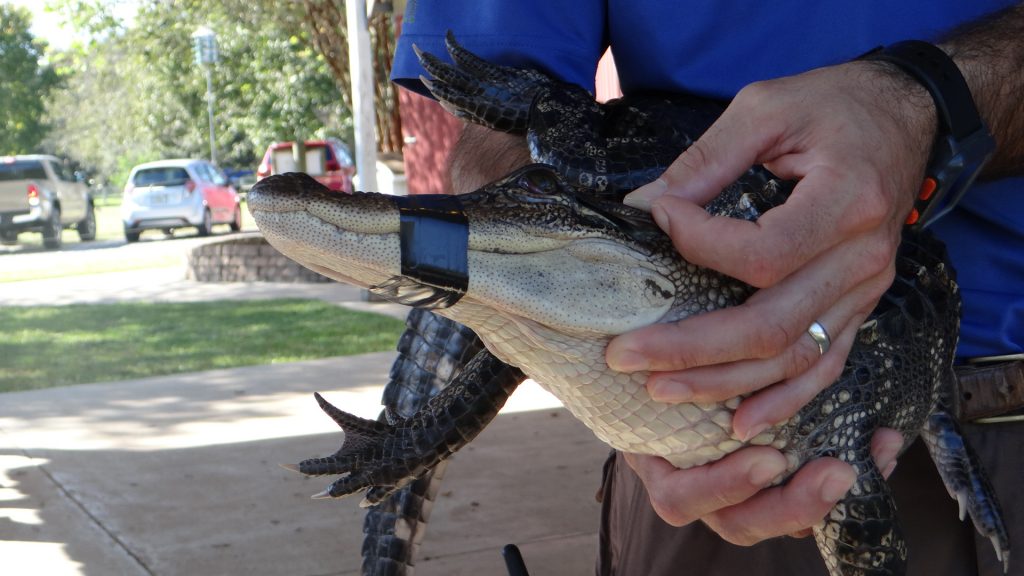
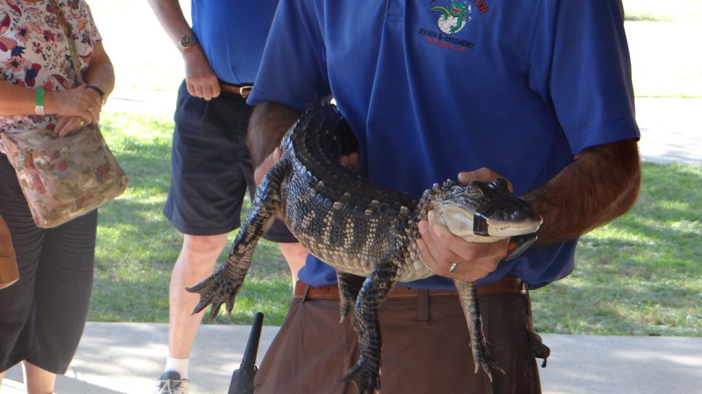
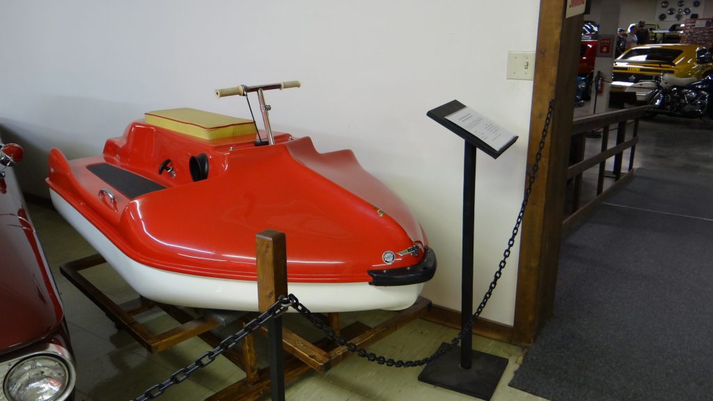
Day 3 of our stay in New Orleans saw us visit an Alligator Farm. Louisiana has a wild population of alligators that is added to each year by the farms that rear the alligators from eggs (which they collect themselves).. They have to release 12% of each year’s rearing (at 4 years old) and then are allowed to keep the rest for skins, meat and by-products. The percentage released is based on what would have survived naturally to 4 years old in the wild. Since the farm released alligators are usually bigger and in better condition than naturally reared 4 year olds they tend to survive longer in the wild. This has enabled Louisiana to stabilise its population at almost 2 million which has recovered from its low point of 150,00 in 1962 when hunting and commercial operations were banned.
The Alligator Ranch we visited.A baby alligator from this years hatch.These were 2 year old alligators.And these were 3 years old.A 3 year old caught and taped so it could be held.An alligator ear.As you can see it is quite big!!Not sure why but when put on the ground if you tapped its head it did this.Luckily for some this was a fibreglass model!!
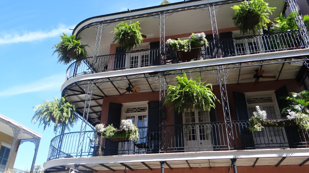
And on Day 4 we returned to New Orleans and walked around the city and the famous French Quarter.
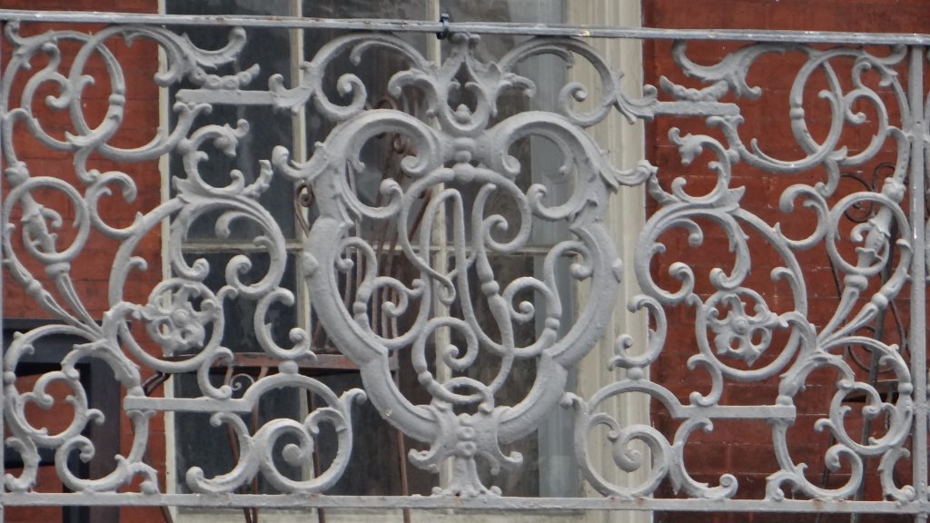
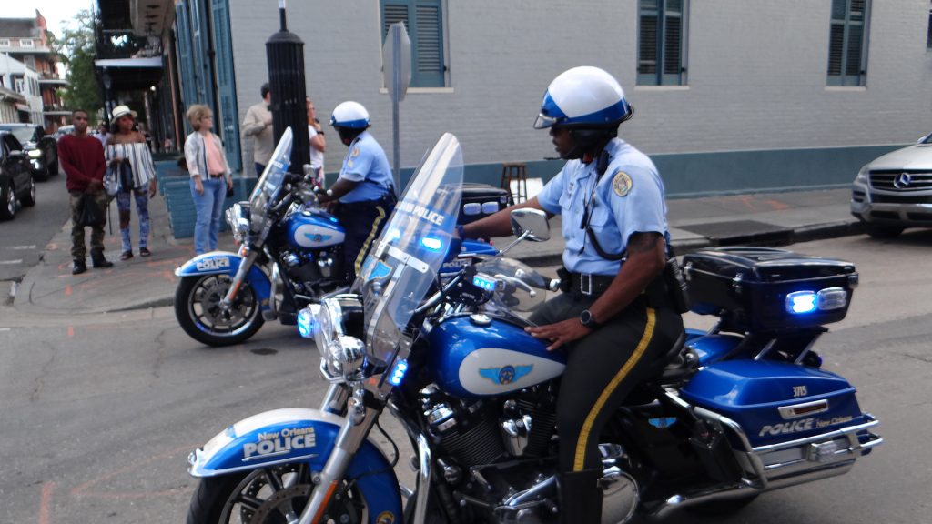
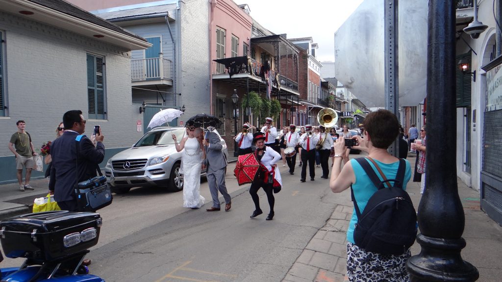
A lovely wrought iron balcony that the French Quarter is famous for.“Fats” Domino, Al “Jumbo Hurt and Pete Fountain, famous NOLA Jazz musicians.And it’s still Halloween!!A live Jazz band.Picture of a funeral band.There wasn’t enough room on the seat for me (my excuse!!).Jackson SquareA train running on top of the levee right next to the Mississippi.The Natchez travelling at full steam.The Fire Department got stuck in the narrow streets.New Orleans Police bikes, BIG Harleys!!A New Orleans Wedding procession has to have a band!!
And then we moved on to Houston with an overnight stop at Lake Charles.
Kathy was going to stay with Nikki as it would be the last time she would see them prior to their move to Canada.
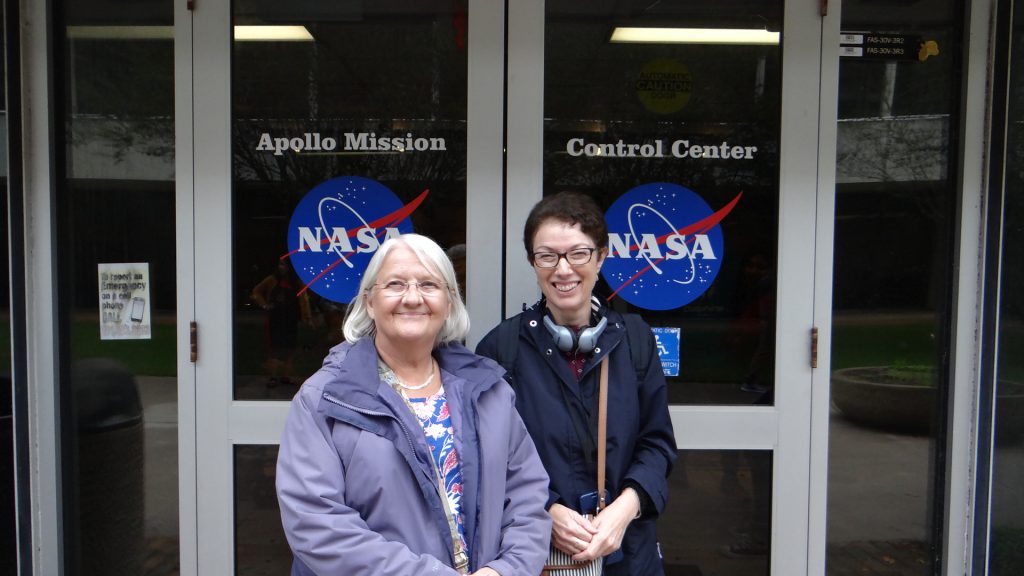
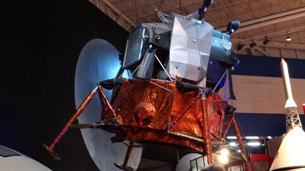
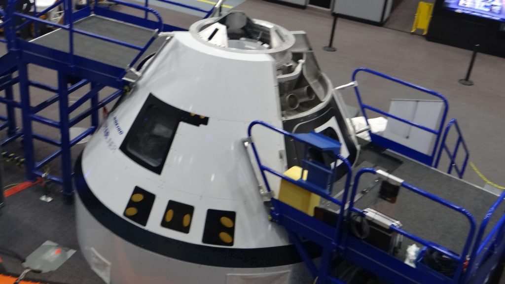
So the two Annes and I visited the Nasa Apollo Mission Control Centre and Museum, which despite the famous words “Houston we have a problem” is South West of Houston near the coast.
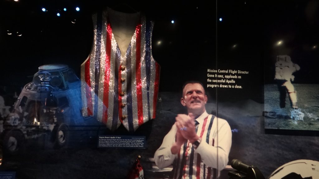
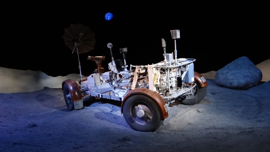
Outside Mission ControlUnfortunately Mission Control itself was in the middle of an upgrade, due to open in 2019.Flight Director Gene Kranz and his famous Stars and Stripes waistcoat.The Saturn V rocket that took all the Apollo Missions into space.The Lunar buggy.The Lunar landing module.The crew of Apollo I who died in a launch pad fire while testing the launch procedures.The last Shuttle into space on the back of its Boeing 747 delivery vehicle.The Orion Module being developed for Mars.Mars Rover vehicle.Mars living quarters pod which when joined to other pods makes up a base.
Very interesting place (for me anyway), but give yourself a day to view it as it is a big museum.
On the last day we joined up with Kathy, Nikki and family and went out for a Mexican meal.
Mexican restaurant.
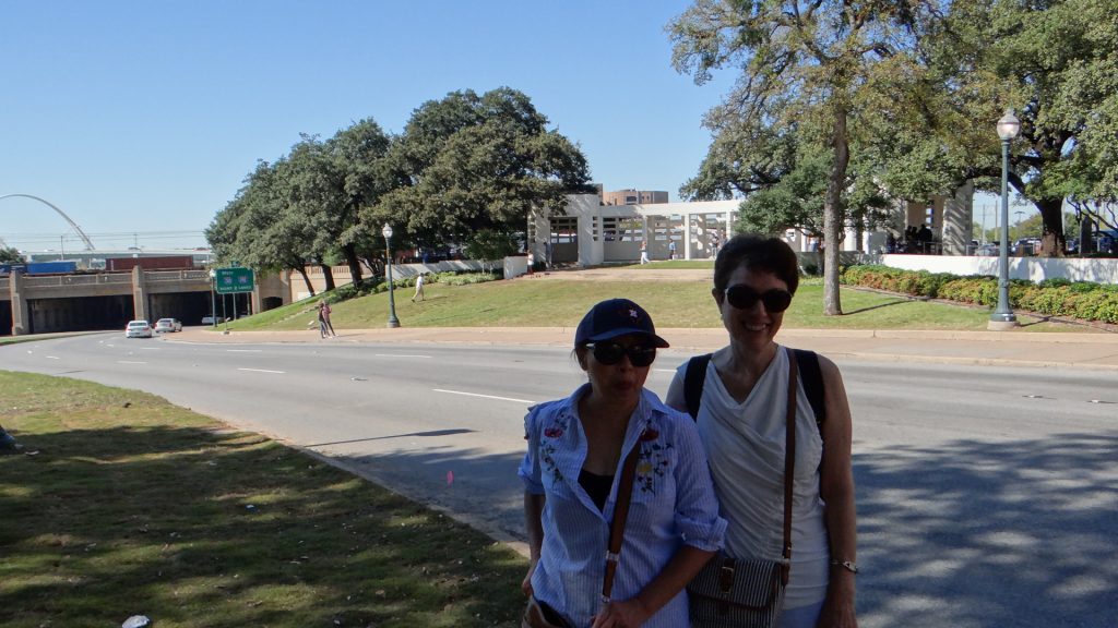
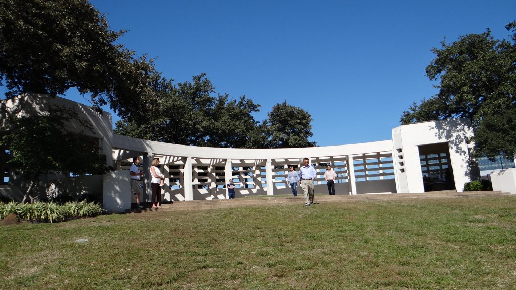
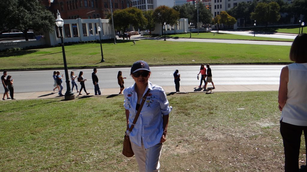
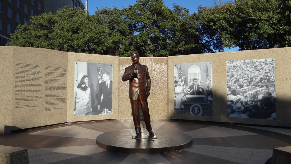
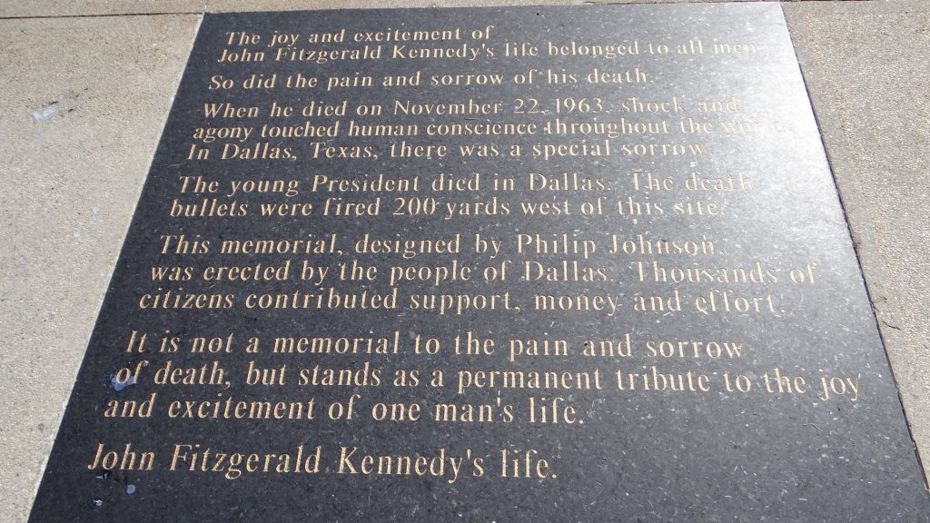
Then we moved on to Dallas. The first point of call was the JFK memorial and the Book Repository.
Outside Dealey PlazaThe Book Repository.The camera in the window on the 6th Floor where the shots were fired from.Standing in front of the infamous spot where JFK died.The Pergola at the back of Dealey Plaza to the right of the Grassy Knoll. The words of the speech that JFK would have made, later in the day, are on a memorial plaque here.The view back to the Book Repository standing in the road when the lights were on red!!Kathy standing at the pergola looking towards the road where JFK was killed.The view from the Book Repository showing the snipers view.A model showing the trajectory of the bullets etc.A seat was needed after the Museum tour.
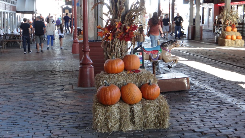
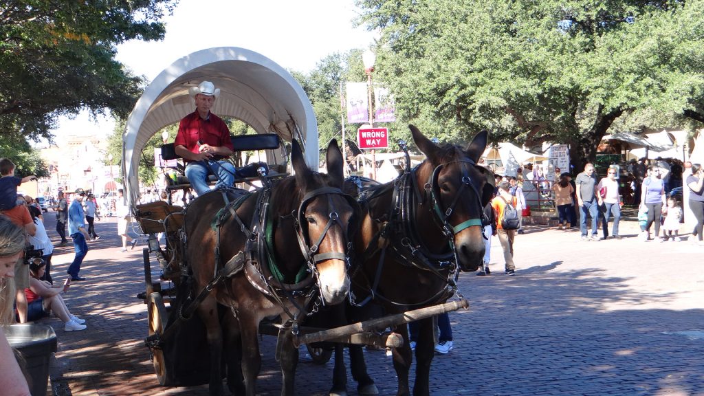
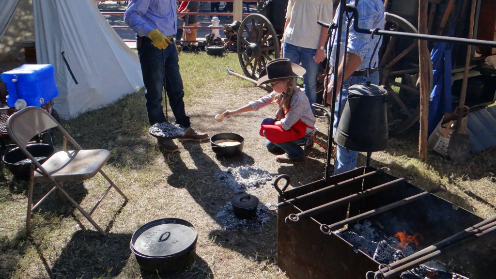
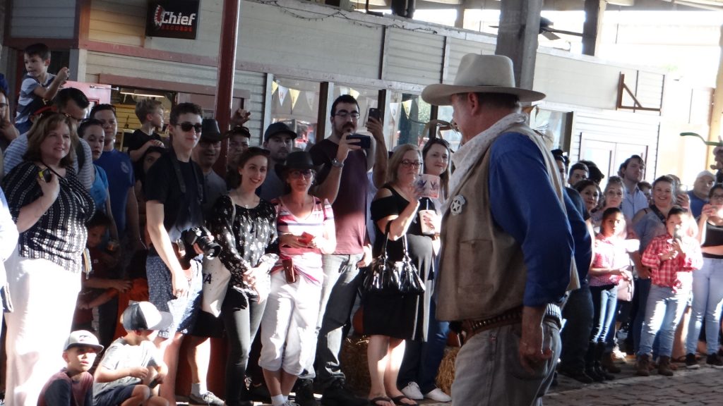
Fort Worth and the Stockyards was on the agenda for the next day.
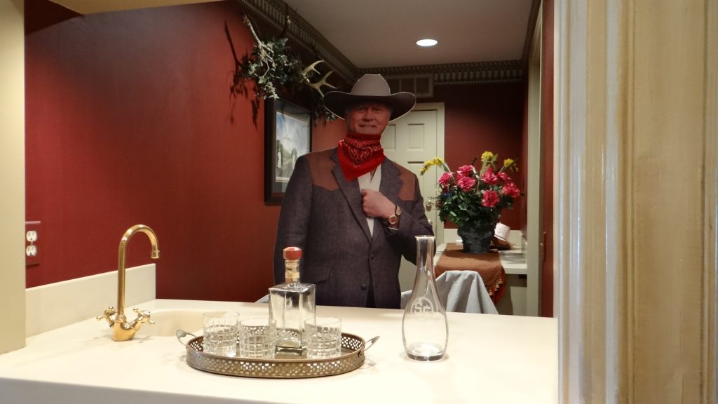
What makes you think it is still Halloween.There was a “Chuck Wagon” display plus a children’s cooking competition using cast iron cookware.Preparing the bull for people to sit on and have their picture taken.The longhorns being moved to the outside corral.The stock wagon children’s cooking competition, with help from a few adults. Huge pot of coffee and the big skillets contain the food.This was a peach cobbler.Think this was meatballs.Some nice Harleys on show.A chromed tank.A mariachi band.Some people dressed in period costume.This guy didn’t half look like John Wayne from the back.This was another gun fight!Dead cowboys lying all around. John Wayne rules again.The Kennedy memorial in Fort Worth.Butch Cassidy and the Sundance Kid memorial in Fort Worth.Anne really wanted to sit on Butch Cassidy’s lap!!
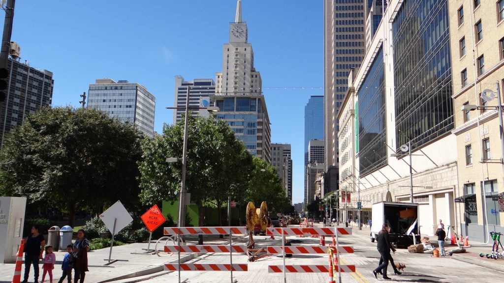
The final day for Anne in Dallas we spent on the trolley bus tour of Dallas and some other Museums and the Kennedy memorial.
The Dallas skyline.
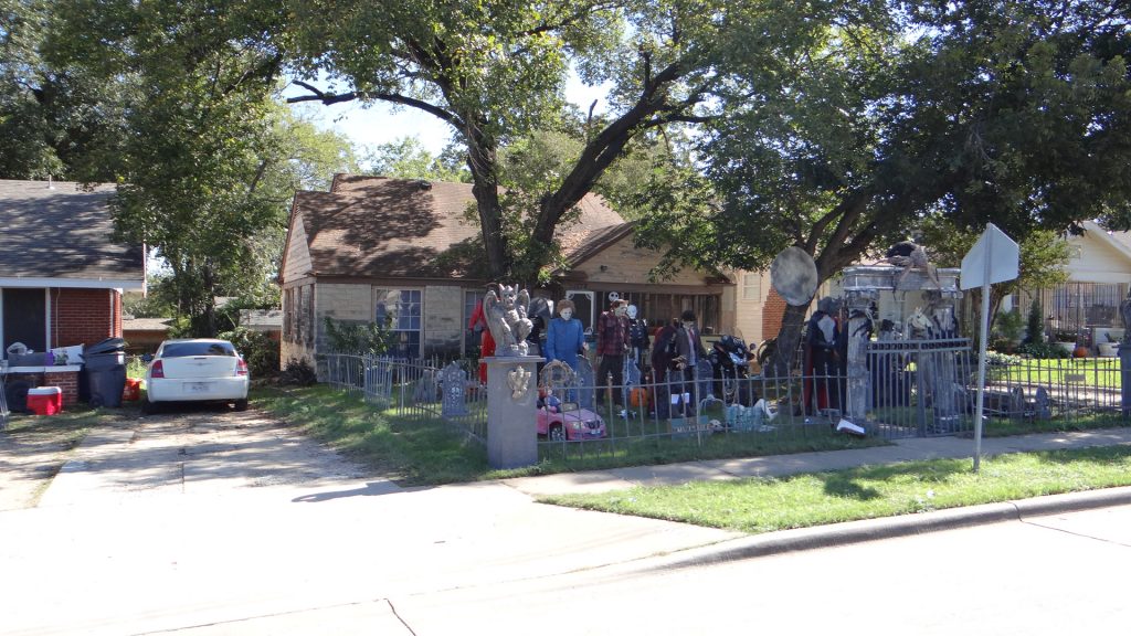
The Reunion Tower, with an observation deck and 2 revolving restaurants. Everything is bigger in Texas.A garden decorated for Halloween.Kennedy MemorialInside the memorial.The writing on the plaque.The original trading post at the centre of Dallas.
Anne(J) and I visited the Holocaust museum, while Anne and Kathy did a different Trolley Tour.
Then Anne left for London.
The wishbone at Dallas airport.
And then there were 3.
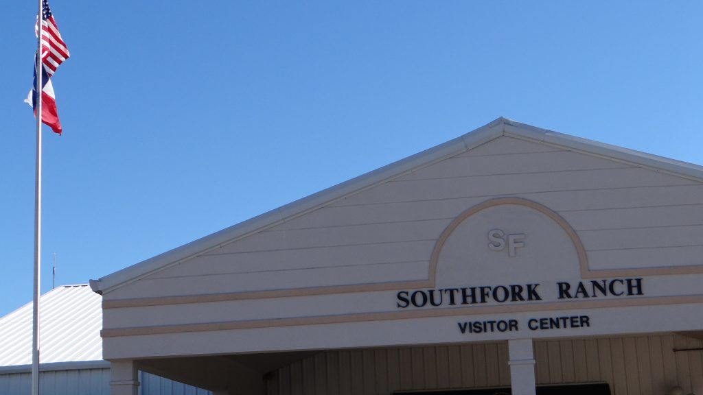
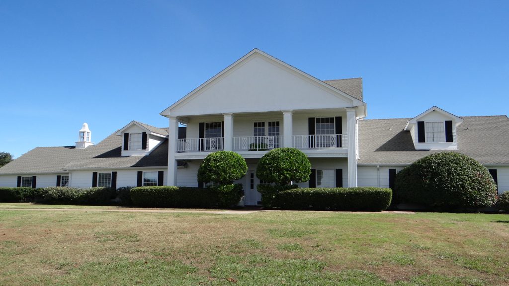
Before we set off back to Houston we visited South Fork Ranch the famous ranch used in the Dallas TV show (1978 – 1991)
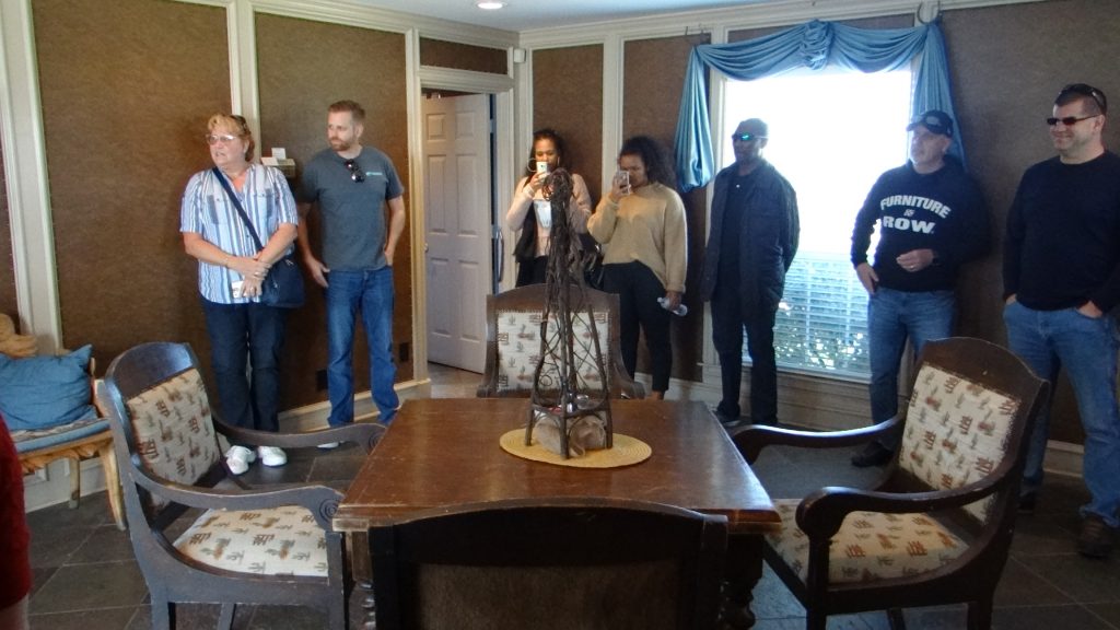
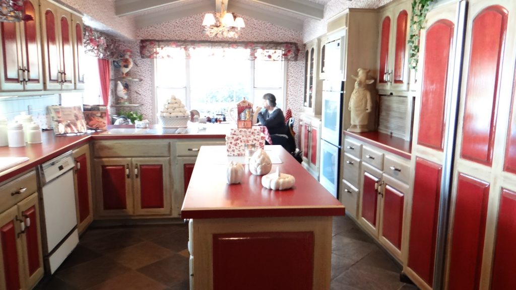
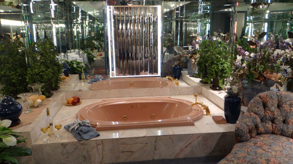
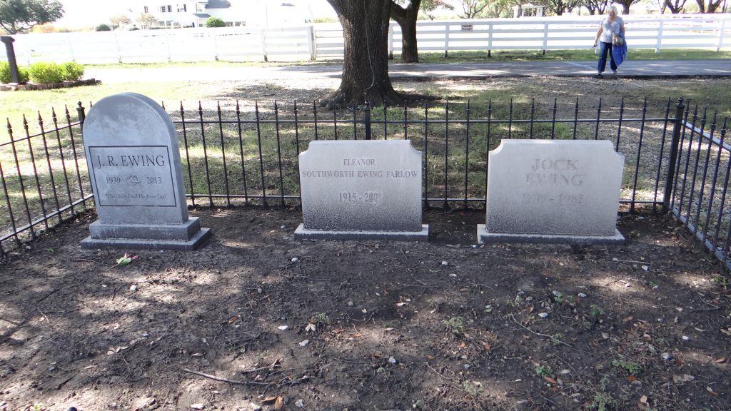
The original cast of Dallas. Apparently there has been a remake, but it never made it to the UK.The trolley bus tour.The house tour. “Ya’all been here before?”.The kitchen.The main living room.Do you remember who shot him?Miss Ellie’s bedroom.The matriarch and her sons.His and her portraitsOne of the opulent bathrooms.The famous swimming pool.South Fork from the front.Jock Ewing’s Lincoln Continental.The graveyard used in the show.Two Dallas cowboys.
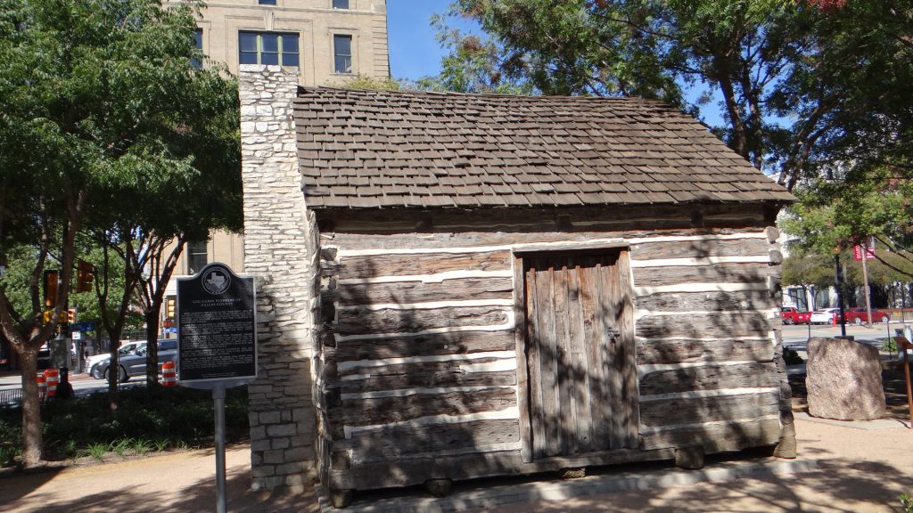
We also revisited the Dallas Heritage site but since I have already posted pictures of it I won’t post them again.
And then we left for Houston, stopping in Waco on the way where we visited a working co-operative farm.
A working waterwheel.It drove the grinding stone in this flour mill.The water source.
We arrived back in Houston, but since this was mainly for Anne to visit the Houston Quilt Show and do the Christmas shopping and for Kathy to go shopping with her, there are no pictures!!
Saying goodbye to Kathy, it had got cold!!
The next post will finish 2018 with our visit to Big Bend National Park.
After the last monster post, this one is going to be slightly shorter. Everyone breathes a sigh of relief!!
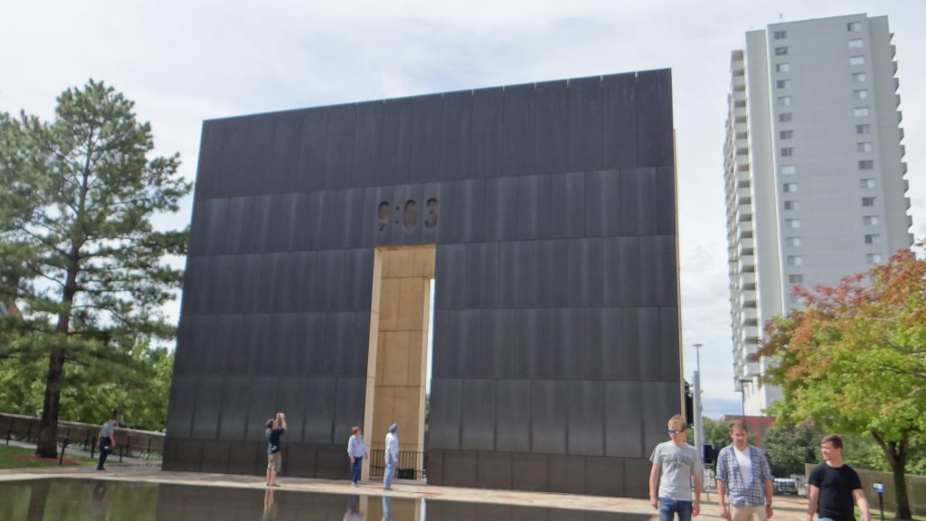
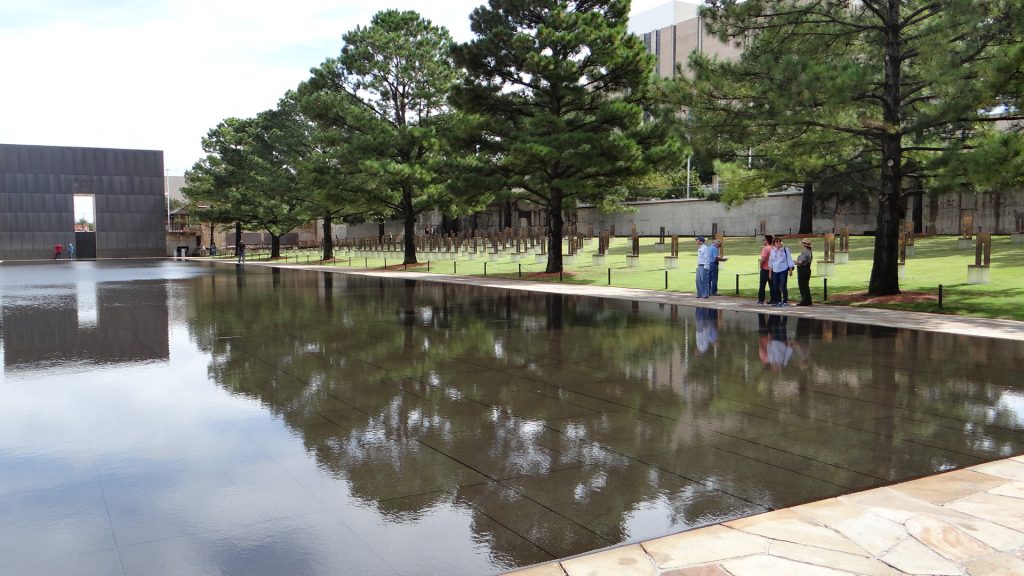
We left Amarillo and after an overnight stop arrived in Oklahoma City. I am sure it has many attractions but Oklahoma city is remembered mainly for the horrific truck bomb that exploded outside the Alfred P. Murrah Federal Building killing 168 people and injuring several hundred more. It was so powerful a bomb that over 300 other buildings were either destroyed or damaged.
Where the building stood is now a memorial garden.
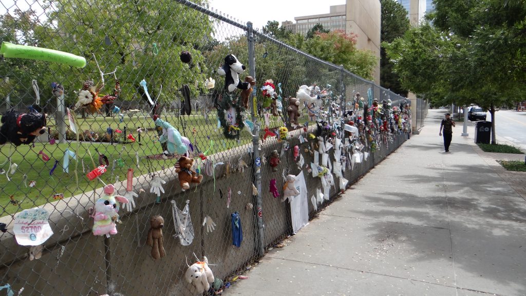
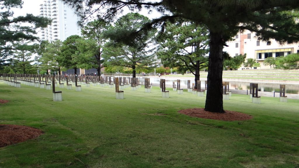
The main memorial showing the time one minute after the bomb went off.The main area where the building stood is a reflection pond.Each seat commemorates a person killed. The smaller seats commemorate the children killed. 19 children were killed, mainly from a day care centre that was run for employees.Remembrance items hung on the fence.Remembrance tiles from children all over America.Other views of the garden.
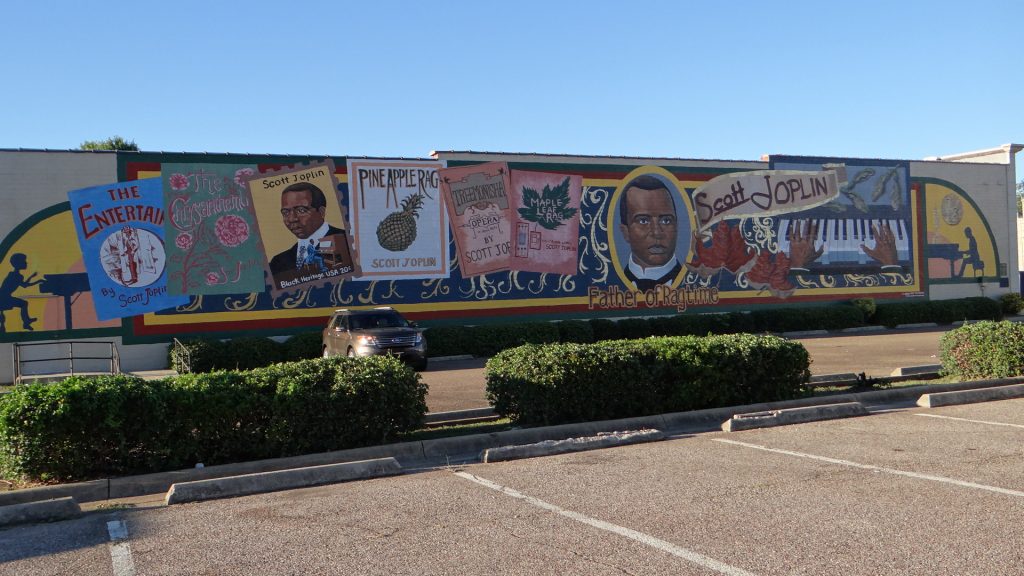
We then moved on to Texarkana, which is a town right on the Texas / Arkansas border. If you drive down the Main Street one half is in Texas and the other in Arkansas, which must be interesting comparing taxes etc. !!
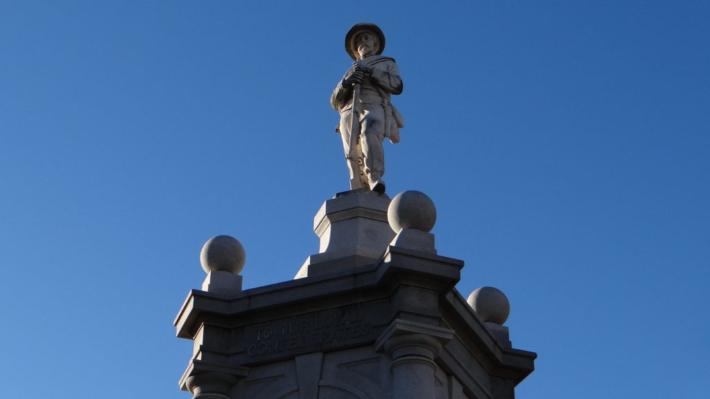
It also has a lot of Confederate state connections including a statue that has managed to survive the current fad to take them all down.
The statue commemorates all the soldiers that fought for the Confederate states.Inscription reads “To our Loyal Confederates”It is the home town of Scott Joplin the “King Of Ragtime” who wrote the Maple Leaf RagThis is the Saenger Theatre one of the Theatres of the Julian and Abe Saenger’s theatre empire, which built a lot of the early movie theatres. Nowadays it is used as theatre and does not show movies.
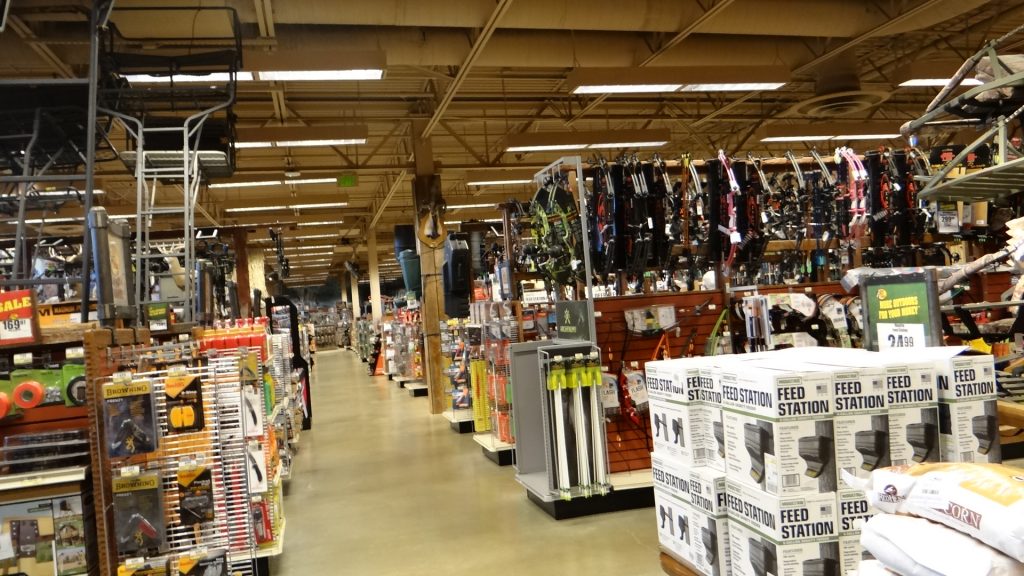
We then moved on to Shreveport. We had a day of rest here so we went into Shreveport to a Mall that was recommended.
It had a massive Bass Pro Shops Outdoor World shop where you could buy anything you wanted to go hunting, shooting and fishing, from boats to guns and anything in between.
The outside of the shop. The cage at the front contained the alligators.The alligators
Inside. The blue tank under the huge tree trunks was a massive fish tank containing at least one specimen of all the fish caught locally. To the right is the upper floor.Guns, crossbows, bows, feed stations, you name it they have got it!!Clothing, seaplanes, boats, outboards …… the list was endless. You could spend all day in this store just looking around or I could!!
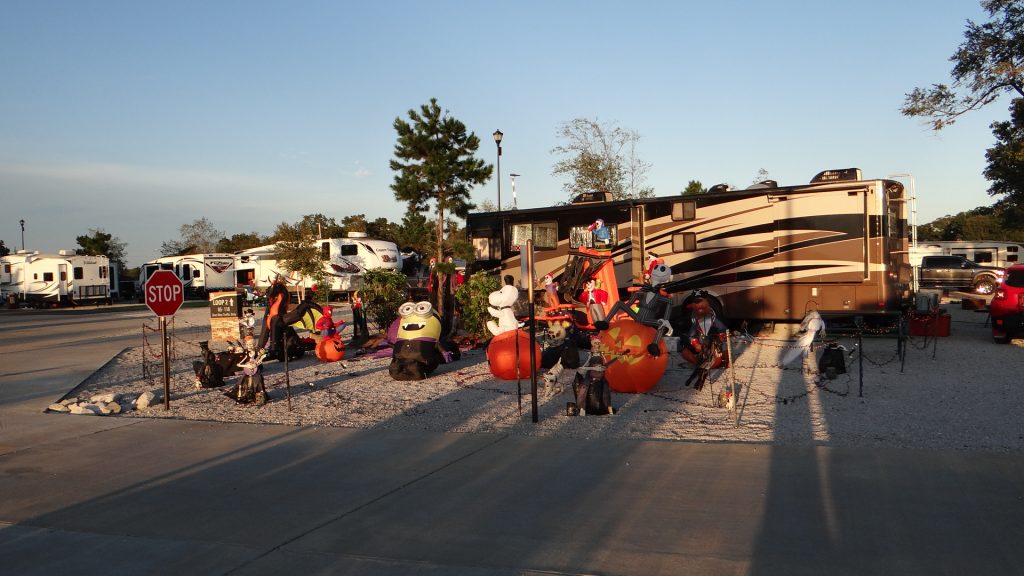
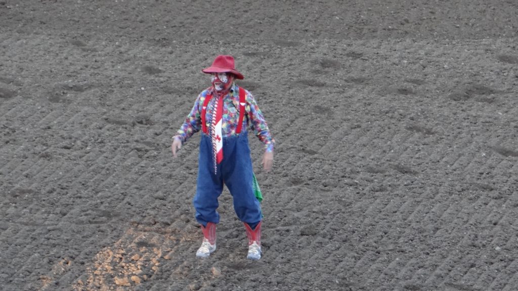
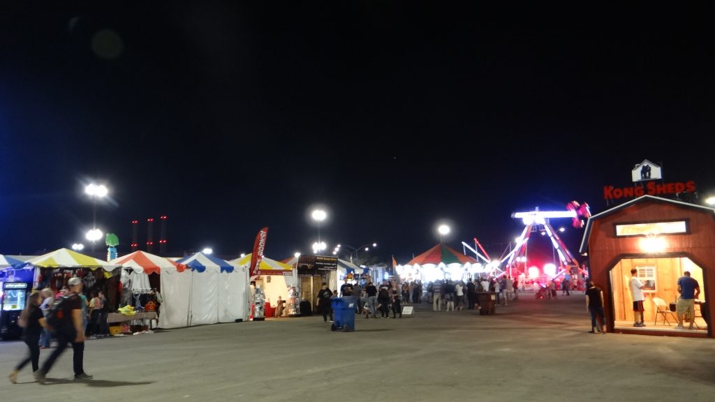
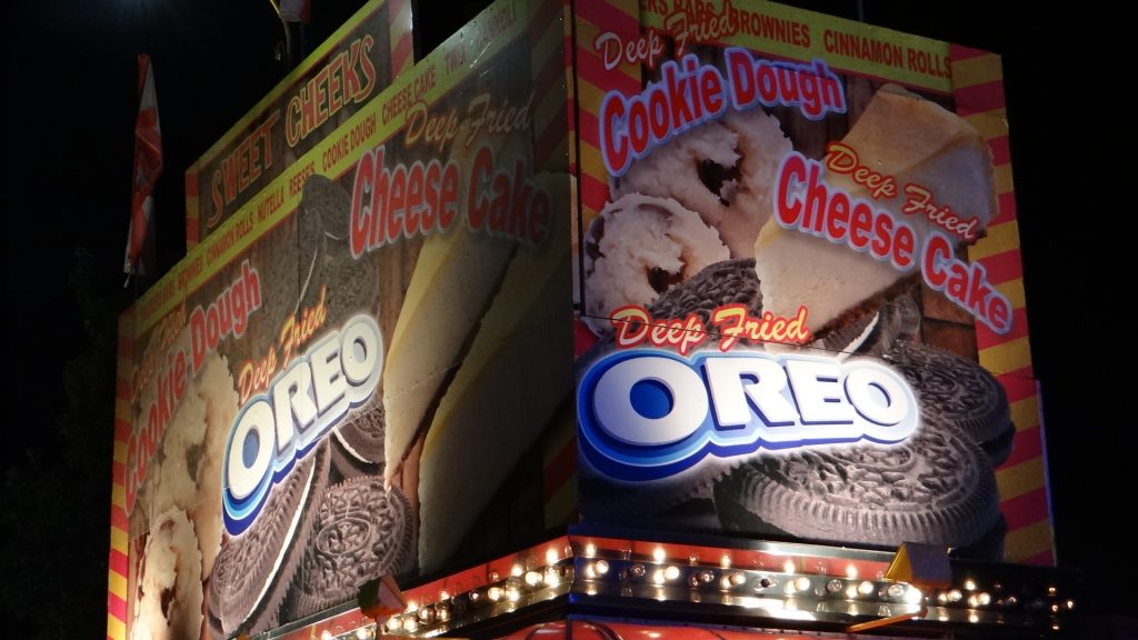
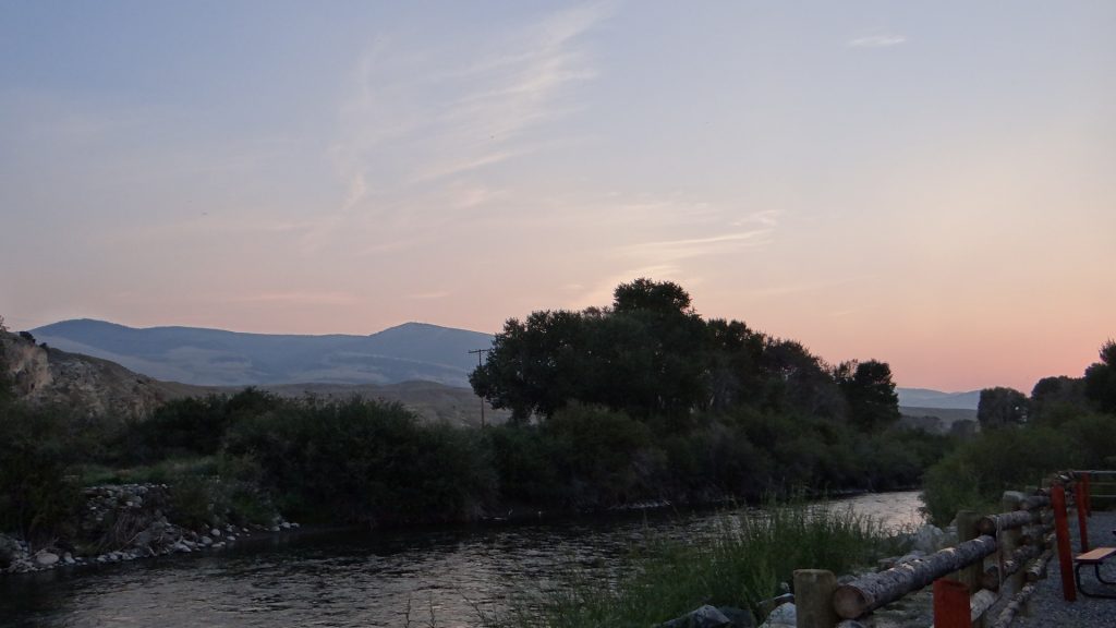
And our final stop before getting to New Orleans was Gator Grounds RV Park. I had just booked it via Good Sams not realising it was a very child oriented park with water slides etc.. I suppose I should have realised when they asked me to make sure I was parked before 5pm as the campground roads would be closed from 5.30pm.
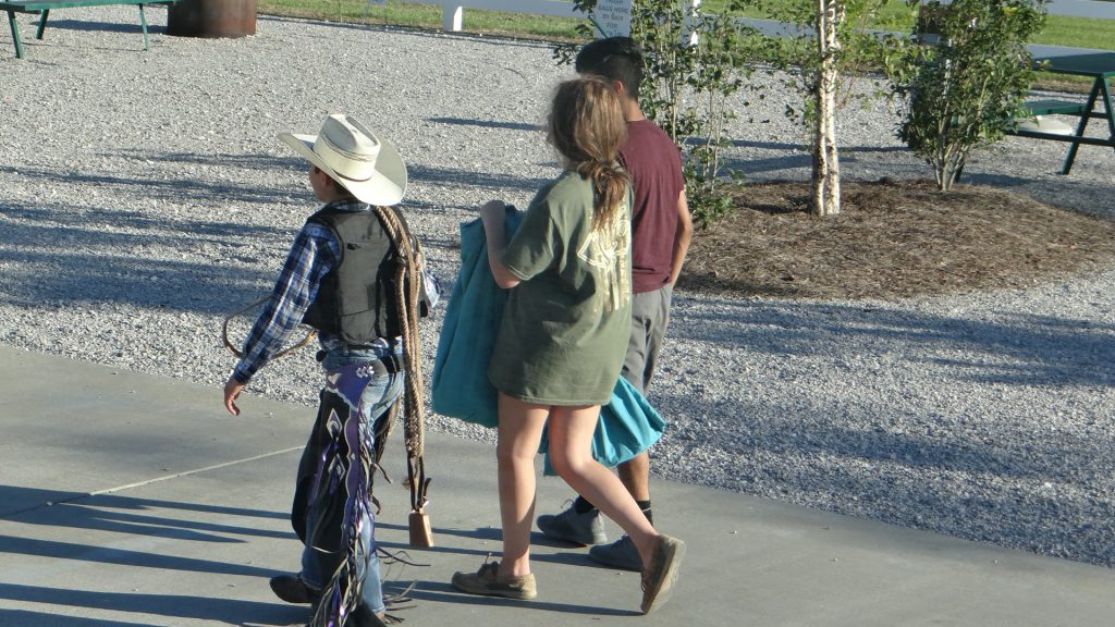
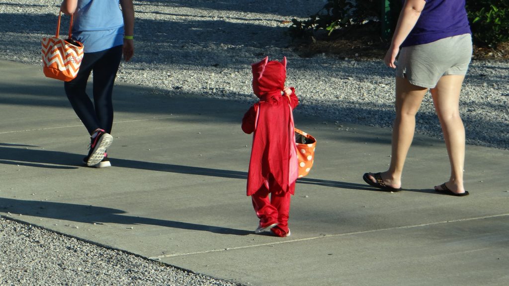
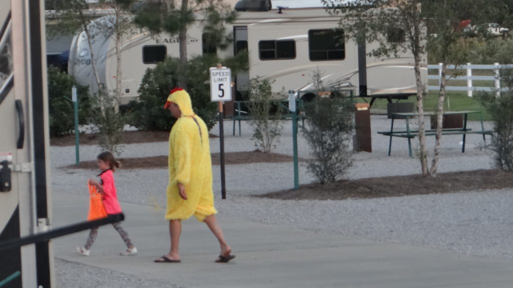
Bearing in mind this was the 13th October, it turned out this was the first of 3 weekends that they celebrated Halloween!! So we got in parked up and there were some spectacular decorated RVs.
One of the decorated RVs
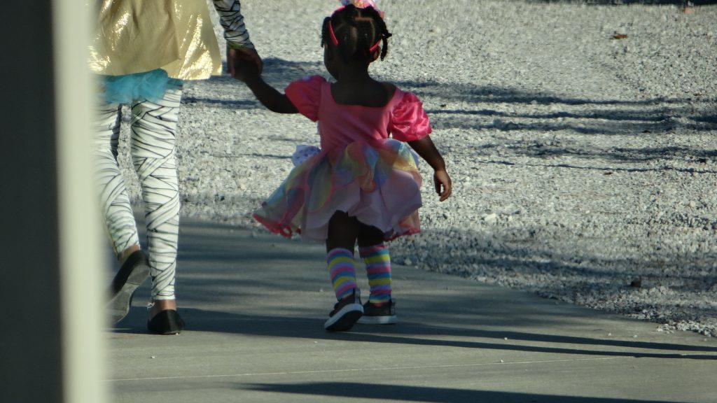
And then the “Trick or Treat” procession. I had actually gone out and bought some sweets in case our door was knocked on. But what we didn’t know was the protocol said “only knock on the doors of decorated RVs or ones with pumpkins outside” and we had neither!!
Mum and daughter all dressed up.A bull rider (the rope with bell on it is the giveaway) with a huge sack for sweets!!You can’t quite see but even the pets were dressed up!!A little devil with his sweet bag!!Dad dressed up as a chicken!!
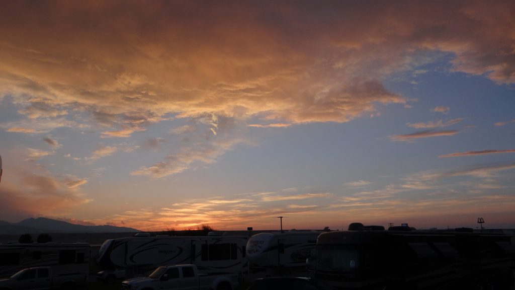
It was an interesting evening finished by a magnificent sunset.
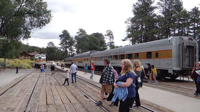
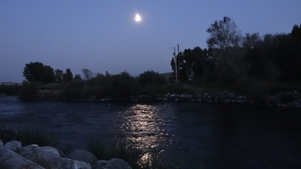
The next day we arrived in New Orleans to pick up Kathy and Anne from the airport on the 15th October.
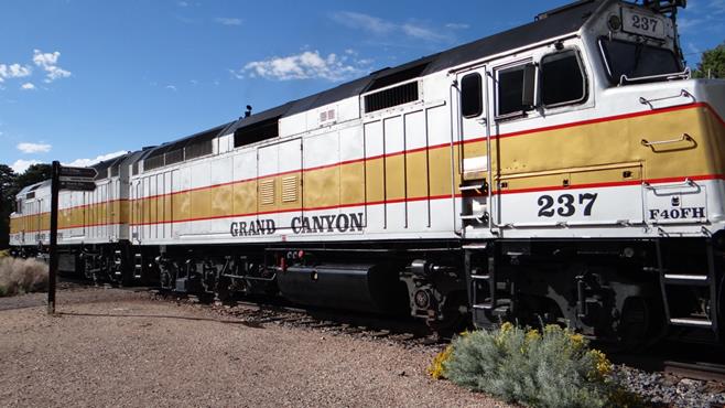
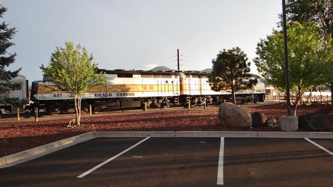
When we were planning this trip one of the places we had to visit was the Grand Canyon. I found out that you could take a train ride from a town called Williams to the Grand Canyon Rim and back again. So we decided that had to be the way to do it!!
We arrived in Williams and parked at the Grand Canyon Railroad RV Park. Williams is a small town known for two things, 1) it is the town where the Grand Canyon Railroad track runs from and 2) it is one of the best known towns on Route 66.
View down Williams Main Street.Café 66 in the middle of Williams.
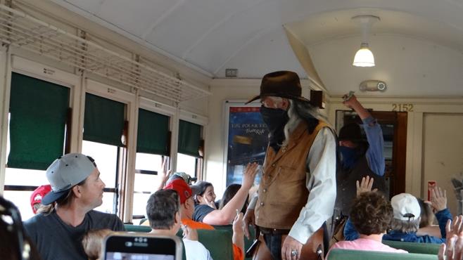
The following day we boarded the train after an early morning gunfight staged as part of the day.
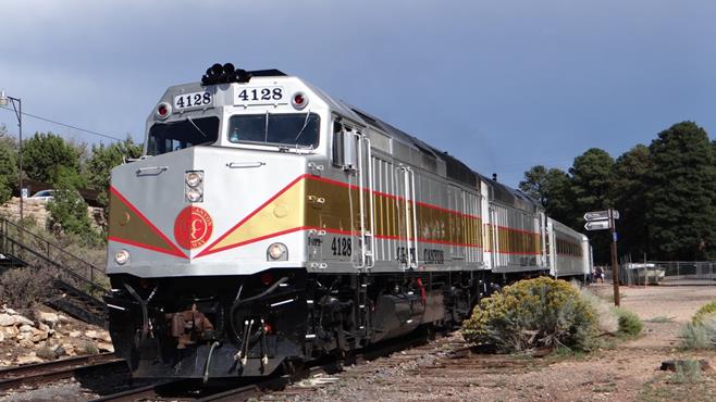
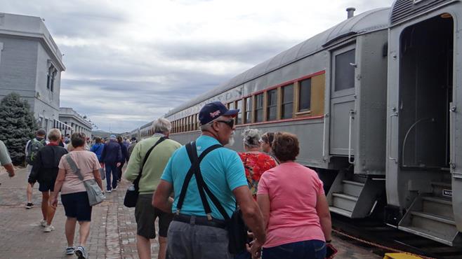
The Grand Canyon Railroad train. If you are lucky on certain days they run a steam train.These are the Gunfighters taking on the Marshall.A volunteer being briefedThe Marshall tidying up the town. One dead, two more to go!!Boarding the train.
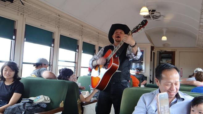
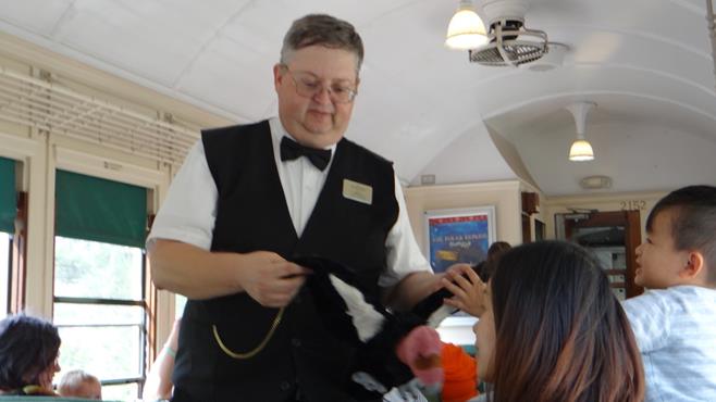
The actual train trip is 2 hours there and back, so they have strolling musicians and a conductor in each carriage who provides entertainment.
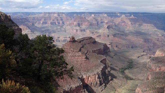
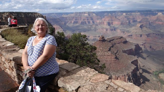
One of the strolling musicians.Our conductor. He was a local wildlife expert and had stuffed toys representing all the local wildlife, which he let the kids stroke as he told you all about them. Very, very good and he certainly knew his stuff, we learnt a lot.The train trundling along on the way to the Grand Canyon.We have arrived, and from here it was short walk to the Canyon rim.
The Grand Canyon.You can’t quite see it but behind Anne to the right a rainstorm was on the way in. We retreated to a restaurant for lunch!!And after lunch the sun came out.And it got warmer.Panoramic view with storms in the distance on the right.
We then got back on the train.
When the train got close to Williams it was held up by the outlaws in the gunfight.
We was robbed!!And again.And the marshal came last.The steam train that is used on Special occasions.Back at Williams.The engine at the end of the line.
A very interesting trip and a long day.
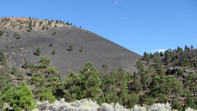
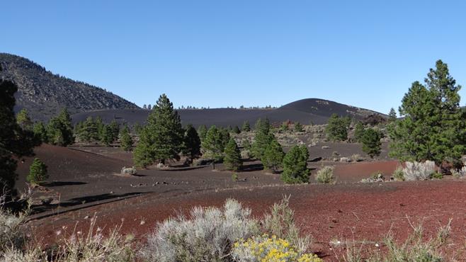
After a day of rest we decided to explore an area locally that has huge volcanic cinder fields and remains of Pueblo Indian dwellings.
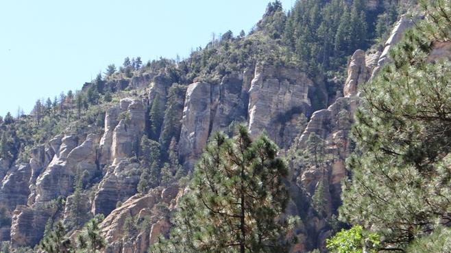
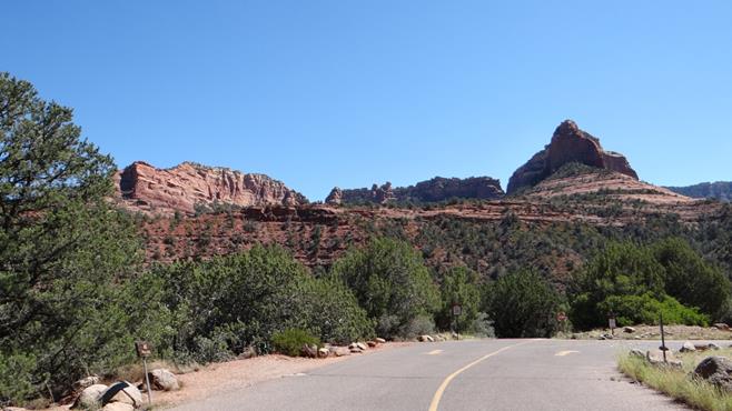
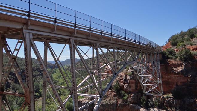
But before we did that we revisited Sedona and the Red Rock country from the north via Flagstaff. We did this by driving down RT 89A which took us down Sterling Canyon which reminded us of Cheddar Gorge only on a slightly larger scale.
Sterling CanyonA parking spot halfway down the Canyon.Getting closer to Sedona the rocks started to turn red.Some of the Red Rocks we saw last time when we visited Sedona from Phoenix when we were on our way to California.An Iron bridge that carried RT 89A over a canyon to Sedona.
We had a coffee in Sedona and then headed back to the Cinder field. There must have been a lot of active volcanos around here as the cinder fields were huge.
Huge cinder hills all over the place.And more.An overlook that shows you the extent of the fields.Very fine cinder and cinder dust.
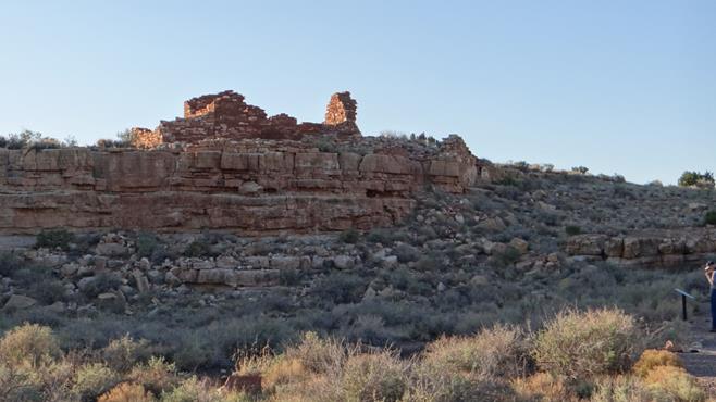
From here we drove down through Sunset Crater National Park to the site of some Pueblo’s.
This was the first and the biggest.Very inhospitable land to have a house in!!Built on a rocky outlook which gave it good views.
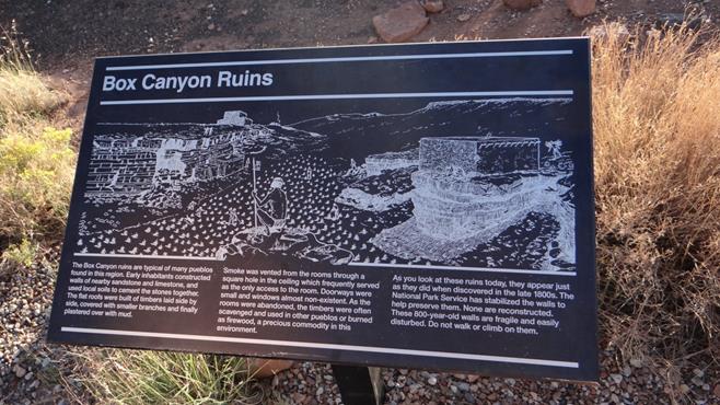
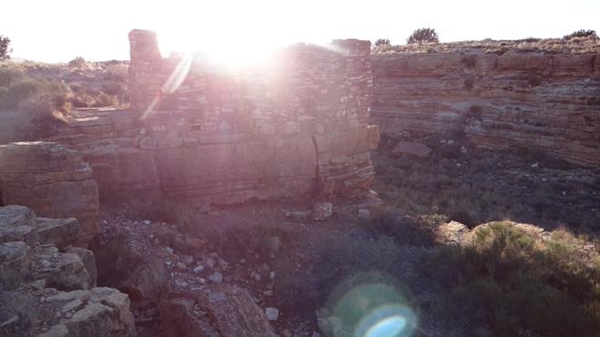
We then visited another Pueblo in a box canyon.
The sun was going down at this point.The Box Canyon from the ruin.Another Pueblo further up the Canyon.How they managed to live here.
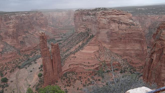
We then moved on to Holbrook so we could see the Canyon de Chelly, and the Painted Desert and Petrified Forest National Park.
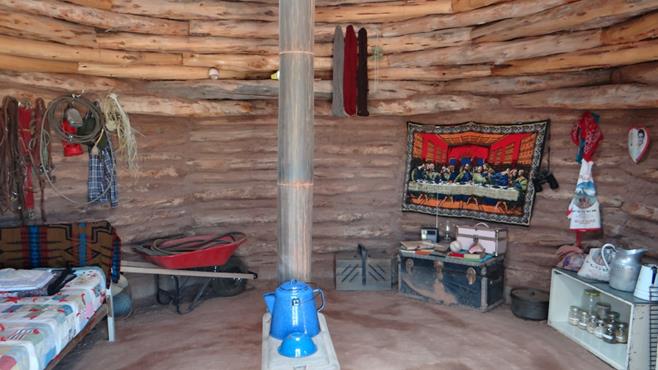
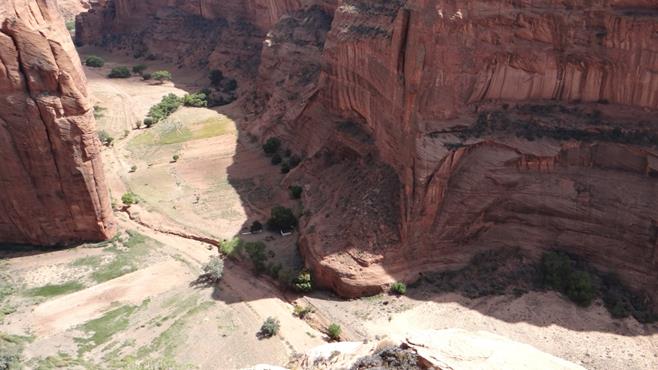
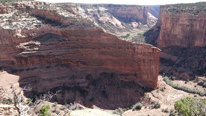
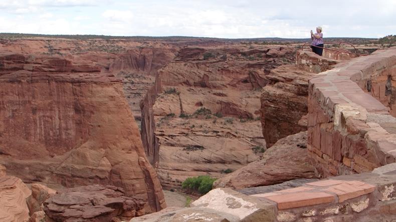
Canyon de Chelly is a red rock canyon on a Navajo reservation north of Holbrook which has been home to native Indians for thousands of years.
It has a North and South branch and you can look down into the canyon from roads and overlooks, but if you want to actually travel on the canyon floor you have to do that with Park Ranger or Navajo guide who use 4x4s. This is because the canyon itself is rich farmland and it is still farmed.
To get there we went through some of the Painted Desert.
At the Visitor Centre they have some examples of native Indian buildings.
The Canyon is massive with over 1,000ft drops to the floor below.Farm buildings.Pueblo buildings built into the side of the Canyon.A view down one branch of the Canyon.This Pueblo building is known as the White House for obvious reasons.A lookout area.Closest I have seen Anne to steep drop!!It also contains steepling Buttes like the ones in Monument Valley.
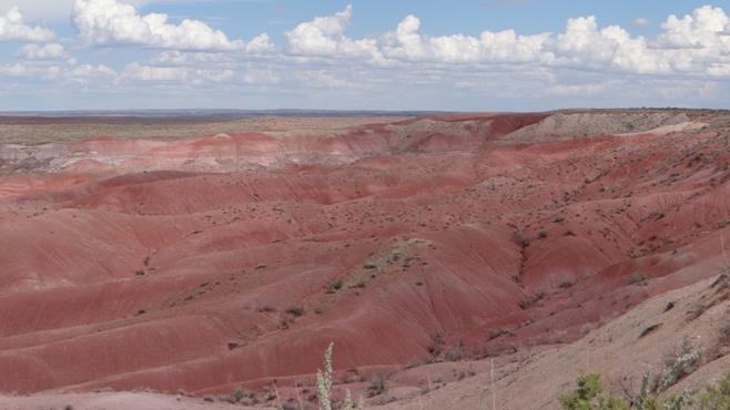
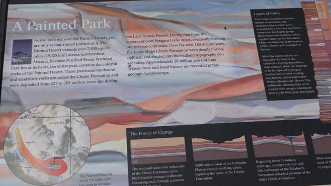
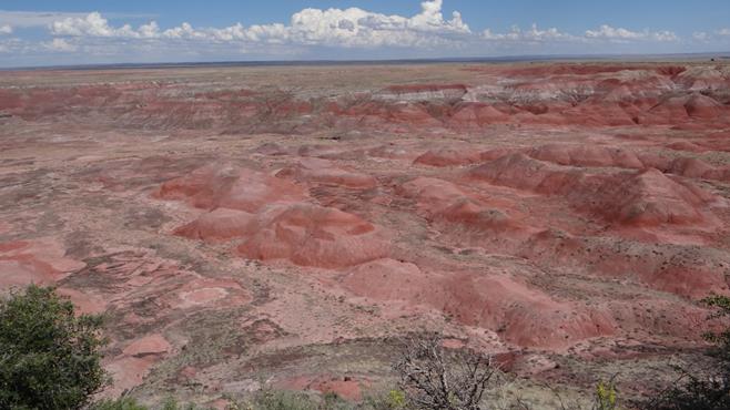
The Painted Desert and the Petrified Forest were next on the itinerary. It is north of Interstate 40 and the Petrified Forest is on the South side.
The Painted Desert is part of what is known as the Badlands and some of you may recognise the area as it has been used for many films.
Colours are from a mixture of mud and sandstone rocks.This explains how they were formed.Beautiful day and Anne’s top matches the colours.Pink as far as you can see.And more.An adobe hotel that used to be on Route 66. It is a museum now.It contains some painting by a local Indian artist.
And some elaborate windows in the ceiling.
From here we followed the road across I40 towards the Petrified Forest.
There was still more painted Desert.
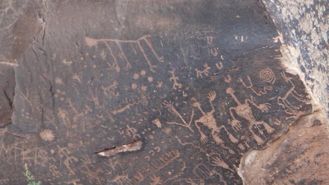
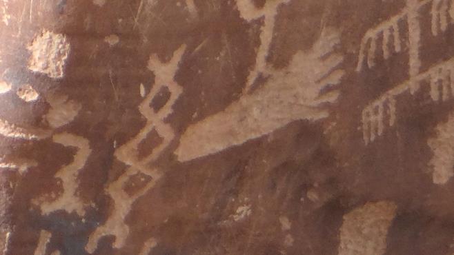
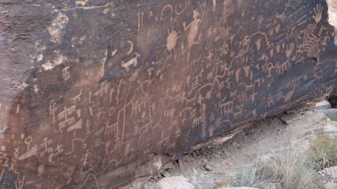
And then we came across a petroglyph site. These are pictures scratched on black rocks that are thousands of years old and are thought to have been done by Pueblo Indians.
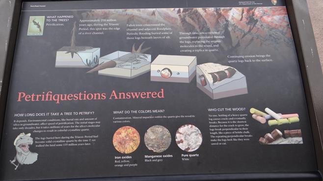
The we started to see the petrified trees. Small amounts at first but they soon became almost forests.
Individual trees.How petrification occurs.
Still more eroded painted desert.
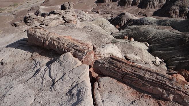
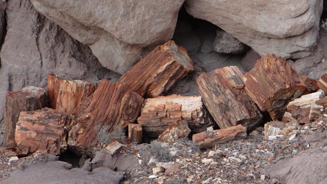
This was originally a petrified tree that formed a bridge, but started to fail so someone built a concrete platform under it to support it.There were whole areas covered in stacked trees. You can actually buy petrified trees for your garden, but not from the National Park as this is illegal. They are lying in fields outside the park.
A polished log showing the variety of colours in the logs.
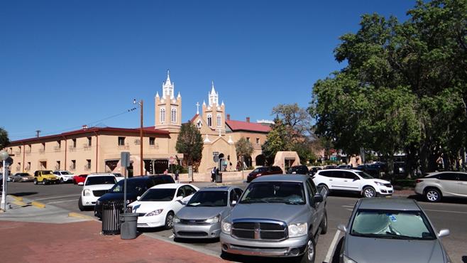
We then moved on to Albuquerque as we gradually moved East towards New Orleans.
We explored Albuquerque, home to the famous Balloon Festival (we were too early as it was mid October).
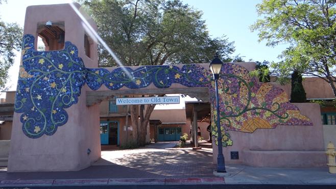
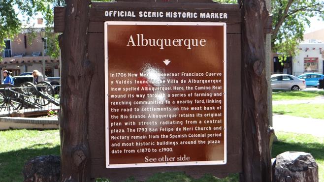
We entered through the Old Town.A plaque in the central Plaza.Police transport.A view across the central plaza towards the Church.One of the oldest churches in the USA.Magnificent interior.Because it was founded by the Spanish coming up from Mexico it is one of the oldest towns in the USA and celebrated its Tricentennial in 2006.Some interesting pieces of art in the Albuquerque Museum.
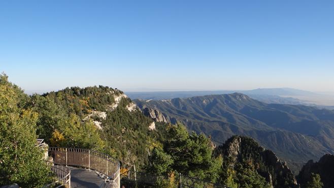
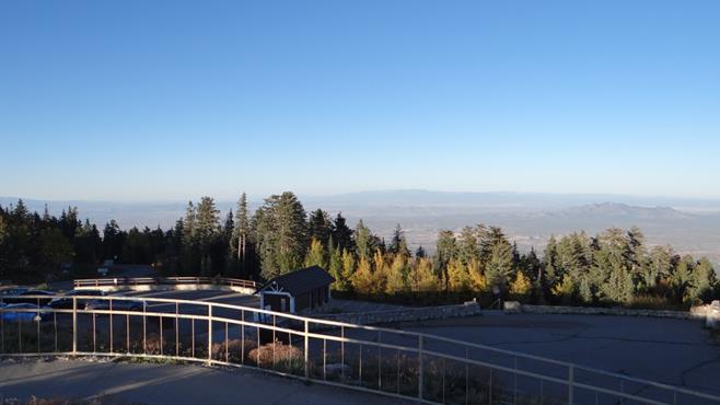
Later we drove to the top of Sandia Crest, a mile above Albuquerque and 2 miles above sea level at 10,678ft. Driving there seemed to go on for ever but the views were worth it.
Albuquerque a mile below us in the setting sun.Mountains all around.
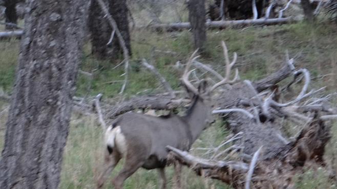
Managed to get a photo by balancing the camera on a rock!!On the way down we met some deer.
The next day we went to Santa Fe. This is another old Mexican town but a very interesting place with lots to see.
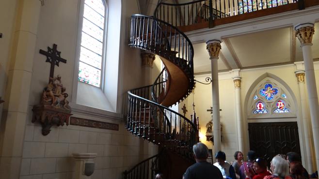
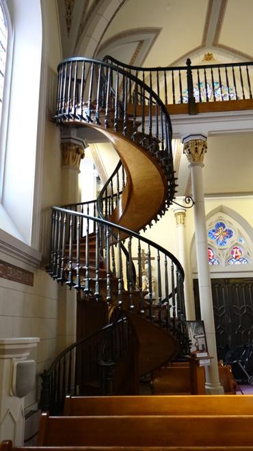
We started off at the Loretto Chapel , home of the “miraculous staircase”. When the chapel was originally built there was no access to the choir loft. Building a staircase to access it seemed to defeat most carpenters, until, so the story goes, a carpenter appeared and built what all thought impossible, a spiral staircase to access the loft.
It is said the carpenter disappeared after it was built without being paid, so no one knows who he was, how he built it and what wood it was made of.
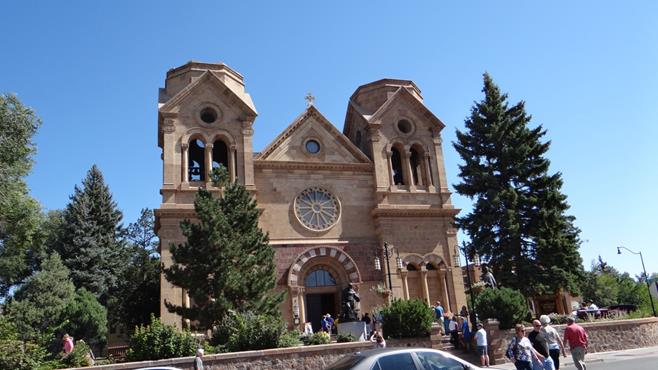
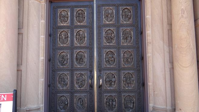
Cathedral Basilica of St. Francis of Assisi.Its beautiful front door.The main altar.Stained Glass windows.The ceilings were beautifully painted.
As were the windows.A lot of the area had colonnaded walkways, some of which were decorated.On the left is the Palace of the Governors, on the right a market in the plaza.An unusual clock.Santé Fe police transport.A view across the plaza.Various cars were being driven around.
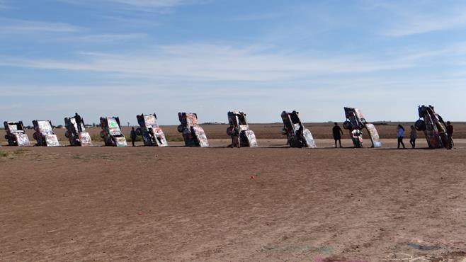
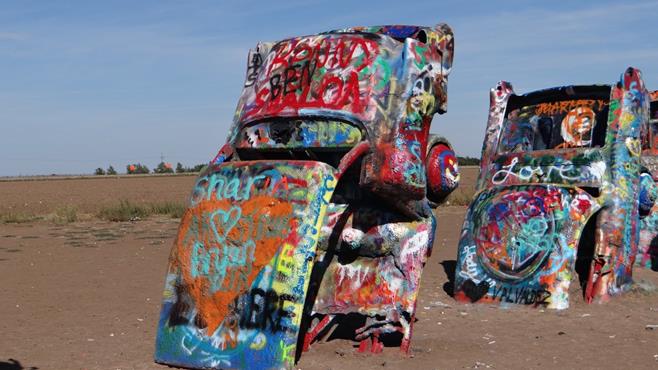
We then moved on to Amarillo, famous for that song, but it is also home to the Cadillac Ranch. This is field where a farmer has buried 10 Cadillacs nose down and invited people to spray them with aerosol cans.
Very colourful.
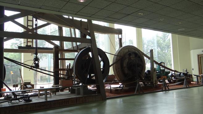
We also visited the Panhandle-Plains Historical Museum on the campus of West Texas A&M University in Canyon just south of Amarillo.
It is really about four museums in one and no amount of photos are going to do it justice, but if you are nearby make sure you visit it.
One huge exhibit is a complete cable tool drilling rig.
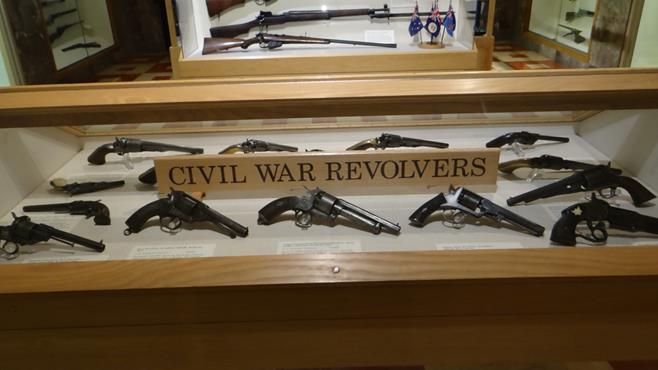
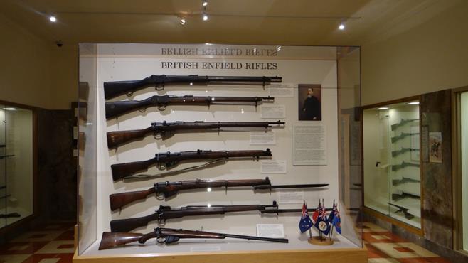
There is a large gun exhibition with guns from the Civil War to a complete case of Enfield Rifles from the UK.
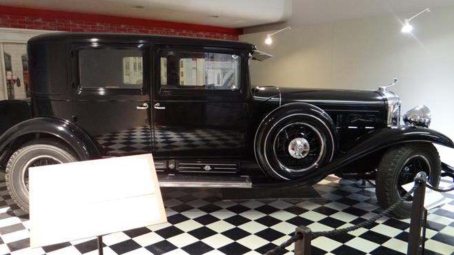
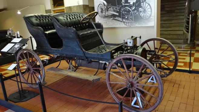
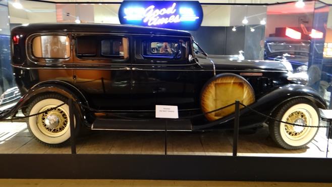
There is also a large vintage car exhibition.
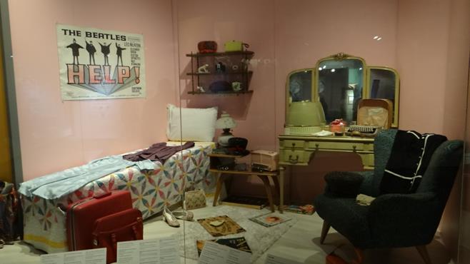
Another area shows teenage bedrooms from 1950 to 2010.
Other floors had a Native American exhibition and a Cowboy exhibition.
Various cattle brands.A full Indian headdress.
The next post will be the journey down to New Orleans to pick up our friends from England, Kathy and Anne.
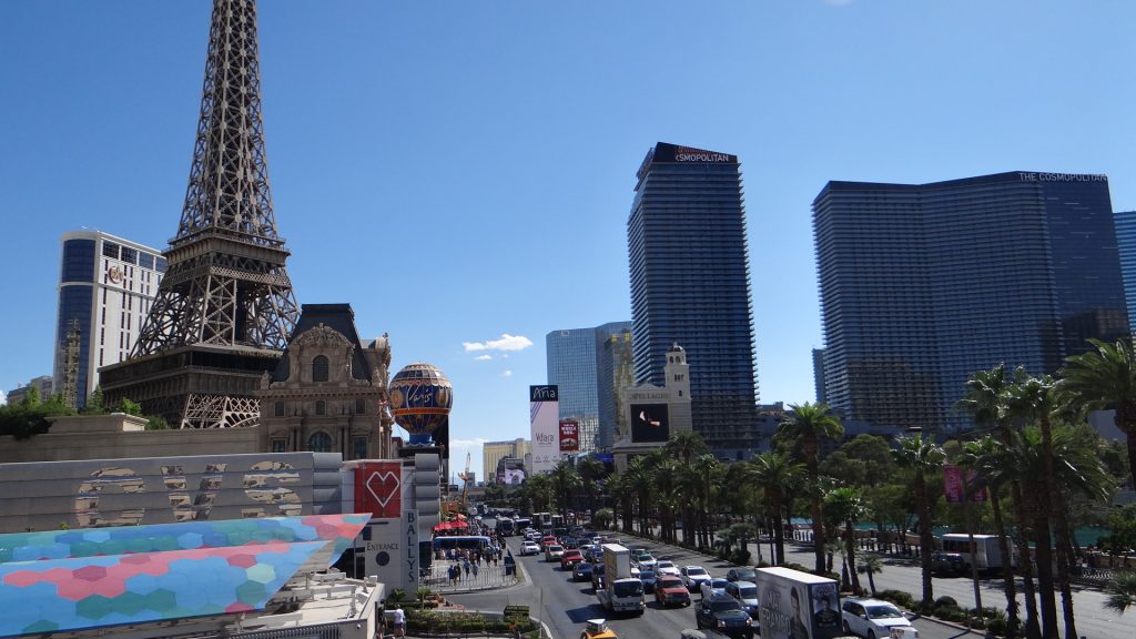
We arrived in Las Vegas not really knowing what to expect. Neither of us gamble, slot machines don’t interest us, so I guess you could say we weren’t sure why we were there apart from everyone saying we must visit it.
It also didn’t help that we arrived in temperatures that were touching 100F (38C+) and over. We decided to drive into “the Strip” and see what it was all about. After driving up and down the strip and witnessing the mayhem we decided to park and have a walk around.
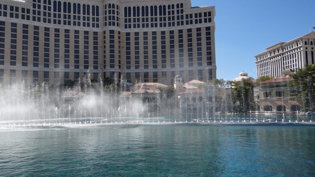
We came out from the parking lot roughly in the middle of the Strip near the Paris casino and then walked down to the Venice casino (with its canals and gondolas) and then walked back up the other side to see Caesar’s Palace and the fountains outside the Bellagio casino.
Paris with a Montgolfier balloon.An Arc de Triomphe. You can see how hot it is.And an Eiffel Tower and Élysée PalaceLooking down the Strip back towards Paris.He has a tower here too!!Bellagio fountains.Caesar’s PalaceThe mural on the ceiling in the Venice Casino (apologies for the blur hadn’t realised I touched the lens).Venice canal and gondolas.
I also took a video of the Bellagio fountains performance of “Hey Big Spender”.
After that I must admit we had to give up as it was just too hot, even after using the air conditioning in the casinos to cool off. Some of the casinos and their accompanying themes were very interesting but overall impression was, its very brash, over the top, frenetic and not for us!!
Even though it was just as hot on the next day we decided to go and visit the Hoover Dam.
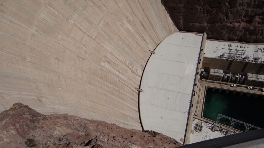
The dam was built between 1931 and 1936 and at its peak over 5,000 men worked there on a daily basis. Until the early 1950’s it was the tallest dam in the world at 726.4ft high but since then it has been relegated to 30th place although it is still the second largest in the USA. When it was built, so much concrete was poured in such a short time, they had to build a refrigeration system to cool the concrete to allow it to set. Lake Mead the reservoir created by the dam is still the largest in the USA.
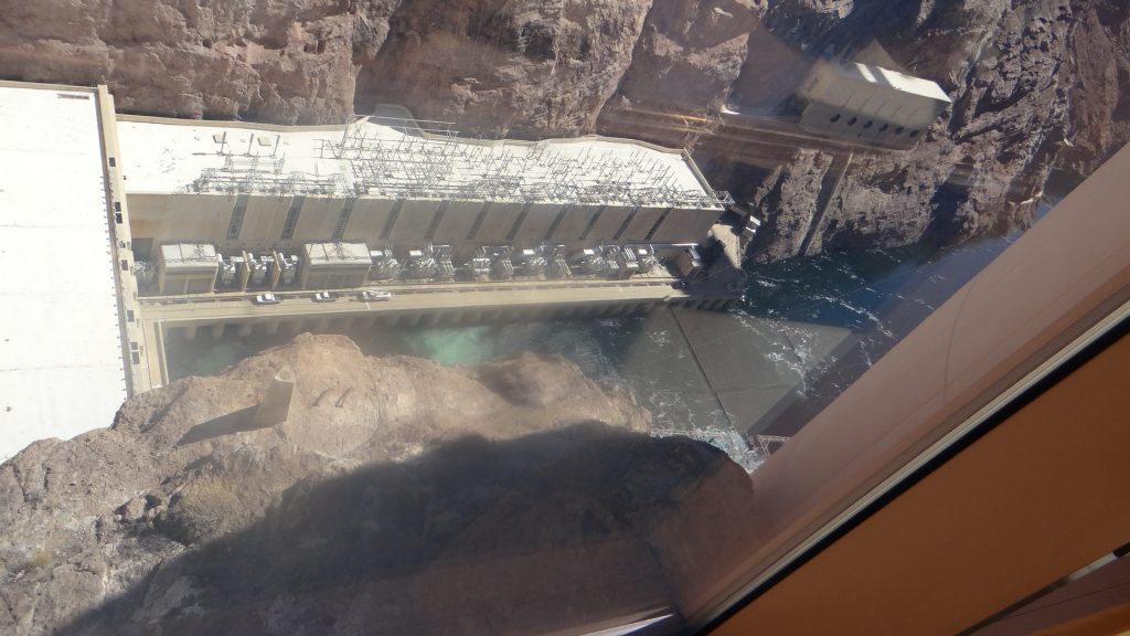
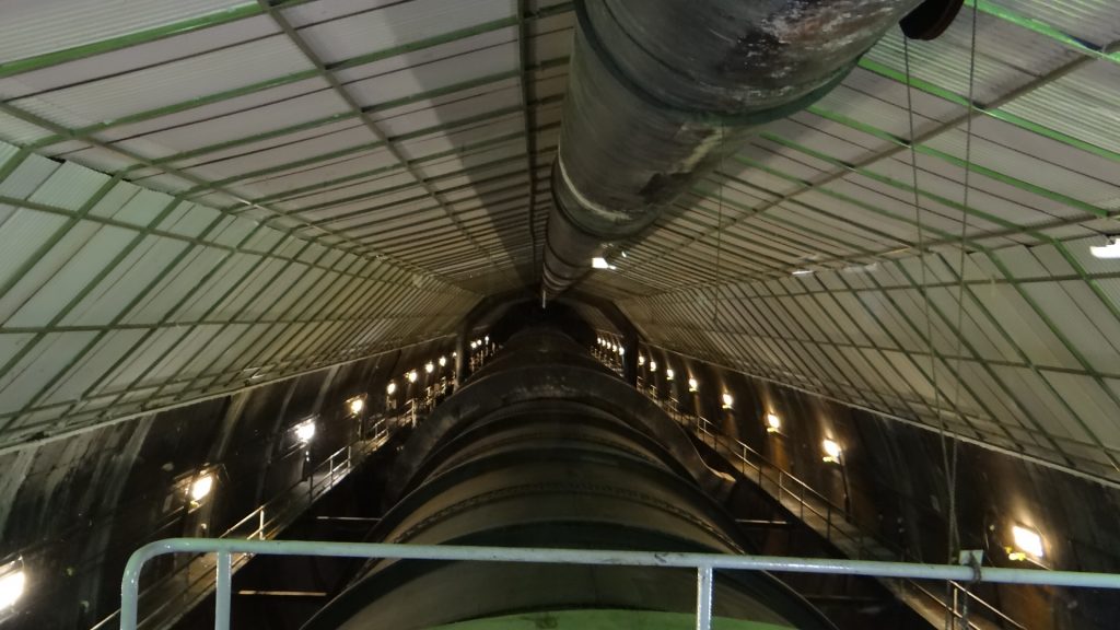
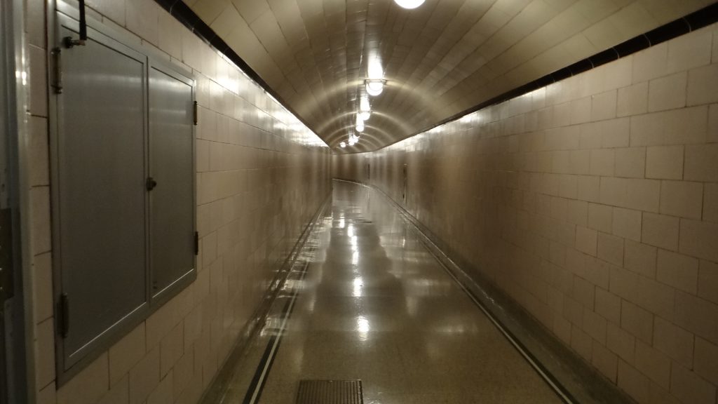
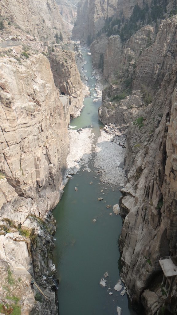
We took a tour of the dam that allowed us right into the middle of the dam in some of the tunnels that are still used for maintenance. If you ever decide to do this I hope you don’t suffer from claustrophobia as some of these are very narrow and deep inside the dam.
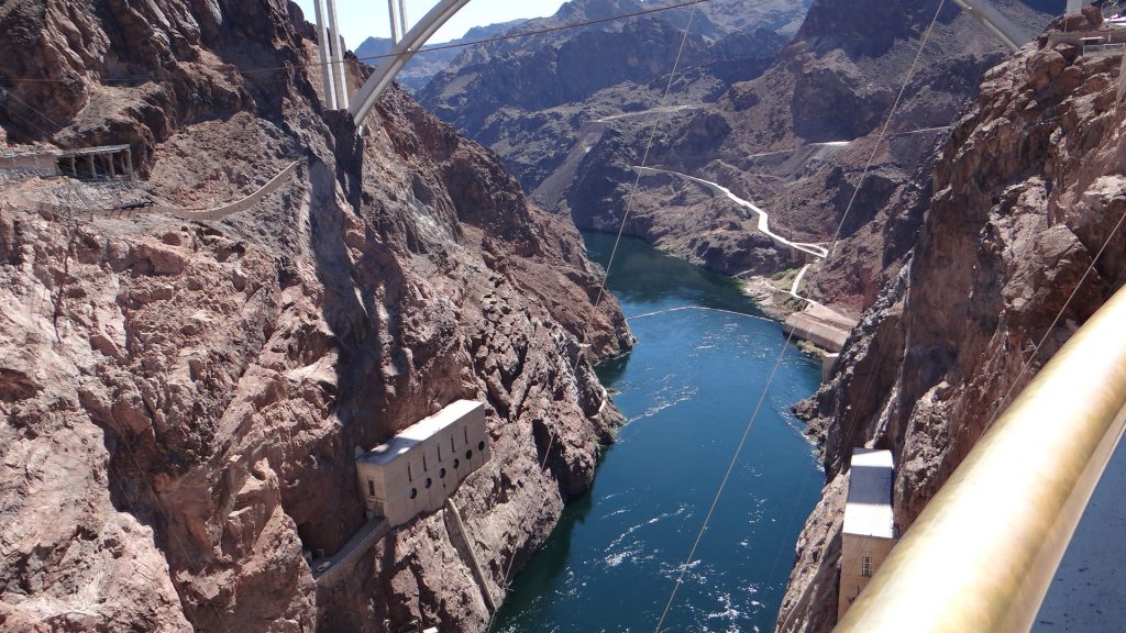
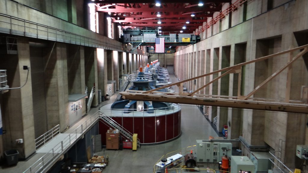
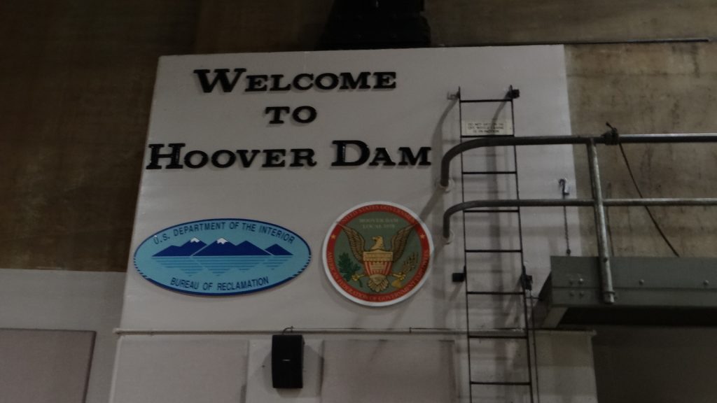
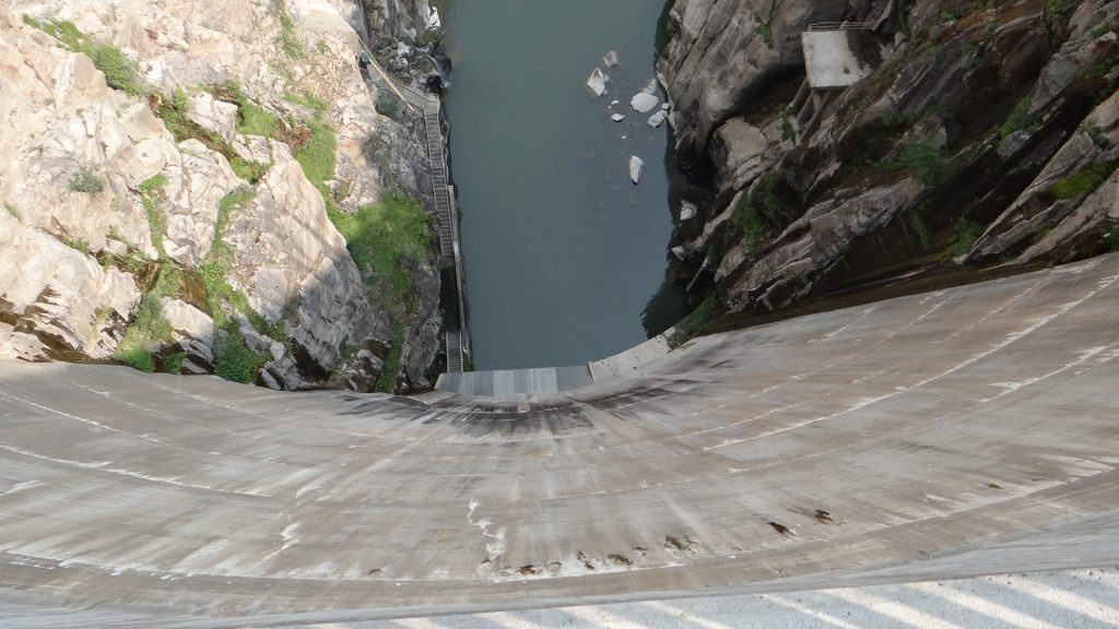
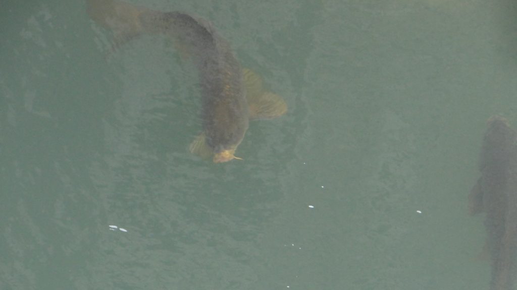
The original highway across the top of the dam (bottom of the picture) was replaced by the highway on this bridge which we crossed in the RV on the way to Williams and the Grand Canyon.Looking down onto the Colorado river existing the dam.The dam wall down to the generating houses over 700ft below.The Colorado river beyond the dam.One of the massive pipes that feeds water from the reservoir to the turbine halls.One of the turbine halls containing 8 turbines. The other contains 9 turbines.The Welcome message in the turbine hall.A tunnel deep in the dam.One of the maintenance tunnels leading up and down the dam. Look at all the stairs!!This picture was taken at about 300ft down the dam from a tunnel that leads from the previous tunnel to the dam face. Just enough room for two people to pass each other. Thank goodness for lifts, wouldn’t have fancied walking up all the stairs!!
View along the top of the dam. The lift was in the second tower along.The view of the bridge and river from the top of the dam.A statue commemorating “high-scalers”, men employed to remove loose rocks etc. from the canyon walls so they didn’t fall on the workforce below. They worked by abseiling from the top of the canyon over 1,000ft above the canyon floor. Some of them became very famous by entertaining the public who came to watch the dam being built.
As I said earlier our next stop was to be Williams, to visit the Grand Canyon and Route 66. All of this and more in my next post.
On our way down to Las Vegas we stopped off at a WillowWind RV Park that allowed us to visit both Bryce Canyon and Zion National Parks.
Very nice campsite with a shady back-in for us.
Anne took this as we were setting up, no slides out yet!!
The following day we set off for Bryce Canyon which meant a drive through Zion national Park to reach it, so I will not steal Zion’s thunder!! But I will say it involved quite a steep climb and a tunnel.
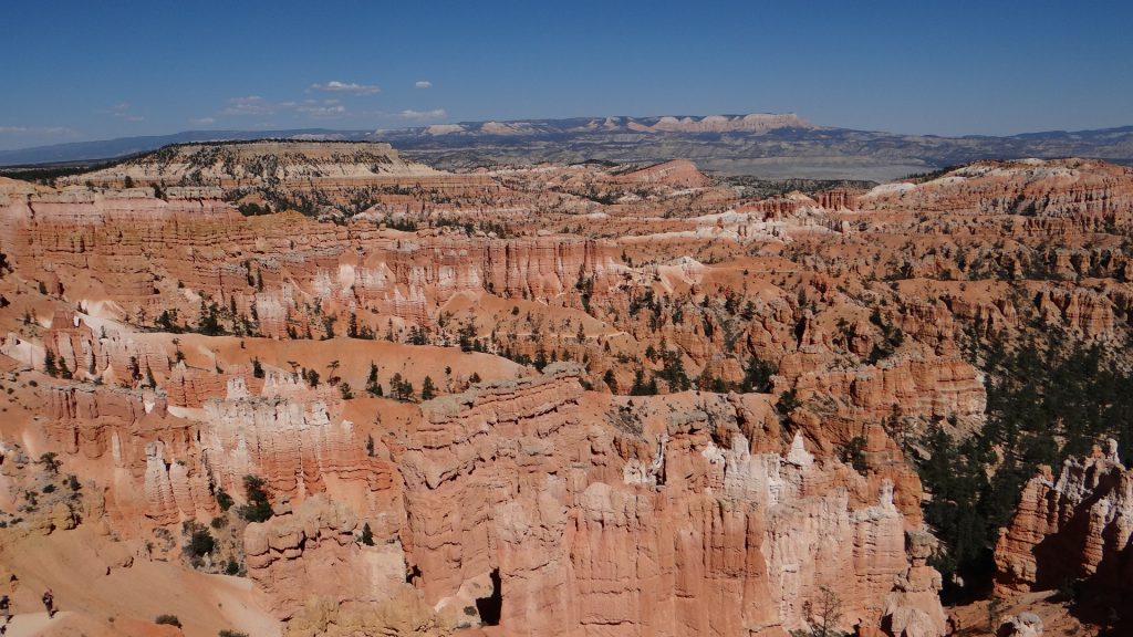
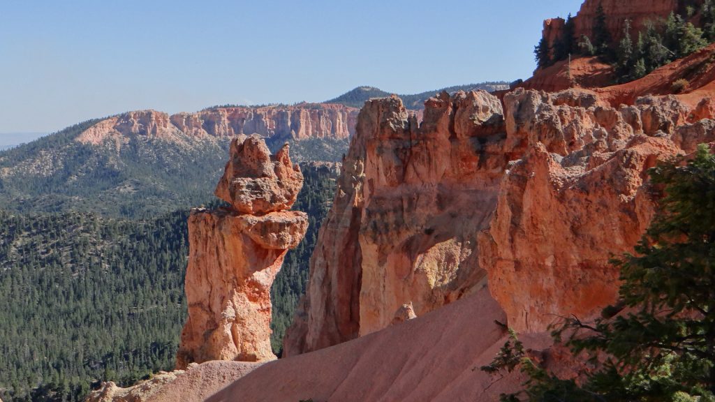
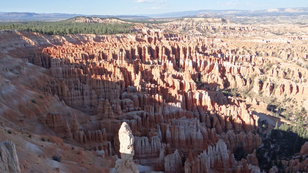
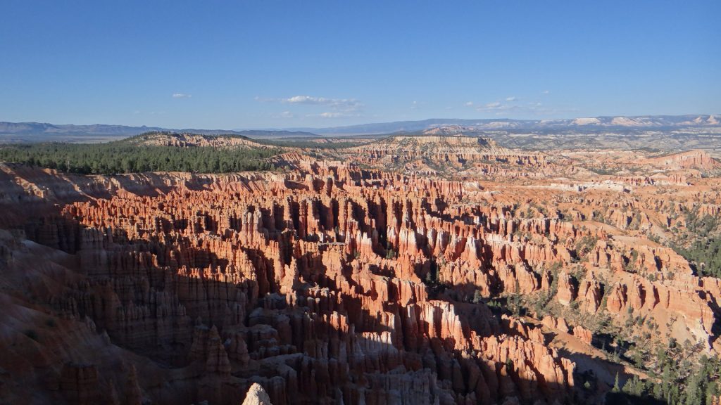
We reached Bryce Canyon about midday and boy oh boy is this place spectacular. It involves an 18 mile drive up the canyon and every stop seems to get better and better. For those of you who have never been there, Bryce is famous for its “hoodoos”. These are tall skinny spires of rock that protrude from the bottom of arid basins and “broken” lands with multiple levels of strata in them, all of different colours. The ones in Bryce Canyon are hundreds of feet high!! So with that explanation here they are.
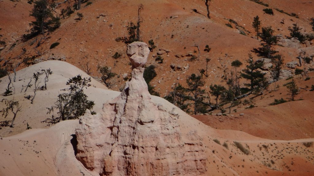
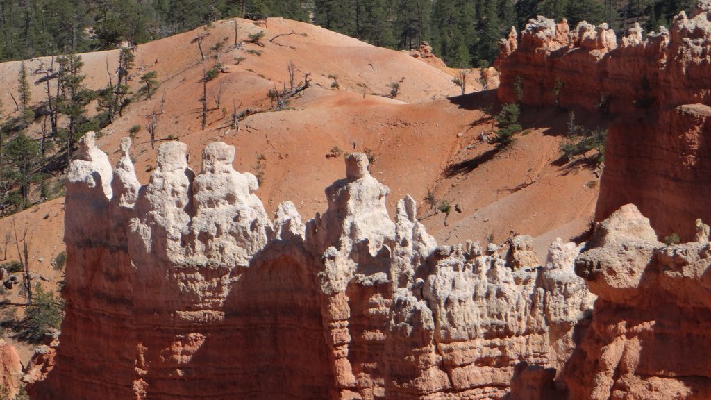
Our first site of hoodoos, spectacular but it gets better.It was quite hot!!A complete vista of hoodoos.The thing about them is, it seems as though a sculptor has carved them, when it is really just wind and rain.Thor’s hammer for obvious reasons.This angle shows it better.More carvings, look at the colours.Another set of figures!!And a close up. The one on the right is almost a human statue!! And all done by nature.
We moved up the route and discovered this.
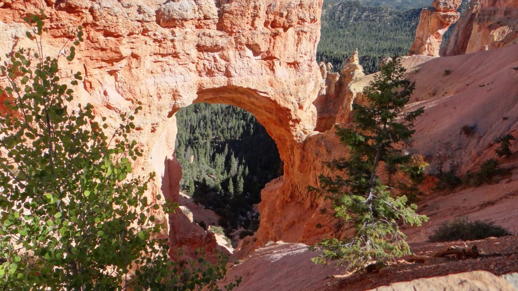
A natural arch carved by wind and rain.Amazing sight!And more hoodoos.They get better.Just to prove that we were both there although we got photo bombed.
We got to the end of the canyon route where there was a controlled burn going on, so there were lots of fire fighters.
Looking back along the entire canyon. At this point we were over 9,000ft above sea level!!
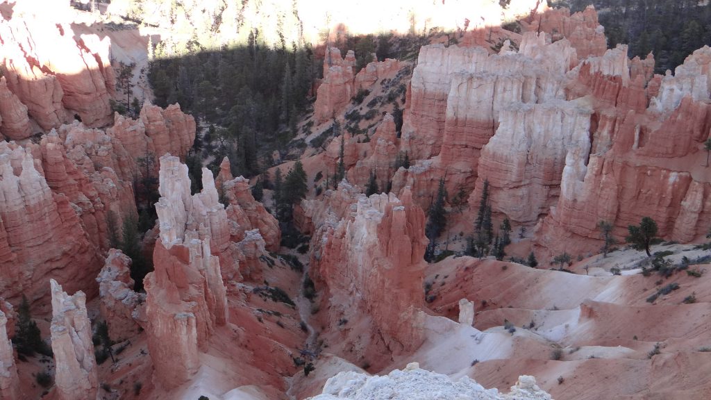
We then tracked our way back filling in the bits we missed and I climbed Inspiration Point, which made me puff a bit, climbing 500ft at 9,000ft does that, but the view was worth it.
Just when you think you are hoodoo’d out this appears. A massive field stretching into the distance.It’s getting late look at the shadows.And more!!Impressive colours.
There is one other place I ought to mention, Red Canyon. This is on the road up to Bryce Canyon and it has some pretty impressive red rocks in its own right. But in the evening sunset they are something else!!
Red Canyon on the way up to Bryce.Impressive rocks.Shows how high they are when someone stands in front of them.And the road goes through part of the rock.On the way back from Bryce the Red Canyon in the sunset. Wow!!As red as you can get!!
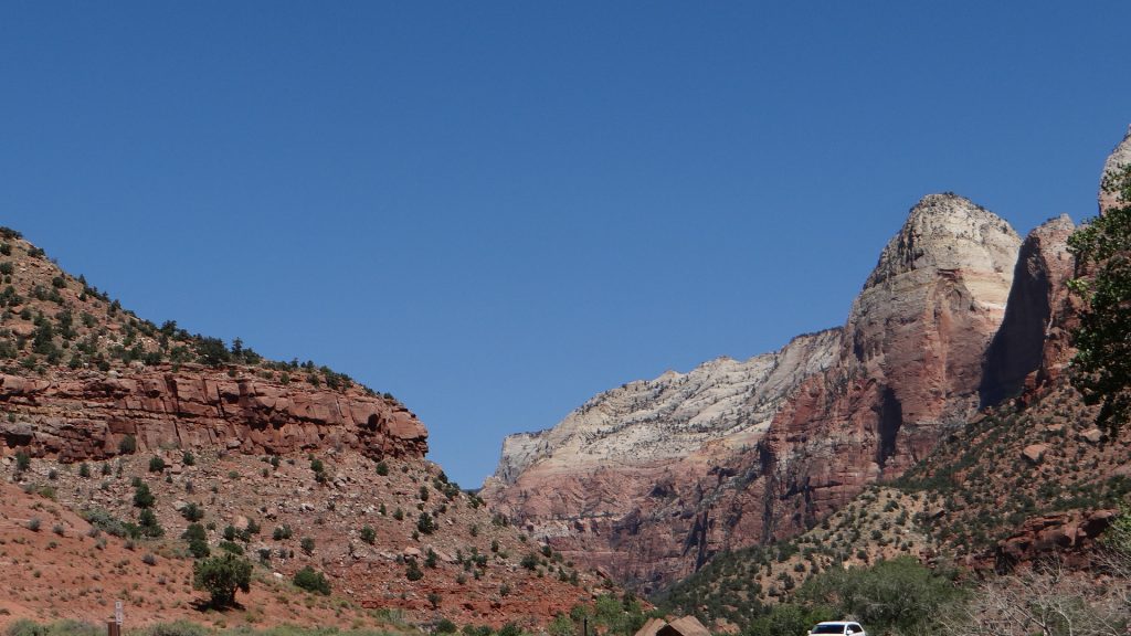
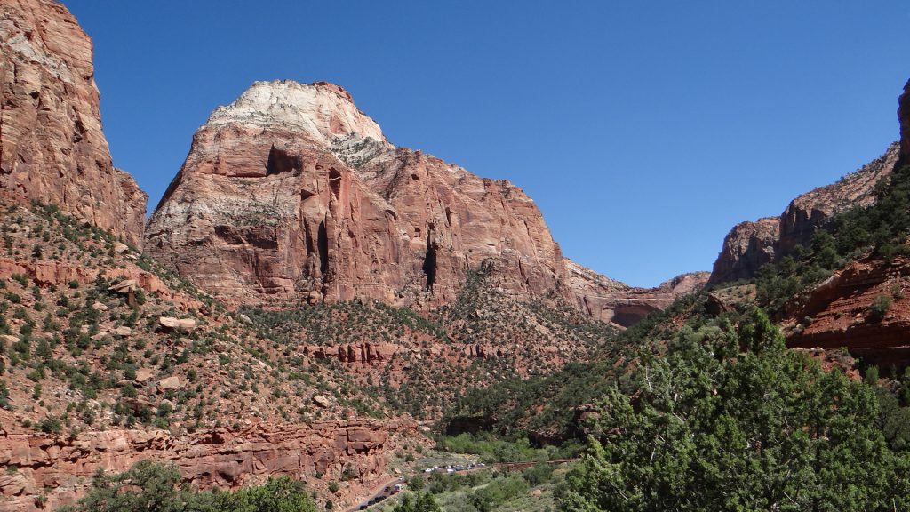
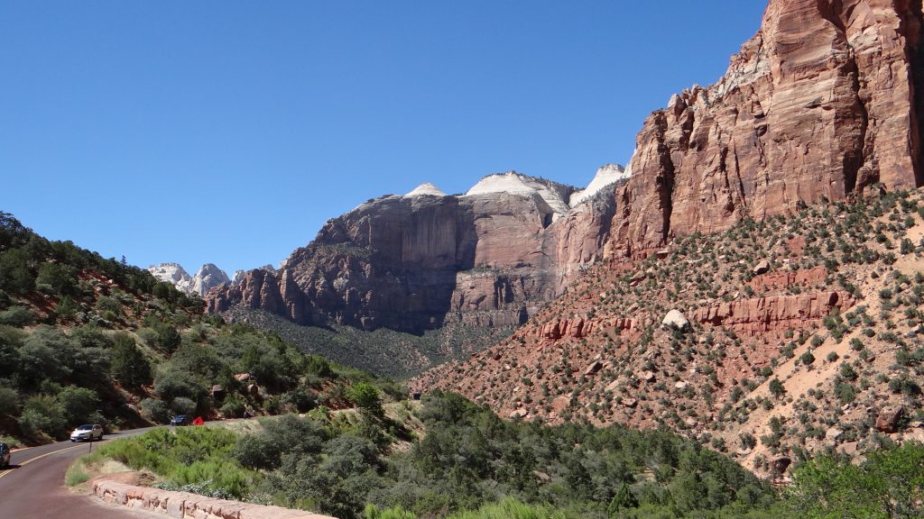
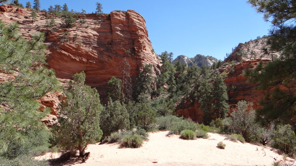
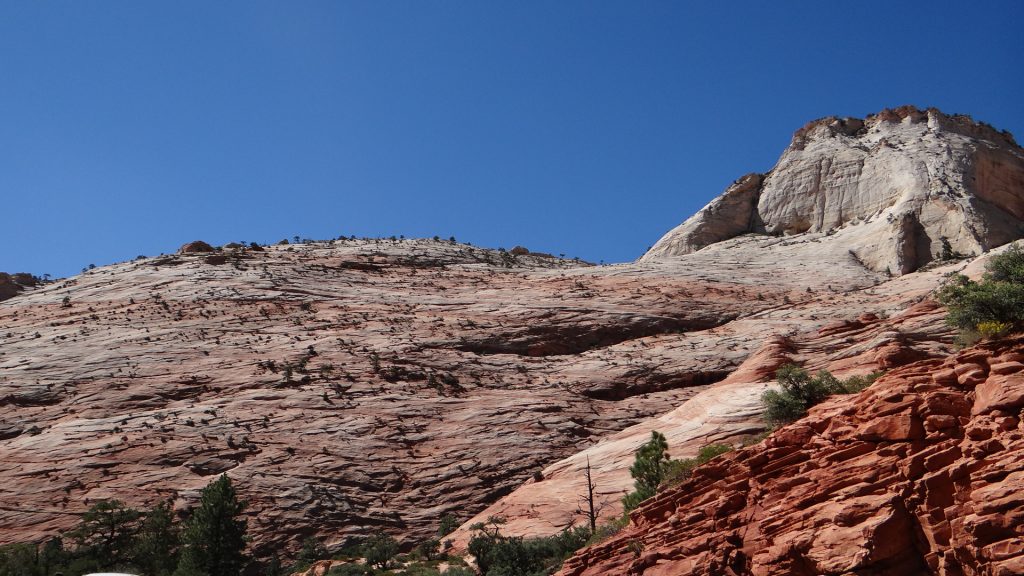
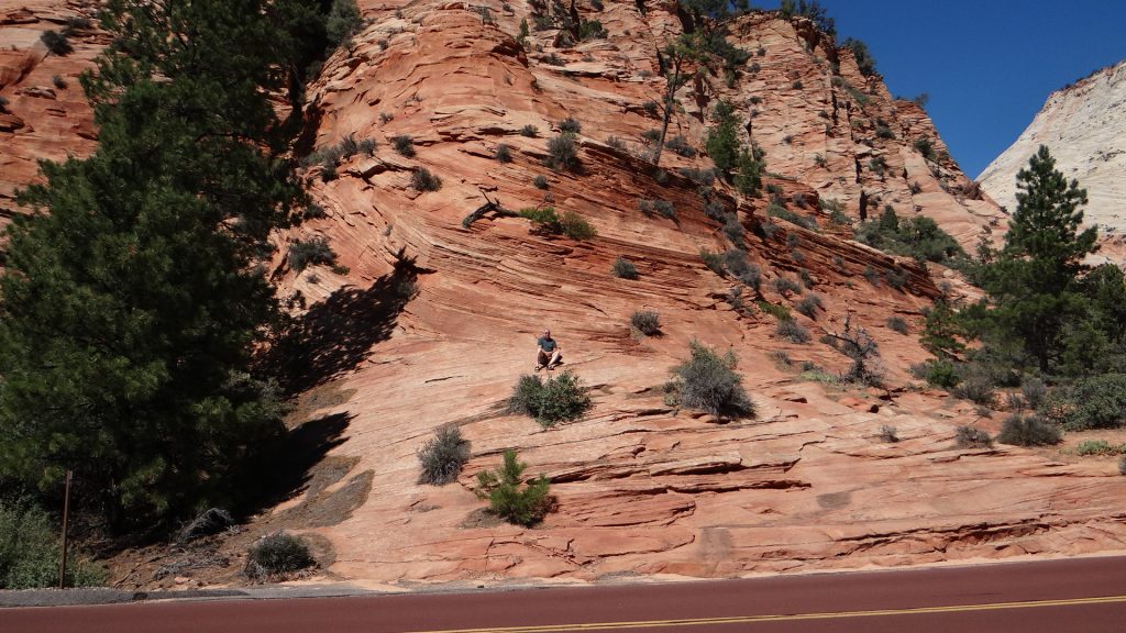
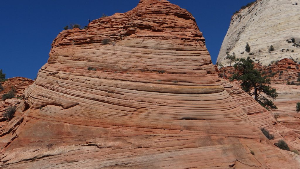
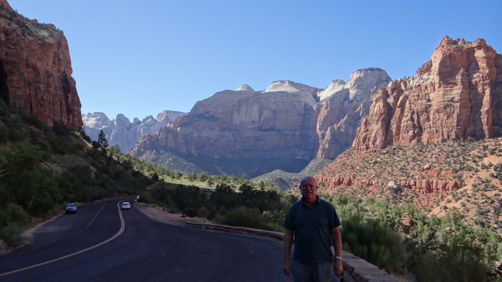
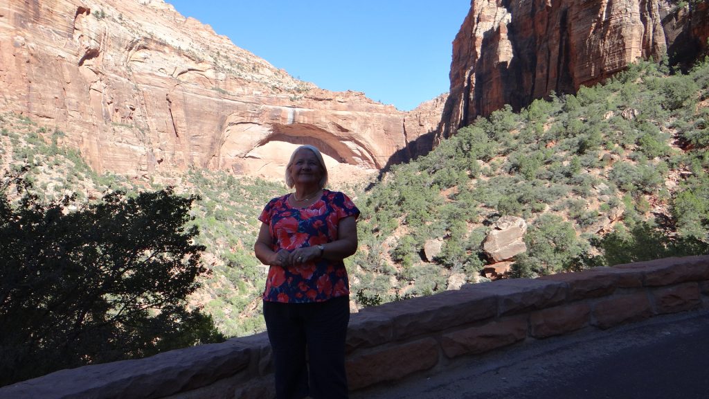
The next day saw us visit Zion National Park which we had previously just driven through. A different type of park, but equally as spectacular with its massive rock faces, the 1.1 mile tunnel to the top, and at the top so many types of rock formations.
As you enter the park you see these massive rock faces.And they get bigger and multi coloured.That is not snow. It is as tall as El Capitan in Yosemite.Huge curves in the rock. To the right of this is the tunnel.Looking back down the valley.And they get higher as we climb towards the tunnel.Queuing to go through the tunnel.After the tunnel it flattens out and there are lots of sandy valleys and rock canyons carved by water.And layers of rock and colour.From red to white.Impressed they made the road red to match the rock.Look carefully, that is me sat just below a huge curve of rock.How’s that for strata!!.And this is called Chequerboard rock. Vertical stripes down the strata caused by water freezing and cracking the rockA huge red fault line.On the way back down this is a window into the tunnel. It goes to the left up through the rock and is 1.1 miles long.A view down the valley with me in the way!!Anne framed by the curve in the rock.
After this we moved on to Las Vegas, one of the subjects of my next post, but I will always remember the hoodoos!!
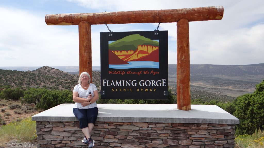
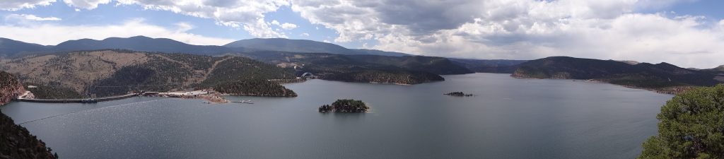
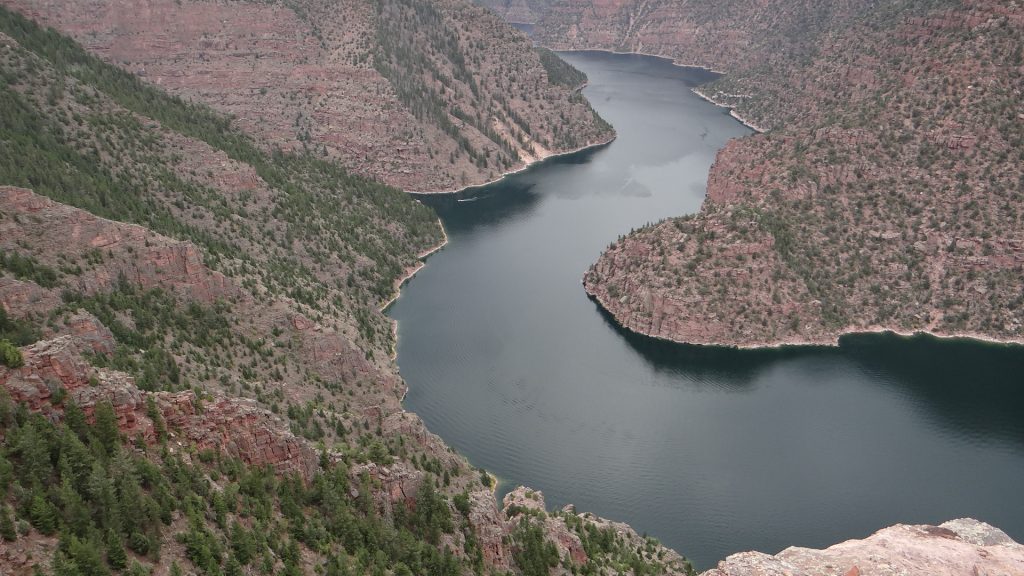
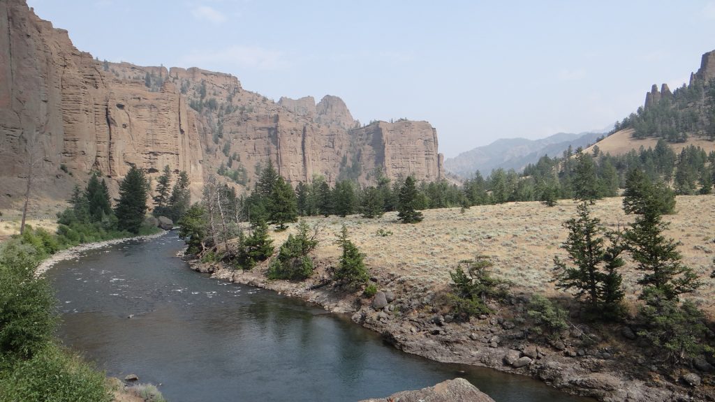
As I said in my last post we moved on to a site near Green River Wyoming as a base to see the Flaming Gorge.
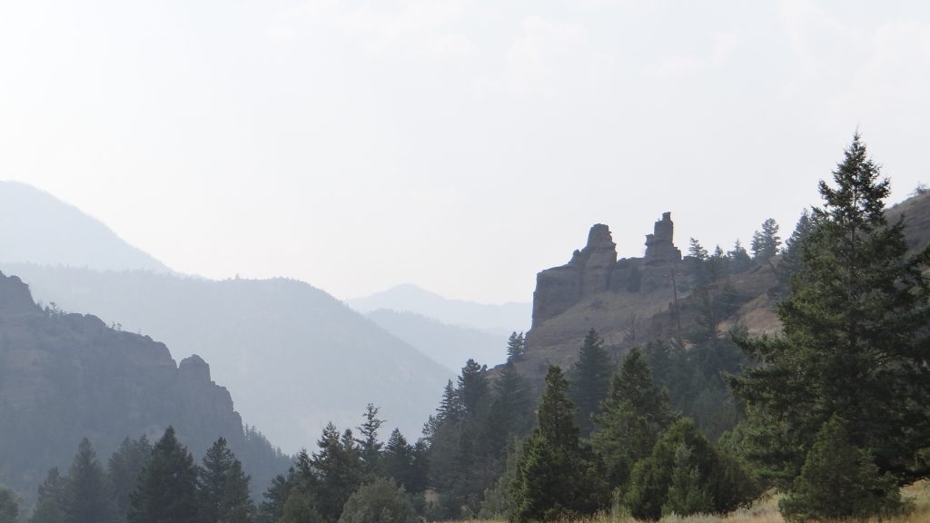
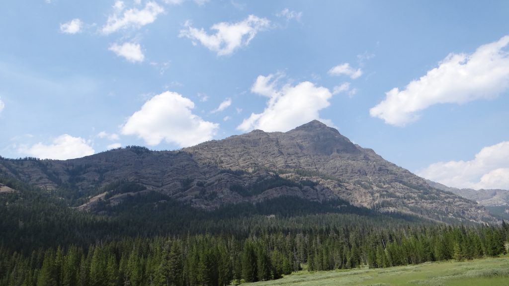
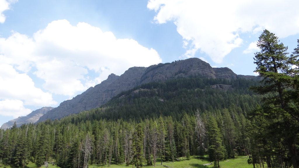
Our route took us along the Chief Joseph Scenic Byway all the way up to a spectacular view of the valley we had driven through.
Some of Wyoming’s wildlife!!The view.
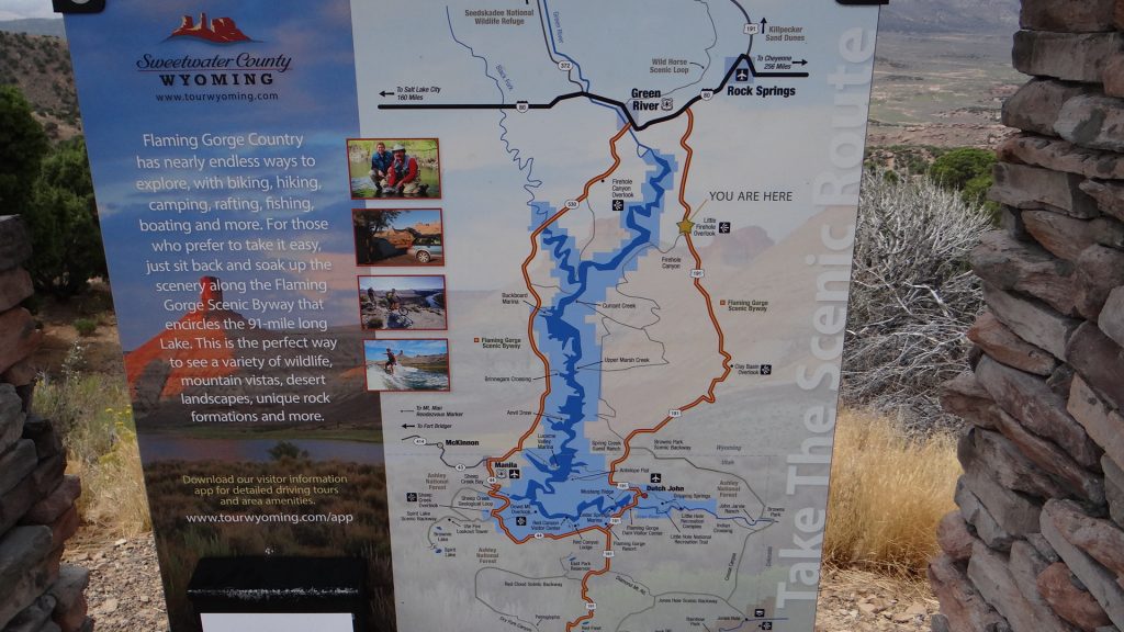
After arriving at Green River we set off the following day on a circular route that took in the Flaming Gorge Dam, Flaming Gorge and the Sheep Creek Geological area.
Map of route. We went down the right side and up the left side back to Green River.I guess we are on the right route!!
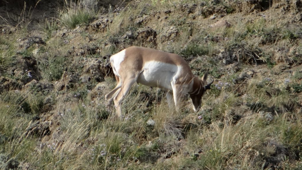
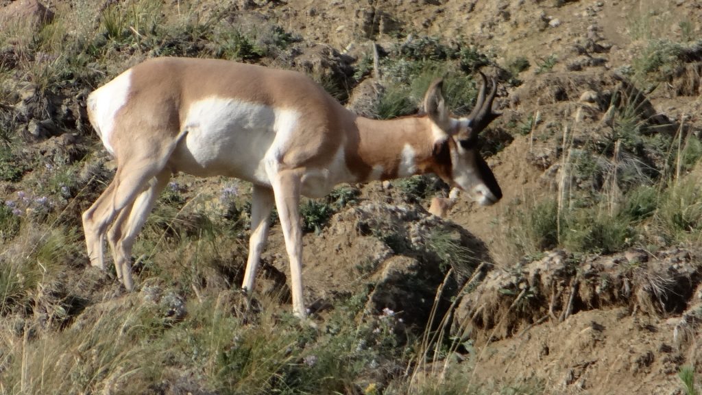
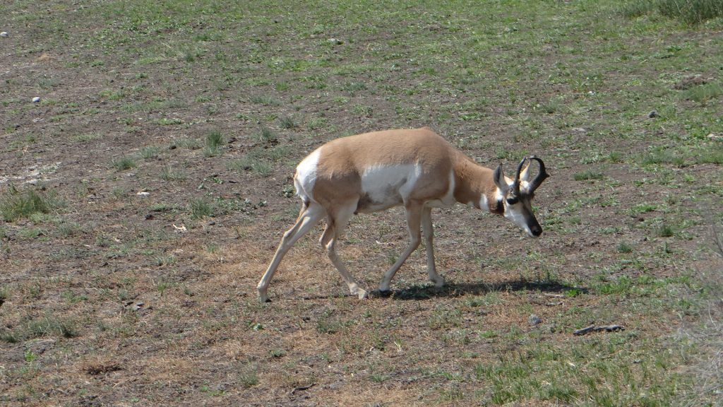
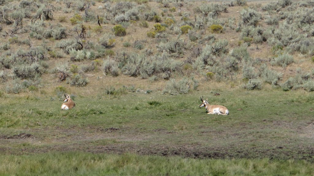
After about an hour we reached the dam but on the way we saw quite a few herds of Pronghorn Antelope.
And they saw us!!
And many bluffs displaying great strata lines of rock.
You can see how the rock was laid down, but this was nothing compared to what was to come.
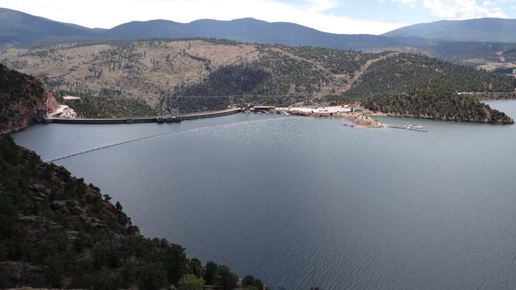
Just before the dam there was a “scenic overlook” that gave a great view across the dam and the lake.
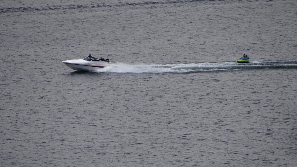
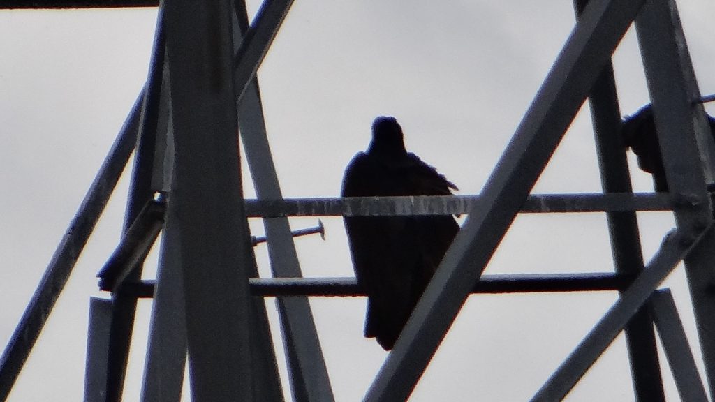
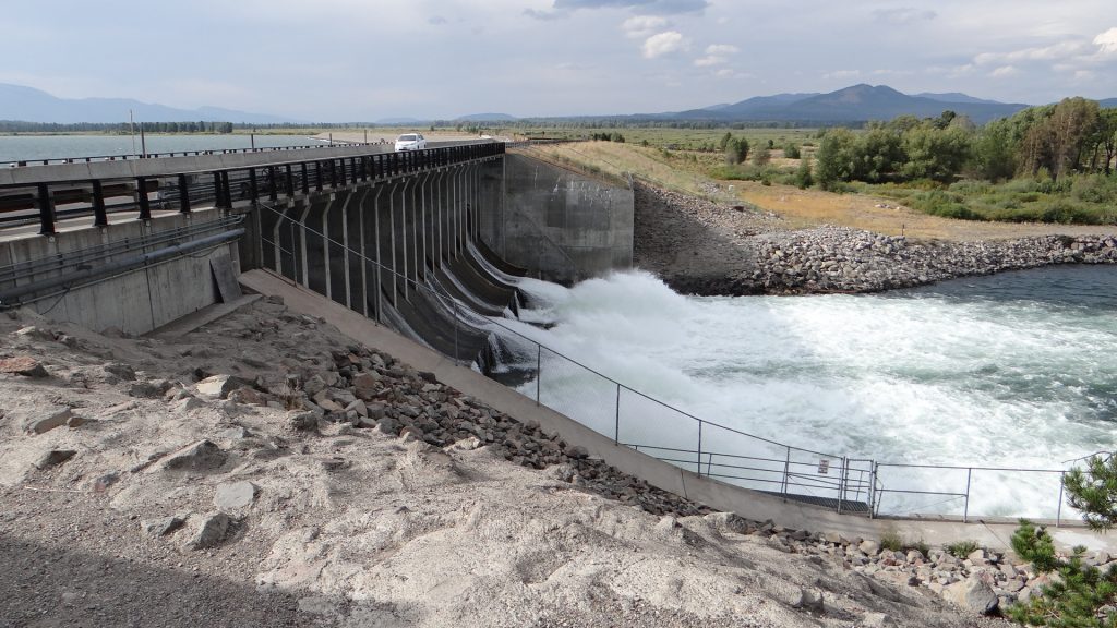
Flaming Gorge DamPanoramic view.A bridge we crossed after the dam.The lake had a lot of recreational boats on it.The dam would have been interesting but you could only visit it on a tour and they were over for the day.Eagle (one of many) on the pylons of the dam.
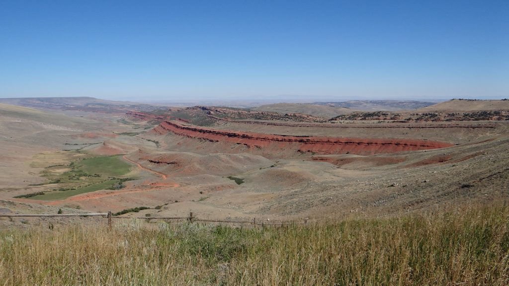
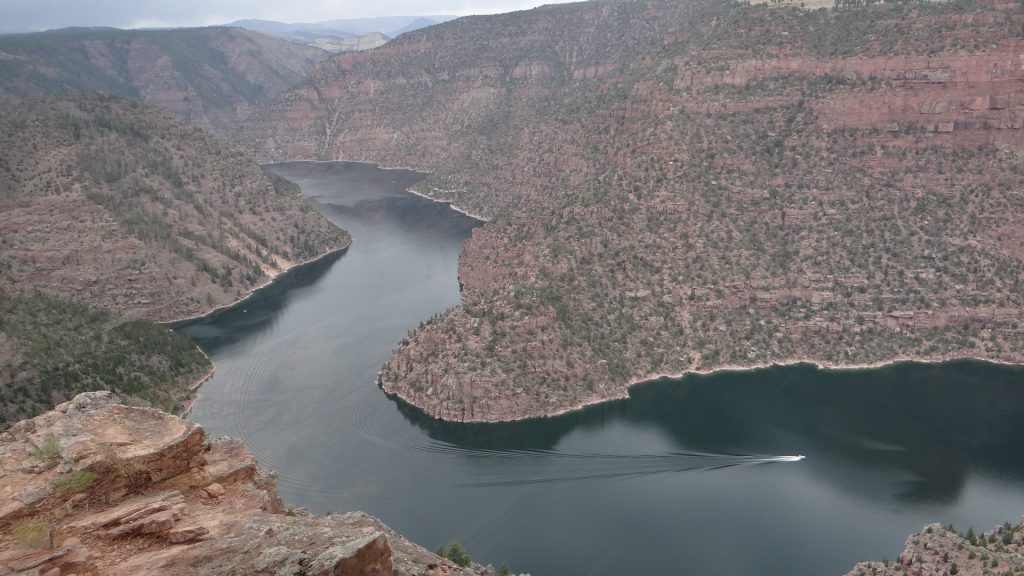
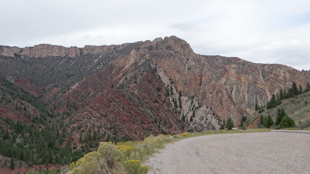
So we moved on to the Red Canyon visitor centre to see the Flaming Gorge.
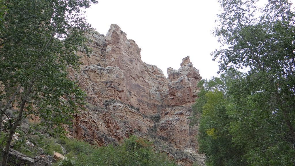
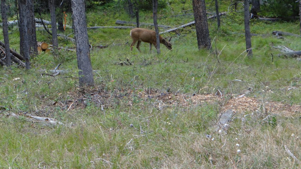
On the way there we saw this mule deer.And then we were there. To be honest it looked redder than my photos but the sun had gone in.It’s a long way down.And you could walk right up to the edge if you have a head for heights.Closest I got to the edge!!Lots of fissures in the rock you had to jump across.Another edge photo, I got on my knees and crawled forward to look over as I didn’t fancy getting blown over!!More Mule deer.
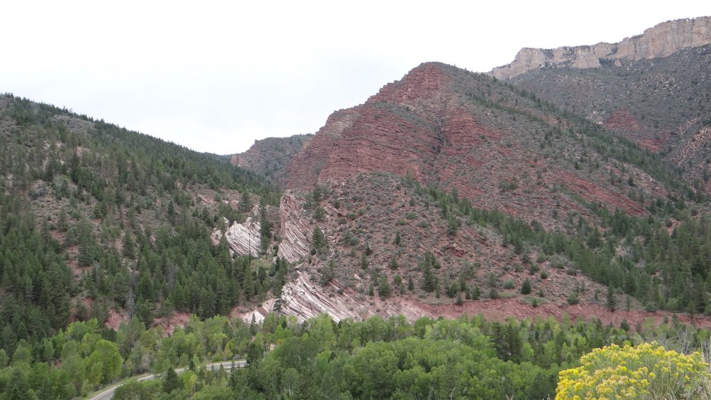
We then went round the Sheep Creek geological area where there were many examples of how the rocks were formed.
Different types of rock provide the colours and the strata.Towering cliffs.If you look carefully above the pale line of rock in the centre you can see how the rock has been folded into a loop. Just shows the forces that managed to bend an entire rock layer.More red rock.The rusty colour is caused by water leaching iron out of the rock.This part was like the Cheddar Gorge but much higher and towering above us as we drove down the narrow canyon.This was Tower RockOn the drive back to Green River you could see lots of eroded bluffs with multiple coloured rocks in them.
We then moved on to Salt Lake City Utah.
Rest area with more red rocks!!The Interstate followed one of the old wagon routes through the mountains.
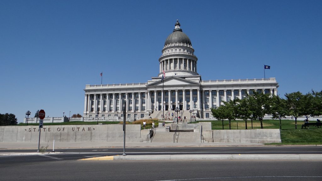
We arrived in Salt Lake City on Saturday and set off to explore on Sunday not expecting much to be open, and found that the Visitor centre and State Capitol building were open.
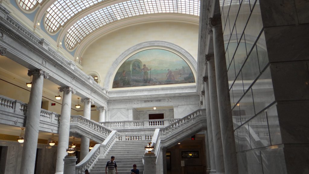
The visitor centre was the old Capitol building.And then they came into some money via an inheritance tax they introduced so they built this!!They were running a Gromit type competition but using Buffalos.The amazing interior. So much marble!!Statue of Brigham Young the Mormon founder of Salt Lake City. Notice the index finger which has been worn down by people touching it.
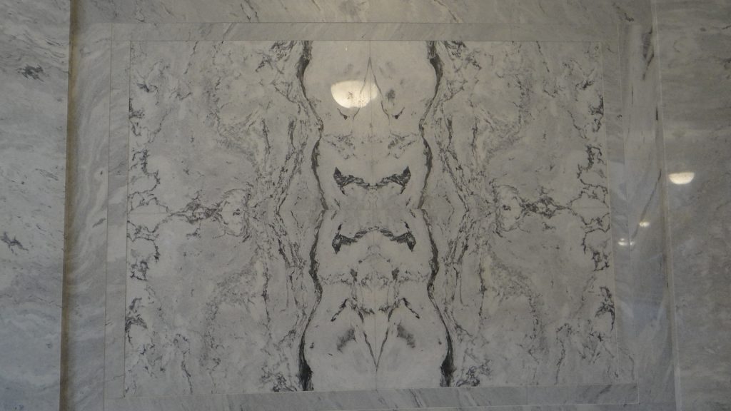
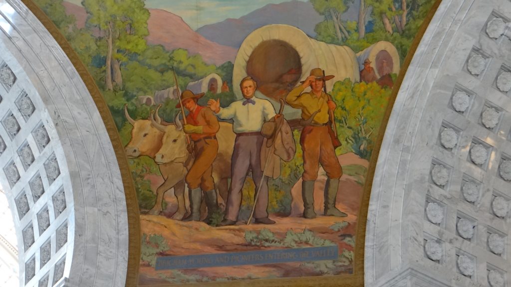
One of the many marble panels with amazing patterns in them.A view from one wing to the other with the cupola in the middle.View up into the cupola.One of the painted murals around the cupola. This shows Brigham Young looking out over the valley and declaring this is where the Mormon city would be founded.The State seal.The state bird was everywhere.View from the Capitol buildings front steps across the rest of the city. The Mormon buildings are to the right hidden amongst the trees.A memorial to the Mormon Battalion which made a gruelling march of nearly 2,000 miles from Council Bluffs, Iowa, to San Diego, California to fight in the Mexican War.
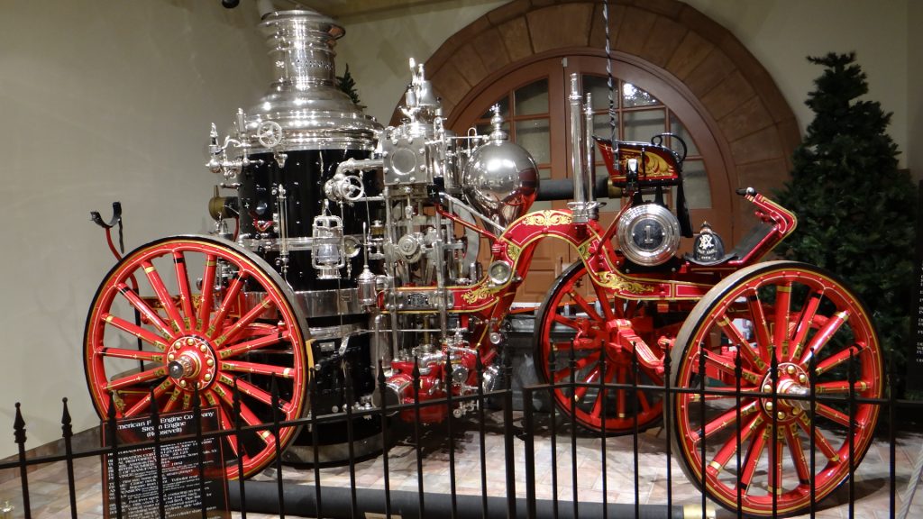
The next day we took the Trolley Bus tour and visited the Pioneer Memorial Museum, which did not allow pictures to be taken, but I managed to persuade them to allow me to take a photo of an amazingly restored Steam Pump Fire Engine.
The Mormon Temple.The Catholic Cathedral (with a bus in the way!!).Amazing tiled mural.University of Utah gardens.According to the driver we should have been able to see the Salt Lake from here but that California fire smoke got in the way again.Tram painting.Memorial statues of Brigham Young and the Mormon Battalion.A junction of opposites!!Think this was another Mormon Church.Eagle Gate which once marked the entrance to Brigham Young’s farmland.Pioneer Memorial Museum.The beautifully restored Steam Fire Pump.
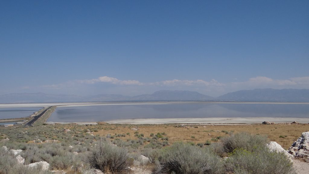
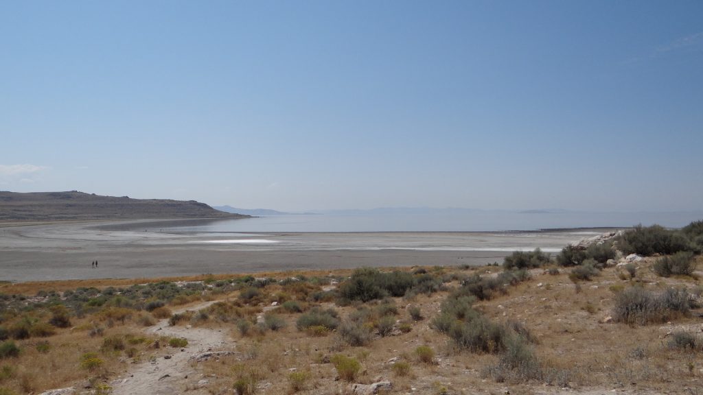
The next day we decided to go and visit Antelope Island State Park, which is an island in the Salt Lake accessed by a causeway.
A view of the 7 mile causeway that links the park to the mainland.
The island is surrounded by the Salt Lake which gets a bit stinky in places but was a fascinating place to visit.
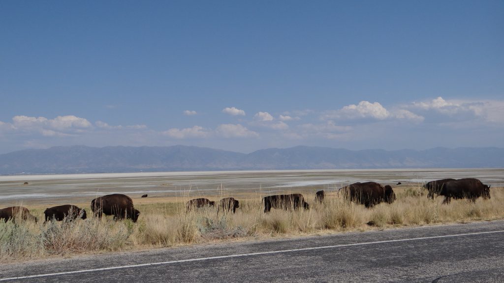
It is also home to one of the largest Buffalo herds in the USA.
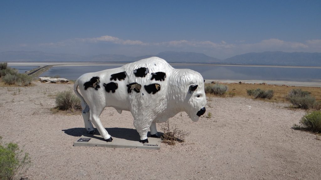
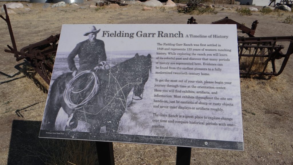
A view across the Lake from Lady finger Point. Looks like a beach and the sea, but apparently swimming in the lake is not a pleasant experience. We didn’t try it!!Another Bison in the competition at the Visitor Centre.The real thing.And a larger herd crossing the road.A herd of Pronghorn Antelope after whom the island is named.This part of the herd was heading across a dried out bit of the lake to a grassy island.The Fielding Garr Ranch was the last working ranch on the island before it was taken over by the State and turned in to a Park.A Humming bird on a feeder at the ranch.A golden eagle.A panoramic view from a high point on the island.Salt Lake city in the distance.
On the Thursday Anne and I spent the whole day in the Mormon Family History Museum looking up our family trees and filling in the holes. It is an amazing place that allows you to set up a free account to investigate your family trees and while you are there you get access to records that would normally cost you money to access. You also get access to some Mormon helpers who lead you through how to access certain sites and how to use the search facilities. A fascinating day, which finished all too soon, but we had planned to go and see the Mormon Tabernacle choir which held its practice on a Thursday and you could watch for free. It was a fascinating 2 hours and the choir and orchestra were very good.
A memorial to Brigham Young and the Pioneers.The Temple of the Church of Latter Day Saints.The inscription on the main front of the Temple.Gardens surrounding the Temple.The Tabernacle Choir and Orchestra. The choir is named after the building they sing in.The massive Tabernacle organ.The Temple lit up at night.
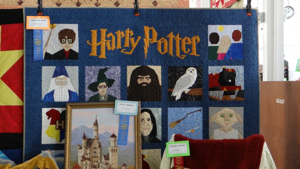
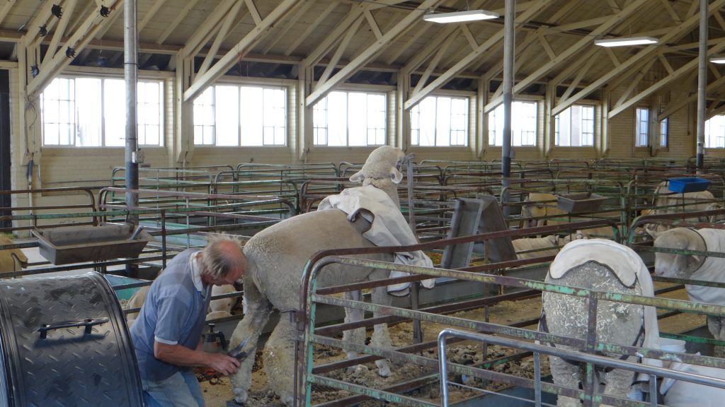
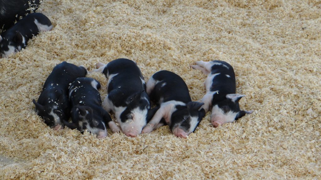
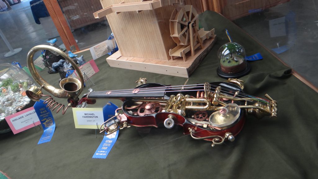
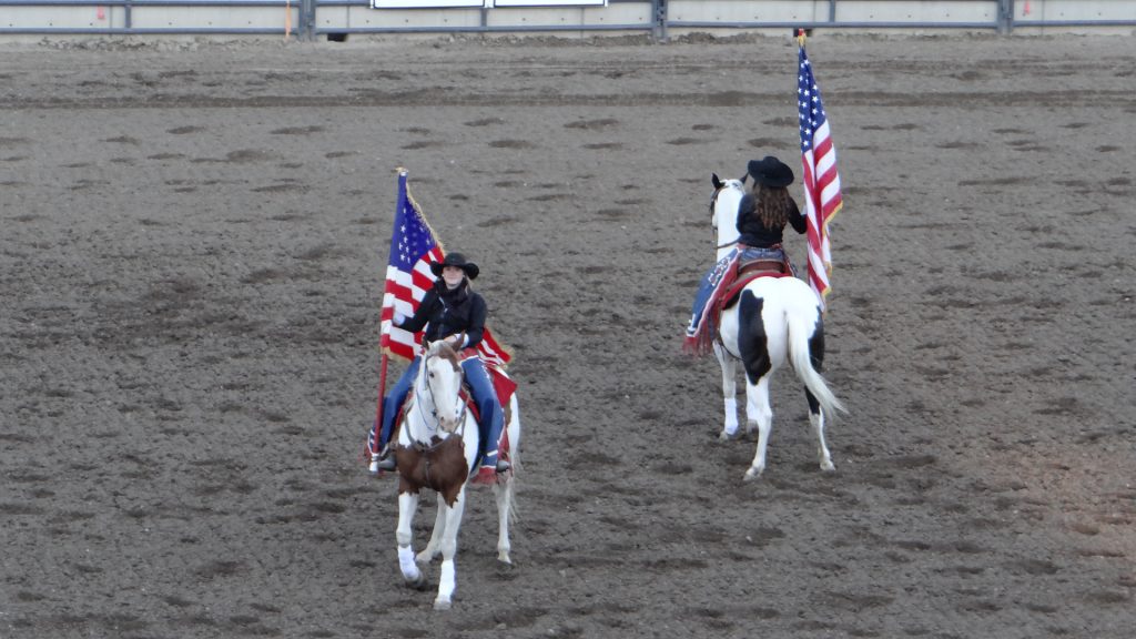
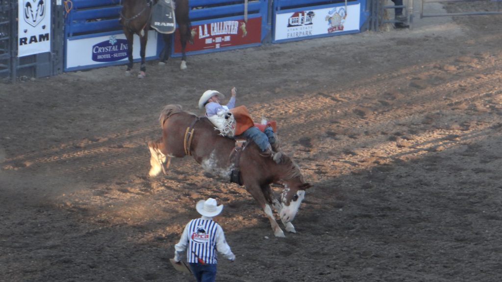
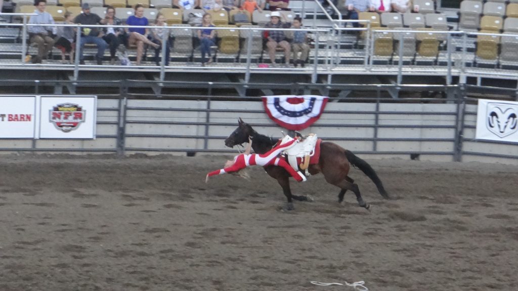
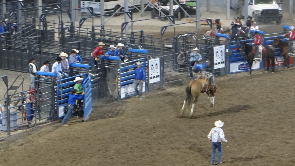
On the Friday we went to the Utah State Fair and in the evening the Rodeo. We finally got to see a complete Rodeo from start to finish including the bull riding. How they stayed on the bulls I do not know, but getting off looked even more dangerous.
A quilt in the Handicrafts arena.A show sheep getting a trim.Huge cattle arena.Pigs all over the place including sleeping piglets!!Goats were also there.A beautiful metalwork eagle with a gold beak and talons.An amazing violin.One of the many art exhibits.The opening of the Rodeo included cattle herding cowboy style.Part of the main parade.Bucking bronco time.And getting them off after they had achieved the 8 second ride.The rodeo clown is also part of the entertainment.Trick riding and roping.More trick riding.Sun setting on the mountains behind Salt Lake CityMore bronco riding.Best bull riding photo I could get. The bulls are really quick and difficult to photograph. The riders must be nuts!!The Fairground all lit up as we left.You can have FRIED anything!! And I thought fried Mars Bars were bad enough!!
On our last day we spent the afternoon back in the Mormon Family History Museum completing some of the searches we were unable to finish the first time we were there.
The next day we set off for Las Vegas, but first stopping half way down to see Bryce Canyon and Zion National Parks, my next post.
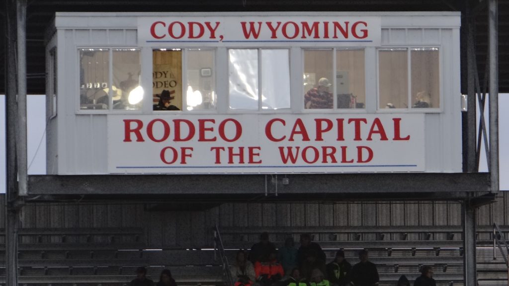
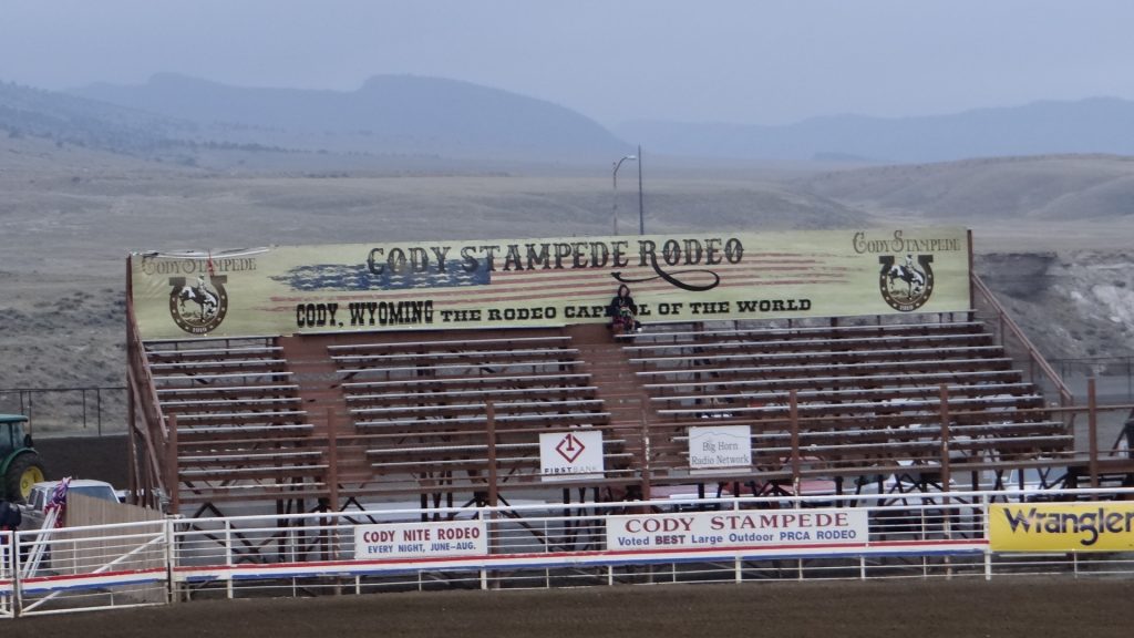
We went to Cody on the recommendation of Judy Goff (our friend in Bend, Oregon, who was born in Wyoming) and I have to say it did not disappoint.
I had managed to get a site reserved at the Ponderosa Campground right in the middle of Cody and we had a back in site that was a bit tight but provided views over the canyon behind us (just don’t go too far back!!).
Our site in the Ponderosa Campground, Cody.The view 6ft behind us, rather a large drop-off!!
Judy told us that, in her words “It will give you a fun and memorable bit of insight to this part of the American West! “, and it certainly did.
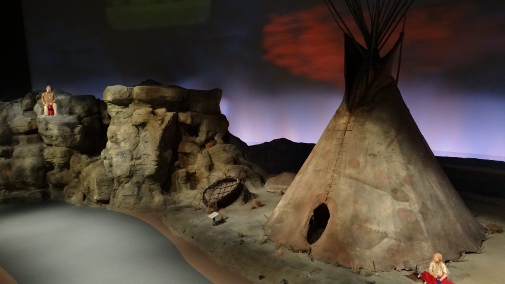
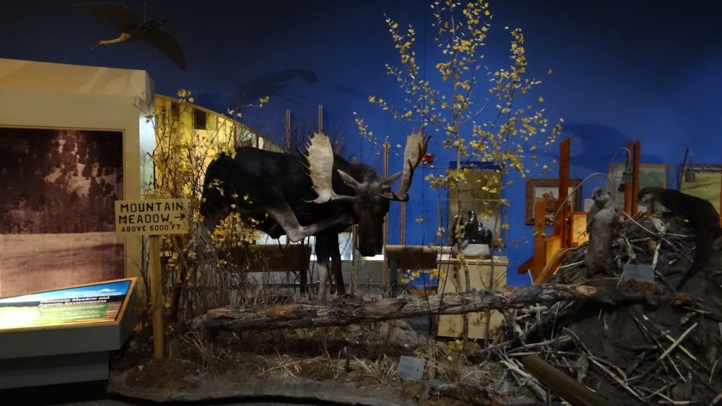
Centre piece of that experience was the Buffalo Bill Center of the West a massive museum that was actually 5 museums in one. A Firearms museum, a Western Arts museum, a Plains Indian Museum, The Buffalo Bill museum and a Natural History museum. Every one of them was an experience in their own right, but together they are incredible. If you ever go there make sure you have a day, as we did, because it will take you that long to go around it and do it justice.
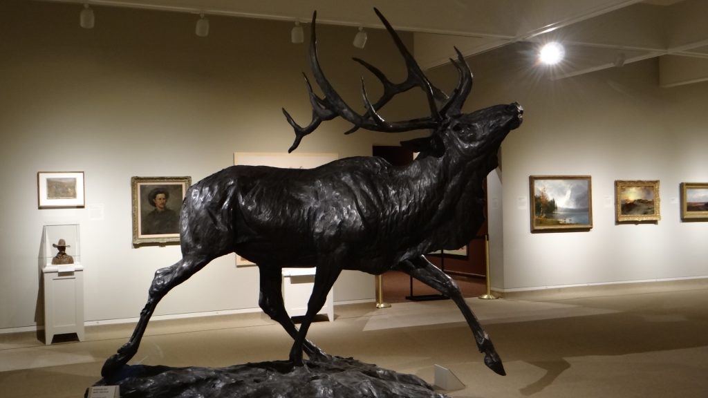
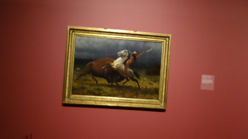
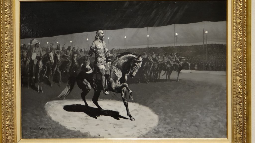
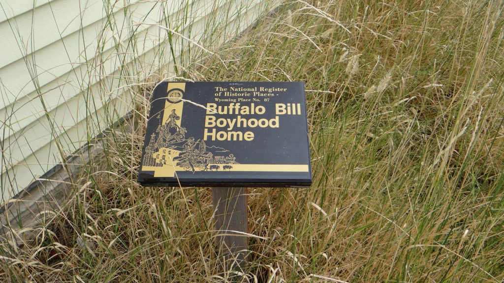
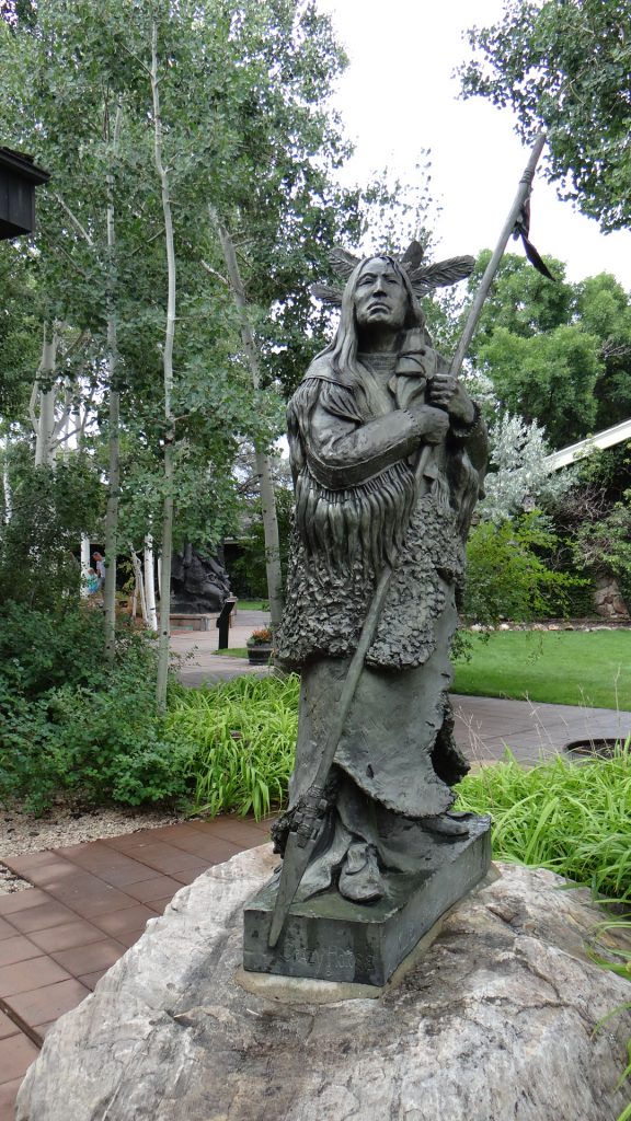
William F Cody (Buffalo Bill) and a friend!!Another statue to “Buffalo Bill”.A painting of Custer’s Last Stand in the Western Art museum.An immense bronze of an Elk.Recognise this from my pictures of Yellowstone Park!! Beautiful painting.Another piece of “Wild West” art.A picture of an Indian brave killing a Bison.One of the many exhibits in the “Buffalo Bill” museum.Poster of Buffalo Bill meeting Queen Victoria.The people who visited the Buffalo Bill Wild West show in London 1887.Buffalo Bill also led many foreign visitors on hunts in Wyoming.Plain’s Indian exhibit.An actual buffalo hide tepee, very rare nowadays .Wyoming Natural history exhibit.One of the many huge exhibits in the Natural history museum.A painting of a large Bison herd in Wyoming before they were nearly wiped out by hide hunters.As opposed to how the Indians hunted them by driving them off a cliff. But in their case none of the animal was wasted as the buffalo were regarded as sacred by the plains Indians.A collection of Indian artefacts.A goat exhibit in the Natural History museum. More than we have seen in real life!!Another large exhibit of the inhabitants of a Mountain Meadow.Buffalo Bill’s (William F Cody’s as he was then) actual boyhood house has been moved into the grounds of the museum.It is an Historic Place in its own right.Crazy Horse statue.Beautiful Bison bronze in the grounds of the Museum.
For some reason I do not seem to have taken any pictures of the Firearms Museum, but it incorporates many exhibits from the Winchester Museum. I think I must have been so fascinated I forgot to take pictures!!
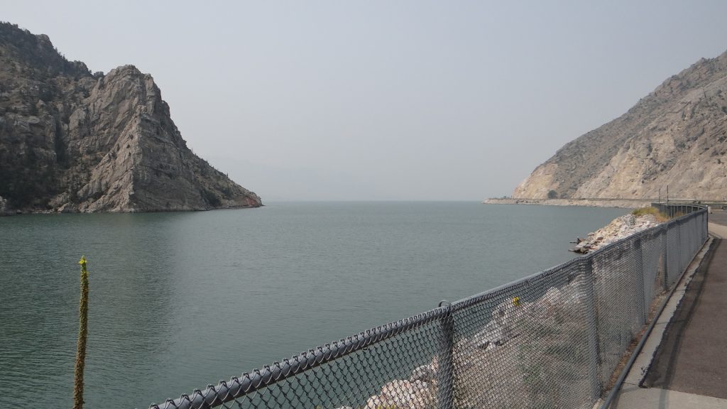
On the following day we decided to visit the Buffalo Bill Dam, which when it was built was the highest dam in the USA. You certainly needed a head for heights when you stood on top of the dam wall and looked down!!
Buffalo Bill Dam, the people are walking across the dam wall.The reservoir held back by the dam is huge.And it is surrounded by very high mountains.Looking down the river valley below the dam at the Shoshone River.Looking down the dam wall.Fish swimming close to the dam.
From here we headed West towards the East Entrance of Yellowstone Park along the Buffalo Bill Scenic Byway. We were told we would have a good chance of seeing some bear and Longhorn Sheep on this road. We certainly saw signs but no actual animals.
Bear droppings, they eat lots of berries!!
The scenery was also very interesting with lots of spectacular rock formations.
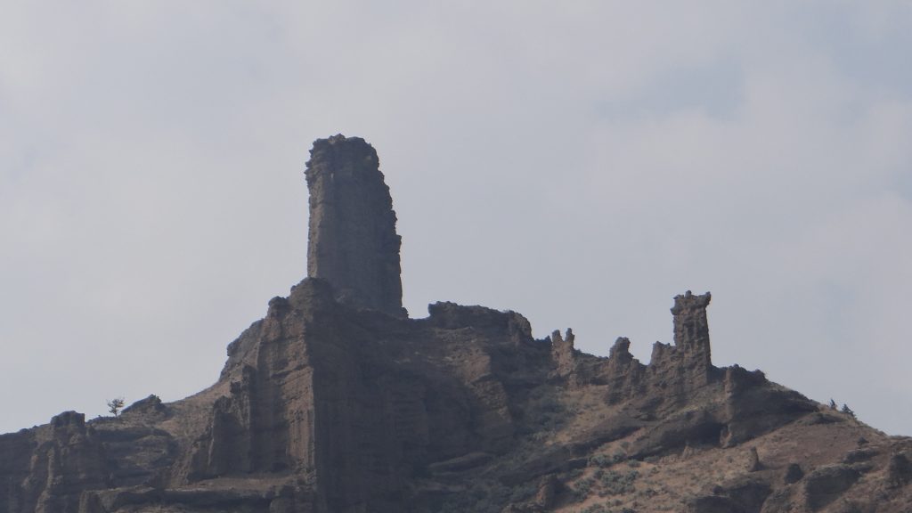
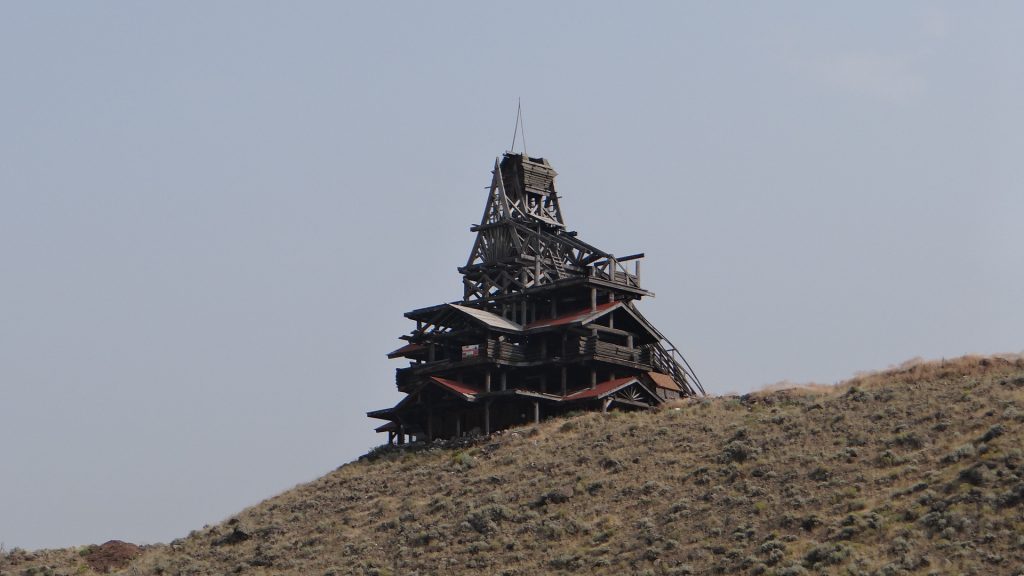
Remains of volcanos.Volcanic butteInteresting shapes all along the valley.Very phallic.How on earth does that stay up there!!More balancing rocks. Notice the windows through the rocks.And even more.Hazy view was caused by smoke from California fires.Your can tell which way the wind blows, never seen a tree growing just on one side!!And the river wound along the valley, and it’s a very good trout river.River meandering down towards the dam.East entrance of Yellowstone, where we turned around.A pile of deer antlers.And this was built by a local man out of hand hewn timber. Unfortunate part was he never finished it as he fell to his death off one of the pagoda roofs as he refused to wear a safety harness!!
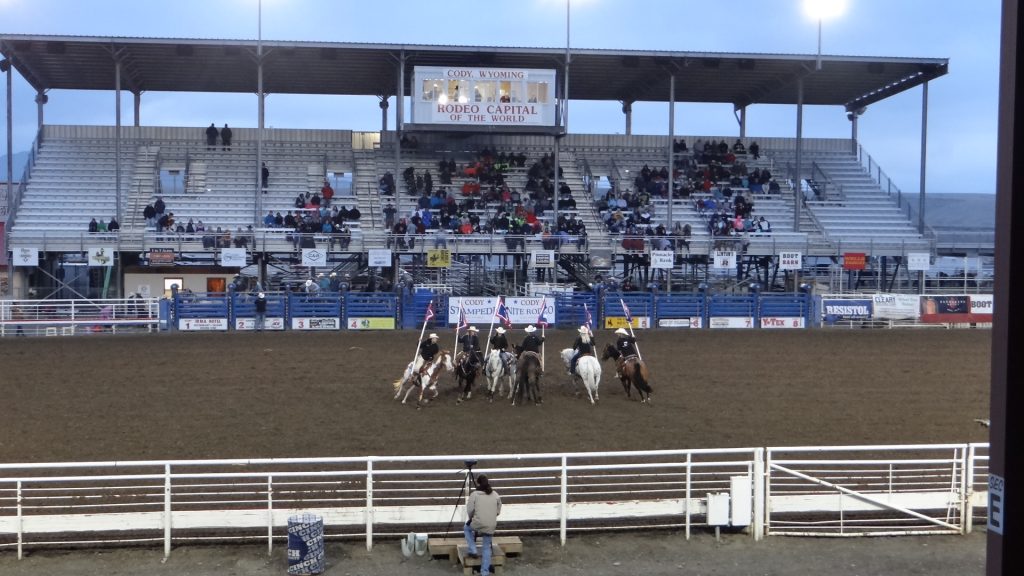
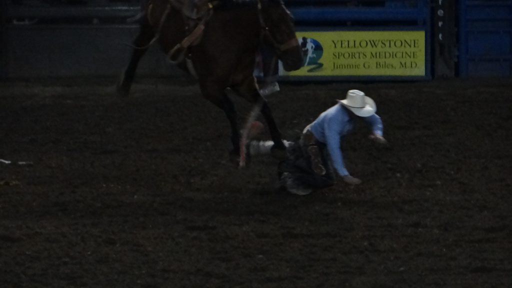
And on our last night we decided to go to the rodeo, unfortunately the weather had turned cold and we left half way through as we were freezing!! We saw the bucking horse rides, some steer roping and met a brahma bull, but didn’t see any ridden as we were so cold.
Brahma bull on show outside the arena.Cowgirls getting ready. You can tell how cold it was look at their coats. Unfortunately we didn’t have thick enough clothing!!Cody’s boast.Not all the stands were full!! And there were lots of blankets on show.The opening display of horse riding.Ooops he didn’t last long.This one did much better.Steer roping. Cowboy is just getting off to hog tie the steer, while the horse is trained to keep the rope tight. Pity about the pole!!
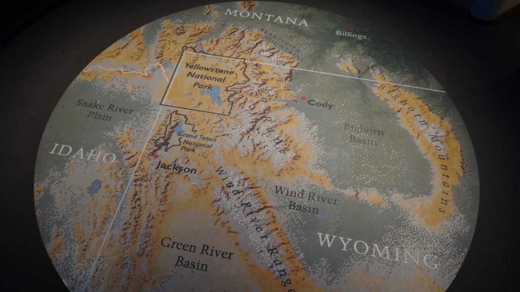
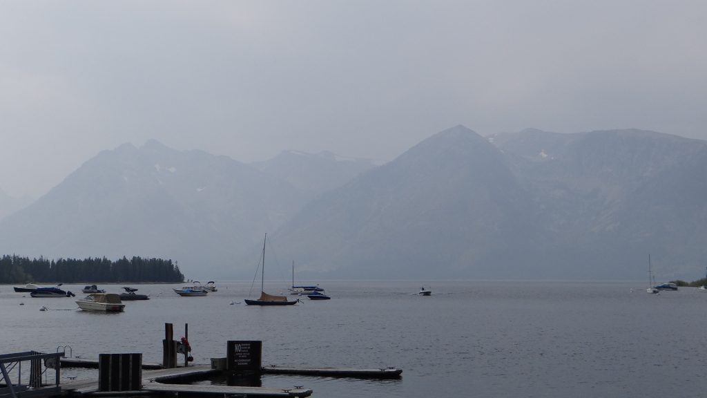
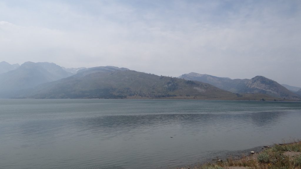
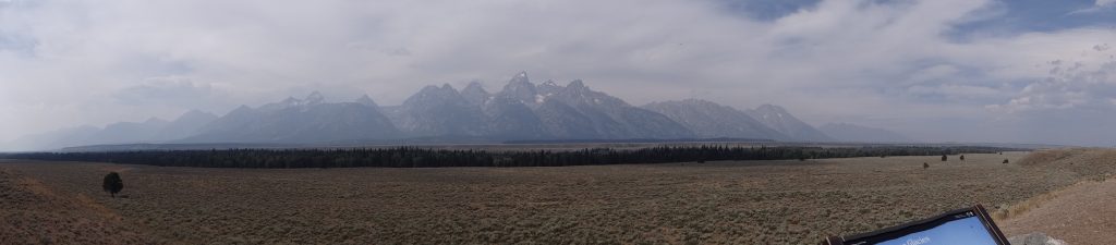
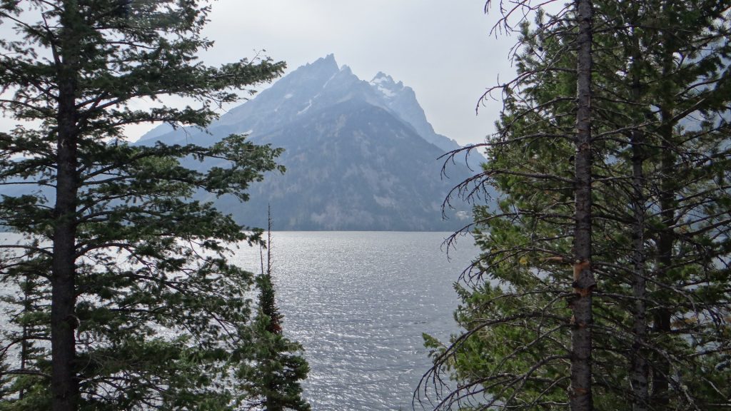
From here we moved on to Dubois (pronounced Duboys here as they don’t like the French version!!). We were using this site as our base to explore the Grand Tetons.
We arrived at Windhaven RV Resort after a particularly windy drive ( I guess we should have expected that given the name of the RV site!!) and got set up with a site facing the river.
The Site.View out of the front window, down river.And the view up river.Moon reflecting on the river.
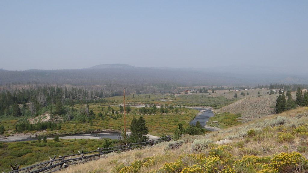
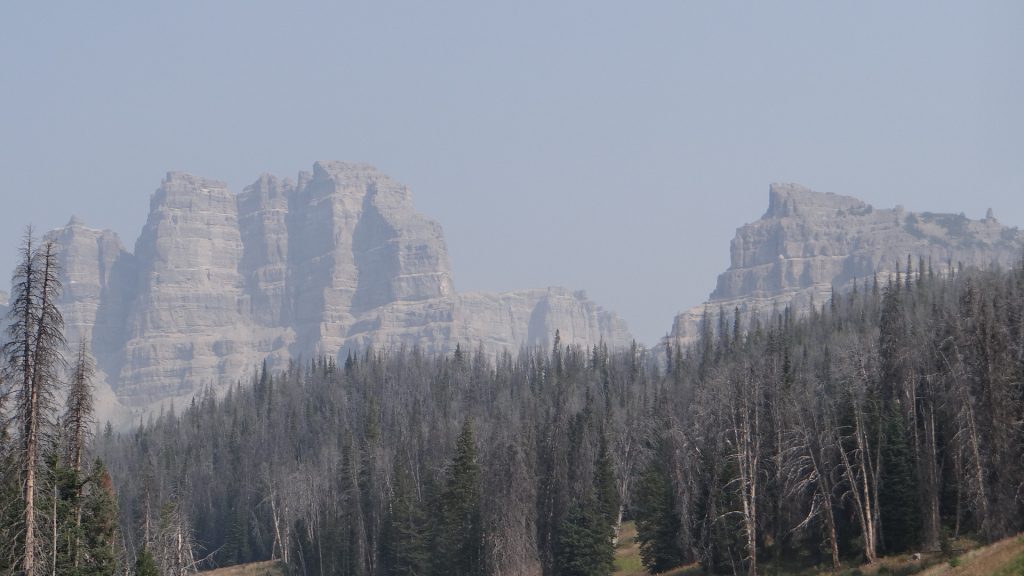
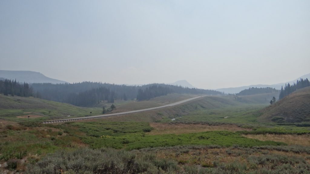
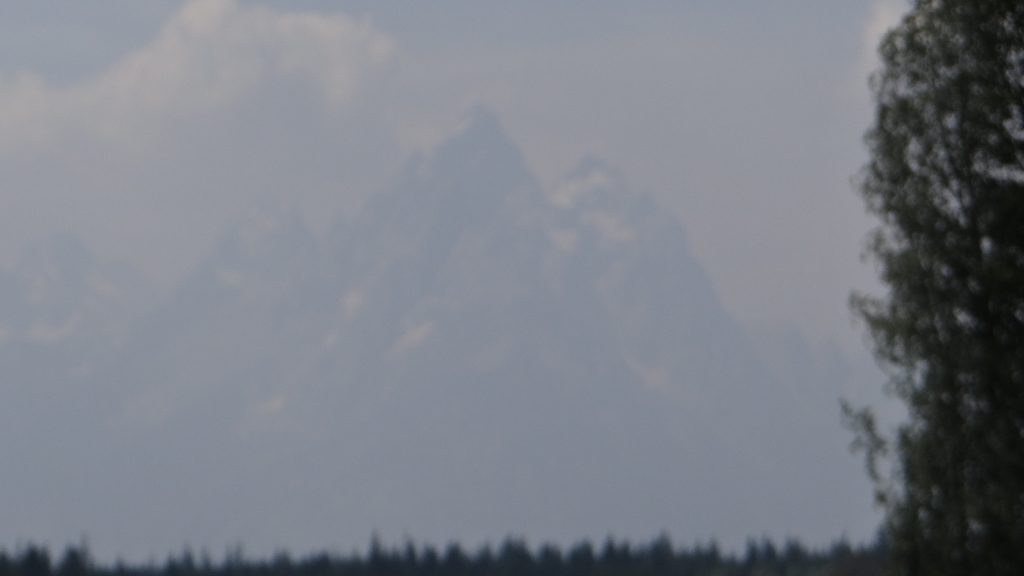
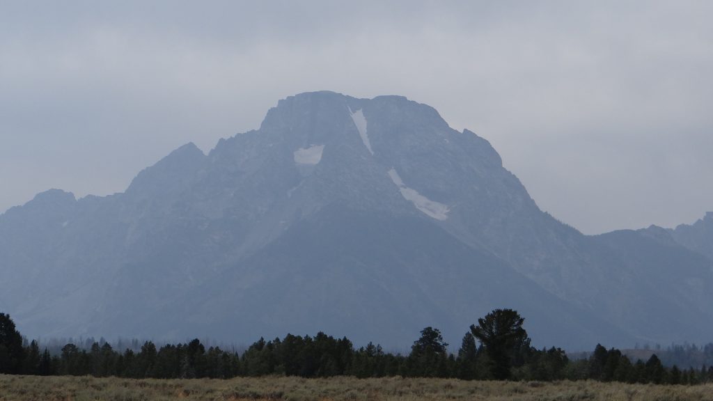
We used Dubois as our base to drive to see the Grand Tetons National Park. Decided to do it over two days as you drove into the National Park roughly in the middle and then you went North towards Yellowstone Park or South to Jackson Hole. Good job we did, as you will see from the pictures, because the first trip in we thought we had missed them! You only saw them once you were right on top of them because of all the smoke from the fires in California.
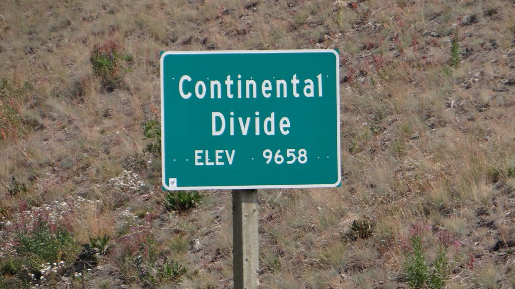
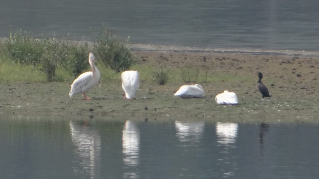
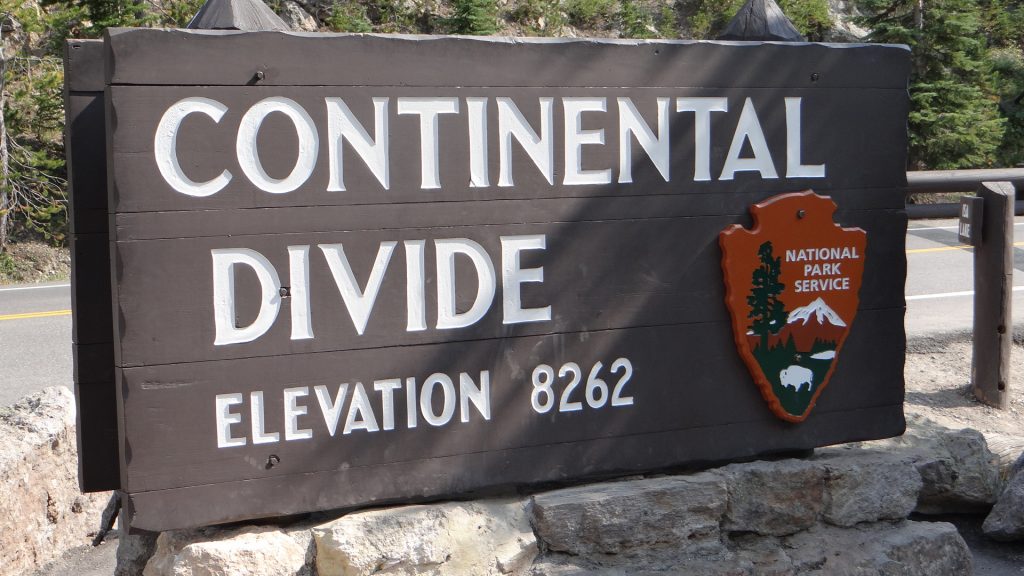
Memorial erected to remember all lumberjacks who made their living cutting railroad ties (we call them sleepers) by hand. This area produced the majority of the railroad ties used in the entire USA. You can see the smoke in the background.Smoke, smoke wherever you looked.Edge of the Grand Tetons, just!!On the way in we crossed the Continental Divide again at the highest we have been. Getting used to the rarefied air, although the Spark and I puff a bit going up hills!!Scene from a well known lookout point. You are supposed to see mountains up to 13,776ft high from here, but just smoke!!Finally got closer but you have to look very closely to see the snow on the mountains opposite.We chose North first as it was supposed to have bears, but no such luck. Saw some white freshwater Pelicans.It seemed to clear a bit later in the day.
After this we decided to wait a day (we had some chores to do anyway) and then try the South Loop in the hope that some of the smoke would clear. But it did make some fantastic sunsets.
Sunset at the RV Park looking back towards the National Park. My, my, America is a lovely place.
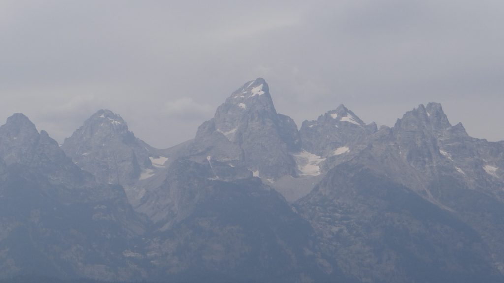
So, fingers crossed we set off on the Southern Loop around the park. It was obvious as we got closer that things had improved, but it still took a while before we actually saw the mountains.
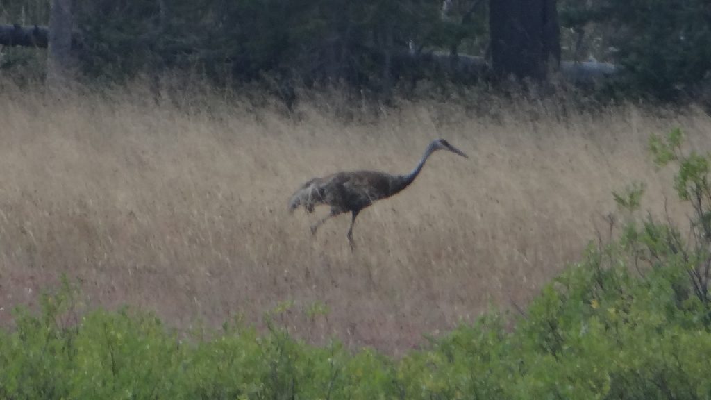
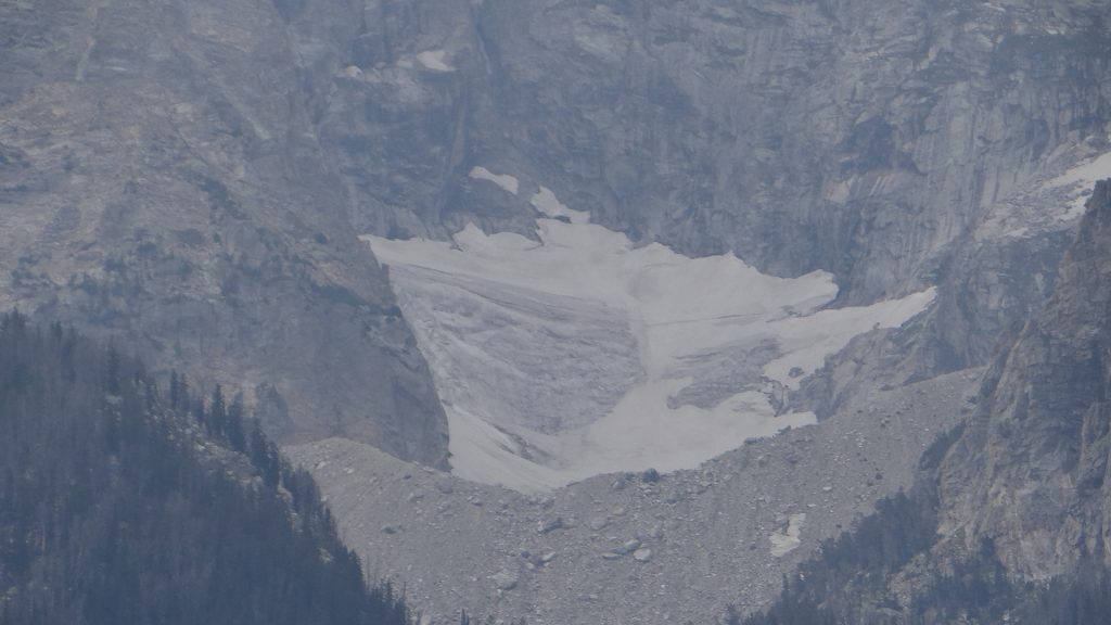
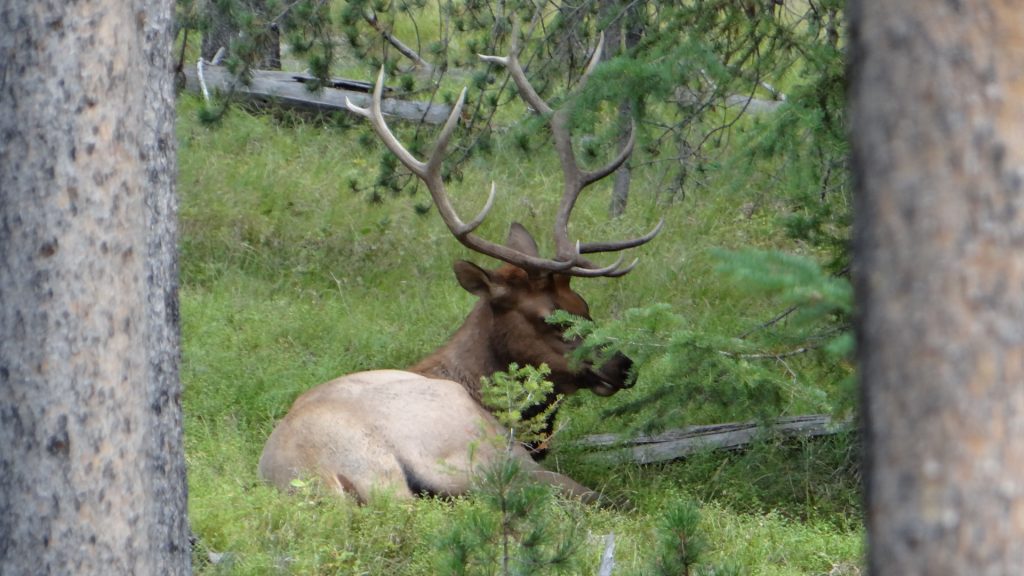
A Sand Crane we saw on the way in.And the mountains started to appear, just!!Need to get closer!!Loads of Bison grazing alongside the road.Trying to recreate a famous photo by William H Jackson showing the Snake River with the Tetons behind. He didn’t have the smoke.It’s improving gradually, but still need to get closer!!The highest peak at 13,776ft.One of the Antler Arches at the four corners of the George Washington Memorial Park, Jackson HoleGetting closer and it is improving!!Panoramic view of the entire range.These are the highest peaks and you can see what remains of the glaciers in the valleys. They are retreating year on year.Close up of one of the glaciers, with the moraine field in the foreground. The black colouration is caused by the smoke.This is known as the Cathedral group.Jenny Lake with Tetons in the backgroundPhoto opportunity.More glaciers.This is the view from Signal Mountain that is not part of the main group, but still 7,720ft high, with a road right to the very top!!This is the road we went South on to Jackson Hole, taken from Signal Mountain. You can see the Bison grazing beyond the road.Not very clear as it is at extreme range for my camera but this was a Pronghorn Antelope herd grazing in the valley below. Focus on the white butts (bums).Then on the way down the mountain this female Mule deer appeared.And took a rest!! Very relaxed.And THEN we saw this magnificent Mule deer stag. What a set of antlers!!This is the spillway of the Jackson Dam that forms Jackson Lake in the background.And then on the way back we saw more Pronghorn Antelope.
We were late getting back that evening and decided to eat out at a local restaurant in Dubois called The Cowboy Café. It was a really informal dining place with great food. As we were sat there we were joined by a group of people who had taken their horses in trailers up to the National Park. They had been riding the park trails with their horses all weekend. They were all friends from Lander, Wyoming and we got talking with them and they were really interested in our trip. One of then turned out to be a High School teacher at Wyoming Indian High School near Lander and he asked us if we would be willing to talk to his pupils. So I foolishly agreed, and he gave me a number to contact him on.
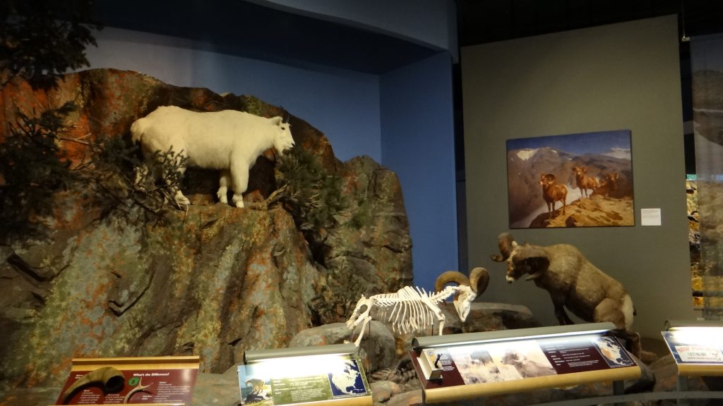
Our final day in Dubois was spent in the National Bighorn Sheep Centre, where we learnt that they had the biggest wintering herd, kept on a State park just outside of the town. We still haven’t seen any Bighorn Sheep but at least we learnt the the main reason we had not seen them. At this time of the year they are high in the mountains keeping out of the way of Mountain Lions!!
Bighorn Sheep with a Mountain Lion (Cougar) close on his tail!!
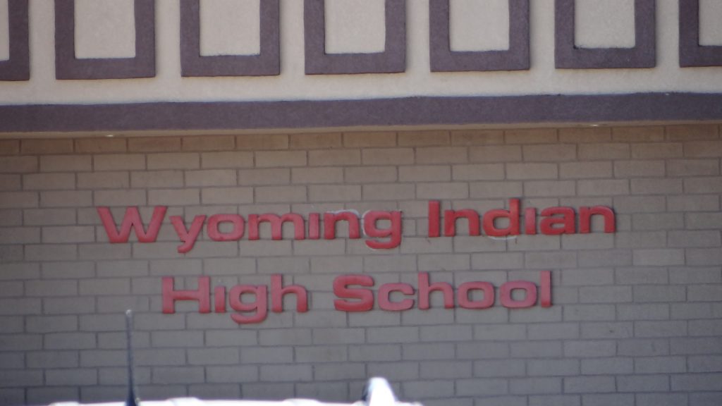
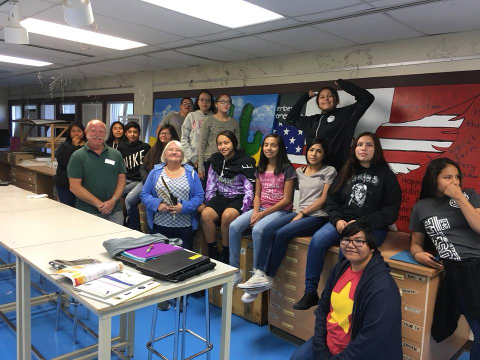
Our next stop after leaving Dubois was going to be Lander, so I contacted the High School teacher (Cleeve Bell) thinking he would have changed his mind about speaking to his pupils, but he was even more insistent it was a good idea! We would be going right past his High School on the way to our next camp site so we should call in. In exchange for me doing the talk he and his wife would cook us a meal that evening. And he had elk on the menu.
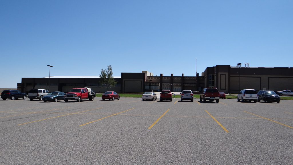
So, hoping I had not bitten off more than I could chew, we drove the RV into the car park at Wyoming Indian High School.
Parking lot at the High School.We were at the right place!!
And it all seemed to go quite well. The pupils all introduced themselves to us, including telling us what Indian tribes they were descended from. I used my laptop to show them where we were from, and then gave them a potted history of the British Isles. I showed them pictures of the Queen, Houses of Parliament and how we lived in England (not all in stately homes!!). We passed around our passports, UK notes and coins, and luckily Anne had a Hello magazine featuring the wedding of Prince Harry to Megan Markle which they were very interested in. We also got asked about the Spice Girls and One Direction!!
The High School class.
We then went on to the campground, got set up and drove back into Lander for a lovely meal with Cleeve and his wife. Their website is Here.
After dinner we got back to the campground to see a magnificent sunset over a lake in the grounds.
Wow!!Double Wow!!
The next day we moved on to Green River to visit the Flaming Gorge, the subject of my next post.
Ever since I read an Eagle comic recreation of the Battle of Little Bighorn when I was a young boy, I have always wanted to visit the site of the only battle in which the Indians actually won!
So we moved on from Livingston to Billings, which was slightly off route but got us close enough to the battlefield to make my wish come true.
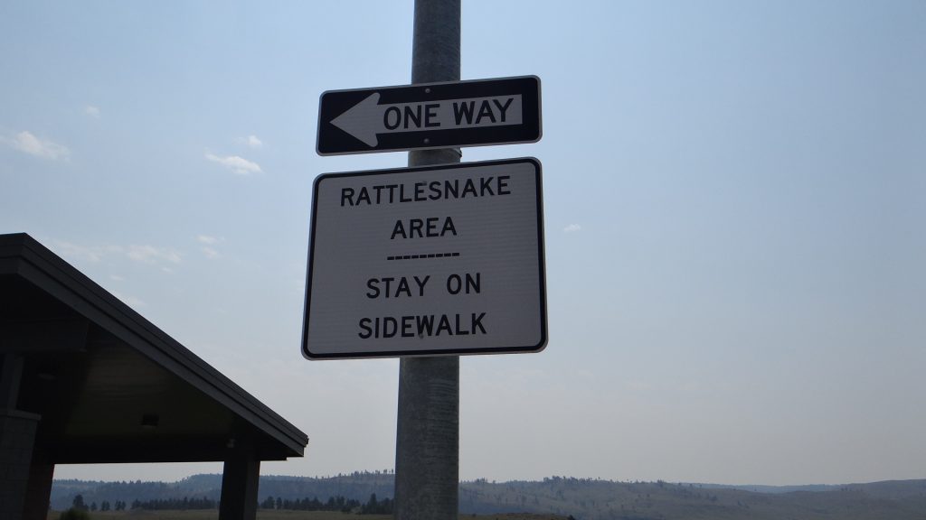
Rest area in I90Another rattlesnake warning. Didn’t see any. I suppose I should be careful what I wish for!!Parked up in Billings.
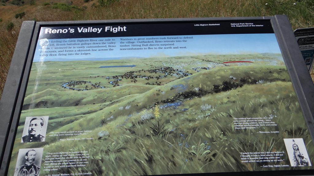
We drove to the battlefield the next day. I hadn’t realised until we got there that it was quite a long battlefield. I always envisaged it was just the hill on which the Last Stand took place but it was in actual fact spread out over 5 miles, after a crucial decision by Custer to split his command in two. One group of men under Major Reno was sent to attack the Indian encampment and the other group under General Custer continued West to try and flank the village and capture them in a pincer movement.
7th Cavalry are the blue routes, Indian braves the red routes.
You can see here where the main 7th Cavalry force split on the right. Unfortunately for General Custer, Major Reno’s force was beaten back and forced to retreat back over the river and take up a defensive position in the hills above.
General Custer not knowing that continued west, splitting his group again to attack the village while he continued west. That force under Lt. James Calhoun was harried by Indian forces, losing many men, until they too turned back to the hills and rejoined General Custer’s main group.
General Custer then turned to attack the village, only to be met by superior Indian forces and was forced to retreat (dotted blue lines) back to where they were surrounded and lost their lives in the Last Stand.
Major Reno’s group knew nothing about this, as they were over 4 miles from that area, so they consolidated their position and beat off Indian attacks until they were saved by the advancing columns of Generals Terry and Gibbon.
The Indian village was camped amongst the trees in the Valley below. It was here that the force was split and Major Reno sent down into the valley to attack the village.This shows you Major Reno’s force attacking the village (blue arrow) but the Indians counter attacked and …..Forced them to retreat back across the river, losing many men on the way. They retreated back up to the top of the hill where they set up a defence.A map of the defensive position that Major Reno’s troopers set up, and defended successfully until the arrival of the relief troops.
While moving west General Custer was harried all the way by Indian braves. Wherever a white marker is positioned it is approximately where a 7th Cavalry soldier fell. Most of them have no names on them, as all they knew at the time was a soldier was killed here.
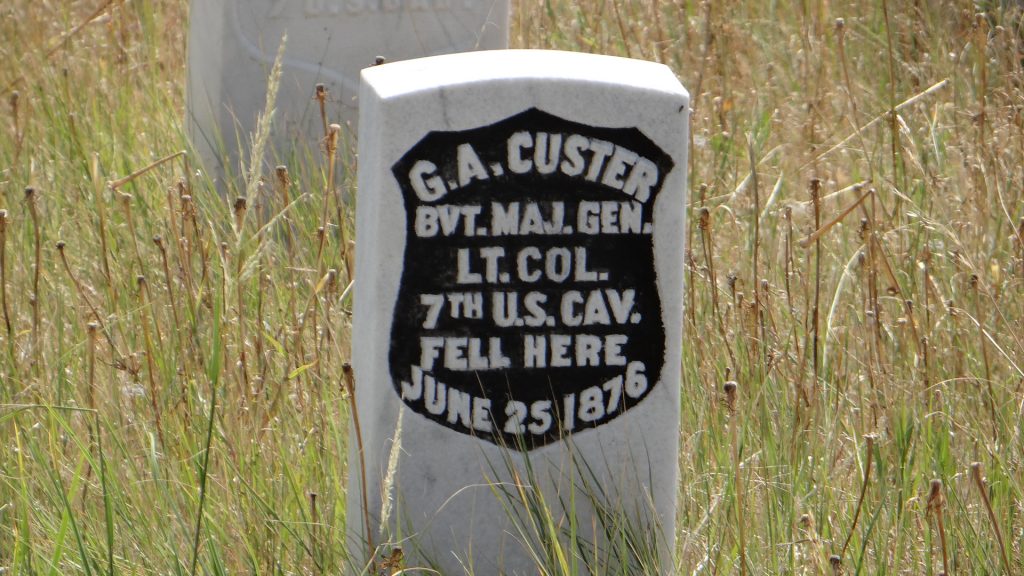
White markers show where 7th Cavalry soldiers were killed. Inscriptions read “US Soldier 7th Cavalry fell here June 25 1876”.This is the area where Lt. Calhoun and his men fought his way back to General Custer. As you can see a lot of soldiers lost their lives here.
They re-joined General Custer who began his attack on the village but were met by a large Indian force, so they too had to retreat back up into the hills.
This was the route of the retreat back to the hills. There is a valley at the far end with more markers in it that you cannot see, but it is painfully obvious that the 7th Cavalry lost a lot of men in this retreat.
And then General Custer tried to defend the hill top that became known as the “Last Stand” hill.
Overall view of the Last Stand site and monument.View of the Last Stand from the monument.Where General Custer was killed, in the previous picture it is in the middle.
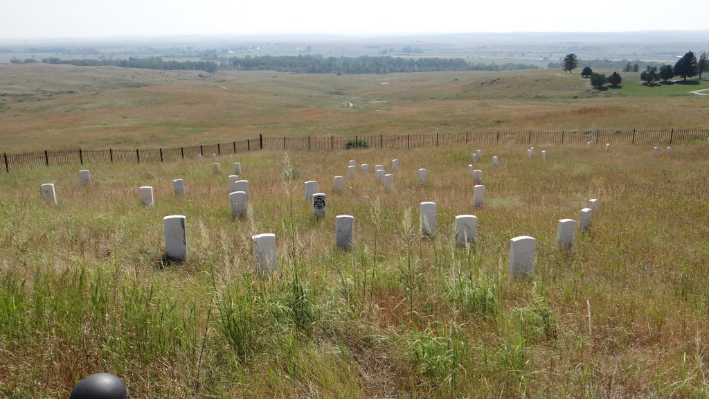
The memorial lists the 268 men made up of 7th Cavalry soldiers, Indian scouts and civilian workers who died at Little Bighorn.
The memorial to the dead.This side shows the Indian Scouts and Civilians who lost their lives.
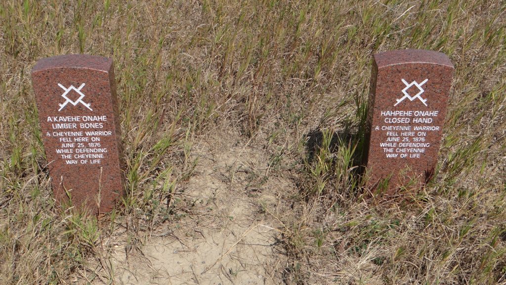
It should not be forgotten that many Indians also died here and to this end they have started to place markers for the Indian dead as well.
Indian markers are made of sandstone.
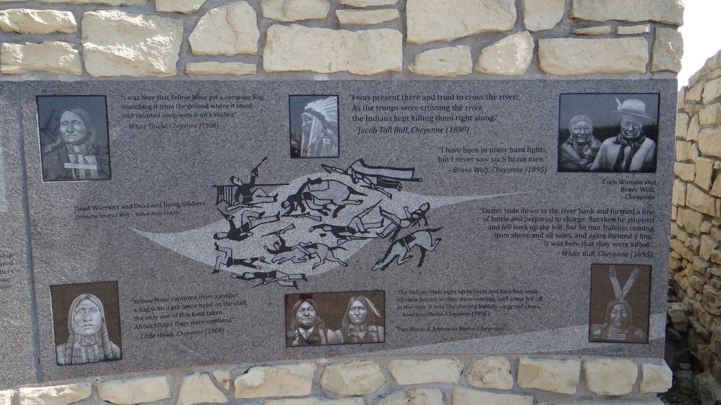
There is also an Indian Memorial.
The memorial traces the history of the tribes that fought at the battle.And tells some of their stories from the day.And commemorates a way of life that was lost after this day.
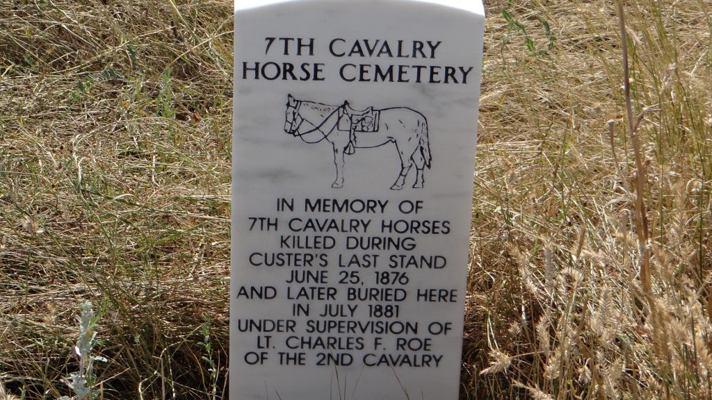
And there was one other group that lost their lives at the battle, the horses, and they are remembered too.
The Horse memorial. Many were shot by their own riders so they could use their bodies as protection.
All in all a very sobering place to visit. From my point of view I always thought of General Custer, after reading that Eagle comic story, as someone to be looked up to. This battlefield memorial makes you think of all the people and animals involved and makes you stop and think whether he deserves that image, and could all this have been avoided.
From here we turned South again and headed to Cody, home of William F Cody sometimes called “Buffalo Bill”.
We moved on from Butte to Livingston which was close to the Northern Gate into Yellowstone Park.
Rest Area on the way to Livingston.Still “Big Sky” countryWe keep meeting these people!! Lewis & Clarke expedition.
Arrived at Osen’s RV Park and got set up.
Our site.
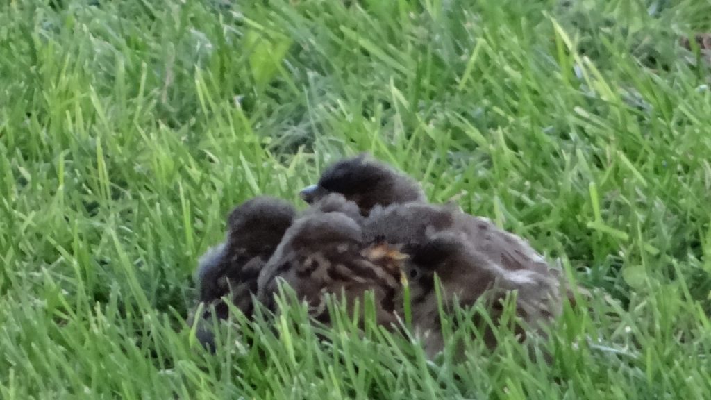
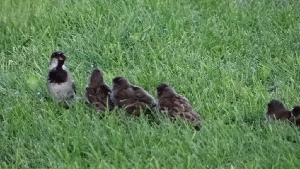
While we were eating we noticed that there were 5 chicks on the ground and the mother trying to feed them all!!
The five chicks huddled together.Every time the mother turned up there was a rush to get fed first.
Livingston was chosen as it was close (in American terms) to the North entrance to Yellowstone National Park.
After looking at the maps it looked like we would have to make at least 3 visits in order to cover it all.
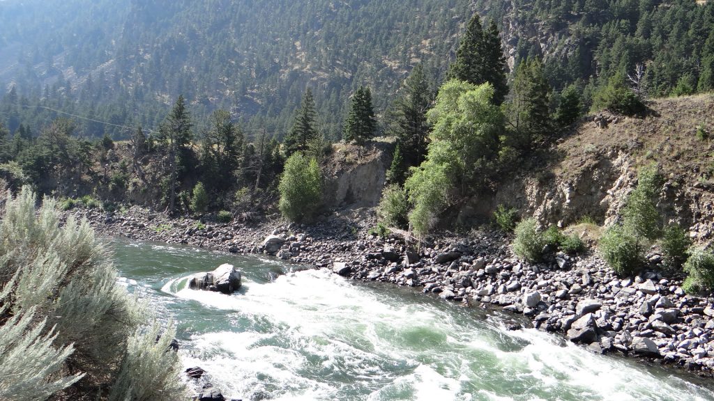
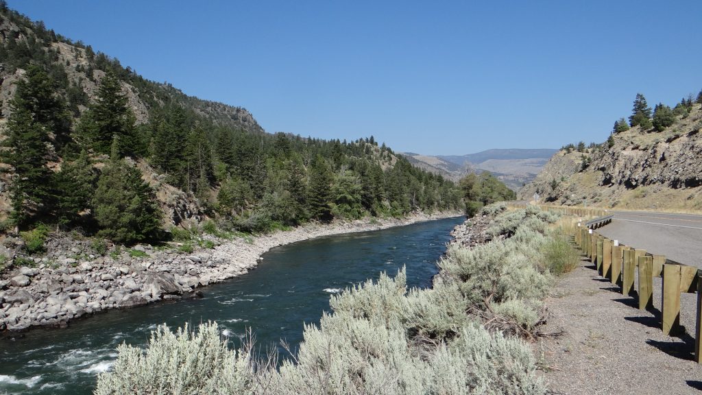
So we set off on visit one. Even getting there was interesting with the Yellowstone River running alongside the road all the way and numerous trout fishing areas.
Lots of places advertising white water rafting and you can see why.Yellowstone river valley.And “Big Sky” was still with us.
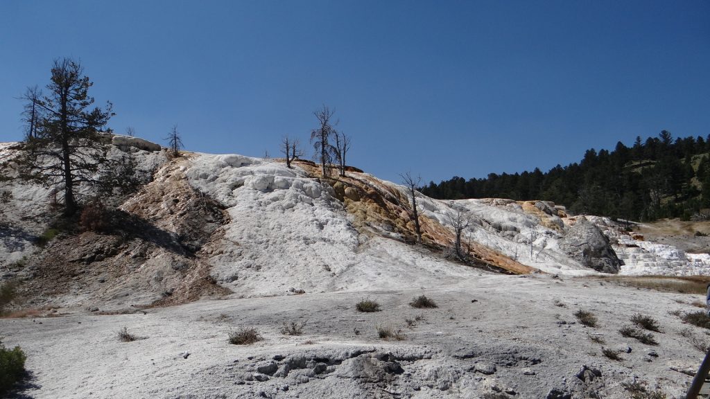
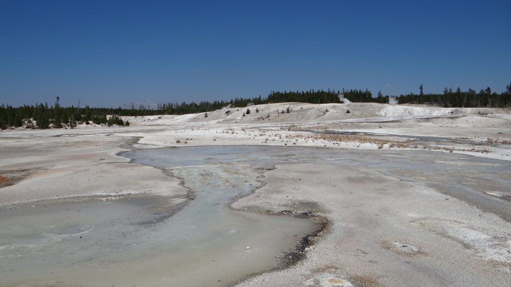
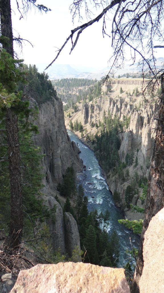
And then we were in the Park. I think this is the most magnificent place we have been, but you, the viewer, will have to decide for yourself.
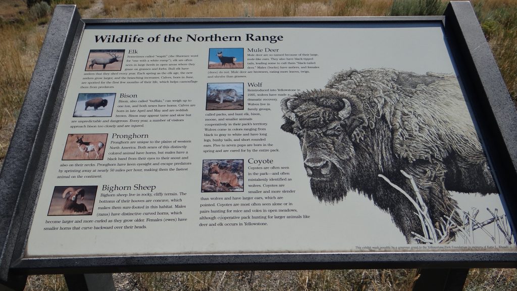
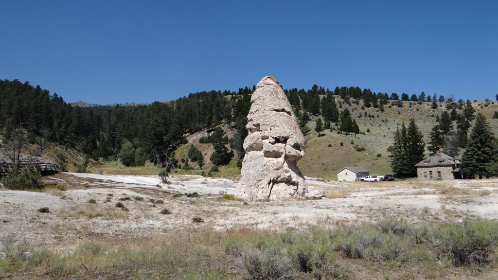
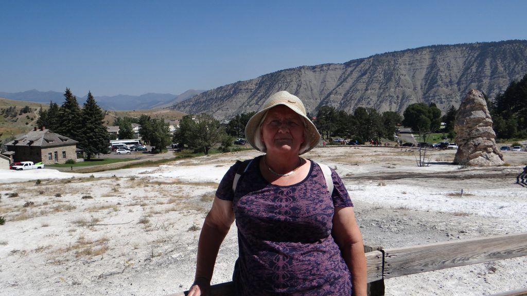
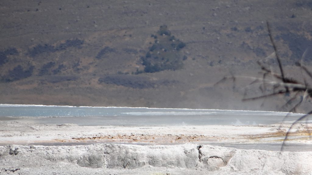
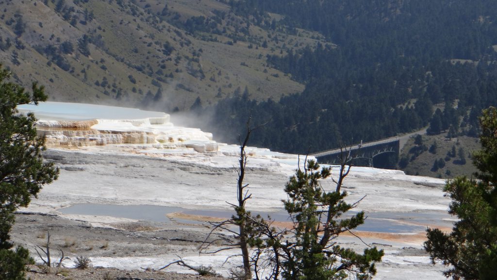
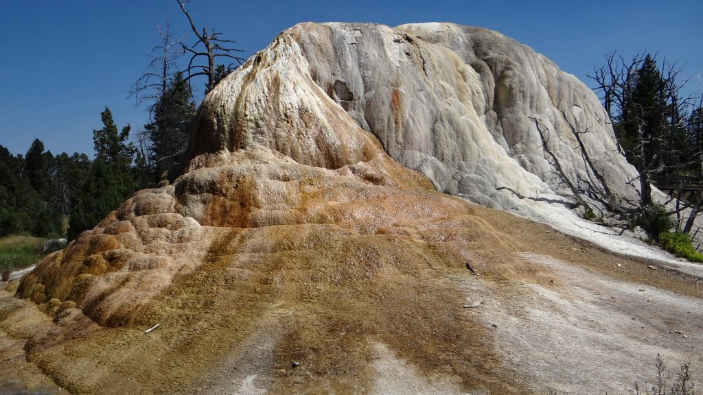
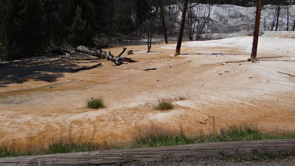
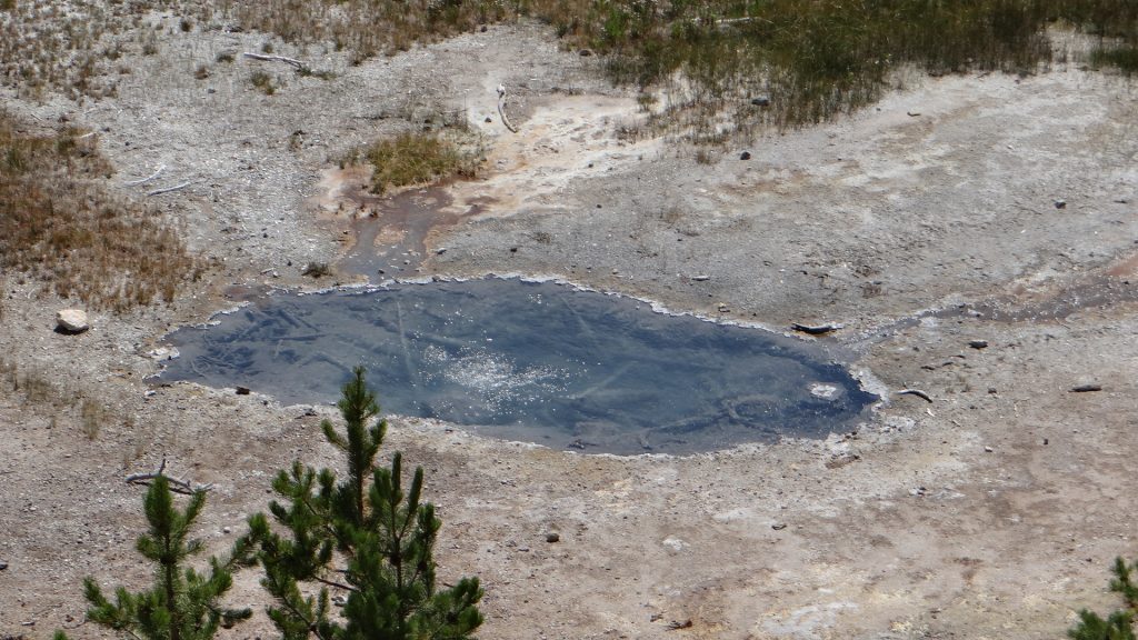
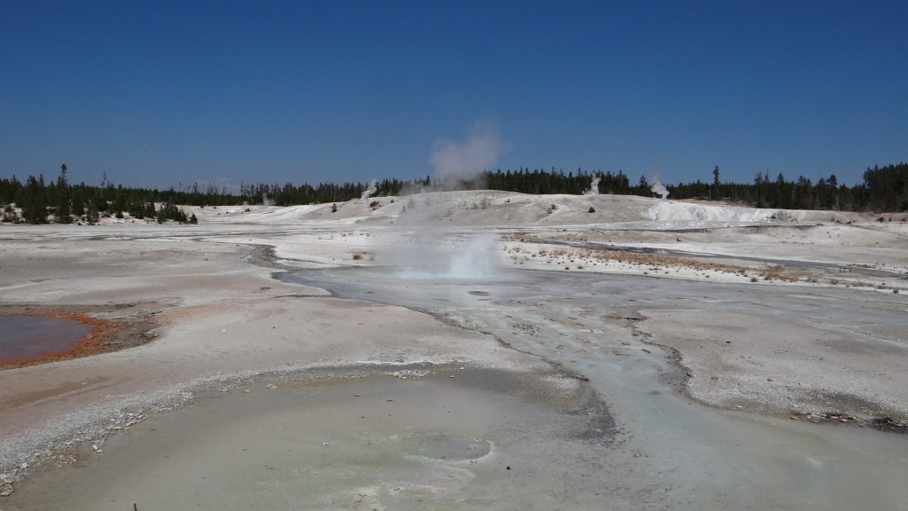
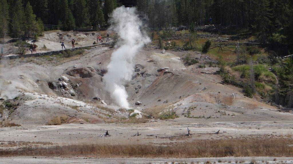
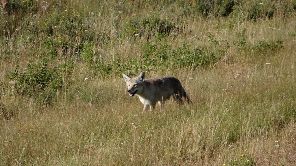
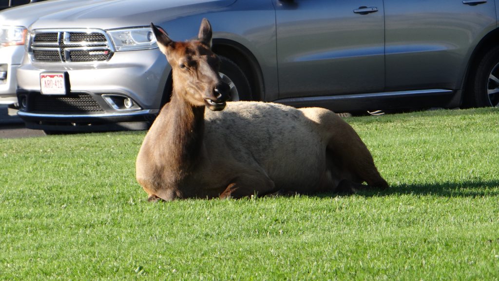
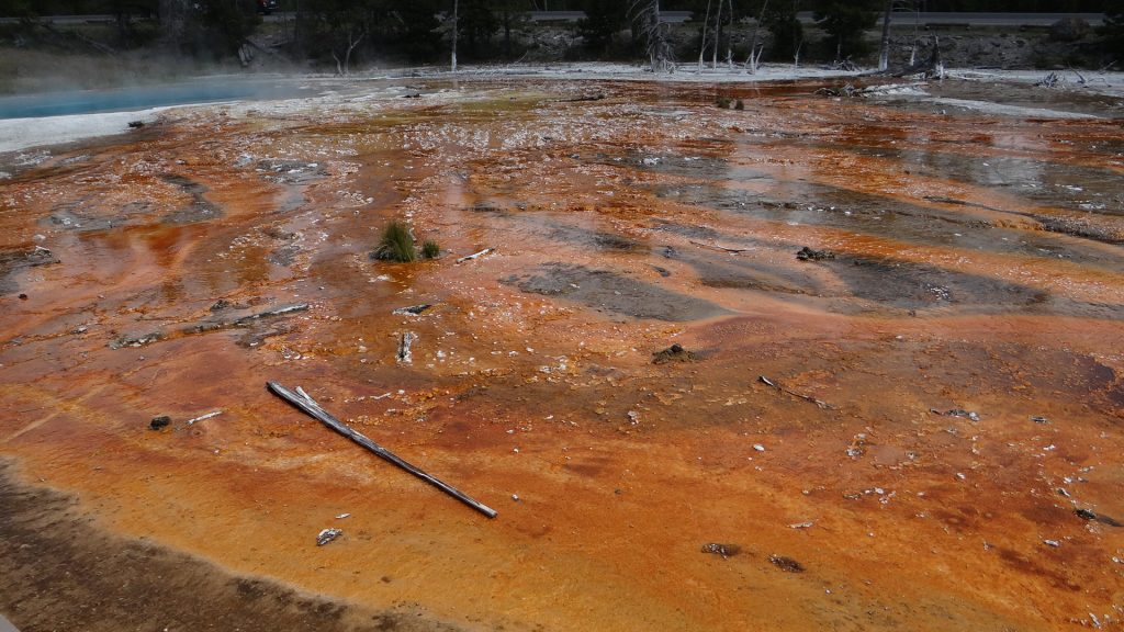
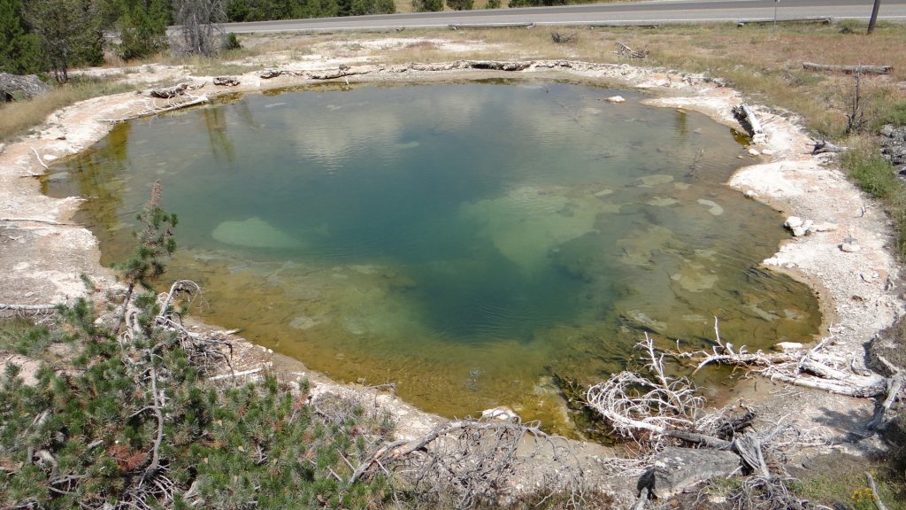
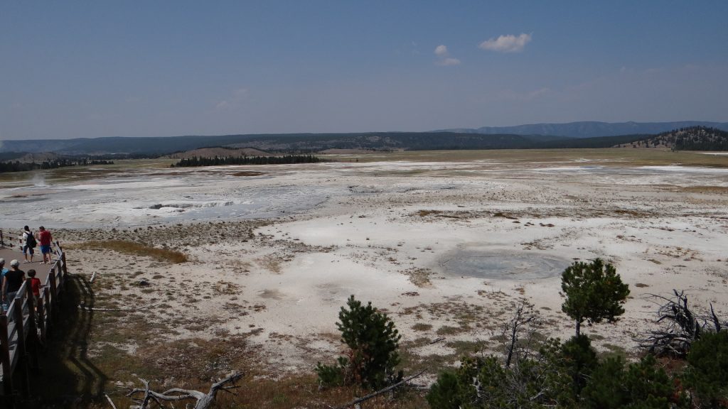
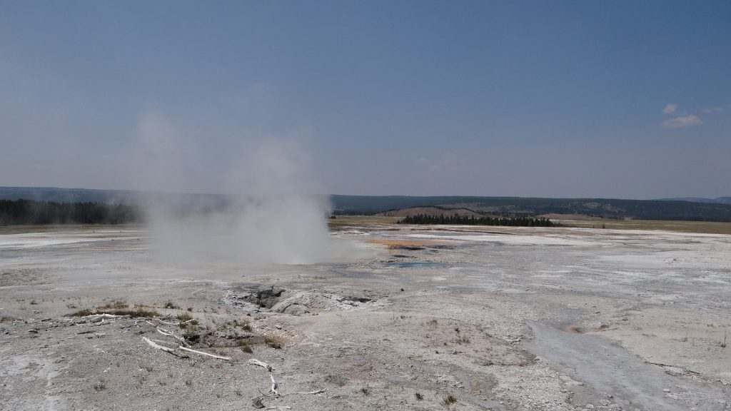
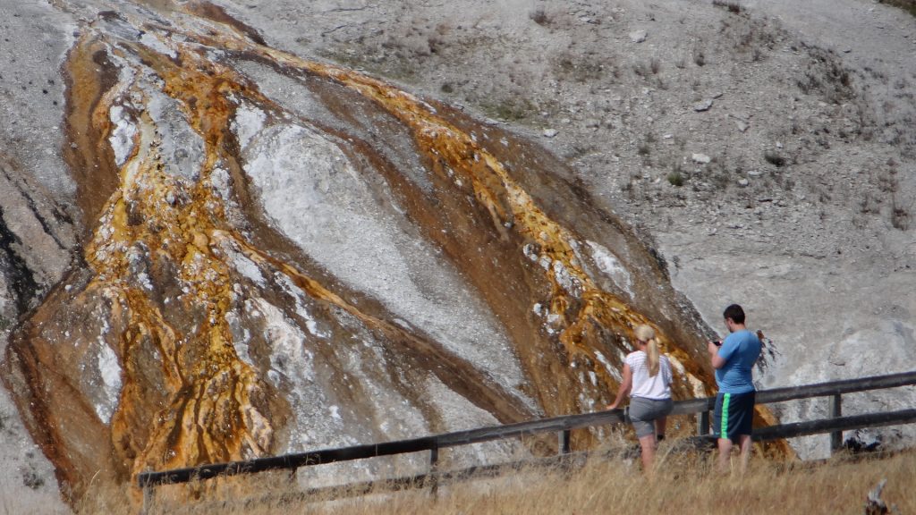
What we can expect to see in Yellowstone Park.Mountain Ranges from Mammoth Springs.The remains of a calcified spring in Mammoth Springs.The runoff from the hot spring above causes the calcification.This spring has also attracted bacteria that causes the change in colour.Steps caused by gradual build up of calcium.Mammoth springs in the background which has huge ranger station.This is the hot spring above the previous pictures that fed the cascade.And further up the levels there was this spring.And then at the top this beautiful pale blue spring, so hot it had steam blowing off it.Calcium column caused by the spring growing up the middle of the column. More bacteria causing the colouring.A whole bed of coloured calcium deposits.The Spark parked on one of the plains on top of the park around 8,000ft up.Snow still on the mountains in August.Panorama showing the lake (Swan Lake) and the mountains.This was called Staircase Rocks. Same basalt configuration of the Needles in IrelandAnother lake formed by hot springs.And this is the spring that did it!!Norris geyser basin.Wherever you looked something was either bubbling, gushing or spouting!!Small geyser going off.Very hot steam fumarole.Yellowstone river cut this valley.Strata in the rock face that ran alongside the road.Yellowstone river canyon.A petrified tree.And just when we had gone all day without seeing any wildlife I spotted these Sand Cranes.And while we were stopped for the Cranes this guy/gal turned up. Coyote!!And he proceeded to catch something right in front of us and here he is chewing on it!!And when we got back to Mammoth on the way back to Livingston there were Elk feeding on the lovely mown lawns. They obviously know where the best grass is!!
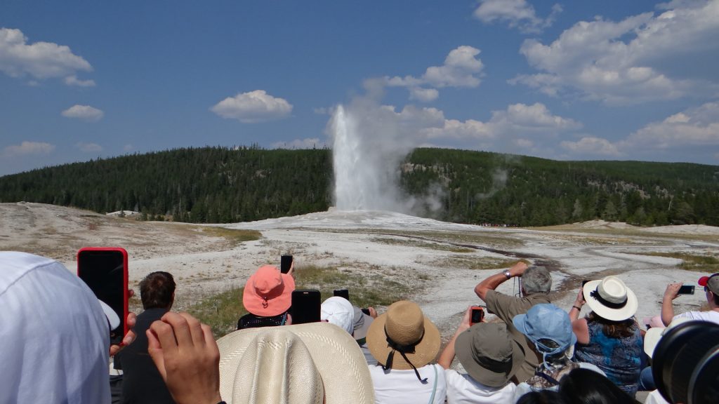
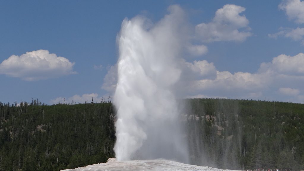
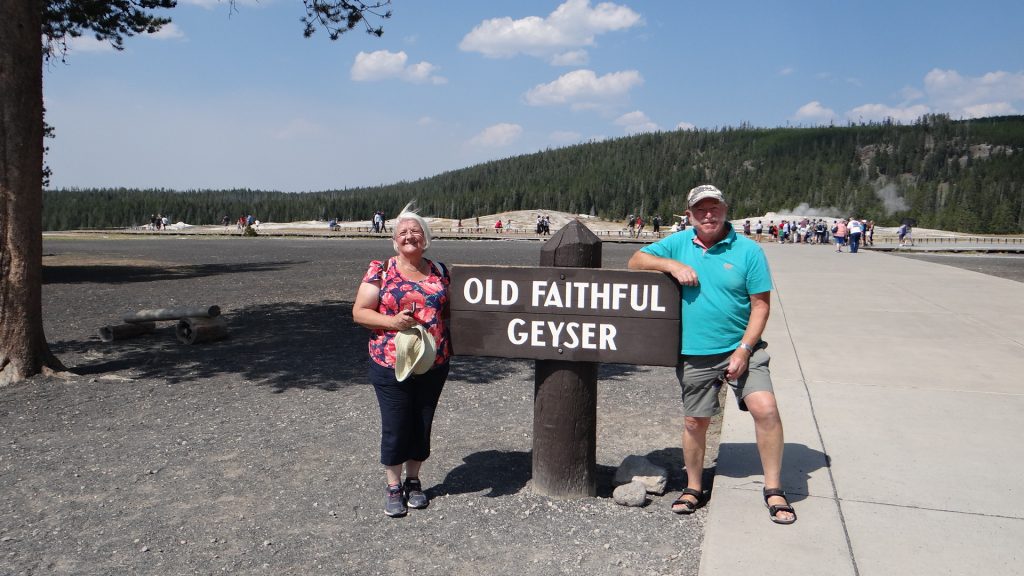
We had a day’s rest and then did the bigger loop to see Old Faithful.
An amazingly coloured Spring that flowed into the river.And the colours of Anne’s top nearly matched it!! I don’t think!!
A hot spring called Beryl. Temperature is between 188.5F (87C) and 192F (89C) so don’t take a bath!!
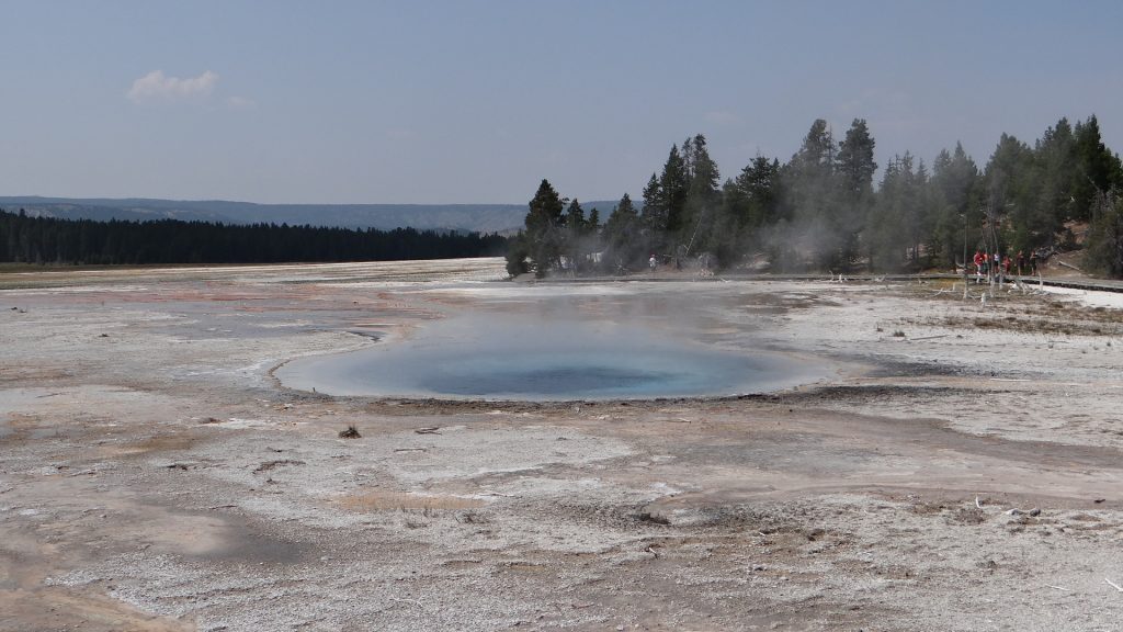
Lower Yellowstone FallsLower Geyser Basin, a hot spring.Bacteria causes the beautiful colours.A deep blue hot spring.A mud spring, just as hot!!This is called Leather Spring.The whole Lower Geyser Basin, it was huge!!A steam geyser, as you walked past it water droplets hit your skin. Very cooling.The main hot spring.This hot spring drained into the Yellowstone River.And then we arrived at ……And with brilliant timing it erupted just as we got to the viewing area.Reached about 50-60ft in the air.Two old geezers at the geyser!!Another beautiful multi-coloured spring.And then we crossed the Continental Divide again at quite a height!!And there was this beautiful lake full of water lilies right next to the Continental Divide that fed two rivers one going east and the other west.Yellowstone Lake as with everything in Yellowstone was huge!!
At this point we turned towards Livingston and thought the Jordan curse of seeing no wildlife had hit again and then out of the corner of my eye as we passed a picnic area………
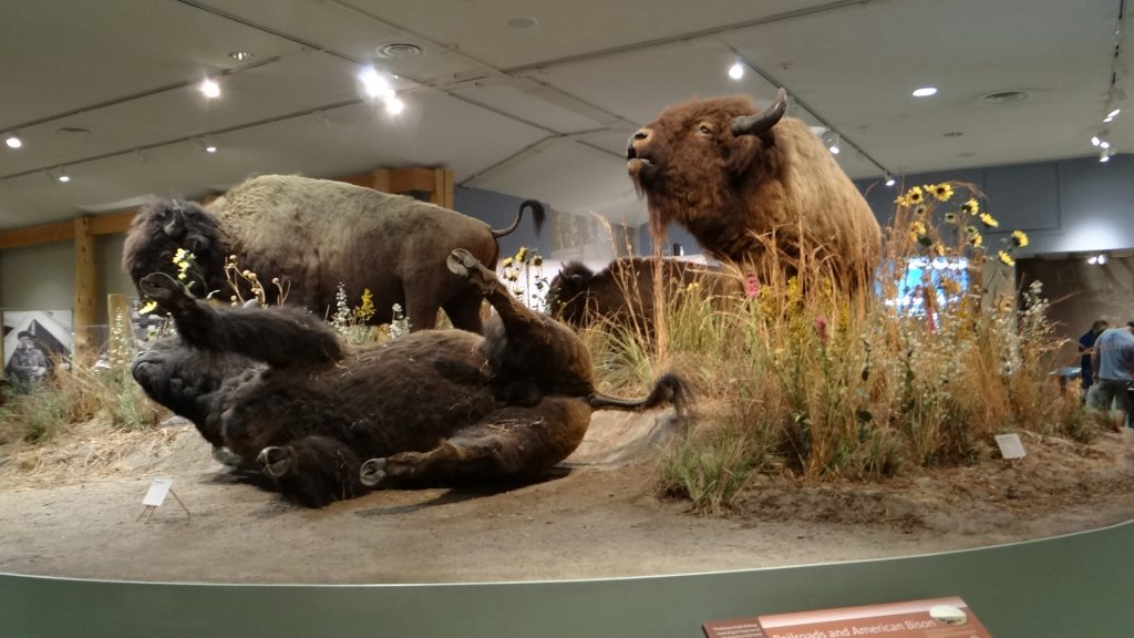
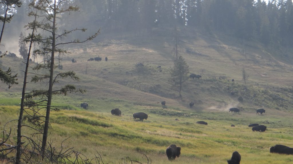
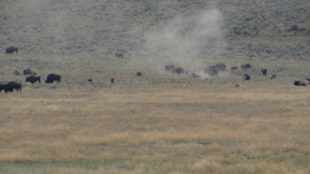
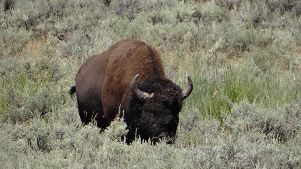
Bison feeding just about 50yds from a family sat at picnic table!!He had a massive head and horns.And then it got silly, a massive herd!!Feeding right next to the road and causing a traffic jam as they crossed it.You can see how close we were to them here.
So we returned to the campsite after a meal in a cowboy grill in Gardiner just outside the Park.
For our third visit we decided to go along the Lamar valley where we were told we had the best chance of seeing bear.
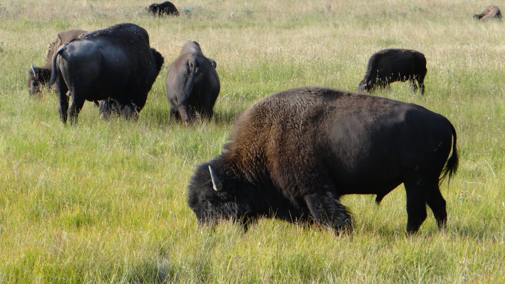
Yellowstone River again.Beautifully marked Pronghorn deer.Better view of the markings.And massive herds of Bison. One having a dust bath to cool down.Another two Pronghorns further down the road.Mother and calf.While we concentrating on the main herd, this huge bull bison came wandering down behind us, and wandered across the road and then back again holding up traffic. You wouldn’t argue with him he was much bigger than the Spark.Magnificent scenery at the end of the Lamar Valley road.Huge mountains either side of the road.
And that was the end of our visits to Yellowstone, still no bear, but lots of other animals and seeing Bison was a treat.
Then we moved on to Billings so I could see the Battle of Liitle Bighorn National Monument.
Well our first stop in Montana was Campground St. Regis a small but very nice campground just outside, you guessed it, St. Regis.
Our site, nicely shaded if a little dusty!!View down the site to the Office, and the swimming pool.
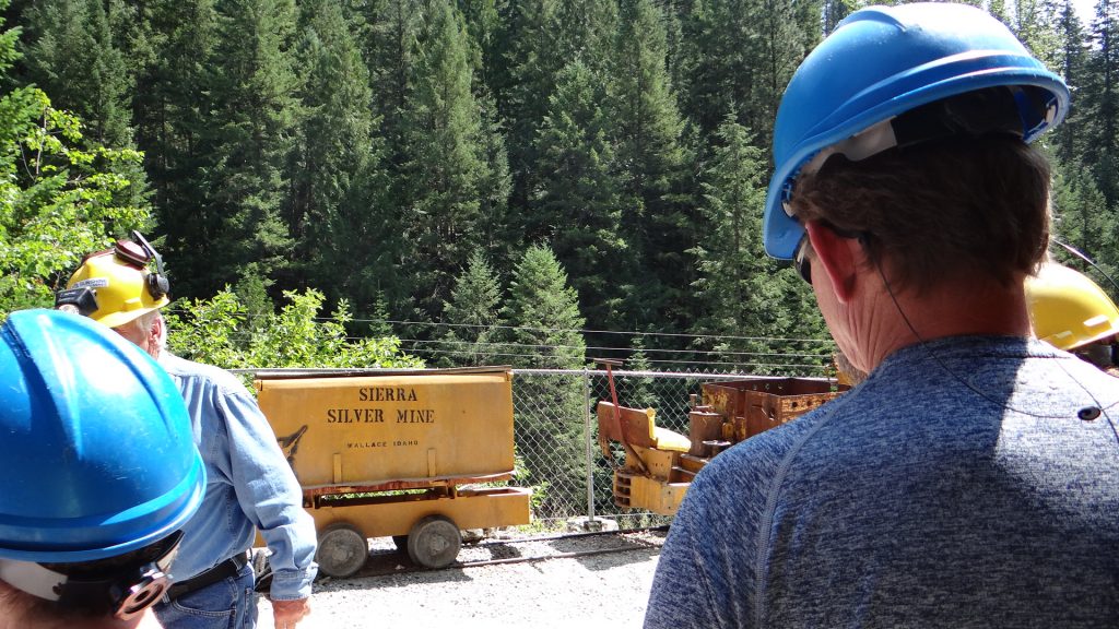
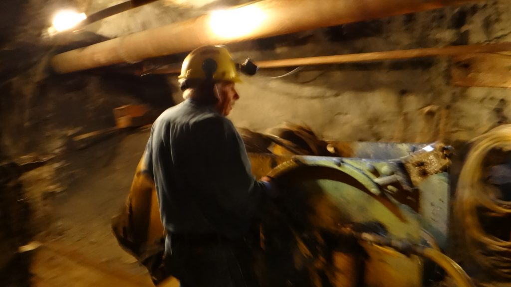
We were told by our Canadian friends from Spokane we just had to go back into Idaho and visit a town called Wallace where, among other things, there was a very good Silver Mine tour.
And so it turned out, we really enjoyed the tour of the mine and the rest of the trolley bus tour gave us an orientation of Wallace.
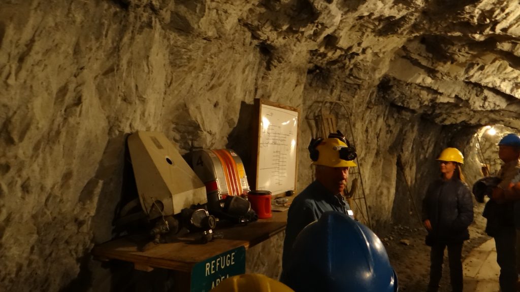
We met our guide (an ex-miner of Swedish origin who had a very good sense of humour) and got kitted out with our hard hats.
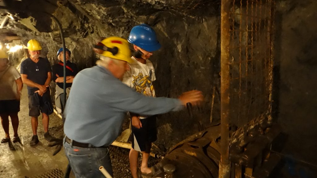
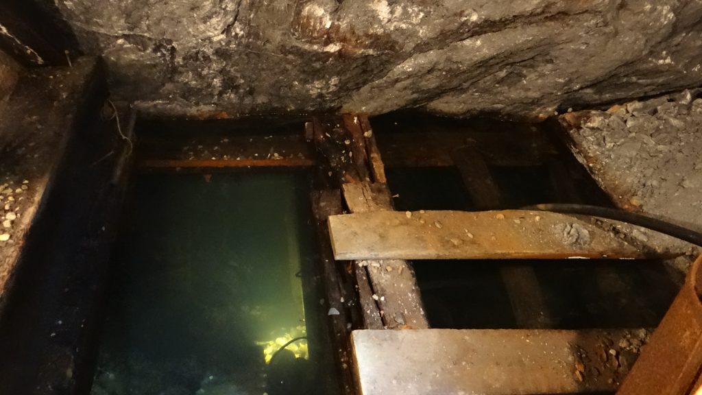
He moved!! This was our guide.Anne and I in appropriate attire.And off we go into the mine.Our guide showing core samples from the mine.Explaining the levels of the mine and mine rescue breathing sets.Diagram of mine levels. Mine when in production had 14 levels.Guide demonstrating a pneumatic drill. Water is also sprayed at the face to keep the dust down.Demonstration of a blast sequence. Luckily only lights flashed.Child on the tour running the drag shovel.Steel hawsers running back to drag shovel. Pneumatic powered.Tunnel got quite tight at times.Our guide explaining how the mine lifts worked and showing these girls how to work the lift signals.Flooded section.A pneumatic dump shovel . Run the digger forward, fill up the shovel, and the shovel goes up and over and deposits the ore into a cart behind. Keep you fingers out of the way!!Core sample showing silver which is actually the black rock, white is quartz.
We then had a look around Wallace itself. It is quite an old town that has the distinction of every downtown building being on the National Register of Historic Places. This came about because when they were building I90 they planned to knock down most of Wallace for the Interstate to go through, which obviously the inhabitants thought was a bad plan. A local businessman, Harry Magnuson, sued the Road building authorities saying they hadn’t done a proper environmental impact. And he won, and as part of that process got all the downtown buildings placed on the National Register which forced them to build I90 over Wallace on a flyover!!
It also considers itself to be the “Centre of the Universe” which came about because it claimed to be the centre of the silver mining area that had mined over 1.2 billion ounces of silver in the mines surrounding it. With a population of just 784 that is a pretty big boast, but you can see the plaque if you take your life in your hands as it is in the middle of a cross roads!!
Centre (Center) of the Universe Plaque.
There is also quite an interesting museum of the Northern Pacific Railroad.
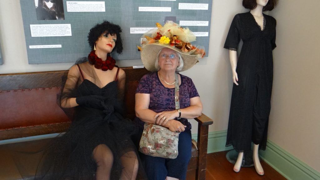
Illustration of the route of the Northern Pacific Railroad.Anne modelling a dressing up hat in the Museum. For some reason this was also in the part of the museum that had a display of bordellos in Wallace, hence the other “ladies”.Pictures showing how they moved the station building (where the museum is housed) during the building of I90Apparently Lana Turner, the Hollywood star, was born in Wallace.Lots of old silver mine sites around the town.Including one that was blown up with dynamite by the miners in a gun war between the miners and the mining company! The rubble behind is all that is left.
Wallace was a very interesting place and well worth the trip if you are ever close by.
You can see why they call it “Big Sky Country”, blue skies and magnificent views.
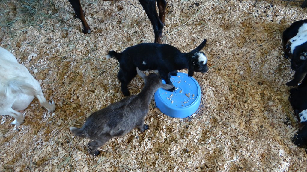
The following day we went to a local county fair. Local people displaying their handiwork, and their livestock, plus some events in the rodeo arena. Unfortunately the rodeo itself was not on until after we left the area.
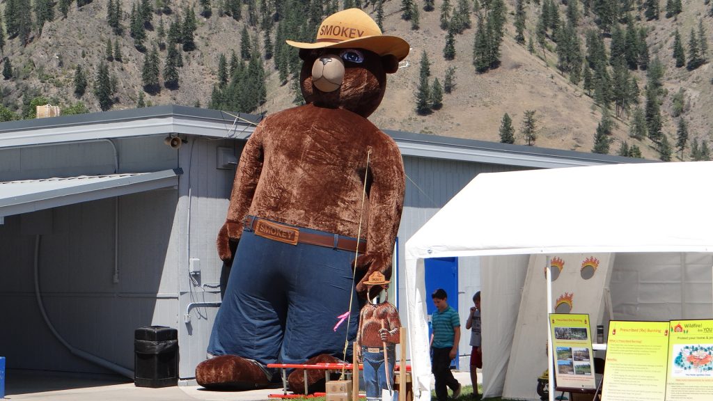
Award winning quilt.Goat kids having fun.Lots of pigs.Rodeo arena set up for dog agility.This one was very good.This one hadn’t got a clue and was a bit large for the tunnels!!Smokey the Bear put in an appearance but had to be taken down when the wind got up (he is already leaning!!).
And then we moved on to Indian Creek Campground, Deer Park which is just above Butte, Montana.
Rest stop and more “Big Sky”.Blue skies everywhere.Even the sunsets are huge!!
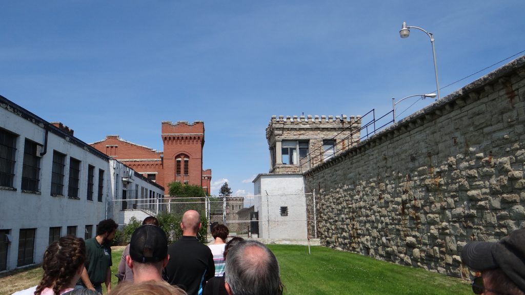
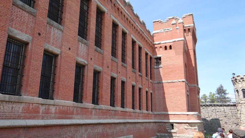
It never ceases to amaze me what we find on this trip of ours. Deer Lodge was chosen because it is just above Butte, Montana the site of the largest opencast copper mine in the country. But Deer Lodge itself was home to the Montana State prison Museum, a huge classic car museum and at least another 3 museums, plus the Grant-Kohrs Ranch National Historic Site a completely preserved Ranch.
External granite walls and internal prison brick buildings built by prison labour in the late 1800s.Execution of two prisoners who killed a guard trying to escape.Main prison building.Typical cell, block was very like Alcatraz.Cell block at rear, shower block and canteen in foreground.
And right next door is a classic car museum with cars from very early Mercedes Benz (1886) to the classic cars of the 70’s & 80’s.
1914 Detroit Electric Car with an advertised range of 80 miles although in tests it did over 200 miles on a single charge.1926 Chevrolet Superior CoupeFord Model T cabriolet, very rare.Early air conditioning a Thermador Car Cooler. You filled it with cold water and the air was cooled as it passed through the unit into the car.Beautifully restored green Chevrolet circa 1951. The paintwork was immaculate.Chevrolet Impala ConvertibleAnother classic Chevrolet.“Gone in 60 seconds” Mustang GT500 “Eleanor”1965 Shelby Cobra.Corvette Stingray.Guess what this is?The first jet ski!! 1958
I could put up more pictures but there are over 160 cars in immaculate condition.
And outside were two immense trains.
This massive diesel loco is nicknamed “Little Joe” as they were originally built for Russian railways after WWII, but the contract was stopped because of the Cold War, so they were converted to work on US railways but that meant a change of track width, and they did it!!And then the “Milwaukee Road” was electrified and these were used to pull passenger trains. Funny how now the entire network out here seems to have reverted to diesel and freight only.And when we got back to the RV there was a “Big Sky” sunset.
The following day we came back to see the other museums and the Grant-Kohrs Ranch National Historic Site.
A small town exhibit.Another house in the town.Dentist price list (notice “Without Pain”!!)Gun exhibit in the Western Museum.Dolls in another museum. There were at least 20 exhibits like this.Grant-Kours Ranch.Ranch HouseLonghorn cattle on the ranch.Ranch cat in the Blacksmith’s shop.
All I can say is we were amazed that so much was available in a town with a total population of 3,111!!
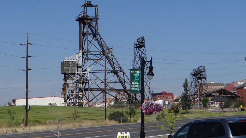
So on to Butte, the reason we stayed in Deer lodge in the first place. We took the Trolley Bus tour.
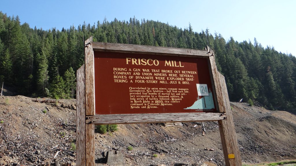
Butte is a copper mining town established in 1864 and grew to become the largest copper mining town in the USA and at one time in the world. Incredible amounts of copper were mined using conventional techniques i.e. digging a shaft and then cutting galleries into the seam. Some of the mines were over 6,000 ft deep. In its heyday there were 19 mines (14 mine headframes are still standing) and in 1910 alone copper ore mined from the Butte mining district totalled 284,000,000 pounds (130,000 tons). It attracted miners from all over the world including Cornish miners from the tin mines hence why there are these.
We actually ate pasties in this shop and they weren’t at all bad.Mine HeadframeAnd another one at the Museum of Mining.
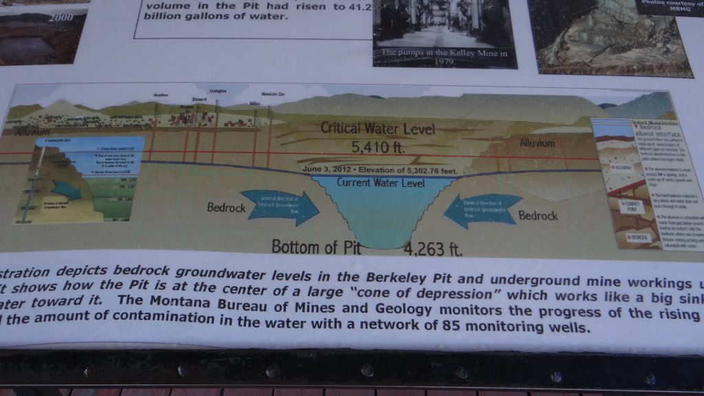
In the 1950’s underground mining gave way to open cast mining leading to the creation of one of the largest open cast pits in the world, the Berkley Pit.
The Berkeley open cast pit, which flooded when mining ceased in 1983 and was replaced by an equally large and productive open cast pit called the Continental Pit. The water came in from the old mine shafts when pumping also ceased in 1983.A 4,263 ft deep lake was formed, which is highly toxic and they have to scare water birds away as they will die if they ingest the water. They are gradually reducing the level by purifying the water and pumping it elsewhere as it mustn’t be allowed to seep into local aquifers and poison the drinking water. Lots of “old” buildings around Butte including Dumas House, a house of Prostitution opened in 1890 and wasn’t closed until 1982 even though prostitution was illegal in Butte!!Example of a pre 1900’s house.And another, mainly built for the mine owners. They liked their round towers!
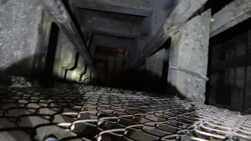
After the trolley bus tour we visited the World Museum of Mining which included another mine tour.
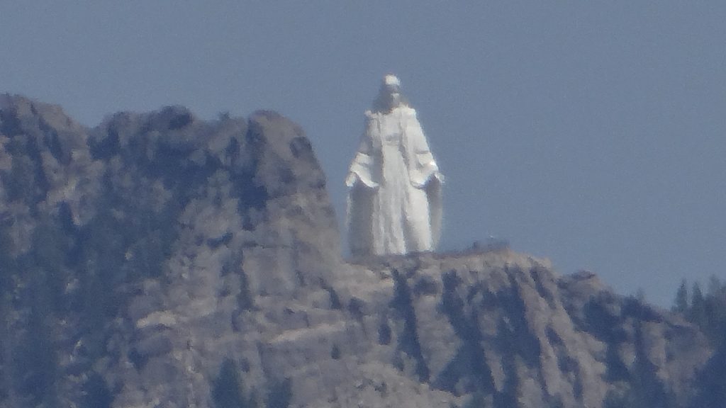
Down we go into the mine.Imagine going to work in this every day. This is a mine cage for lowering the miners into the mine. Apparently it was usual for 6 to go down but 9 to come up!! This was about 3ft square so it was a tight fit!!Looking down the shaft to the levels below. This mine when it was in production was 2,600ft deep. Now the bottom levels are flooded.The mine signals universally used by hoisting engineers. This one goes from 100ft to 5,000ft but we have seen them down to 6,000ft. At that depth the temperature reached 50C (122F) and ventilation was very important.View from the top of the headframe about 100ft up. Big Sky!!This is Our Lady of the Rockies. The statue was built by volunteers using donated materials to honour women everywhere, especially mothers. The base is 8,510 feet above sea level and 3,500 feet above the town. The statue is lit and visible at night. It was put there by helicopter and they plan to build a cable car to visit it. It looks down on Butte and I got this photo from the top of the headframe.
The Museum also had an old town section and a collection of dolls houses.
The drug store.The Soda store.One of the dolls houses.And another.
As always there is so much to see and we ran out of time.
From here we moved on to Livingston Montana and Yellowstone Park.